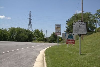
On East Main Street (U.S. 11) at Exit 73 (Interstate 81), on the right when traveling west on East Main Street.
Walter Crockett was born in the 1730s. By 1760, he had joined the Augusta County militia. Rising to the rank of lieutenant colonel, he subsequently served in the militias of Botentourt, Fincastle, and then Montgomery Counties, beginning in 1769. He . . . — — Map (db m44893) HM
On Stony Fork Road (U.S. 52) at Krenning Road (Virginia Route 717), on the right when traveling south on Stony Fork Road. Reported permanently removed.
On July 13, 1863, Union Col. John T. Toland led 872 officers and men of the 34th Regiment Mounted Ohio Volunteer Infantry from Camp Piatt, West Virginia, into Southwest Virginia to attack the railroads, telegraphs, and salt and lead mines essential . . . — — Map (db m298755) HM
On Greenville Road (Virginia Route 640) at Justice Road ( Route 634), on the right when traveling west on Greenville Road.
Grayson County, formed in 1792 from Wythe County, was named for William Grayson, one of Virginia's first two United States senators. Its court initially met at William Bourne's farm near present-day Fries. Here at Old Town, earlier known as . . . — — Map (db m182112) HM
On Crocketts Cove Road (County Route 600) at Cove Road (County Route 603), on the right when traveling east on Crocketts Cove Road.
Crockett’s Cove has been home to the Crockett
family for two centuries. It was named for
Lt. John Crockett, Sr. (1737–1799), son of Samuel
and Esther Thompson Crockett, a Revolutionary
War veteran buried in the family cemetery a
mile . . . — — Map (db m43553) HM
Near North 4th Street (U.S. 52) at Holston Road, on the right when traveling west. Reported damaged.
St. John Lutheran Church
St. John Lutheran Church, formally organized in 1799, is an important Wythe County historical landmark located at the intersection of Interstate 81 and U.S. Routes 21/52. The congregation came into being as a result . . . — — Map (db m306230) HM
On West Monroe Street east of North 4th Street (U.S. 21), on the left when traveling east.
On the night of August 15, 1926, a mob of rowdy Wythe County citizens forced their way into the Wythe County jail that stood on this site until 1928. Overpowering the county jailer, the mob breached the cell in which a black man, Raymond Arthur . . . — — Map (db m208773) HM
On Fort Chiswell Road (U.S. 52) 0.2 miles north of Foster Falls Road, on the right when traveling south.
By 1770 Capt. William Herbert had established a ferry across the nearby New River that became known as Jackson’s Ferry. Thomas Jackson erected the 75-foot shot tower in the early 1800s to manufacture shot for firearms. The Austinville mines supplied . . . — — Map (db m32514) HM
Near Virginia Route 623 west of Foster Falls Road ( Route 608), on the left when traveling west.
"Forged by mountains, river and America's desire for progress, the New River Trail State Park provides you unparalleled opportunities for physical, intellectual and spiritual adventures."
For centuries ferries have existed, primarily . . . — — Map (db m238245) HM
On Peppers Ferry Road (County Route 610) 2.1 miles east of Interstate 77.
The 340-acre Wythe County Poorhouse Farm was established in 1858 for the care of the elderly, disabled, and impoverished people of Wythe County. It was governed by the Wythe County Board of Supervisors and owned by the county until 1957 when the . . . — — Map (db m1820) HM
Near Crockett's Cove Road (Virginia Route 600) 2.5 miles east of Cove Road ( Route 603), on the right when traveling east.
The oldest surviving Church building in Wythe County in constant use, having been listed on the Virginia Landmarks Register in 1989 and placed on the National Register of Historic Places in 1992.
This historic building located in the heart of . . . — — Map (db m193308) HM
Near North 4th Street at Holston Road, on the right when traveling north.
Johan Casber Rötter on the ship Edinburgh from Rotterdam entered Philadelphia on 13 August 1750. On 12 May 1763 he and Regina Gerhardt, daughter of John Conrad Gerhardt, were married in Bethel Township, Lancaster County, Pennsylvania, by Rev. . . . — — Map (db m306229) HM
"Jeremiah Vardeman was a distinguished minister somewhat rare in the annals of the church. He possessed the peculiar talent of bringing the leading truths of the gospel home to the consciences of his hearers his illustrations were singularly . . . — — Map (db m244374) HM
On State Highway 72 at Mt. Carmel Road (State Highway 823), on the left when traveling south on State Highway 72.
5.5 miles southeast is the burial ground of Patrick and Martha Caldwell Calhoun, Parents of John C. Calhoun; Deputy Surveyor 1756; First Representative from Up Country to Commons House of Assembly, 1769-1772; Member of First Provincial Congress, . . . — — Map (db m10627) HM
On Farm to Market Road 619 2.4 miles north of Farm to Market Road 696, on the left when traveling north.
Prior to 1848, the land around the Yegua Spring, later known as Sam Smith Springs and now Lawhon Springs, was inhabited by Native American tribes. In 1848, the families of John Lewis Smith (1796-1851), and son, Samuel Alexander "Sam" Smith . . . — — Map (db m205339) HM
On West Main Street (County Route 1001) at Scenic Road and Ivanhoe Road ( Route 94), on the left when traveling west on West Main Street.
On 10 Dec. 1923, millhand Henry Whitter of
Fries, Virginia, recorded nine songs in New York
City for OKeh Records. Released early in 1924,
the coupling of “Wreck on the Southern Old 97”
and “Lonesome Road Blues” became one of the
first . . . — — Map (db m65717) HM
On West Main Street (U.S. 11) west of Tazewell Street, on the right when traveling west.
A pioneer and soldier of the American Revolutionary War. Enlisted in Montgomery County and served in the companies of Captain Findlay and Captain James Kent.
The first court held for Wythe County in the town of Wytheville was at the home of . . . — — Map (db m228344) HM
On West Monroe Street east of North 4th Street (U.S. 21), on the left when traveling east.
L represents the role the railroad played in the development of Wytheville. In 1847, as a result of the efforts of Thomas J. Boyd, the "Father of Wytheville", the rail line was extended from Lynchburg, Virginia to Wytheville, making it . . . — — Map (db m208892) HM
Thin black lines indicate changes in relevance. Between each pair of lines entries are ordered geographically but all have the same relevance.
* Inflectional forms of words are their plurals, singulars, and possessives as well as gramatical tenses and similar variations.