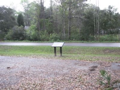
A heritage tourism trail centering on the life and campaigns of General Francis Marion. Francis Marion, also known as the Swamp Fox, was one of the most successful partisan military leaders of the American Revolutionary War. Francis Marion Trail is a driving
and mural tour tracking Revolutionary War sites,
On Cainhoy Road, on the right when traveling south.
In the summer of 1781, with the British hold on the interior of South Carolina significantly weakened, Continental commander Maj. Gen. Nathaniel Greene sent Brig. Gen. Thomas Sumter, with Brig. Gen. Francis Marion and Lt. Col. Henry “Light . . . — — Map (db m53889) HM
After Eutaw Springs, the British retreated to their post at Fair Lawn Plantation. In November 1781, Brig. Gen. Francis Marion sent Col. Hezekiah Maham with 180 horsemen and Col. Isaac Shelby with 200 mountain riflemen to eliminate British foraging . . . — — Map (db m53885) HM
Fair Lawn Plantation was an enormous property granted to Sir Peter Colleton, oldest son of Sir John Colleton, one of the original eight Lords Proprietors of the Carolina colony. During the Revolutionary War, the British army first occupied the . . . — — Map (db m53883) HM
Near State Highway 402 just north of State Highway S-8-44, on the left when traveling west.
Wadboo was a Native American name given to the enormous landholding of James Colleton, a son of Sir John Colleton, who was one of the original eight Lords Proprietors of the Carolina colony. Called a barony according to the Proprietors’ plan . . . — — Map (db m53891) HM
Near Sunset Drive (U.S. 301) at South Boundary Street, on the right when traveling east.
William Dobein James, who rode with General Francis Marion during the Southern Campaign of the American Revolution, wrote in 1821 about L/C Tarleton following Marion "...as he (Tarleton) says, 'for seven hours, through swamps and defiles.' In fact . . . — — Map (db m161310) HM
On North Brooks Street (US 301 / 521) near West Rigby Street, on the left when traveling north.
During the American Revolution, December 1780, over 750 recently arrived British fusiliers were marching from Nelson’s Ferry on the Santee River. Major McLeroth’s British troops from Moncks Corner joined them as an escort to Camden. General Marion’s . . . — — Map (db m24370) HM
On Bozard Street east of South Mill Street (South Carolina Highway 260), on the right when traveling east.
During the American Revolution, the Bridges Campaign began March 6, 1781, with the Battle of Wyboo Swamp. Colonel Watson and British troops from Fort Watson were sent to crush General Marion. Marion’s Militia challenged them on the ¼ mile causeway . . . — — Map (db m227902) HM
On North Mill Street at Rigby Street, on the left when traveling south on North Mill Street.
During the American Revolution, 1780, General Marion and the men of his Brigade pushed back the British forces in the Black and Santee River Basins. It is unlikely that they thought they would be remembered by future generations. It may be that . . . — — Map (db m49051) HM
On South Mill Street (State Highway SC260) at W. Hospital Street, on the left when traveling north on South Mill Street.
During the American Revolution, General Marion and his Militia needed help from local farmers for food, horses and medical care for wounds and diseases. Those shot or sick were left at the mercy of comrades and sympathy of Patriots. Medical care was . . . — — Map (db m93817) HM
On US 301 & US 521, on the left when traveling north.
On the night of November 7, 1780, Lt. Colonel Banastre Tarleton and his Green Dragoons—together with Harrison’s Provincials, a large unit of Tories from the area between the upper Santee and Wateree Rivers—camped at the plantation of the late . . . — — Map (db m51985) HM
After the American Revolution, General Marion’s militiamen re-built his home. Francis Marion, at age 53, married Mary Esther Videau, April 20, 1786. They lived at Pond Bluff, on the south edge of the Santee Swamp and raised pineland cattle. With . . . — — Map (db m43156) HM
On Patriot Road (State Highway 14-410) at Wyboo Road on Patriot Road.
In March 1781, Lord Francis Hastings Rawdon, the British commanding officer in Charleston, designed a two-pronged assault against the forces of General Francis Marion. From Camden, Col. Welbore Ellis Doyle and the Volunteers of Ireland moved east . . . — — Map (db m51986) HM
On Old River Road at Elliots Landing Road, on the right when traveling south on Old River Road.
In December 1781, Maj. Robert McLeroth and the 64th Regiment were conducting newly-arrived British army recruits of the Royal Fusiliers from Charleston to the High Hills of Santee. Learning of McLeroth’s movement, Col. Francis Marion led some 700 . . . — — Map (db m227715) HM
On Fort Watson Road (State Highway 14-803) 1 mile west of St Paul Road (U.S. 15/301), on the left when traveling west.
One of the chain of British posts in South Carolina. Located on this Indian Mound. Besieged April 15-23, 1781 by use of Maham's tower, Francis Marion forced the British to surrender and secured for his men badly needed ammunition and supplies. — — Map (db m300988) HM
On Fort Watson Road (State Highway 14-803), on the left when traveling west.
The first post in S.C. retaken from the British, the stockade fort on this old Indian mound had controlled the road from Charleston to Camden as well as the Santee River. On April 15, 1781, Gen. Francis Marion and Lt. Col. Henry Lee encircled it . . . — — Map (db m301930) HM
On St. Paul Road (U.S. 301/15), on the right when traveling north.
Assigned to hold all of eastern South Carolina but with only a small force at his disposal, Col. John Watson needed to build a fort to protect the vital transportation corridor between Charleston and Camden, the British inland headquarters. The spot . . . — — Map (db m51477) HM
On South Dukes Street at Main Street, on the right when traveling south on South Dukes Street.
During the American Revolution, Colonel Lee's Legion of Virginia joined General Marion's Brigade along the Santee River. They laid siege to British-held Fort Watson built on top of Santee Indian Mound. Major Maam's idea was to build a tower so . . . — — Map (db m300948) HM
On Calvert Street (State Highway 14-119) at Main Street (U.S. 301), on the left when traveling west on Calvert Street.
Capt. Wm. Henry Mouzon II had a friendship with Banastre Tarleton from their boyhood school days in France. Yet the British Tarleton burned the Mouzon Plantation House, on August 7, 1780. Ann Mouzon, age eleven, was the first to see the British and . . . — — Map (db m227713) HM
On Odell Venters Landing east of Kingsbury Highway (State Route 41), on the right when traveling north.
Late in the summer of 1780, Maj. Gen. Horatio Gates led a Continental army toward South Carolina to attempt to roll back the British conquest of the province. As Gates prepared to meet the British at Camden, he sent Col. Francis Marion ~ a . . . — — Map (db m53899) HM
In South Carolina, the Revolutionary War had many of the characteristics of a civil war, with those who supported independence, (the Whigs or Patriots) fighting against neighbors and kinsfolk who remained loyal to the King (the Tories or Loyalists). . . . — — Map (db m115304) HM
In September 1780, Francis Marion returned to South Carolina after a short tactical retreat into the swamps of eastern North Carolina. Hearing that British and Loyalist forces were burning the homes of Whig militiamen in Williamsburg District, . . . — — Map (db m53702) HM
From the time Col. Francis Marion took control of the Williamsburg Militia in August 1780 until the following spring, a network of camps in the area where the Great Pee Dee, Little Pee Dee, and Lynches Rivers meet formed a base of operations for his . . . — — Map (db m53901) HM
Perhaps no place is more closely associated with Francis Marion’s Revolutionary War career than his legendary camp on Snow’s Island, the large, thickly forested landmass in front of you across the Great Pee Dee River. With plenty of high, dry . . . — — Map (db m53900) HM
On Hemingway Hwy (State Highway 261/512), on the left when traveling west.
After Francis Marion’s initial victories in August and early September 1780, British military authorities in South Carolina moved to eliminate the threat of an insurgency in Williamsburg District. Lord Cornwallis ordered Maj. James Wemyss to . . . — — Map (db m53898) HM
On Academy Street near Kelly Street, on the right when traveling north.
By late August 1780, Francis Marion and the Whig militiamen of eastern South Carolina had already begun to cause alarm among the British military leaders in charge of subduing the province. Sensing the British would move against him, Col. Marion . . . — — Map (db m53897) HM
On Martin Luther King, Jr. Ave. (State Highway 377) 0.5 miles north of Thorntree Road (State Highway S45-143).
Over three weeks in March 1781, Brig. Gen. Francis Marion conducted a series of engagements between the Santee River and Georgetown, battering a larger force of British regulars and Loyalist militiamen under the command of Col. John Watson. This . . . — — Map (db m53893) HM