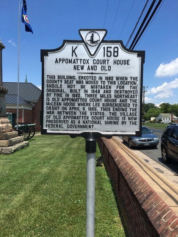
By Brandon D Cross, June 7, 2016
Appomattox Court House Marker
SHOWN IN SOURCE-SPECIFIED ORDER
| On Court Street (Virginia Route 131) at Morton Lane, on the right when traveling south on Court Street. |
| On Virginia Route 26 at County Route 677, on the right when traveling south on Virginia Route 26. |
| On Old Courthouse Road (Virginia Route 24), on the left when traveling west. |
| On Old Courthouse Road (Virginia Route 24), on the left when traveling west. |
| On Old Courthouse Road (Virginia Route 24), on the left when traveling west. |
| On Old Courthouse Road (Virginia Route 24), on the left when traveling west. |
| On Old Courthouse Road (State Highway 24), on the right when traveling east. Reported permanently removed. |
| On Old Courthouse Road (Virginia Route 24), on the right when traveling west. |
| On Old Courthouse Road (Virginia Route 24), on the right when traveling west. |
| On Old Courthouse Road (Virginia Route 24), on the right when traveling west. |
| On Appomattox Court House NHP entrance road, on the right when traveling north. |
| On Old Courthouse Road (Virginia Route 24), on the right when traveling west. |
| Near Old Courthouse Road (Virginia Route 24), on the right when traveling west. |
| On National Park Drive (State Highway 24), on the right when traveling north. |
| On Richmond-Lynchburg Stage Road, on the left when traveling west. |
| Near National Park Drive (State Highway 24), on the right when traveling west. |
| On Price Edward Court House Road at Richmond-Lynchburg Stage Road, on the right when traveling north on Price Edward Court House Road. |
| On George Peers Drive (State Highway 24), on the right when traveling west. |
| On George Peers Drive (State Highway 24), on the right when traveling west. |
| On Richmond-Lynchburg Stage Road, on the left when traveling east. |
| On Richmond-Lynchburg Stage Road, on the right when traveling east. |
| On Richmond-Lynchburg Stage Road, on the left when traveling east. |
| Near Old Courthouse Road (Virginia Route 24) north of George Peers Drive, on the right when traveling south. Reported permanently removed. |
| On Old Courthouse Road (State Highway 24), on the right when traveling east. |
| On Old Courthouse Road (Virginia Route 24), on the right when traveling west. |
| On Old Courthouse Road (State Highway 24), on the right when traveling east. |
| On Old Courthouse Road (Virginia Route 24), on the left when traveling west. |
| On Old Courthouse Road (Virginia Route 24), on the left when traveling west. |
| Near Old Courthouse Road (Virginia Route 24), on the left when traveling west. |
| On Richmond Highway (U.S. 460) 0.6 miles east of Police Tower Road ( Route 613), on the right when traveling east. |
| On Richmond Highway (U.S. 460) 0.6 miles east of Police Tower Road ( Route 613), on the right when traveling east. |
