By Bernard Fisher
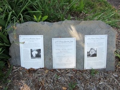
Ivy Chapel Union Church Marker
RANKED BY RELEVANCE
| Near Taylor Street at 4th Street. |
| On Lynchburg Highway (U.S. 460) at County Route 649, on the right when traveling east on Lynchburg Highway. |
| On East Main Street east of Cedar Street, on the left when traveling east. Reported permanently removed. |
| On Main Street 0 miles 1st Street, on the right when traveling south. |
| Near Pennsylvania Turnpike (Interstate 70/76). |
| On Horse Mountain Wartrace Road, on the left when traveling north. |
| On South Bridge Street at West Main Street (U.S. 221), on the left when traveling north on South Bridge Street. |
| On East Lynchburg-Salem Turnpike (U.S. 460) west of Ryland Drive, on the right when traveling west. |
| Near Avenel Avenue north of Burwell Way, on the right when traveling south. |
| On Bedford Lane east of Kenney Drive, on the left when traveling north. |
| On Richmond Highway (U.S. 460) at Village Highway (Virginia Route 24), on the right when traveling east on Richmond Highway. |
| On Oakwood Street north of Longwood Avenue (U.S. 221), on the right when traveling north. |
| On Bedford Highway (Virginia Route 43) at Chellis Ford Road, on the left when traveling east on Bedford Highway. |
| On Main Street (U.S. 11) at 15th Street (County Road T-1313), on the right when traveling south on Main Street. |
| Near Avoca Lane west of Main Street (Business U.S. 29), on the right when traveling west. |
| On Washington Street at Broad Street, on the right when traveling south on Washington Street. |
| On Patrick Henry Highway (Virginia Route 40) 0.3 miles east of Owl Road, on the left when traveling west. |
| On Northbound Rest Area (Interstate 81 at milepost 129). |
| On West Dupont Avenue (County Road 60/12) 0.5 miles east of Simmons Creek Road (County Road 60/15), on the right when traveling east. |
| On Sam Snead Highway (U.S. 220) south of Main Street (County Route 615), on the left when traveling north. |
| On E Lynchburg Salem Turnpike (Virginia Route 460) 7.5 miles west of Bedford/Campbell County Line, on the right when traveling west. |
| On Forest Road (U.S. 221) just west of Newcomb Boulevard, on the left when traveling west. |
| On Lynchburg Salem Turnpike (U.S. 460), on the right when traveling east. |
| Near Interstate 81N at milepost 129, 0.9 miles north of North Fork Road ( Route 603), on the right when traveling north. |
| On Farmville Road (U.S. 15) at Worsham Road (County Route 665), on the right when traveling north on Farmville Road. |
| On Main Street 0 miles west of 1st Street, on the right when traveling south. |
| On Ohio Route 160 at Thompson Road (County Route 123), on the left when traveling south on Ohio Route 160. Reported missing. |
| On College Street east of Ashland Avenue, on the right when traveling east. |
| On East 2000th Road at North 175th Road, on the right when traveling south on East 2000th Road. |
| Near Taylor Street at 4th Street. |
| On New Columbia Highway (U.S. 431) at Tennessee Road 50, on the right when traveling north on New Columbia Highway. |
| On Liberty Road (County Road 634) north of Old Stage Road (County Road 712), on the left when traveling north. |
| On West Virginia Avenue (U.S. 460) just west of Lee Street (County Road T-1031), on the right when traveling east. |
| On Bluff Street at Dinah Shore Boulevard (Tennessee Route 50), on the right when traveling north on Bluff Street. Reported permanently removed. |
| On Tavern Street, on the right when traveling west. |
| On Motlow Barn Road 0.1 miles north of Nursing Home Road, on the right when traveling north. |
Thin black lines indicate changes in relevance. Between each pair of lines entries are ordered geographically but all have the same relevance.* Inflectional forms of words are their plurals, singulars, and possessives as well as gramatical tenses and similar variations.
Nov. 12, 2026
