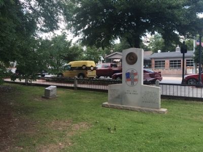
By J. Makali Bruton, June 21, 2015
Confederate Veterans of Gwinnett County, Georgia Marker
RANKED BY RELEVANCE
| On Lawrenceville Highway (U.S. 29) east of North Perry Street (County Route 20), on the left when traveling west. Reported permanently removed. |
| On North Clayton Street at East Pike Street (U.S. 29), on the right when traveling north on North Clayton Street. |
| On Sunset Drive at North Peachtree Street, on the right when traveling west on Sunset Drive. |
| On West Peachtree Street at Park Drive NW, on the right when traveling south on West Peachtree Street. |
| On Lawrenceville Street NW 0 miles north of Jones Street NW, on the left when traveling north. |
| On Jones Street NW at Lawrenceville Street NW, on the left when traveling east on Jones Street NW. |
| Near South Perry Street (Georgia Route 20) at Luckie Street, on the left when traveling south. |
| Near Valley Forge Road (Pennsylvania Route 23), on the left when traveling west. |
| On Lawrenceville Highway (U.S. 29) 0.1 miles west of Sugarloaf Parkway, on the right when traveling west. |
| On Mount Vernon Road at Jett Ferry Road, on the right when traveling east on Mount Vernon Road. |
| On Dacula Road 0.6 miles south of Hog Mountain Dacula Road (Georgia Route 324), on the left when traveling south. |
| Near South Perry Street (Georgia Route 20) south of Luckie Street, on the left when traveling south. |
| Near South Clayton Street (Georgia Route 20) south of Luckie Street, on the right when traveling south. |
| On East Crogan Street east of South Clayton Street, on the right when traveling east. |
| Near Lawrenceville Street Northwest west of Mitchell Road NW, on the left when traveling east. |
| On Sandy Springs Circle at Sandy Springs Place, on the right when traveling north on Sandy Springs Circle. |
| Near South Poplar Street north of Oak Street, on the left when traveling north. |
| On Alcovy Road SE west of Sweet Pond Road, on the right when traveling west. |
| Near South Clayton Street (Georgia Route 20) south of Luckie Street, on the right when traveling south. |
| Near South Perry Street (Georgia Route 20) south of Luckie Street, on the left when traveling south. |
| Near South Perry Street (Georgia Route 20) at Luckie Street, on the left when traveling south. |
| Near Clean Water Drive 0.8 miles south of Plunkett Road. |
| Near South Perry Street (Georgia Route 20) at Luckie Street, on the left when traveling south. |
| On 5th Street (U.S. 411) at 7th Avenue, on the right when traveling south on 5th Street. |
| On College Street at Jones Street, on the right when traveling north on College Street. |
| On Clairmont Road, US 23/SR 155 (Georgia Route 155) 0.2 miles south of North Decatur Road, on the right when traveling south. |
| On North Perry Street (Georgia Route 20) at Lawrenceville Highway ( Route 8), on the left when traveling south on North Perry Street. |
| On Ravine Loop Trail, on the right when traveling west. |
| On South Peachtree Street just south of Jones Street Northwest, on the left when traveling south. |
| Near South Clayton Street (Georgia Route 20) at Luckie Street, on the right when traveling south. |
| On Miller Loop Trail, on the right when traveling west. |
Thin black lines indicate changes in relevance. Between each pair of lines entries are ordered geographically but all have the same relevance.* Inflectional forms of words are their plurals, singulars, and possessives as well as gramatical tenses and similar variations.
Nov. 13, 2026
