
23 entries match your criteria.
Entries Containing All of the Phrases «hennepin county» AND «minnesota»
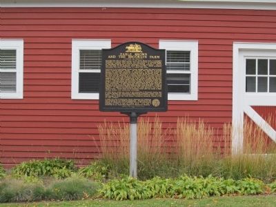
By K. Linzmeier, October 24, 2013
Earle Brown and the Brooklyn Farm Marker
RANKED BY RELEVANCE
1 ► Minnesota, Hennepin County, Brooklyn Center — Earle Brown and the Brooklyn Farm —  |
| Near Earle Brown Drive 0.3 miles east of Summit Drive North, on the left when traveling east. | |||
| 2 ► Minnesota, Hennepin County, Minneapolis, Saint Anthony Main — Richard Chute Square — |
| On Bank Street Southeast at Ortman Street Southeast on Bank Street Southeast. | |||
| 3 ► Minnesota, Hennepin County, Robbinsdale — The Great War — |
| Near Memorial Parkway at Xerxes Avenue N., on the right when traveling west. | |||
| 4 ► Minnesota, Hennepin County, Minneapolis, Downtown West — Stone Arch Bridge — |
| Near West River Parkway west of Portland Avenue South. | |||
| 5 ► Minnesota, Hennepin County, Minneapolis, Saint Anthony Main — Lucy Wilder Morris — and Father Hennepin Bluffs Park — |
| Near 6th Avenue Southeast just south of Southeast Main Street. | |||
| 6 ► Minnesota, Hennepin County, Shorewood — HE-SHC-022 — Christmas Lake — |
| On State Highway 7, on the right when traveling east. | |||
| 7 ► Minnesota, Hennepin County, Bloomington, East Bloomington — A Bridge to the Past — |
| Near Old Cedar Avenue South. | |||
| 8 ► Minnesota, Hennepin County, Richfield — Richfield Pioneer Homestead — General Riley Lucas Bartholomew — 30 May 1807 - 21 September 1894 — |
| On West 69th Street at Lyndale Avenue South on West 69th Street. | |||
| 9 ► Minnesota, Hennepin County, Robbinsdale — To Our Comrades Who "Went West" — |
| Near Memorial Drive at Xerxes Avenue N.. | |||
| 10 ► Minnesota, Hennepin County, Minneapolis, Phillips — Martin Olav Sabo Bridge — |
| On the Midtown Greenway west of Hiawatha Avenue (Minnesota Highway 55). | |||
| 11 ► Minnesota, Carver County, Mayer — Dakota Rail History in Mayer — |
| On 1st St NW at County Highway 25, on the right when traveling east on 1st St NW. | |||
| 12 ► Minnesota, Hennepin County, Brooklyn Park — How the Dam Works — |
| Near Russell Avenue North / West River Road 0.7 miles north of 97th Avenue North, on the right when traveling north. | |||
| 13 ► Minnesota, Hennepin County, St. Louis Park, Triangle — In 1939, this was more than just a park. — It was a Destination — |
| Near Minnesota 7 Service Rd. | |||
| 14 ► Minnesota, Hennepin County, Minneapolis, Downtown East — A Changing Landscape — Mill Ruins Park — |
| On W. River Parkway east of Portland Avenue, on the left when traveling east. | |||
| 15 ► Minnesota, Hennepin County, St. Louis Park, Triangle — 1 — From the City to the Lake / Peavey-Haglin Grain Elevator — Southwest LRT Corridor — C M & St P RR / Minneapolis & St. Louis RR — |
| On the Cedar Lake Regional Trail, on the left when traveling east. | |||
| 16 ► Minnesota, Hennepin County, Minneapolis, Calhoun Isles — 2 — The Railroad and the City — Midtown Corridor — CM & St P Grade Separation Historic District — |
| On the Midtown Greenway at Humboldt Avenue, on the left when traveling east on the Midtown Greenway. | |||
| 17 ► Minnesota, Hennepin County, Robbinsdale — Victory Memorial Drive — |
| Near Memorial Drive at Xerxes Avenue N., on the right when traveling west. | |||
| 18 ► Minnesota, Hennepin County, Minneapolis, Saint Anthony Main — The Ard Godfrey House — |
| On University Avenue Southeast (State Highway 47) at Central Avenue Southeast (State Highway 65) on University Avenue Southeast. | |||
| 19 ► Minnesota, Hennepin County, Fort Snelling — Fort Snelling's Later Uses — 1946-2023 — |
| On Taylor Avenue south of Leavenworth Avenue, on the right when traveling south. | |||
| 20 ► Minnesota, Hennepin County, Eden Prairie — Phipps–Grill Families — |
| Near Pioneer Trail. | |||
| 21 ► Minnesota, Hennepin County, Minneapolis, Marshall Terrace — River, Railroad and Industry — |
| On St. Anthony Parkway at California Street NE, on the right when traveling east on St. Anthony Parkway. | |||
| 22 ► Minnesota, Hennepin County, Minneapolis, Hiawatha — Welcome to the Wabun Picnic Family Play Area! — |
| Near the road to the Wabun Picnic Area east of 46th Avenue S.. | |||
| 23 ► Minnesota, Hennepin County, Minneapolis, Southwest Minneapolis — Harriet Bandshells / Our Park Legacy — Music, Wind and Fire on the Lake — Established 1993 — |
| Near West Lake Harriet Boulevard at William Berry Parkway and West Lake Harriet Blvd.. | |||
Thin black lines indicate changes in relevance. Between each pair of lines entries are ordered geographically but all have the same relevance.
* Inflectional forms of words are their plurals, singulars, and possessives as well as gramatical tenses and similar variations.
Nov. 19, 2026