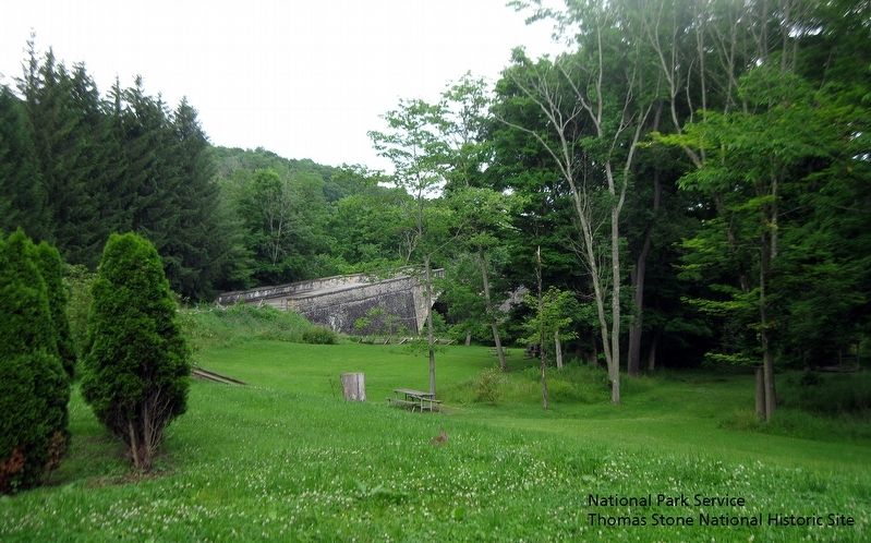
National Park Service, Thomas Stone National Historic Site, June 17, 2019
Casselman River Bridge. Image taken from east end of bridge.
RANKED BY RELEVANCE
| Near National Pike (Alternate U.S. 40) 0.3 miles Patton Lane, on the left when traveling east. |
| On Main Street (Alternate U.S. 40) at Hershberger Lane, on the right when traveling west on Main Street. |
| On Casselman Road 0.2 miles west of National Pike (Alternate U.S. 40), on the left when traveling west. |
| On Fairfax Road (West Virginia Route 9) at Seneca Trail (U.S. 219), on the right when traveling west on Fairfax Road. |
| On Mosser Road east of Bumble Bee Road, on the right when traveling east. |
| On Mosser Road east of Allen S. Paugh Sr. Road, on the left when traveling east. |
| Near Taylor Avenue (Maryland Route 435) south of Rowe Boulevard ( Route 70), on the right when traveling north. |
| Near State Park Road at Brant Road. |
| On East Green Street west of South 3rd Street (U.S. 219), on the left when traveling west. |
| Near Bumble Bee Road 1.3 miles north of Mosser Road, on the left when traveling north. |
| On Sang Run Road 0.1 miles south of Oakland Sang Run Road, on the right when traveling south. |
| On Friendsville Road (Maryland Route 42) south of Hoyes Road, on the left when traveling north. |
| Near U.S. 219 5.5 miles south of U.S. 50, on the left when traveling south. |
| Near Maple Glade Road 0.4 miles north of Swallow Falls Road when traveling north. |
| On Maple Street at Water Street, on the right when traveling west on Maple Street. |
| On National Pike (Route Alt-40) 0.3 miles east of Patton Lane, on the left when traveling east. |
| On U.S. 340, on the right when traveling north. |
| On Garrett Highway (U.S. 219) 0.2 miles south of Deep Creek Drive, on the right when traveling south. |
| Near West Liberty Street south of Liberty Square Drive, on the left when traveling north. |
| Near Bumble Bee Road just north of Mosser Road, on the left when traveling north. |
| On Mayberry Poling Road south of Maybury Lane, on the left. |
| Near Casselman Road 0.1 miles National Road (Route Alt-40). |
| On Walnut Street at Park Street, on the right when traveling west on Walnut Street. |
| On Mosser Road 0.2 miles east of Garrett Highway (U.S. 219), on the right when traveling east. |
| On Visitors Center Drive south of Garrett Highway (U.S. 219), on the left when traveling south. |
| Near Bumble Bee Road 1.3 miles north of Mosser Road, on the left when traveling north. |
| On Sang Run Road 0.2 miles south of Oakland Sang Run Road, on the left when traveling south. |
| On East Alder Street, on the right when traveling west. |
| Near Bumble Bee Road 1.3 miles north of Mosser Road, on the left when traveling north. |
| On Deep Creek Drive 0.3 miles north of Fort Drive, on the left when traveling north. |
| Near Bumble Bee Road 1.3 miles north of Mosser Road, on the left when traveling north. |
| Near Bumble Bee Road 1.3 miles north of Mosser Road, on the left when traveling north. |
| On North 2nd Street just north of East Center Street, on the right when traveling north. |
Thin black lines indicate changes in relevance. Between each pair of lines entries are ordered geographically but all have the same relevance.* Inflectional forms of words are their plurals, singulars, and possessives as well as gramatical tenses and similar variations.
Nov. 13, 2026
