By Mike Stroud, 2008
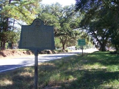
The Confederate Line at Ogeechee Church Marker
RANKED BY RELEVANCE
| On Effingham Hwy (State Highway 17) at Oliver Highway (State Highway 24), on the right when traveling south on Effingham Hwy. |
| Near South Railroad Avenue (U.S. 221) just south of Broad Street, on the left when traveling south. |
| On Bartow Road (Georgia Route 242) 0 miles west of Riddleville-Davisboro Road ( Route 231), on the right when traveling east. |
| On Georgia Route 15 S at Montgomery Road, on the right when traveling south on Georgia Route 15 S. |
| On North Main Street (Florida Route 77) just north of Old Bonifay Road, on the right when traveling north. |
| On North Harris Street (Georgia Route 15) at West Haynes Street, on the right when traveling south on North Harris Street. |
| Near North Harris Street (Georgia Route 15) south of East McCarty Street, on the right when traveling north. |
| On Smith Street at West North Central Avenue on Smith Street. |
| On Georgia Avenue Northwest (U.S. 29) at Missouri Avenue Northwest, on the right when traveling south on Georgia Avenue Northwest. |
| On Ebenezer Cemetery Rd (County Road 714) 1 mile south of State Highway 7, on the right when traveling south. |
| On Ebenezer Cemetery Rd (County Road 714) 1 mile south of State Road 7, on the right when traveling south. |
| On West Haynes Street 0 miles east of Jones Street, on the left when traveling east. |
| On 124 near County Road 248, on the left when traveling north. |
| On Mud Road 0.1 miles west of Black Creek Church Road, on the right when traveling west. |
| On East Washington Street, on the right when traveling east. |
| On Chipola Street (County Route 274) 1.3 miles west of North Main Street (Florida Route 71), on the right when traveling west. Reported missing. |
| On New Hope Church Road at Heards Bridge Road on New Hope Church Road. |
| On Bartow Road (State Road 242) west of Ridge Road, on the left when traveling west. |
| On West Haynes Street at Stacer Avenue, on the right when traveling west on West Haynes Street. |
| On East 3rd Court at Park Street, on the right when traveling west on East 3rd Court. |
| On North Harris Street (Georgia Route 15) at Malone Street, on the right when traveling south on North Harris Street. |
| On Farm to Market Road 1363 0.1 miles east of Front Street (County Highway 315), on the right when traveling west. |
| On Farm to Market Road 390 south of Longpoint Road, on the right when traveling west. |
| On County Road 28 2.5 miles east of State Route 95, on the right when traveling east. |
| Near Navasota Street near East 7th Street, on the right when traveling north. |
| Near Dwight D. Eisenhower Highway (Interstate 70) south of Baltimore National Pike (U.S. 40), on the right when traveling east. |
| On Dwight D. Eisenhower Highway. |
| On outh Potomac Street (Maryland Route 65), on the right when traveling north. |
| On East Baltimore Street (U.S. Alt 40) at King Street, on the right when traveling west on East Baltimore Street. |
| On 6th Avenue North, on the left when traveling north. |
| On Old Baylor College Road at Waters Lane on Old Baylor College Road. |
| On Colonial Road SW east of Reedy Creek Road, on the left when traveling east. |
| On Omussee Creek Road 0.5 miles north of Picnic Road, on the right when traveling north. |
| Near Capitol Avenue Southwest south of M.L.K. Junior Drive Southeast, on the left when traveling north. |
Thin black lines indicate changes in relevance. Between each pair of lines entries are ordered geographically but all have the same relevance.* Inflectional forms of words are their plurals, singulars, and possessives as well as gramatical tenses and similar variations.
Nov. 13, 2026
