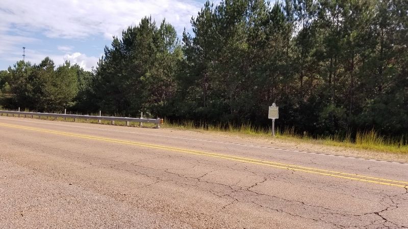
On U.S. 278 at Tribble Road, on the right when traveling south on U.S. 278.
The first community in N. Miss., begun here by John Wise in 1816, had stores, a cemetery, a camp ground, a church called "Uncle Jimmy Wise's Meetinghouse," a blacksmith shop in which future Gov. Tucker worked. — — Map (db m123031) HM
On U.S. 45 0.7 miles north of Hall Road, on the right when traveling north.
In 1865 Macon became the last center of Mississippi's wartime government, following its evacuation from Jackson and Meridian. A house on this site became the executive residence of Governor Charles Clark. — — Map (db m92652) HM
On Jefferson Street (State Highway 145) at East Green Street, on the right when traveling north on Jefferson Street.
Front
The roots of blues and gospel music run deep in the African American culture of the Black Prairie region. Among the performers born near Macon here in Noxubee County, Eddy Clearwater, Carey Bell, and Jesse Fortune went on to . . . — — Map (db m92636) HM
On North Wayne Street 0.1 miles north of Noxubee School Drive, on the right when traveling north.
The Calhoun Institute, a school for girls, was est. here in 1851 by W.R. Poindexter. From early 1864 until the end of the Civil War it was used for the state capitol. Now site of the Noxubee County High School. — — Map (db m92656) HM
On Jefferson Street (State Highway 145) 0.2 miles south of South Street, on the right when traveling south.
West 15 miles is the site which gave name to last treaty with the Choctaws, Sept. 7, 1830, whereby the remaining tribal lands in the state were opened to white settlement. — — Map (db m92655) HM
On Lawrence Street at West North Street, on the right when traveling south on Lawrence Street.
Organized June 20, 1835, with nine charter members. This building, dedicated Dec. 19, 1909, is the third to be occupied by this church. Basement of second church used as a military hospital, 1861-65. — — Map (db m140686) HM
On Jefferson Street (State Highway 145) at East Adams Street (State Highway 14), on the right when traveling north on Jefferson Street.
Noxubee County was formed on December 3, 1833. The first term of the county's circuit court was held in January 1834 in the south end of the Frith Hotel, a log cabin-style home owned by Joseph H. Frith. With Judge Thomas Sterling presiding and R.J. . . . — — Map (db m92658) HM
On North Jefferson Street (State Highway 145) north of East 8th Street, on the right when traveling north.
In 1834, nine people met in a house north of the village of Macon to discuss forming a Methodist congregation. In November 1834, the Macon Methodist Episcopal Church became part of the Noxubee Circuit, which was then part of the Alabama Conference. . . . — — Map (db m178999) HM
On South Wayne Street at East 8th Street, on the left when traveling north on South Wayne Street.
Est. 1837. Enrolled into Tombecbee Presbytery, 1842. Site of original church at S.E. corner, block 7. Present site deeded to church 1889 by R.C. Patty; building erected 1890; burned 1941. Rebuilt 1947. — — Map (db m92657) HM
On Mississippi Route 490 0.8 miles south of Route 14, on the right when traveling south.
Constituted May 15, 1835. in a schoolhouse on Hashuqua Creek with fifteen members. Present building erected in 1855. Services held continually since organization. — — Map (db m140665) HM
On Jefferson Street at Dr Martin Luther King Jr Drive, on the right when traveling north on Jefferson Street.
To our
Confederate
Dead.
Names listed on monument
Wm. Franklin Wm. Cason James Goodwin
Ike Griffin Jasper Holmes Wm. Hurt
B.T. Tatum Franklin Rogers A. Rickey
Abe Ware J.O. Gavin Sam Connor
Joe Robbins J. Luttrell S. . . . — — Map (db m92669) WM
On Mississippi Route 14 0.5 miles east of Salem Road, on the left when traveling east.
Built in 1914, this structure is Noxubee County's most significant extant early twentieth century public school building. Listed on the National Register of Historic Places in 1939. — — Map (db m140685) HM
On U.S. 45 at Buggs Ferry Road, on the right when traveling north on U.S. 45.
N W 3 mi. Church & cemetery date from 1835. Originally Cockrell Church. Renamed for
bishop Joshua Soule. Some of its preachers, achieved eminence in Methodism, some
members in affairs of state. — — Map (db m140687) HM
On Monument Road / Dancing Rabbit Road 2.2 miles south of Butler Road, on the right when traveling south.
Here on September 27, 1830 was signed the Treaty of Dancing Rabbit Creek. The Choctaw Nation of Indians surrendered their lands to the U.S. and removed west of the Miss.
Commissioners – John Coffee, John H. Easton
Choctaw Chiefs – Greenwood . . . — — Map (db m179034) HM
On Mississippi Route 21 at Sandhill Road, on the right when traveling west on Mississippi Route 21.
Est. in 1845; closed in 1876. Only functioning secondary school in Miss. during Civil War. Founded by T.L. Gathright who later became State Superintendent of Ed. and first pres. of Texas A & M College. — — Map (db m140664) HM
On Mississippi Route 21 west of Butler Road, on the right when traveling west.
About 5 miles north of here on September 7, 1830, the Choctaw Indians signed their last treaty with the United States, yielding most of their remaining tribal lands in Miss. to white settlement. — — Map (db m140663) HM
On Moor High Road 0.1 miles west of Belk Road, on the right when traveling west.
Constructed in 1960, B.L. Moor High School was
built for African American students as part of
Mississippi's equalization program following the
1954 Brown v. Board of Education ruling. The school
was formed from the consolidation of local . . . — — Map (db m244525) HM
James "Cool Papa" Bell (1901-1991) was born in Starkville. Renowned as the fastest man to ever play baseball. During his career (1922-1950), Bell played for or managed teams primarily in the Negro Leagues. In his career, Bell never hit below .300. . . . — — Map (db m140782) HM
On East Lampkin Street east of South Washington Street, on the right when traveling east.
Organized July 28, 1839. Thirteen original members, one a slave. Used as a Confederate hospital during War Between the States. L. S. Foster, founder of Mississippi Baptist Orphanage, ordained here. General Stephen D. Lee, first president of A. & M. . . . — — Map (db m140704) HM
On University Drive west of Caldwell Street, on the right when traveling west.
On May 6, 1821, seven local citizens, including Rev. Cyrus Kingsbury, established the Mayhew Church in the area known as Mayhew Mission. This congregation was received into the Tombeckbee Presbytery in 1829 and moved to Starkville in 1834. The first . . . — — Map (db m121845) HM
On Greensboro Street at Lousiville Street, on the right when traveling east on Greensboro Street.
This historic district, placed on the National Register of Historic Places in 1982, contains thirty historically and architecturally significant structures built along Old Greensboro Road from 1865 to 1930. Residents have included a university . . . — — Map (db m51624) HM
On Louisville Street at Route 12, on the right when traveling north on Louisville Street.
During the Vicksburg Campaign, a Union cavalry raid led by Colonel Benjamin H. Grierson moved from LaGrange, Tennessee, toward the Southern Railroad at Newton, Mississippi. On the afternoon of April 21, 1863, Grierson's cavalrymen rode into . . . — — Map (db m102566) HM
On West Lampkin Street at Wilson Street, on the right when traveling west on West Lampkin Street.
Methodist circuit rider Jacob Matthews conducted this area's first Methodist worship service near this site in 1834. The first meeting, held in a grove of sweet gum trees next to a spring known by the Choctaw Indians as Hicashabaha, led to the . . . — — Map (db m51617) HM
On Dr Martin Luther King Jr Dr E (Mississippi Route 182) at North Lafayette Street, on the right when traveling west on Dr Martin Luther King Jr Dr E.
In the early morning hours of May 11, 1965, Johnny Cash was arrested for public drunkenness after he was found picking flowers on this site following a show at Mississippi State University the previous evening. Cash, who spent the night at the . . . — — Map (db m235196) HM
On Louisville Street south of Bryan Street, on the right when traveling south.
Also known as the Old Presbyterian Cemetery, this cemetery was established in 1834 and contains approximately forty nine graves. Among those buried here are Dr. Araunah Bardwell and David Ames. Bardwell came to the area as a member of the Mayhew . . . — — Map (db m140703) HM
On North Nash Street north of University Drive, on the right when traveling north.
This neighborhood was Starkville's first subdivision. Most of these houses were built between 1932 and 1939 during the Great Depression. Houses in the block-long historic district are of Tudor Revival, Craftsman, and Colonial Revival styles. . . . — — Map (db m102652) HM
On Spring Street north of Spruill Place, on the right when traveling north.
The Needmore Community, one of Starkville's earliest African American neighborhoods, was first settled in the late 1800s with the construction of the Gulf, Mobile and Ohio Railroad. Having a number of homes, churches and businesses, Needmore was . . . — — Map (db m140762) HM
On Henderson Street at Dr Martin Luther King Jr Drive West (State Route 182), on the right when traveling north on Henderson Street.
One of the oldest black cemeteries in Mississippi. Here are buried many who made significant contributions to the growth of Mississippi and the advancement of the black race. Restoration begun 1975. — — Map (db m140702) HM
On Fellowship Street at Russell Street, on the right when traveling south on Fellowship Street.
Front
Oktibbeha County has produced several blues artists who achieved fame for their recordings and live performances in Chicago, California, or other areas. Blues Hall of Famer Big Joe Williams (c. 1903-1982), who waxed the classic . . . — — Map (db m102869) HM
On Oktibbeha Drive at Broad Street, on the right when traveling north on Oktibbeha Drive.
Listed in the National Register of Historic
Places in 2017, Oktibbeha Gardens was platted
in 1937 as Starkville's first large, planned
subdivision. Most of its houses were in place
by the 1960s and were built predominantly in
the Colonial . . . — — Map (db m235116) HM
On South Jackson Street at Green Street, on the left when traveling south on South Jackson Street.
Listed in the National Register of Historic Places in 1992, the Overstreet School Historic District is representative of Starkville's development from 1870 to 1940. The focal point of the district is the Overstreet Elementary School, originally . . . — — Map (db m140761) HM
On Sessums Road 0.1 miles north of Sessums Circle, on the left when traveling north.
This small community was named for
Captain S. D. Sessums, a Confederate
veteran who. owned a large amount of land
in this area. The Sessums community
developed around a branch line of the
Mobile and Ohio Railroad, which ran
from Artesia to . . . — — Map (db m244528) HM
On Dr. Douglas L. Conner Drive south of W Main Street, on the right when traveling south.
1830 The Treaty of Dancing Rabbit Creek, which ceded land from the Choctaw Indians to the U.S. government, ushered in white settlement and slavery.
1869 Mississippi passed a new constitution granting African-American men the right to vote.
. . . — — Map (db m302509) HM
On North Jackson Street at West Main Street, on the right when traveling north on North Jackson Street.
Established as Boardtown in 1831, this was among the first settlements in this area. In 1837 the town received its charter and was renamed Starkville, in honor of Revolutionary War general John Stark. The same year Starkville became the county . . . — — Map (db m221676) HM
On South Montgomery Street at East Lampkin Street on South Montgomery Street.
The Borden Company opened this milk condensing plant in April 1926. The plant helped bring over 1,200 dairy farm and milk distributing operations to Oktibbeha County. The plant closed in 2005, and the property was sold in 2009. Following extensive . . . — — Map (db m102644) HM
On State Highway 12 0.2 miles east of Willow Road, on the right when traveling east.
Eminent educator & agriculturist. Pres. of Miss. State U. & first Pres. of USM. Served as State Rural School Supervisor & State Supt. of Ed. Founded first Boys Corn Club in 1907, forerunner of 4-H & FFA Clubs. — — Map (db m51201) HM
137 entries matched your criteria. Entries 101 through 137 are listed above. ⊲ Previous 100