156 entries match your criteria. Entries 101 through 156 are listed.⊲ Previous 100
Maryland, Montgomery Parks Historical Markers
These markers are erected by Montgomery Parks, the Parks and Recreation Department for Maryland's most populous county in the DC suburbs - Montgomery County.
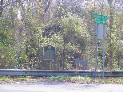
John Garrett laid out a town called Newport here in 1797 and gave away lots as prizes in a lottery, but a town did not actually appear until after 1830, when the C&O Canal was completed from Georgetown to Seneca Creek. The town was called Seneca. A . . . — — Map (db m764) HM
Historically, being near water was advantageous for businesses and homeowners in Seneca. The Seneca Sandstone Quarry transported cut red sandstone blocks on the Potomac River by way of the C & O Canal. The Seneca Grist Mill relied . . . — — Map (db m306044) HM
Sitting near the junction of the Potomac River and the Great Seneca Creek, the Seneca Mill had a long tradition at this pivotal location.
By 1725, a grist mill functioned here as a commercial staple for the small village. Early proprietors . . . — — Map (db m96104) HM
With only the Potomac River between Montgomery County and the Confederate South, Seneca Mills residents were always close to impending troop activity.
At the beginning of the war, the Seneca Mill community was worthy of consideration by the . . . — — Map (db m306050) HM
In 1900, Frederick Allnutt purchased the 1855 Darby House and 1½ acres of land from Wilson Tschiffely, who had recently acquired the property along with the nearby mill. Allnutt, who had been running a store next to the canal for several years, . . . — — Map (db m765) HM
Constructed in 1901, Frederick A. Allnutt built this gable-front, general store on Old River Road beside his newly acquired place of residence, the c. 1855 Darby House. This two-and-a-half story wood and frame store originally had counters on both . . . — — Map (db m96105) HM
As you enjoy the beautiful location where Seneca Creek empties into the Potomac River, know that you are part of a long tradition of folks seeking a respite from hard work at the “good time place” for outdoor fun!
Until the early 20th . . . — — Map (db m306052) HM
August 8, 1866 - Born in Charles County, Maryland.
1877-1879 - At the age of 12, leaves home to live in Washington, DC and Baltimore, MD.
1879-1884 - Joins the crew of the ship "Katie Hines" as a cabin boy and explores the . . . — — Map (db m205930) HM
Outside the Mill
In searching for the remains of a mill, an archaeologist is forced to ask the same questions a miller pondered years ago — where should the mill be built and what should this building look like.
Of prime importance to . . . — — Map (db m115376) HM
Whirl of the Wheel, Clickety-Clack of the Loom
In 1850, there were 9,780 sheep raised in Montgomery County - more than double the amount of horses or cows in this agrarian setting. Sheep were highly valued for their outer coat of wool, a . . . — — Map (db m115378) HM
Inside the Mill
Built by 1723, the grist mill that Richard Snowden operated here is considered the earliest commercial enterprise in Montgomery County. Local resident patronized his "custom" mill where neighbors paid a "toll" to have flour . . . — — Map (db m115789) HM
Recording the Past
In 1936, John Brostup came to Colesville to take photographs for the Historic American Buildings Survey (HABS), a New Deal federal works project established to capture pre-1860s structures on film before they disappeared. . . . — — Map (db m115372) HM
Several water powered mills operated along Paint Branch from as early as 1723. In the 1790s, Peter Kemp built a saw and grist mill and brick miller's cottage on this site. Two subsequent mills replaced the original in the nineteenth century. The . . . — — Map (db m115373) HM
Francis Preston Blair brought his family to Washington from Kentucky at the invitation of President Andrew Jackson to publish a newspaper supporting his administration. Between 1842 and 1854, the Blair family built three summer homes in Silver . . . — — Map (db m306103) HM
6 August 1863: “Our weather continues intensely hot, so far Blair endures it well — cheerful as a bird — out under the trees all day about the Spring where it is cool from the dense shade & the cool waters, he makes mill dams, mud cakes & runs . . . — — Map (db m82236) HM
In his declaration of war on April 15, 1861, President Lincoln made an urgent request:
“I appeal to all loyal citizens to favor, facilitate and aid said effort to maintain the honor, the integrity, and the existence of our National Union, . . . — — Map (db m82166) HM
Just west of the Jesup Blair House was "Falklands," home of President Lincoln's Postmaster General, Montgomery C. Blair, and "Silver Spring," home of his father, Francis Preston Blair. During the attack on Ft. Stevens, July 11 and 12, 1864, . . . — — Map (db m3972) HM
The Community of Silver Spring, Maryland, derives its name from this spring, discovered in 1840 by Francis Preston Blair and his daughter, Elizabeth. While riding on horseback in the woods beyond Washington, rays of sun on mica sand particles in . . . — — Map (db m74684) HM
The community of Silver Spring derives its name from a mica flecked sparkling spring which existed in the immediate area and is now commemorated in this park. Francis Preston Blair, who came to Maryland from Kentucky to publish a newspaper in . . . — — Map (db m101) HM
George Washington Getty was born in Washington, D.C. on October 2, 1819. He graduated from the U.S Military Academy in West Point in 1840 and served in Michigan at Fort Monroe, Virginia. He was a captain of artillery in the Mexican War (1847-48), . . . — — Map (db m113877) HM
August 8, 1866 - Born in Charles County, Maryland.
1877-1879 - At the age of 12, leaves home to live in Washington, DC and Baltimore, MD.
1879-1884 - Joins the crew of the ship "Katie Hines" as a cabin boy and explores the . . . — — Map (db m114209) HM
Pictured here is Rachel Carson exploring this stream valley with local children in the 1960s. Rachel Carson (1907-1964) was a scientist who had a remarkable talent for making complicated scientific information easy to understand. Her most . . . — — Map (db m229725) HM
Mothers and fathers alike sought to ensure that their sons and daughters had continual access to education between 1861 and 1865. At the height of the Civil War, public primary schools in Montgomery County were closed due to deficient state . . . — — Map (db m306114) HM
In 1860 James Holland purchased this land and built the general store that still stands today. Located at the intersection of the toll roads to Baltimore and Olney, the store was at the heart of a community that became known as Holland's Corner. . . . — — Map (db m49924) HM
Some of the plants in Sligo Creek Park may not belong here. Many plants from other parts of the world have been brought in, on purpose or by accident, and have established themselves all over our region. They have left behind animals . . . — — Map (db m231318) HM
Hans Hanses, the M-NCPPC landscape designer responsible for designing the original gardens, was asked by several people what his design concept was for the gardens: "They were disappointed because there was no such [thing as a garden concept]. We . . . — — Map (db m114203) HM
The original concept for Brookside Gardens was to create an arboretum (a site that primarily focuses on trees and other woody plant materials); however after visiting several botanical gardens in New York plus a stop at Longwood Gardens in . . . — — Map (db m114208) HM
Evans Parkway Neighborhood Park is the first Maryland-National Capital Park & Planning Commission park certified by the Sustainable Sites Initiative (SITES).
SITES was created to transform land development and management practices through . . . — — Map (db m110603) HM
According to Carl Schoening, Chief of Horticulture for the Parks in 1969, "We're always kind of fashioned Brookside to be a miniature Longwood Gardens. To Some extent. Not a copycat, but along those lines."
If you've ever visited Longwood . . . — — Map (db m114206) HM
The original design for this garden area was conceived as a Garden for the Senses, which included many features intended for blind visitors, including plants with notable fragrances and a water feature that ran the length of the garden—adding the . . . — — Map (db m114202) HM
The Gude Garden (dedicated by Congressman Gilbert Gude to his father and nurseryman, Adolph Gude) has a calming, Asian feel to it — though it was not designed to be a Japanese garden in the strict sense. Its emphasis on forms (land, water, and . . . — — Map (db m110642) HM
A 1794 map of Maryland indicates a mill at this site owned by Quaker minister and political activist Evan Thomas. Thomas' Mill, leased to Thomas Brown in 1803, was sold to Aaron Dyer in 1816. Francis Valdenar purchased the frame saw and grist mill . . . — — Map (db m332) HM
The mine was located in a wooded area on the western bank of the Northwest Branch, which is now adjacent to the Springbrook Forest subdivision.
Mica is a silver-colored, heat resistant rock that can be split into thin transparent sheets. In . . . — — Map (db m110671) HM
Over a hundred years ago an acorn sprouted in this spot. During its long life, the oak provided food and shelter for animals. Tree rings tell the story of a tree's life. Wide rings mean years of good growth; narrow rings may mean drought when the . . . — — Map (db m113949) HM
Beginning about 1000 B.C., local American Indian tribes used these rock shelters as "prehistoric motels." Although the tribes had adopted agriculture by that time, they supplemented their diet with wild plants and animals. These shelters provided . . . — — Map (db m312325) HM
Wheaton Regional Park was established in 1961, making it Montgomery County's first park. It remains one of the finest parks in the County today. Visitors can enjoy a variety of recreational and educational opportunities within its 536 acres. . . . — — Map (db m110633) HM
"The Stubbs Farm"
As of 2014 there were five regional parks in Montgomery County, collectively encompassing over 8060 acres. Wheaton Regional Park became the first regional park in the County when it opened in 1961. Defined by a noticeably . . . — — Map (db m110631) HM
Wheaton Branch
The health of Wheaton Branch affect the condition of all the waterways into which it flows, from Sligo Creek to the Atlantic Ocean. Wheaton Branch is a tributary of Sligo Creek which flows into the Northwest Branch of the . . . — — Map (db m110607) HM
Take a moment to think about your home and family life. Thomas Harper and his wife Elizabeth raised six children in this home. Later, their son Richard and his wife Rachel raised fifteen children there. They kept chickens and pigs, had vegetable . . . — — Map (db m109224) HM
This tree, an Emmett's Pumpkin Full Moon Japanese Maple (Acer japonicum 'Emmett's Pumpkin'), is the first tree acquired through the Tree Trust, a fund established to purchase and plant new trees at Brookside Gardens, fostering an appreciation for . . . — — Map (db m244330) HM
The first Trial Garden was a temporary display that tested new varieties of vegetables and annual plants for use in home landscapes. The permanent Trial Garden (pictured far right after completion) continues with this mission, but with more . . . — — Map (db m114204) HM
This carousel, circa 1915, was operated by Jim Wells on the National Mall for many years as the Herschell-Spillman Carousel. It was purchased and renamed by the Maryland-National Capital Park and Planning Commission as part of the dedication of the . . . — — Map (db m111571) HM
On July 25, 2010 a microburst (similar to a tornado) tore through this section of the Gardens, breaking and toppling many large trees in a matter of seconds. As this old tuliptree fell, parts of the substantial root system lifted an entire section . . . — — Map (db m114207) HM
The Washington Suburban Sanitary Commission built the Burnt Mills water filtration facility in 1929 to meet increasing demand for clean water in the rapidly-growing Washington. D. C. suburbs.
The two brick Colonial Revival buildings housed . . . — — Map (db m74198) HM
Ms. Rachel Louise Carson was born on May 27, 1907 in Springdale, Pennsylvania, but spent most of her adult life in and around Montgomery County, Maryland. She was a renowned biologist and owed her love of nature to the encouragements of her mother, . . . — — Map (db m74150) HM
You are about to enter the most scenic and rugged section of the Northwest Branch. This rocky gorge marks the "Fall Line," where the tough metamorphic rocks of the Piedmont, meaning "foot of the mountain," give way to the sandy sediments of the . . . — — Map (db m113739) HM
In 2004, this trail corridor was named in honor of the mother of the modern environmental movement, Rachel Carson. When complete, the Rachel Carson Greenway Trail will be 25 miles long, connecting the Anacostia Trail System in Prince George's . . . — — Map (db m114368) HM
The only contingent of Confederate soldiers to enter Washington during the Civil War marched down Georgia Avenue, formerly called Seventh Street Pike, the 11th and 12th of July 1864 and attacked Fort Stevens. President Lincoln arrived at Fort . . . — — Map (db m65510) HM
On July 11-12, 1864, General Jubal Early's 20,000 Confederate troops marched down Georgia Avenue (formerly Seventh Street Turnpike), in their attack on Fort Stevens in the District of Columbia (1). Francis Preston Blair's vacant home (2) "Silver . . . — — Map (db m37580) HM
This demonstration garden was installed on October 30, 2010 to promote landscaping methods that conserve water. These methods have become increasingly important as our global climate changes. D&R International, an environmental consulting firm . . . — — Map (db m111214) HM
Dedicated April 26, 1948 as a living memorial to the men who "Gave their last full measure of devotion to their county" in the War, 1861-1865.
The unique inscriptions on this American Beech Tree were carved by the nimble finger of Samuel . . . — — Map (db m73813) HM WM
Heffner Park and its community center exist because of decades of advocacy by Takoma Park's African American residents. The park building gave Black residents of Takoma Park a public place to gather and celebrate after years without a place of . . . — — Map (db m301163) HM
The dam and building foundations seen here are the remains of the Sligo Creek Waterworks which served the town of Takoma from 1900 to 1930. At times, Silver Spring, Chevy Chase, Kensington and Bethesda also received water from this plant until these . . . — — Map (db m73796) HM
156 entries matched your criteria. Entries 101 through 156 are listed above. ⊲ Previous 100