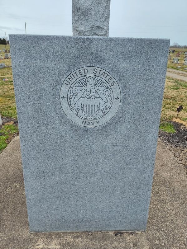
In 1804, a group of Scotch-Irish Covenanters from Rockbridge County, Virginia, erected a log church on this location. In 1805, they organized the Cherry Fork Associate Reformed Presbyterian Church. Two brick churches were also built on this . . . — — Map (db m133853) HM
Dr. Jarrod Burks, from Ohio Valley Archaeology, Inc., conducted a magnetic gradient survey of Serpent Mound in 2012. This kind of survey reveals changes in the magnetic properties of soil that are a result of some kind of ground disturbance in the . . . — — Map (db m268316) HM
"The most singular sensation of awe and admiration overwhelmed me... there seemed to come to me a picture as of a distant time, of a people with strange customs, and with it came the demand for an interpretation of this mystery. The unknown must . . . — — Map (db m268308) HM
Serpent Mound sits within a large crater almost nine miles across. The bedrock in the center of the crater has been thrust upward to between 400 and 900 feet above its original position, while an outer ring of bedrock has dropped from at least . . . — — Map (db m268306) HM
In the traditions of many American Indian tribes, the Great Serpent was a powerful spirit. People could call upon the Great Serpent for the power to cure illnesses or to be successful in hunting animals. The Great Serpent offered its power in the . . . — — Map (db m268319) HM
According to Tenskwatawa, often referred to as the Shawnee prophet, when the first Shawnee people came to this land many thousands of years ago, several warriors were lost when they were taken beneath the sea on the back of an immense turtle. . . . — — Map (db m268320) HM
Frederic W. Putnam, the Harvard University archaeologist who studied Serpent Mound in the late 1800s, described this area as a village site - actually two overlapping village sites, one earlier and one later.
Here he found "sites of dwellings," . . . — — Map (db m268321) HM
"Serpent Mound was purposefully built for a special, sacred purpose. I should think that anyone who views the Serpent will realize its sacredness and treat this place as they would a cathedral, synagogue or mosque. When we see this . . . — — Map (db m268307) HM
An effigy mound is a geoglyph, or symbol made of earth. The most common effigy mounds in North America are animal effigies.
Ohio has two well-documented effigy mounds, Serpent Mound and Alligator Mound.
Ohio's effigy mounds were not burial . . . — — Map (db m268313) HM
The ancestors of the American Indians of the Eastern Woodlands built Serpent Mound, but archaeologists disagree about when they built it. Some argue that the Adena culture built the mound around 2,300 years ago. This is the same culture that built . . . — — Map (db m268312) HM
William Bradford 1770-1862 Was one of the original settlers on the lands in the Fox Military Survey No. 401 ———— His son David Bradford 1806-1879 Established the Bradford Family Burial Ground south of the Aberdeen-Manchester Road in Sprigg . . . — — Map (db m303685) HM
An early settler, set aside the Kimble Family Burial Lot on his farm at Kimble’s Landing on the Ohio River Sprigg Township, Adams County, Ohio about 1830 ————Those members of his family and their descendants buried there have been . . . — — Map (db m303489) HM
William Grimes Pioneer, those members of his family and their descendants who were interred in the Grimes Family Burial Grounds on the Grimes Farm at Grimes Landing on the Ohio River, Sprigg Township, in Adams County, Ohio, have been . . . — — Map (db m303692) HM
Graduates from Manchester High School
who gave their lives in Vietnam in 1969
William Sparks
June 9
William Rigdon
July 6
James Woolard
Nov. 3 — — Map (db m268332) WM
Israel Donalson, member of the First Constitutional Convention of Ohio.
In May 1800, Congress passed an act building the Northwest
Territory, with the western division becoming Indiana
Territory and the eastern called the Territory of the . . . — — Map (db m136539) HM
Son of Nathan Ellis 1749-1819 Founder of “Ellis Ferry,” now Aberdeen, Ohio Established the Ellis Family Graveyard on his farm near Ellis’ Landing on the Ohio River Sprigg Township, Adams County, Ohio about 1820 ———— It was with thoughtful . . . — — Map (db m185498) HM
A local preacher organized a Methodist Society in 1797 at his home on the Scioto Brush Creek north of the village of Blue Creek in Adams County in the Northwest Territory. In August 1800 the Society built a log church on a site provided by Mr. . . . — — Map (db m185497) HM
Manchester was founded in 1791 by Nathaniel Massie as a base to
survey the land warrants of American Revolutionary War soldiers in
the Virginia Military District. This bank of the Ohio River provided
a secure site for the last civilian stockade . . . — — Map (db m136536) HM
In 1784, the state of Virginia ceded all of its Northwest Territory
to the federal government except for this tract to satisfy the
land bounties owed to its Revolutionary War soldiers. The Virginia
Military District extended from the Scioto River . . . — — Map (db m136532) HM
Massie’s Station, built in 1791, was the fourth
permanent settlement center in Ohio and the
last stockade settlement built in Ohio.
It
provided protection from the Indians
for
Manchester’s settlers until 1794.
Manchester was . . . — — Map (db m136537) HM
Set aside a family burial lot on the high ground at a bend in Little Three Mile Creek on his farm in the Fox Military Survey No. 401 Sprigg Township, Adams County, Ohio about 1847. ————The remains of those buried there and not removed to . . . — — Map (db m303660) HM
Medicinal value of springs promoted by Charles Matheny, 1840. First hotel built 1864 and resort named Sodaville. Under ownership of General Benjamin Coates, 1888–91, Smith Grimes 1891–08, and J. W. Rogers 1908–20. Mineral Springs Health Resort . . . — — Map (db m132963) HM
Cairn of Peace
dedicated at
World’s Conservation Exposition
and
5th World Plowing Contest
September 19- 20, 1957
These competitors were in the
World Plowing Matches
Peebles, Ohio 1957 . . . — — Map (db m268240) HM
On the night of July 15, 1863, Brigadier General John Hunt Morgan and his Confederate raiders set up camp along a seven-mile stretch between the villages of Jacksonville and Locust Grove. The following morning, General Morgan rode into Locust . . . — — Map (db m214407) HM
Platted in 1881 by Isaiah Custer on the junction of old Zane's Trace (1796-97) and the Cincinnati & Eastern Railway (1881). Incorporated 1886. Named after John G. Peebles, Portsmouth, Ohio businessman. David Nixon constructed the first house in . . . — — Map (db m223788) HM
In the traditions of many American Indian tribes, the Great Serpent was a powerful spirit. People could call upon the Great Serpent for the power to cure-illnesses or to be successful in hunting animals. The Great Serpent offered its power in the . . . — — Map (db m268229) HM
According to Tenskwatawa, often referred to as the Shawnee Prophet, when the first Shawnee people came to this land many thousands of years ago, several warriors were lost when they were taken beneath the sea on the back of an immense turtle. . . . — — Map (db m268230) HM
Frederic W. Putnam, the Harvard University archaeologist who studied Serpent Mound in the late 1800s, described this area as a village site - actually two overlapping village sites, one earlier and one later.
Here he found "sites of . . . — — Map (db m268232) HM
RR Station, Peebles, Ohio
Made famous by The Great Serpent Mound.
Post Card
Explore the beautiful forests nestled in the rolling Appalachia foothills
Doc Dumenil Peebles, Oh.
Serpent Mound
One of North America’s most . . . — — Map (db m268325) HM
An effigy mound is a geoglyph, or symbol made of earth. The most common effigy mounds in North America are animal effigies.
Ohio has only two well-documented effigy mounds, Serpent Mound and Alligator Mound.
Ohio's effigy mounds were . . . — — Map (db m268231) HM
The head of Serpent Mound is lined up to the point on the western horizon where the sun sets on the Summer Solstice – the longest day of the year.
Some think the three main curves of the serpent's body point to the Summer Solstice sunrise, . . . — — Map (db m268236) HM
The head of the Serpent Mound is lined up to the point on the western horizon where the sun sets on the summer solstice - the longest day of the year.
Some think the three main curves of the serpent's body point to the summer solstice . . . — — Map (db m268310) HM
"the most singular sensation of awe and admiration overwhelmed me … there seemed to come to me a picture as of a distant time, of a people with strange customs, and with it came the demand for an interpretation of this mystery. The . . . — — Map (db m268234) HM
Serpent Mound sits within a large crater almost nine miles across. The bedrock in the center of the crater has been thrust upwards to between 400 and 900 feet above its original position, while an outer ring of bedrock has dropped from at least . . . — — Map (db m268238) HM
One of North America’s most spectacular effigy mounds, Serpent Mound is a gigantic earthen sculpture representative of a snake. Built on a spur of rock overlooking Ohio Brush Creek around 1000 A.D. by the Fort Ancient culture, the earthwork was . . . — — Map (db m268239) HM
The inn was built 1800-01 by Peter Wickerham, a Revolutionary War veteran. It was used as an overnight stagecoach stop and tavern on Zane's Trace until ca. 1850. Runaway slaves were hidden here when the "Underground Railroad" was in operation. . . . — — Map (db m108129) HM
A thriving riverport in the 19th Century founded in 1835 by William Stout. Elisha Stout, son of William, born and raised here, was one of the founding fathers of Omaha, Nebraska and Denver, Colorado. Former site of Adamsville which served as the . . . — — Map (db m73138) HM
I will endeavor and will continue to train my soldiers to seek these lesser men out and make them know fear. I will continue to fight when others falter and grow weary of their duty. I firmly believe in my Constitution, in fact I believe it applies . . . — — Map (db m268362) WM
This hat represents Company E of the 70th Ohio Volunteer Infantry which was formed locally and served in the Civil War mustering into military service on December 23, 1861 to August 14, 1865. This per-dated the . . . — — Map (db m268411) HM
Dedicated to the memory of the T/SGT Charles Harris Eyre,
U.S. Army Air Corps, B-17 Gunner, 384 Bomb Group,
545 Squadron, shot down on his 24th mission,
April 13, 1944 over Schweinfurt, Germany,
Killed in Action
In Grateful Appreciation . . . — — Map (db m268361) WM
Founded 1887 by John Q. Roads on the Cincinnati & Eastern Railway (1881) and the Old West Union Road (1807). Incorporated 1911. Named after Franklin Seaman who donated land to the railroad for a station. Home of Will Rogers, "The Black King of the . . . — — Map (db m108200) HM
"Serpent Mound was purposefully built for a special, sacred purpose. I should think that anyone that views the Serpent will realize its sacredness and treat this place as they would any cathedral, synagogue, or mosque. When we see . . . — — Map (db m268228) HM
The ancestors of the American Indians of the Eastern Woodlands built Serpent Mound, but archaeologists disagree about when they built it. Some argue that the Adena culture built the mound around 2,300 years ago. This is the same culture that . . . — — Map (db m268235) HM
Archaeologists from Ohio Valley Archaeology, Inc. assisted by volunteers, followed up on the magnetometry survey by excavating a trench across a portion of the lost coll feature. The results suggested that part of the mound had once covered this . . . — — Map (db m268237) HM
The serpent head was first described by Squire and Davis in "Ancient Monuments of the Mississippi Valley" 1843
Saved from destruction in 1885 by Fredrick Ward Futnam, Professor of American Archaeology and Ethnology, Harvard University. . . . — — Map (db m214416) HM
This structure erected 1835 as Associate Reformed Presbyterian Church. Congregation organized in 1812. Many members active participants in Underground Railroad. Church closed 1894. Oscar C. Roebuck operated mortuary here 1909 ’till 1936. Then used . . . — — Map (db m135304) HM
The Bradford Tavern, West Union’s first inn built circa 1804,
served the Maysville-Zanesville stagecoach route and such travelers as Andrew
Jackson, Henry Clay, and Santa Anna. After 1840,
it was continued as the Marlatt House and,
later, the . . . — — Map (db m135307) HM
Country music writer and recording star
Lloyd Estel Copas was born on July 15,
1913 on Moon Hollow near Blue Creek in
Adams County, Ohio. Reared by musical
parents, he learned to play the guitar
and fiddle at an early age and began
a singing . . . — — Map (db m135306) HM
side A
First Presbyterian Church
The First Presbyterian Church of West Union, built in 1810, is known as the "Church of the Governors." Although the date is uncertain, the congregation was organized circa 1800 on Thomas Kirker's land on . . . — — Map (db m122227) HM
Hon. John T. Wilson's tribute to the Soldiers.
1861 - 1865.
Ohio Bicentennial
1803-2003
Rededicated June 14, 2003
In celebration of the Ohio Bicentennial
In memory of the Soldiers of Adams County Ohio who were killed or died . . . — — Map (db m199326) WM
The William Lafferty Memorial Funeral and Carriage Collection shows the development of the
funeral business since the mid-1800s through an
exhibit of caskets, funeral clothing, and hearses
collected and preserved by James William . . . — — Map (db m135347) HM
A short distance south of Zane’s Trace, West
Union was established by an act of the Ohio
Legislature on April 13, 1803, as the seat of
Adams County. West Union was surveyed in the
spring of the following year, and became
important stagecoach . . . — — Map (db m135312) HM
Members of the Associate Reformed Presbyterian
Church settled in Adams County as early as 1797.
The West Union congregation was organized in 1812,
and a lot was purchased for the construction of a
public house of worship. This brick church, . . . — — Map (db m135303) HM
Ohio’s first highway and mail route authorized by Congress 1796 marked and cleared in 1797 by Col. Ebenezer Zane a blazed trail, it became the route of the old stage line from Maysville to Wheeling used by noted statesmen to and from the . . . — — Map (db m121836) HM
Originally a vigilante group, the Anti-Horse Thief Society was formed here in March 1853 by area landowners to recover stolen horses and prosecute the thieves. Horse theft was a serious offense in the antebellum era. Trustees nominated a captain and . . . — — Map (db m214406) HM
Confederate Brigadier General John Hunt Morgan
and his raiders galloped into Winchester about 8:30 am
on July 15, 1863. The rebels immediately began searching
businesses and private residences for firearms, food, horses
and anything else that . . . — — Map (db m108236) HM
Winchester, Ohio. Founded November 8, 1815 by General Joseph
Darlinton and named for his Virginia birthplace.
Winchester was incorporated in 1864 and later
became the eastern terminus of the Cincinnati and
Eastern Railway (1877-1880). The . . . — — Map (db m133890) HM
One half mile north of this monument the home of Gen. Nathaniel Massie, founder of Manchester in 1791, first settlement in the Virginia Military District. Residence of Charles Willing Byrd, Secretary and Acting Governor, Northwest Territory and . . . — — Map (db m45344) HM
In honor of all men and women from Aberdeen and Huntington Township who served in all branches of the armed forces of the United States of America during war and peace times past and present.
Never forget love of your fellowman, devotion to . . . — — Map (db m273161) HM
In honor of the boys
of Byrd Township
who served the American colors
in the World War 1917- 1919
for liberty and humanity
Earl H. Baird · E. Victor Bennett · Walter F. Bennett · + Frank Brooks · George B. Brown · Alonzo Davis · John W. . . . — — Map (db m214452) WM
Spanish American
Co. H. 3rd O.V.I
R. H. Fisher •
J. M. Sheeler •
J. F. Burbage •
Arthur Edwards •
Geo. Parker 10th U.S. O.V.C.
Co. F. 1st O. Lt. Art.
Henry Ebrite •
J. G. Kirkpatrick •
Geo. Woods
Co. I. 12th . . . — — Map (db m214451) WM
Historic Decatur. Originally called St. Clairsville and platted in 1801, Decatur was named for early 19th century naval hero Stephen Decatur. It is among the oldest villages in Brown County, which before 1817 was a part of Adams County. Among . . . — — Map (db m121885) HM
Dedicated in memory of
United States Military Veterans
Veterans of Foreign Wars
Scanlon – Kelly Post 5920
Knights of Columbus
Father Sourd Council 2423
Fayetteville Ohio
27 May 2013 — — Map (db m95556) WM
In honor of God
and in memory of
the members of ths parish
who served in World War II
Flischel, Robert E.
killed in action December 31, 1944
(38 names) — — Map (db m95538) WM
Dedicated to the men and women who have served our community (Perry Township, Village of Fayetteville, and St. Martins) with courage and a willingness to give of themselves through service in the Army, Navy, Marines, Air Force, and Coast Guard . . . — — Map (db m273021) WM
HM3 Charles Hugh Crawford U.S. Navy 5-29-67 •
SP4 Jan Bernard Wahl U.S. Army 2-22-68 •
PFC Thomas Glenn Defosse USMC 3-4-68 •
SSGT Joe Franklin Evans U.S. Army 3-11-68 •
SP4 David Lee Bingamon U.S. Army 7-11-68 •
PFC Millard Preston . . . — — Map (db m273036) WM
He ties asleep in hallowed ground.
A gentle heart stilled by nature's hands.
Once eloquent lips emit no sound
Yet eternal flames breathe these commands:
"Remove evil as the dawn consumes the
night, Overcome hatred with . . . — — Map (db m273034) WM
Presented by the Taliaferro Chapter Daughters of the American Revolution to honor all from Brown County who have served in the Armed Forces — — Map (db m273032) WM
Of this furlough after the sophomore
term at West Point, Grant wrote.
"This i enjoyed beyond any other
period of my life. Most of my time
was spent among my old school mates."
Personal Memoirs of U.S. Grant Volume I — — Map (db m199483) HM
This plaque is dedicated to those whose efforts contributed to and made possible the reconstruction of the Brown County Courthouse severely damaged by fire in 1977. — — Map (db m199472) HM
1941 - 1945
In honor
of those of
Brown County
who gave their lives
in World War II
"He lives in fame, that died in virtue's cause"
Charles Colthar •
Calvin Schuler •
Garrett Hamm •
Wilbur Watson •
Paul Kelly •
Eugene . . . — — Map (db m199474) WM