69 entries match your criteria.
Historical Markers and War Memorials in Yarmouth County, Nova Scotia
By William Fischer, Jr., July 24, 2017
A Diverse Fishery Marker
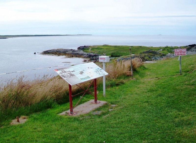
| 1 ► Nova Scotia, Yarmouth County, Cape Forchu — A Diverse Fishery — |
| 2 ► Nova Scotia, Yarmouth County, Cape Forchu — A Footstep into the Harbour — |
| 3 ► Nova Scotia, Yarmouth County, Cape Forchu — Cape Forchu's Guiding Light — |
| 4 ► Nova Scotia, Yarmouth County, Cape Forchu — Cheboque — |
| 5 ► Nova Scotia, Yarmouth County, Cape Forchu — Explosive Geology — |
| 6 ► Nova Scotia, Yarmouth County, Cape Forchu — Harbour of Deception — |
| 7 ► Nova Scotia, Yarmouth County, Cape Forchu — In Dire Need of a Lighthouse — |
| 8 ► Nova Scotia, Yarmouth County, Cape Forchu — Lost to the Sea / Perdus en Mer — |
| 9 ► Nova Scotia, Yarmouth County, Cape Forchu — Phare Cap-Forchu / Cape Forchu Lightstation — |
| 10 ► Nova Scotia, Yarmouth County, Cape Forchu — Pieces of the Past — |
| 11 ► Nova Scotia, Yarmouth County, Cape Forchu — The Power of the Sea — |
| 12 ► Nova Scotia, Yarmouth County, Cape Forchu — The Tusket Islands — |
| 13 ► Nova Scotia, Yarmouth County, Cape Forchu — Welcome to the Leif Ericson Trail — |
| 14 ► Nova Scotia, Yarmouth County, Hubbard's Point — Barges de foin salé de Buttes-Amirault — Salt Haystacks of Amirault's Hill — |
| On Nova Scotia Route 308 at Chemin des Gasson, on the right when traveling south on Provincial Route 308. | |||
| 15 ► Nova Scotia, Yarmouth County, Lower West Pubnico — What and When is Le Village Acadien? — Le Village historique acadien, c'est quoi?...c'est quand? — |
| 16 ► Nova Scotia, Yarmouth County, Lower West Pubnico — A Bond with the Sea / A Sustaining Faith — Un lien avec la mer / Une foi nourrissante — |
| 17 ► Nova Scotia, Yarmouth County, Lower West Pubnico — Les pionniers acadiens / Acadian Pioneers — Le Village historique acadien de la Nouvelle-Écosse — |
| On Old Church Road, 0.7 kilometers east of Nova Scotia Route 335, on the left when traveling east. | |||
| 18 ► Nova Scotia, Yarmouth County, Lower West Pubnico — Recolter la mer / Harvesting the Sea — Quai Dennis Point / Dennis Point Wharf — |
| On Dennis Point Road, 1 kilometer south of D'Entremont Road, on the left when traveling south. | |||
| 19 ► Nova Scotia, Yarmouth County, Lower West Pubnico — Sieur Phillippe Mius-d'Entremont — 1609 - 1699 — |
| On Old Church Road, 0.7 kilometers east of Nova Scotia Route 335, on the left when traveling east. | |||
| 20 ► Nova Scotia, Yarmouth County, Lower West Pubnico — What and Where is Acadie? / L'Acadie, c'est quoi?...c'est ou? — |
| 21 ► Nova Scotia, Yarmouth County, Lower West Pubnico — Who are the Acadians? / Qui sont les Acadiens? — |
| 22 ► Nova Scotia, Yarmouth County, Middle West Pubnico — Dennis Point — Living Wharves / Tchais Vivants — |
| On Dennis Point Road, 1 kilometer south of D'Entremont Road, on the left when traveling south. | |||
| 23 ► Nova Scotia, Yarmouth County, Rocco Point — Chapelle de la Pointe-à-Rocco / Chapel site at Rocco Point — Racines religieuses / Religious Roots — |
| Near Rocco Point Road, 1.2 kilometers south of the Lighthouse Route (Nova Scotia Route 3). | |||
| 24 ► Nova Scotia, Yarmouth County, Rocco Point — Chapelle Site / Chapel Site — |
| Near Rocco Point Road, 1.2 kilometers south of the Lighthouse Route (Nova Scotia Route 3). | |||
| 25 ► Nova Scotia, Yarmouth County, Rocco Point — L'histoire des Surette / History of the Surettes — |
| Near Rocco Point Road, 1.2 kilometers south of the Lighthouse Route (Nova Scotia Route 3). | |||
| 26 ► Nova Scotia, Yarmouth County, Ste. Anne du Ruisseau — Église Ste-Anne Church — Une foi vivante / Living Faith — |
| On the Lighthouse Route (Nova Scotia Route 3) at Rocco Point Road, on the left when traveling west on the Lighthouse Route. | |||
| 27 ► Nova Scotia, Yarmouth County, Ste. Anne du Ruisseau — Saint Anne Catholic Church Veterans Memorial — Lest We Forget / De Peur Que Nous Oublions — |
| On the Lighthouse Route (Nova Scotia Route 3) at Rocco Point Road, on the right when traveling west on the Lighthouse Route. | |||
| 28 ► Nova Scotia, Yarmouth County, Tusket — Argyle Township Court House and Gaol — Le Palais de Justice et Prison Canton d'Argyle — |
| On the Lighthouse Route (Nova Scotia Route 3) at Courthouse Road, on the right when traveling north on the Lighthouse Route. | |||
| 29 ► Nova Scotia, Yarmouth County, Tusket — Law in Nova Scotia / La Loi en Nouvelle-Écosse — |
| On the Lighthouse Route (Nova Scotia Route 3) at Courthouse Road, on the right when traveling north on the Lighthouse Route. | |||
| 30 ► Nova Scotia, Yarmouth County, Tusket — Lost at Sea / Perdus en Mer — |
| On the Lighthouse Route (Nova Scotia Route 3), on the right when traveling north. | |||
| 31 ► Nova Scotia, Yarmouth County, Tusket — Palais de justice et Prison d’Argyle / Argyle Township Court House and Gaol — |
| On Courthouse Road just east of the Lighthouse Route (Nova Scotia Route 3), on the right when traveling east. | |||
| 32 ► Nova Scotia, Yarmouth County, Tusket — The/Le Village of Tusket — Looking South, ca. 1910 / Regardant Vers le Sud, Environ 1910 — |
| On the Lighthouse Route (Nova Scotia Route 3) at Courthouse Road, on the right when traveling north on the Lighthouse Route. | |||
| 33 ► Nova Scotia, Yarmouth County, Tusket — United Empire Loyalists — |
| On the Lighthouse Route (Nova Scotia Route 3) at Nova Scotia Route 308, on the right when traveling north on the Lighthouse Route. | |||
| 34 ► Nova Scotia, Yarmouth County, Tusket — World Wars Memorial — 1914 - 1918 • 1939 - 1945 — |
| On the Lighthouse Route (Nova Scotia Route 3) at Nova Scotia Route 308, on the right when traveling north on the Lighthouse Route. | |||
| 35 ► Nova Scotia, Yarmouth County, West Pubnico — 200th Anniversary Commemoration of the "Grand Deportation" — Commémoration du Deuxiéme Centenaire du "Grand Dérangement" — 1755 • 1955 — |
| On the Lighthouse Route (Nova Scotia Route 335) at Argyle Sound Road/Martell Lane, on the left when traveling south on the Lighthouse Route. | |||
| 36 ► Nova Scotia, Yarmouth County, West Pubnico — 300th Anniversary of the Founding of Pubnico — 1651 • 1951 — |
| On the Lighthouse Route (Nova Scotia Route 335) at Argyle Sound Road/Martell Lane, on the left when traveling south on the Lighthouse Route. | |||
| 37 ► Nova Scotia, Yarmouth County, West Pubnico — 350th Anniversary Tribute to Acadian Women — |
| On the Lighthouse Route (Nova Scotia Route 335) at Argyle Sound Road/Martell Lane, on the left when traveling south on the Lighthouse Route. | |||
| 38 ► Nova Scotia, Yarmouth County, West Pubnico — Mémorial des guerres mondiales / World Wars Memorial — |
| On the Lighthouse Route (Nova Scotia Route 335) at Argyle Sound Road/Martell Lane, on the left when traveling south on the Lighthouse Route. | |||
| 39 ► Nova Scotia, Yarmouth County, West Pubnico — Musée acadien et Centre de recherch / Acadian Museum and Research Center — Un musée vivant / Living Museum — |
| On Nova Scotia Route 335, 0.5 kilometers south of Old Abbotts Harbour Road, on the right when traveling south. | |||
| 40 ► Nova Scotia, Yarmouth County, West Pubnico — Perdu aux eaux / Lost to the Waters — |
| On the Lighthouse Route (Nova Scotia Route 335) at Argyle Sound Road/Martell Lane, on the left when traveling south on the Lighthouse Route. | |||
| 41 ► Nova Scotia, Yarmouth County, West Pubnico — Potager Acadien / Acadian Garden — |
| 42 ► Nova Scotia, Yarmouth County, Yarmouth — Ballard [sic - Bollard] — |
| Near Water Street. | |||
| 43 ► Nova Scotia, Yarmouth County, Yarmouth — Bell — |
| Near Water Street. | |||
| 44 ► Nova Scotia, Yarmouth County, Yarmouth — Cape Forchu Lighthouse — |
| On Main Street, on the left when traveling north. | |||
| 45 ► Nova Scotia, Yarmouth County, Yarmouth — Coronation Park — |
| On Main Street (Nova Scotia Route 1) at Herbert Street, on the right when traveling north on Main Street. | |||
| 46 ► Nova Scotia, Yarmouth County, Yarmouth — Early Settlement — A Diverse Background — |
| On Water Street, on the right when traveling south. | |||
| 47 ► Nova Scotia, Yarmouth County, Yarmouth — East and West Camps, RCAF Station Yarmouth Nova Scotia — |
| Near Main Street (Nova Scotia Route 1) just south of Public Street, on the left when traveling south. | |||
| 48 ► Nova Scotia, Yarmouth County, Yarmouth — First Yarmouth Mayor and Council — |
| On Main Street (Nova Scotia Route 1) at Glebe Street, on the left when traveling north on Main Street. | |||
| 49 ► Nova Scotia, Yarmouth County, Yarmouth — Frost Park — |
| On Main Street (Nova Scotia Route 1) just south of Public Street, on the right when traveling south. | |||
| 50 ► Nova Scotia, Yarmouth County, Yarmouth — Frost Park — Town of Yarmouth — |
| On Main Street (Nova Scotia Route 1), on the left when traveling north. | |||
| 51 ► Nova Scotia, Yarmouth County, Yarmouth — Hartlin Trail — Robert E. Hartlin — 1936 - 2005 — |
| On Water Street, on the right when traveling north. | |||
| 52 ► Nova Scotia, Yarmouth County, Yarmouth — Land Transportation — Connecting by Road & Rail — |
| On Water Street, 0.1 kilometers south of Richards Lane, on the right when traveling south. | |||
| 53 ► Nova Scotia, Yarmouth County, Yarmouth — Lost to the Sea — |
| On Water Street at Glebe Street, on the right when traveling north on Water Street. | |||
| 54 ► Nova Scotia, Yarmouth County, Yarmouth — Lost to the Sea / Perdus en Mer — |
| On Water Street at Glebe Street, on the right when traveling north on Water Street. | |||
| 55 ► Nova Scotia, Yarmouth County, Yarmouth — M.V. Bluenose Anchor — |
| Near Water Street. | |||
| 56 ► Nova Scotia, Yarmouth County, Yarmouth — Manufacturing — Goods & Services for the Marketplace — |
| On Water Street, 0.1 kilometers south of Richards Lane, on the right when traveling south. | |||
| 57 ► Nova Scotia, Yarmouth County, Yarmouth — Milton Clock — A Symbol of Community Pride & Confidence — |
| On Water Street, on the right when traveling south. | |||
| 58 ► Nova Scotia, Yarmouth County, Yarmouth — Political Life — A Colourful Past — |
| On Water Street, on the right when traveling south. | |||
| 59 ► Nova Scotia, Yarmouth County, Yarmouth — Rum Running — Rum, Risk, and Riches! — |
| On Water Street, on the right when traveling south. | |||
| 60 ► Nova Scotia, Yarmouth County, Yarmouth — Sarah Corning — She Lived to Serve Others — |
| On Water Street, on the right when traveling north. | |||
| 61 ► Nova Scotia, Yarmouth County, Yarmouth — Shipbuilding — Building a Connection to the World — |
| On Water Street, on the right when traveling south. | |||
| 62 ► Nova Scotia, Yarmouth County, Yarmouth — Shipbuilding in Nova Scotia / Construction navale en Nouvelle-Écosse — |
| On Main Street at Marshall Lane, on the right when traveling south on Main Street. | |||
| 63 ► Nova Scotia, Yarmouth County, Yarmouth — the Yarmouth-Boston Ferry — |
| On Water Street at Lovitt Street, on the left when traveling north on Water Street. | |||
| 64 ► Nova Scotia, Yarmouth County, Yarmouth — The Fishery — A Community Mainstay — |
| On Water Street, on the right when traveling south. | |||
| 65 ► Nova Scotia, Yarmouth County, Yarmouth — The Killam Brothers Buildings & Wharf — |
| On Water Street just north of Central Street, on the left when traveling north. | |||
| 66 ► Nova Scotia, Yarmouth County, Yarmouth — the Parker-Eakins Buildings & Wharf — |
| On Water Street at Lovitt Street, on the left when traveling north on Water Street. | |||
| 67 ► Nova Scotia, Yarmouth County, Yarmouth — War Memorial — |
| On Main Street (Nova Scotia Route 1) at Frost Park, on the right when traveling north on Main Street. | |||
| 68 ► Nova Scotia, Yarmouth County, Yarmouth — Women Philanthropists — |
| On Main Street (Nova Scotia Route 1) at Herbert Street, on the right when traveling north on Main Street. | |||
| 69 ► Nova Scotia, Yarmouth County, Yarmouth Bar — Seafaring Sons of Yarmouth County — |
| On Yarmouth Bar Road (Nova Scotia Route 304), on the left when traveling south. | |||