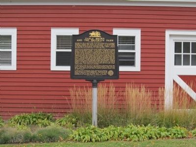
Although this site is known today as the Earl Brown farm, it originally belonged to Captain John Martin, who was involved in steamboating, lumbering, banking, flour milling and railroading. In the mid-1880s, he purchased 420 acres of rich Hennepin . . . — — Map (db m69931) HM
The University of Minnesota's first building, a preparatory school, was located on this site from 1851 until the University moved to its present location in 1855.
When the city of Minneapolis acquired the land for a park in 1903, it was . . . — — Map (db m37825) HM
June 1914: WWI begins
August 1914: Germany wins Battle of Tennenberg
September 1914: German invasion of France is stopped at Marne
January 1915: Germans use zeppelins to bomb England
May 1915: Germans sink Lusitania and provoke USA . . . — — Map (db m251809) HM
"This viaduct...is the only one of its kind that spans the Father of Waters, and is one of the largest and most noteworthy in the United States.
Firmer than the earth which supports it, it is constructed to stand the test of time."
. . . — — Map (db m27042) HM
Did you know that this park began as a power plant easement? A local amateur historian, Lucy Wilder Morris, convinced the St. Anthony Falls Water Power Company to grant an easement for a small park here in 1924. Lucy's interest in local . . . — — Map (db m155469) HM
Named for Charles W. Christmas, first county surveyor of Hennepin County, elected in 1852, who platted the original town site of Minneapolis for John H. Stevens and Franklin Steele. This lake and Lake Minnetonka now occupy what in pre-glacial times . . . — — Map (db m71571) HM
In 1919, Hennepin County hired the Illinois Steel Bridge Company to replace a deteriorating timber trestle built across Long Meadow Lake in 1891. The new 860-foot bridge was the longest Camelback through-truss bridge in the state when it opened in . . . — — Map (db m180917) HM
Born the son of 1812 War Veteran, Benjamin Bartholomew, and a grandson of Revolutionary War heroes, Benjamin Bartholomew and Abigail Patchen Bartholomew, Riley was the oldest of 12 siblings living on a frontier farm in Harpersfield, Ashtabula County . . . — — Map (db m37380) HM
Who made the supreme sacrifice for our country in the World War
1914—1918
This memorial has been erected by the American Legion of Hennepin County.
Dedicated May 30, 1923.
Victory Memorial Drive
constructed by . . . — — Map (db m255372) WM
James J. Hill
The Dakota Rail Regional Trail follows the route of a former railroad line that was once part of the Great Northern Railway. Built by James J. Hill in the late 1800s, this historic line played a part in connecting Minnesota to . . . — — Map (db m98390) HM
The original dam was built in 1913 and had 28 steel gates. The gates moved up and down to allow different amounts of water to flow under them. The current dam was completed in 1997 and is fitted with five crest gates. These gates maintain . . . — — Map (db m74833) HM
Highway 100 was a SLEEK NEW ROAD KNOWN AS 'LILAC WAY.' On sunny spring afternoons, families from Minneapolis piled into their Ford with a picnic lunch. The kids chattered excitedly as the car passed RURAL AREAS WITH OPEN LAND AND BLUE SKY. . . . — — Map (db m118001) HM
Mill Ruins Park embraces the flour-milling district that once lined the west bank of the Mississippi River at the heart of Minneapolis. Between 1858 and 1930, the milling district developed along the waterpower canal built here by the . . . — — Map (db m240366) HM
The Trail West
Although likely known to fur traders, Lake Minnetonka's vast collection of bays and inlets was not explored by white settlers until 1822, when teenagers Joseph R. Brown, William J. Snelling, and two soldiers from . . . — — Map (db m298994) HM
The Expanding City
In 1910, Minneapolis was growing in every direction. From its beginnings at the Falls of St. Anthony about 70 years before, a dense collection of commercial and industrial buildings filled the downtown, and block after . . . — — Map (db m200506) HM
1914: WWI begins
1917: USA enters WWI
1919: WWI ends; Construction of Drive begins
1921, 11 June: Drive is dedicated
1923: Octogon [sic] brick flag base, steel flag pole and bronze plaques are constructed
1924: Original elms are . . . — — Map (db m255275) HM
Built in 1848, the Ard Godfrey House is the earliest frame house still standing in Minneapolis. An example of Greek Revival architecture, it originally occupied a site in the vicinity of Main and Second Streets Southeast.
Ard Godfrey, a . . . — — Map (db m37774) HM
After more than a century as a military outpost, the U.S. Army decommissioned Fort Snelling following World War II. The site was transferred to the Veteran's Administration (VA) in 1946. Some of the Upper Post's building were used for medical . . . — — Map (db m275250) HM
Edwin and Harriet Phipps owned the farm from 1906 to 1934. Their son-in-law and daughter Martin and Mildred Grill owned it from 1934 until 1976.
The Phipps raised grain, vegetables, and flowers, but were especially known for asparagus. Edwin . . . — — Map (db m117774) HM
Marshall Street Brickyards
Construction of the Northern Pacific Railway tracks in 1864 created a new seam across the former prairie landscape of the St. Anthony Township. By the 1890s, spurs reached to a network of small . . . — — Map (db m245837) HM
Camping in the City? This playground, opened in 2014 and designed for Universal Access, recalls the "Minnehaha Municipal Auto Tourist Camp" located here from 1921-1955.
Playground Treasure Hunt! Can you find all seven of these . . . — — Map (db m309694) HM
Do you know how many bandshells have been built at Lake Harriet? Five, each built with a distinct style and features.
1888: The first bandshell was constructed by
the Minneapolis Street Railway Company on their property near the rail line. . . . — — Map (db m86816) HM
Thin black lines indicate changes in relevance. Between each pair of lines entries are ordered geographically but all have the same relevance.
* Inflectional forms of words are their plurals, singulars, and possessives as well as gramatical tenses and similar variations.