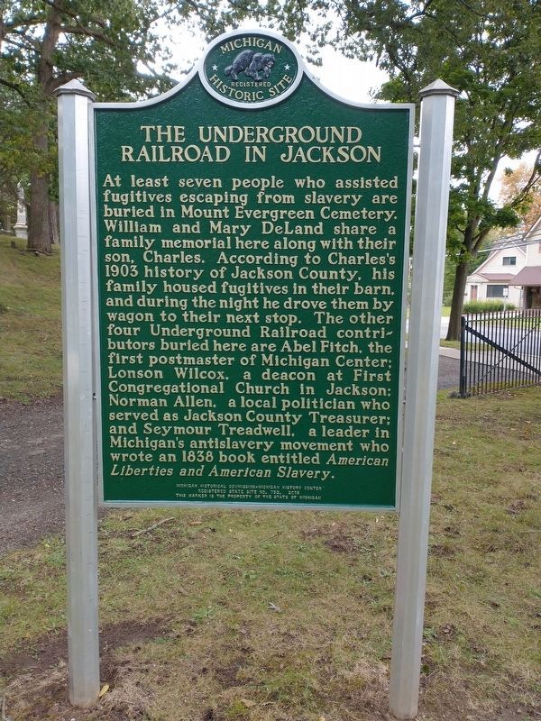
Mount Evergreen Cemetery In 1843 Jackson's village council purchased land from Eunice Dygert to establish public burial grounds in the village. The grounds were officially named Mount Evergreen Cemetery in 1879. The Greenwood Wall on the . . . — — Map (db m206859) HM
A cherished public gathering space with a long, illustrious past and a bright future
Original portions of the Jackson County Fairgrounds were purchased by the Jackson County Agricultural Society (JCAS) in 1856 from the widow of Dr. Oliver . . . — — Map (db m239168) HM
In 1888, the above engineering
building (today at 124 W. Louis
Glick Highway) was added to the
Eldred Mill complex immediately
west of the mill. In later Jackson
history, the building became
known as Howard's Feedstore
Warehouse. Today, . . . — — Map (db m212196) HM
Brooklyn Plant a Significant Employer for Residents
In 1921, American industrialist Henry Ford purchased the property of the former Swain Mill, which had burned 9 years earlier. Ford held the site vacant until 1938, when he began construction . . . — — Map (db m210618) HM
Camp Blair was named after Gov. Austin Blair, who served as "Michigan's Civil War Governor" from 1861-65. Blair, of Jackson, visited the camp several times. He is buried in Mt. Evergreen Cemetery,Jackson.
Camp of Many Purposes
Camp . . . — — Map (db m210745) HM
19th-20th Century Industrial/Commercial Complex
The historic Collins Manufacturing/Jackson Automobile Co. Complex is an important physical reminder of Jackson's industrial and commercial development and an excellent representation of . . . — — Map (db m210726) HM
Underground Railroad Hub
The DeLand family's property was located on the northeast corner of Mechanic and Franklin streets from 1851 until 1878. Three family members participated in the Underground Railroad: William DeLand offered his . . . — — Map (db m210762) HM
Ira McGonagel (1808-
1892) is among those
buried in the Jackson Poor
Farm Cemetery. Ira, the
son of Scottish immigrants,
was the father of 9, a
"farmer” and a "laborer"
He owned real estate in
Jackson County in the
1860s-70s, . . . — — Map (db m212193) HM
Congregation dates back to 1865
The Second Baptist Congregation was founded in 1865 when George and Sarah Green opened their home on Pearl Street, Jackson, for worship services. Over the years, the congregation built a masonry house of . . . — — Map (db m211881) HM
Six Fountains, Eleven Pools and Thousands of Lights Dazzle Fans for Generations The Cascades, an illuminated
man-made waterfall, was the dream
of William "Cap" Sparks (right) and
has thrilled generations of visitors
from all over the world . . . — — Map (db m248050) HM
Part of an ancient network of travel routes extending across southern Michigan
Nottawa Sepee Street is a remnant of the old Nottawa Sepee Indian trail documented by University of Michigan Prof. W. B. Hinsdale in his 1931 . . . — — Map (db m248051) HM
Free Methodist Movement Pursues Educational Freedom
In 1872, Free Methodist leaders bought and developed 10 acres of land that housed two vacant buildings for the purpose of founding Spring Arbor Seminary (see image below left). They hoped . . . — — Map (db m239288) HM
Ground was broken for what is now called "Michigan International Speedway" (M.I.S.), on Sept. 27, 1967. Over 2.5 million cubic yards of dirt were moved to form the . . . — — Map (db m239287) HM
Civil War governor Austin Blair (1818-1894) came to Jackson, Michigan, from New York in 1841. In 1842 he moved his law practice to Eaton Rapids. At that time the area was made up mostly of farmers, and Blair was paid for his legal services with . . . — — Map (db m171841) HM
The Grand River and its valley were formed by the melting of the continental glacier that retreated from this area some 12,000 years ago. Known by Chippewa Indians as Washtanong (further country) and by the French as le Riviere Grand, the Grand is . . . — — Map (db m104018) HM
Austin Blair began his political career in Eaton Rapids, where he was elected Eaton County clerk in 1842. As a member of the Michigan House of Representatives (1846-1849), he served in the Judiciary Committee and was a leading supporter or the 1846 . . . — — Map (db m54275) HM
Pioneers in the 1830's by the tens of thousands traveled west over the Territorial Road (roughly parallel to I-94). Many of them stopped in the Jackson area to take up land. Jackson County was named after Andrew Jackson and organized in 1832. The . . . — — Map (db m86567) HM
Coal was first mined in Michigan in the 1830s in Jackson County, and that area led in production through the 1880s. In the next decade dozens of mines were opened in Bay, Saginaw, and Shiawasee counties, producing thousands of tons of coal annually. . . . — — Map (db m180658) HM
Grass Lake
The first settlers arrived in Grass Lake in 1829. Two years later a post office, the second in Jackson County, opened at the settlement. In 1832 Grass Lake Township was created; the current boundaries were established in 1836. . . . — — Map (db m55223) HM
The railroad came to Ypsilanti in 1838. The inaugural ride was truly a distinguished party that included the 19 year old "Boy Governor," Stevens T. Mason and John D. Pierce, the first State Superintendent of Education. Their arrival on a cold . . . — — Map (db m103371) HM
This monumental Romanesque Revival church was erected in 1859 according to plans by architect Horatio N. White of Syracuse, New York. It is this congregation's third church. In 1871 the building was raised eight feet to accommodate lower-level . . . — — Map (db m54349) HM
On March 30, 1830, a commission appointed to choose Jackson County's seat of government reported: "A territorial road, call the St. Joseph's road, was last winter laid.... Where this road crosses the Grand river... a flourishing village is . . . — — Map (db m54313) HM
Burt Opera House
In 1888, this settlement was named in honor of Wellington R. Burt, the lumber tycoon who arranged for the Cincinnati, Saginaw and Mackinaw Railroad to run through this village. During his 1888 gubernatorial campaign, Burt . . . — — Map (db m180508) HM
Although iron mining in Wisconsin had its beginnings in Sauk, Dodge and Jackson counties in the southern part of the state in the 1850’s, discoveries of vast new deposits shifted the focus to northern Wisconsin in 1880. The major iron mining area . . . — — Map (db m30849) HM
Built in the 1880s by Daniel Striker, this Queen Anne-style building was once considered the "handsomest residence in Hastings." Born in New York State in 1835, Striker moved as a child with his family to Michigan. He was elected to several . . . — — Map (db m216572) HM
This historical plaque is located on the former site of the Detroit, Hillsdale and Indiana Railroad depot, built in 1870 when Manchester's second railroad was constructed. Railroads were essential to commerce and growth in 19th century towns, and . . . — — Map (db m209791) HM
The intersection of Main and Adrian Streets is considered the "heart" of downtown Manchester, and the first commercial buildings were constructed here in 1832-1833.
Why is Manchester Located . . . — — Map (db m206190) HM
(side one)
Few sermons have ever struck Jackson with the force of one delivered
in the Congregational Church on Oct. 13, 1850. There, the Reverend
Gustavius Foster preached from Titus 3:1, “Put them in mind to be
subject to . . . — — Map (db m256872) HM
Side 1
In 1843 New York natives Alfred and Ruth Paddock migrated to Concord Township. Within two years they erected this Greek Revival house, reminiscent of those in their home state. A prominent merchant, Alfred Paddock (1805-1870) owned . . . — — Map (db m78877) HM
In the nineteenth century, Michigan's
counties began to establish "poor
farms" to care for indigent people.
Jackson County leaders appointed a
Board of Superintendents of the Poor
on January 10, 1839, less than two
years after Michigan . . . — — Map (db m248048) HM
Did you know that all of Michigan was completely covered with ice 20,000 years ago? The glacial ice in our region was as much as one mile thick! As its enormous weight scraped across the ground, the glacier easily collected boulders, stone, . . . — — Map (db m243843) HM
(Obverse Side)
St. Mark's Church
St. Mark's parish, organized at the county courthouse on February 22, 1851, is Paw Paw's oldest Episcopal congregation. The Reverend Voltaire Spaulding conducted the first service in a vacant . . . — — Map (db m68435) HM
Community Legacy Isolated North Park, a high mountain valley encompassing Jackson County, requires resilience from those who choose to live here. It is a place where rugged ways of life have endured the test of time. No matter the . . . — — Map (db m283135) HM
This Field of Honor is a Memorial as a lasting tribute to those men and women who have served our country in war and peace. Those who survived were forever changed. Those who died were forever young in their loved ones' memories.
. . . — — Map (db m80141) WM