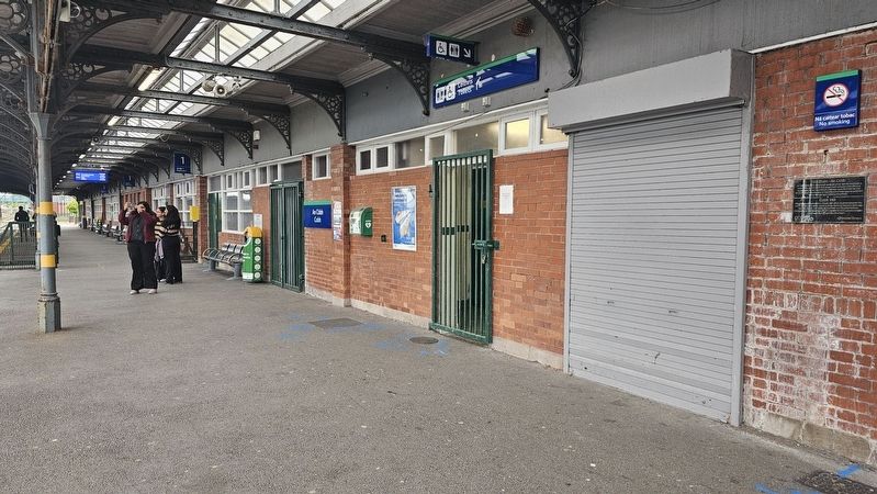
Near Lower Road at Westbourne Place, on the left when traveling west.
[Gaeilge:] 150 Bliain - An Cóbh An 10ú Márta 2012 a cuireadh suas an phlaic seo le comóradh a dhéanamh ar 150 bliain ó d’oscail Cuideachta Iarnróid Chorcaí agus Eochaille an t-Iarnród idir Corcaigh agus An Cóbh an 10ú Márta 1862 . . . — — Map (db m302602) HM
On Deepwater Quay at Westbourne Place, on the left when traveling south on Deepwater Quay.
[Gaeilge:]
Is ón mbaile seo, ar 20 Nollaig 1891, a chuaigh Áine Ní Mhórdha agus a deartháireacha Antaine agus Pilib ar bord an S.S. Nevada. B’í Áine an chéad duine a ligeadh isteach sna Stáit Aontaithe tríd an ionad nua . . . — — Map (db m302679) HM
On Lynch's Quay at East Beach, on the left when traveling east on Lynch's Quay.
This quay saw majestic sailing ships berthed and unloading their precious cargoes. They would take on stones and boulders as ballast for their outward journeys with empty holds. The Town Hall built in 1874 was once the office of the Cork Harbour . . . — — Map (db m302902) HM
On Lynch's Quay east of East Beach, on the left when traveling west.
This quay was built by Mr. W. Inman in 1878 and was formerly known as the “Inman Quay.” The original plan was to erect a series of seaward jetties on this site however this portion of the plan did not come to fruition with the result being that the . . . — — Map (db m302901) HM
English:
Cove Fort was built by Vice-Admiral Malcolm, the first Naval Commander of the Navy garrison in Cobh, in the mid 18th Century as a fortification for the garrison. The Fort comprised of a barracks, with 3 tiers of twenty four . . . — — Map (db m85827) HM
Near West Beach at Kennedy Pier, on the left when traveling west.
Born 23rd November 1845 in Cahirmoyle House, Limerick, Charlotte was the daughter of William Smith O’Brien and his wife Lucy née Gabbett. William was an Irish Nationalist MP, a landlord, a leader of The Young Ireland Movement, exiled to then Van . . . — — Map (db m302740) HM
On West Beach at Pearse Square, on the left when traveling east on West Beach.
[Gaeilge:] Is baile é an Cóbh a bhfuil a am atá thart agus a am faoi láthair cruthaithe ag an bhfarraige. D’éirigh sé ina bhaile saibhir mar gheall ar a shuíomh ag geata an Atlantaigh agus gar do chathair Chorcaí, bhí páirt lárnach . . . — — Map (db m302943) HM
Near Lower Road at Westbourne Place, on the left when traveling west.
[Gaeilge:] Rí an Óipiam agus an tAspal In 1847, ghabh an USS Jamestown
cuan i gCorcaigh agus 800 tonna bia agus éadaí ar bord aici. Daoine ar
fud Mheiriceá a thug na soláthairtí sin d’Éirinn agus iad ag iarraidh
cur . . . — — Map (db m302604) HM
On Lower Road at Westbourne Place, on the left when traveling west on Lower Road.
The Cobh Line From July 1st 1876 the Dublin-Cork day mail trains began running through to Cobh, a practice which continued until the Civil War in 1922, when severe damage was caused to Belvelly viaduct, one of two major structures which carry . . . — — Map (db m302603) HM
On East Beach at Lynch's Quay, on the left when traveling west on East Beach.
On the 50th anniversary of the Cork Harbour tragedy of 12th December 1942 we commemorate the following who lost their lives John Higgins CHC • Patrick Wilshaw NS • Frank Powell NS • William Duggan . . . — — Map (db m302906) WM
On East Beach at Lynch's Quay, on the left when traveling west on East Beach.
On the night of 12 December 1942, in the midst of WW2, a terrible accident occurred in the vicinity of Dognose Buoy, Cork Harbour. The crew of Port Pilot boat “Carraig an Cuan” was tasked with placing a Pilot Pat Lynch on board “Irish Poplar” . . . — — Map (db m302907) HM
On West Beach at Pearse Square, on the left when traveling east on West Beach.
[Gaeilge:] An 11 Aibreán 1912, cuireadh an Titanic ar ancaire cúpla ciliméadar amach ón gcósta nuair a rinne sé a stad deiridh ag Baile na Banríona. Rinne dhá bhád freastail, an PS America agus PS Ireland a bhí á n-oibriú ag . . . — — Map (db m302940) HM
On West Beach east of Kennedy Pier, on the left when traveling west.
Cunard liners have been visiting this port from 1867 to the present day. The line offices were situated in this building with the Cunard pier located at the rear. It was at this pier in 1915 that many victims and survivors of the Lusitania were . . . — — Map (db m302873) HM
Near Deepwater Quay near Westbourne Place, on the left when traveling south.
[Gaeilge:]
Tá an tsaoráid inar cuireadh fáilte roimh imircigh ag Oileán Ellis, Nua Eabhrac ar cheann de na hionaid is mó a bhfuil cáil uirthi i Meiriceá anois.
Idir na blianta 1892 agus 1954, chuaigh os cionn dhá mhilliún . . . — — Map (db m302676) HM
On Deepwater Quay at Westbourne Place, on the right when traveling south on Deepwater Quay.
The heritage centre is housed in the railway station building from where mail and baggage for Titanic were loaded onto waiting tenders at the Deepwater Quay. First and second class passengers boarded the tender “Ireland” here and were taken to the . . . — — Map (db m302658) HM
Near Casement Square at West Beach, on the left when traveling west.
Did You Know? Saviez-vous que? • Sabías que? • Sapevi che? • Wussten Sie, daß? [English:] In 1981, Jack Grimm was the first person to mount an expedition to locate the ship wreck, before its discovery in 1985. . . . — — Map (db m303009) HM
Near Casement Square at West Beach, on the left when traveling west.
Did You Know? Saviez-vous que? • Sabías que? • Sapevi che? • Wussten Sie, daß? [English:] It is reported that out of nine dogs that were onboard Titanic, two were rescued—a Pomeranian and a Pekinese. [Français:] . . . — — Map (db m303010) HM
Near Casement Square at West Beach, on the left when traveling west.
Did You Know? Saviez-vous que? • Sabías que? • Sapevi che? • Wussten Sie, daß? [English:] Titanic was never ‘christened’. It is traditional to break a bottle of champagne against the bow of a ship the day it is launched. But the . . . — — Map (db m303011) HM
Near Lower Road at Westbourne Place, on the left when traveling west.
The History of the Cobh – Cork Railway Line The line between Cobh (formerly Queenstown) and Cork was opened by the Cork & Youghal Railway Company on March 10th, 1862. At that time Cobh was already well established as a prominent deep water . . . — — Map (db m302607) HM
On Pearse Square north of West Beach, on the left when traveling north.
The Irish patriot and socialist James Connolly was one of the signatories to the Irish Proclamation of Independence in 1916 and was executed as one of the leaders of the 1916 Easter Rising. On the 7th March 1911 he addressed an open-air public . . . — — Map (db m302946) HM
On West Beach east of Kennedy Pier, on the right when traveling east.
The Lusitania Tile project was created in conjunction with the Home School Community Liaison ‘One Book One Community’ reading initiative at Carrignafoy Community College in the Lusitania Centenary year of 2015. The Lusitania was torpedoed by the . . . — — Map (db m302874) HM
On Casement Square near Westbourne Place, on the left when traveling north.
Following the Lusitania incident and as a mark of respect, the Irish American Sculptor Jerome Connor was commissioned by the New York Memorial Committee to sculpt a memorial to this tragedy to be installed in Cobh, County Cork. Cobh was chosen . . . — — Map (db m303017) HM
On Casement Square at Westbourne Place, on the left when traveling south on Casement Square.
The memorial nearby was commissioned by an international committee which included President Roosevelt of the USA. It is dedicated to the memory of those lost in the Lusitania sinking and to the cause of international peace. — — Map (db m303013) HM
This area has been a place of worship and burial from Celtic times to the present day. The great diversity of history and culture of Cobh is reflected on the many headstones and epitaphs of those interred here among them, Jack Doyle, Dr. James Roche . . . — — Map (db m85823)
On Westbourne Place west of Spy Hill, on the left when traveling west.
Built in 1854 this building became the headquarters of the Royal Cork Yacht Club. The forerunner of the RCYC was the Water Club formed in 1720. The current name derives from S.S. Sirius which was the first steam ship to cross the Atlantic departing . . . — — Map (db m302683) HM
Near Westbourne Place just west of Casement Square, on the left when traveling west.
[Gaeilge:] Chuimhnigh Jacqueline, bean chéile an Uachtaráin John F Kennedy, ina dhiaidh sin gurbh é a chuairt ar Éirinn i mí an Mheithimh 1963 “an chuairt ba luachmhaire dó ná aon chuairt eile ina shaol”. Bhí an t-am a chaith an . . . — — Map (db m302688) HM
Near Westbourne Place west of Casement Square, on the left when traveling west.
Known Locally as the Prom This park was built in 1805 and originally called the Columbine Quay. It was extended and refurbished throughout the succeeding century. It was renamed the Kennedy Memorial Park in 1966. The prom became a popular . . . — — Map (db m302699) HM
On Westbourne Place west of Casement Square, on the left when traveling east.
Built in 1855, the hotel was named “Queens Hotel” marking the visit of Queen Victoria to Cobh in 1849. It changed its name to the “States Hotel” in 1922 and became the Commodore Hotel in 1939. — — Map (db m303019) HM
On West Beach east of Kennedy Pier, on the left when traveling west.
[Gaeilge:] Ag geata an Atlantaigh, léiríonn méid agus neart daingneán Inis Píc an tábhacht straitéiseach a bhain le Cóbh agus Cuan Chorcaí don mBreatain. Sa bhliain 1775, bhí briseadh amach na Réabhlóide Meiriceánaí mar chúis le . . . — — Map (db m302759) HM
On High Road near Westbourne Place, on the left when traveling south.
Tree of Liberty
[English:] After the Rising of 1798 over six hundred United Irishmen were transported from Cove to the penal colonies of Australia where they subsequently influenced the development of the democratic and . . . — — Map (db m302609) HM
On Casement Square at Westbourne Place, on the left when traveling south on Casement Square.
Operator Cunard Line Launched Sept 20th 1906 Route Southampton–Cobh–New York Maiden Voyage Nov 16th 1907 Out of Service 1934 Capacity 2,165 Decks 9 Tonnage 31,938 GRT Length 790ft Beam 88 ft . . . — — Map (db m303014) HM
On West Beach at Pearse Square, on the left when traveling east on West Beach.
Commemorating R.M.S. Titanic and her last port of call on her maiden and final voyage. April 11, 1912 In special memory of the Irish emigrants and all those who lost their lives in this great tragedy [Gaeilge:] Ar dheis Dé go . . . — — Map (db m302937) HM
On Pearse Square north of West Beach, on the left when traveling north.
During the nineteenth and early twentieth century, Irish emigrant farewell gatherings became known as American Wakes. They were likened to the Irish tradition of funeral wakes where friends and family gathered to commemorate the loss of a loved one . . . — — Map (db m302945) HM
On Casement Square at West Beach, on the left when traveling west on Casement Square.
World Champion and Olympic Athlete, Sonia O’Sullivan was born in Cobh on 28th November 1969. She is Ireland’s greatest ever athlete and one of the greatest Irish sports people ever. Sonia joined the Ballymore Cobh Athletic Club at the age of 12 and . . . — — Map (db m302726) HM
The Cunard Liner, torpedoed and sunk by U Boat U20 off the Cork Coast on 7th May, 1915,
With the loss of 1198 lives.
Many survivors and dead were brought ashore here.
170 of the victims were buried in the nearby
Clonmel (Old Church) Cemetery. . . . — — Map (db m85818) HM WM
Near Casement Square at West Beach, on the left when traveling west.
As well as those who boarded Titanic from Queenstown there were also those who disembarked here. In addition to the 123 passengers who boarded here at Queenstown there were a number of passengers who left Titanic. Some were . . . — — Map (db m303012) HM
On Beechmount 0.1 kilometers east of Thomas Kent Street, on the right when traveling east.
Táimid réidh anois, a cheannasaí!
Nauair a shroich an Ceannasaí Seosaimh K. Taussig, Cabhlach na Stáit Aointaithe Meiriceá, Cóbh ar 4ú Bealtaine 1917, bhí scuadrún longa cogaidh SAM ina dteannta chun teacht i . . . — — Map (db m163613) HM
On Casement Square at West Beach, on the left when traveling west on Casement Square.
Scotts building circa 1830, subsequently remodeled. On the morning of April 11, 1912, Titanic passengers checked in here at the White Star Line office. They embarked by tender from the pier behind this building. Of the 123 who left from Cobh, only . . . — — Map (db m302963) HM
Near Casement Square near West Beach, on the left when traveling west.
Passenger’s gathered here at the White Star Line Ticket Office on the morning of 11th April 1912. They boarded the aptly named tenders Ireland and America. From here 123 Queenstown Passenger’s were transported to Titanic which was anchored off . . . — — Map (db m303008) HM