On King Street East (County Highway 2) at Park Street, on the right when traveling west on King Street East.
Half Moon Bay, so named because of its crescent moon shape, is on the south side of Bostwick Island in the Admiralty Group of the Thousand Islands, near Gananoque.
In 1887, a group of summer campers began to meet on Sunday in the bay for . . . — — Map (db m207424) HM
On Water Street just west of Market Street, on the left when traveling west.
Following the end of the War of 1812, Colonel Joel Stone turned his business interests over to his son-in-law Charles McDonald and Charles’ brother and partner John. By 1816, the garrison settlement of Gananoque was an established and . . . — — Map (db m207632) HM
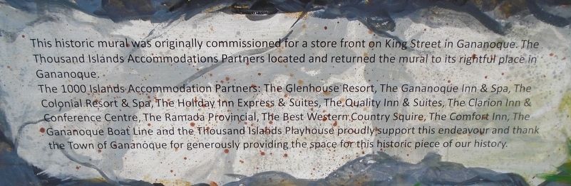
On King Street East (County Highway 2) at Park Street, on the right when traveling west on King Street East.
Built in 1921 by the local firm of Mitchell & Wilson Ltd. and designed by William Rees, a longtime member and leader of the Gananoque Citizens Band. The structure was restored in 1993 by the town and the province with the assistance of:
The . . . — — Map (db m207481) HM
On King Street West (County Highway 2) at Main Street, on the left when traveling east on King Street West.
This monument is dedicated to those
who served in the name of peace
———————————————————————
Ce monument est dédié a ceux qui
on servi au nom de la paix — — Map (db m207420) WM
On King Street East (Provincial Highway 2) 0.2 kilometers west of Stone Street, on the right when traveling west.
Born in Connecticut, Stone forfeited his home and property there when he fled to New York to serve with the Loyalist militia during the American Revolution. He came to Canada in 1786, settled with his family in New Johnstown (now Cornwall) and was . . . — — Map (db m90006) HM
On King Street East (County Highway 2) just west of Park Street, on the right when traveling west.
Built in Oshawa, Ontario, this gasoline-electric locomotive began service for the Thousand Islands Railway in March of 1931.
Although its gas electric engine was replaced with a 250 horsepower diesel engine in 1947, at 28 feet in length and a . . . — — Map (db m207425) HM
On Stone Street South close to Pine Street, on the right when traveling south.
English:
A vulnerable point on the vital line of supply from Lower Canada in the War of 1812-14. Raided on the 21st September, 1812, when the bridge was broken up. Fortified by the Leeds Militia and garrisoned in turn by the 104th, 41st, . . . — — Map (db m83528) HM
On King Street East (County Highway 2) 0.3 kilometers west of the Thousand Islands Parkway, on the right when traveling west.
Erected by the
Citizens of Gananoque
as a mark of loyalty and devotion
to their home town
August 1927
A cordial welcome is extended
to all who enter these gates
--------------
Re-erected in 1956
by the Corporation
of the Town . . . — — Map (db m207397) HM
On King Street East (Provincial Highway 2) 0.2 kilometers west of Stone Street, on the right when traveling west.
Built about 1831-32, and designed in the late phase of the Neo-Classic style, this structure is among the best of its type remaining in Ontario. Constructed as a dwelling for John McDonald, a local landowner, merchant, postmaster and later a member . . . — — Map (db m83532) HM
On Stone Street South at Oak Alley, on the left when traveling south on Stone Street South.
Church bell placed in tower of Methodist Episcopal Church, located east of here on south side of Pine Street, this was the first church spire erected in Gananoque.
1884
Bell moved to Wesleyan Methodist Church (also known as "The Stone . . . — — Map (db m207496) HM
On Water Street just west of Market Street, on the left when traveling west.
When Joel Stone’s sawmill was completed in 1795, it included a timber-and-stone dam at the first of the several Gananoque River rapids, which had previously been harnessed in a rudimental way to power the existing grist mill. The dam . . . — — Map (db m207618) HM
On Water Street at Kate Street, on the left when traveling west on Water Street.
In 1792, as a result of the [R]evolutionary War, Joel Stone, a loyalist to the British crown, arrived on this site and established a settlement which became the Town of Gananoque.
On June 18th the United States declared war on Great Britain. . . . — — Map (db m207521) HM WM
“A shovel for every need”, was the slogan for the Jones Shovel Company. The company was founded in 1852 by D.F. Jones (born in August 22 1818) who had represented South Leeds in Parliament for a number of years. Initially, the Company was . . . — — Map (db m207447) HM
On King Street West (County Highway 2) at Main Street, on the left when traveling east on King Street West.
Dedicated to All Veterans
Past, Present, and Future
The Little Park With A Big Heart
Authentic Corn Poppies from Flanders Fields
[In Flanders Fields]
[John McCrae - 1872-1918]
In Flanders fields . . . — — Map (db m207419) WM
On King Street East (Provincial Highway 2) 0.2 kilometers west of Stone Street, on the right when traveling west.
John Henry Brown enlisted in the Canadian Expeditionary Force on 18 August 1916 and reported to the 10th battalion in France in late June 1917. On 15 August his unit captured Hill 70, just east of Vimy Ridge. But on 16 August it was . . . — — Map (db m90007) HM
On King Street East (County Highway 2) just west of Stone Street (County Highway 32), on the left when traveling west.
Erected by
Branch no. 92 Royal Canadian Legion
on Nov. 11, 1967, in honoured memory of
226353 Pte. Harry Brown, V.C.
Born at Gananoque on 9 May, 1898, and laid
down his life for his country at Hill 70 in
France on 17 August, 1917. . . . — — Map (db m207490) HM WM
On King Street East close to Park Street, on the right when traveling north.
On September 21, 1812, a United States force of some 200 regulars and militia under Capt. Benjamin Forsyth attacked Gananoque. The village was an important forwarding point for supplies moving up the St. Lawrence from Montreal to Kingston and was . . . — — Map (db m83531) HM
On Water Street just west of Market Street, on the left when traveling west.
In 1806, Joel Stone was granted his petition to build a bridge, which would replace the ferry service he had initiated 5 years earlier. By 1810, as a direct consequence to Stone’s various enterprises, settlement at the mouth of the . . . — — Map (db m207622) HM
On Stone Street South at Sydenham Street, on the right when traveling south on Stone Street South.
On this site from
1895 to 1949
stood
Gananoque High School
This stone commemorates
the school the teachers and
the students of G.H.S.
40's Reunion July 1990 — — Map (db m207508) HM
On Water Street just west of Main Street, on the left when traveling west.
On this site stood the
"Thousand Island Railroad Station"
(circa 1906) combined with a steamboat
warehouse making a busy waterfront. — — Map (db m207513) HM
On Water Street just west of Market Street, on the left when traveling west.
By the time Joel Stone took up residence in the area in 1792, a grist mill had been built adjacent to Stone’s land on the east bank of the Gananoque River and was operating by harnessing the power of the first of several rapids along . . . — — Map (db m207617) HM
On King Street West (County Highway 2) at Main Street, on the left when traveling west on King Street West.
At this place on September 21, 1812, the 2nd Regiment of the Leeds Rifle Company, a local militia commanded by Colonel Joel Stone, defended this village during an American raid by Captain Benjamin Forsyth and the 1st Rifle Company from . . . — — Map (db m207414) HM
On Water Street just west of Market Street, on the left when traveling west.
When Colonel Stone returned after the raid, he found the government storehouse in ashes, the bridge destroyed and his home ransacked. His wife, Abigail, had been seriously injured and took some time to recover. As a deterrent to any . . . — — Map (db m207630) HM
On Water Street just west of Market Street, on the left when traveling west.
On June 18, 1812, war was declared between Britain and the United States. By then, Colonel Joel Stone commanded 386 officers and men of the 2nd Leeds Militia. Less than 60 were in the area when on September 21, 1812, Captain Benjamin . . . — — Map (db m207628) HM
On King Street East (County Highway 2) west of Park Street, on the right when traveling west.
This covered platform, dating from the early 1880’s and dubbed the “Umbrella” by the local populace, was built for the convenience of passengers at the uptown stop of the 1000 Islands Railway.
Today, with no rail connection from Gananoque to . . . — — Map (db m207444) HM
On King Street East (County Highway 2) just west of Park Street, on the right when traveling west.
[Photo captions, left column top to bottom, read]
• An awaiting crowd on the old ‘Iron Bridge’ – c. 1900
• New ‘Cement Bridge’ officially opened November 1930
• 1921 Early town aerial view
[Photo captions, center column top to . . . — — Map (db m207443) HM
On Water Street just west of Market Street, on the left when traveling west.
Joel Stone was a prosperous merchant, who was born and raised in Connecticut and who joined British forces as a captain of the Loyalist militia in New York during the American Revolution (1775-1783). Because of his loyalty to Britain, . . . — — Map (db m207525) HM
On King Street East (County Highway 2) at Park Street, on the right when traveling west on King Street East.
Erected by the Citizens of
Gananoque
in honoured memory of the
men of the town and district
who fought and fell
in the Great War
1914 - 1918
Their Name Liveth
For Evermore
Lieut. Col. Russell Hubert Britton D.S.O • Harold . . . — — Map (db m207485) WM
On Water Street west of Market Street, on the left when traveling west.
During the war of 1812, Gananoque was a strategic point along the St. Lawrence River corridor. All supplies heading west to support British and Canadian forces had to pass through this channel.
On September 21, 1812, a company of U.S. army . . . — — Map (db m90003) HM