72 entries match your criteria.
The Sullivan-Clinton Expedition Against the Iroquois Indians Historical Markers
By James R. Murray, August 2, 2016
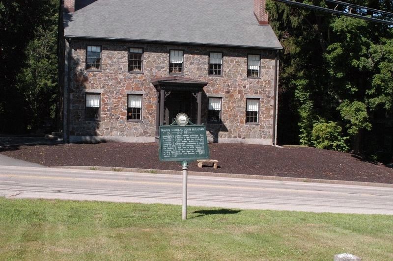
Major General John Sullivan Marker
| 1 ► New Hampshire, Strafford County, Durham — 89 — Major General John Sullivan — 1740-1795 — |
| On Newmarket Road (New Hampshire Route 108), on the left when traveling west. | |||
| 2 ► New York, Broome County, Binghamton — Indian Castle — |
| On Front Street (New York State Route 11). | |||
| 3 ► New York, Broome County, Binghamton — Near This Point 18 August 1779 — |
| On North Shore Drive. | |||
| 4 ► New York, Broome County, Binghamton — Roberson Museum — Sullivan-Clinton Museum Exhibit |
| On Front Street. Reported permanently removed. | |||
| 5 ► New York, Broome County, Binghamton — Routes of the Armies of General John Sullivan and General James Clinton — |
| On Conklin Avenue. | |||
| 6 ► New York, Broome County, Endicott — Routes of the Armies — Of General John Sullivan and General James Clinton — 1779 — |
| On West Main Street (Route 17C) at Badger Avenue, on the right when traveling west on West Main Street. | |||
| 7 ► New York, Cayuga County, Aurora — Routes of the Armies — General John Sullivan and General James Clinton — 1779 — |
| On Main Street (New York State Route 90) 0.5 miles north of Sherwood Road (County Route 42A), on the right when traveling north. | |||
| 8 ► New York, Cayuga County, Cayuga — Gansevoort Trail — |
| On Route 90, 0.1 miles south of Town Line Road (County Route 4A), on the left when traveling south. | |||
| 9 ► New York, Cayuga County, Cayuga — Sullivan-Clinton Campaign — |
| On Railroad Street at Lake Road, on the right when traveling south on Railroad Street. | |||
| 10 ► New York, Cayuga County, Union Springs — Routes of the Armies — General John Sullivan and General James Clinton — 1779 — |
| On New York State Route 90, 0.1 miles north of Great Gully Road, on the left when traveling south. | |||
| 11 ► New York, Chemung County, Chemung — Battle of Chemung — |
| On 1547 County Road 60 (County Route 60) west of Interstate 86, on the right when traveling east. | |||
| 12 ► New York, Chemung County, Elmira — Newtown Battlefield State Park — Revolutionary War Heritage Trail |
| On Newtown Reservation Road. Reported missing. | |||
| 13 ► New York, Chemung County, Elmira — The Sullivan Campaign — July 31 to October 15, 1779 — One of the Revolutionary War's Largest Campaigns — |
| On Newtown Reservation Road. | |||
| 14 ► New York, Chemung County, Lowman — 668 — Native Voices — Empire State Society Sons of the American Revolution — |
| On Oneida Road (County Route 60) at County Route 8, on the left when traveling west on Oneida Road. | |||
| 15 ► New York, Chemung County, Lowman — 616 — Newtown Defense — Empire State Society Sons of the American Revolution — |
| On Oneida Road (County Route 60) near County Route 8, on the left when traveling west. | |||
| 16 ► New York, Chenango County, Afton — About Two Miles Down The Susquehanna River — |
| 17 ► New York, Chenango County, Afton — Routes of the Armies of General John Sullivan and General James Clinton — |
| On Main Street. | |||
| 18 ► New York, Chenango County, Bainbridge — Routes of the Armies of General John Sullivan and General James Clinton — |
| On U.S. 7 at Kelly Road, on the right when traveling north on U.S. 7. | |||
| 19 ► New York, Livingston County, Conesus — Military Route — |
| On West Lake Road (New York State Route 256) at Sliker Hill Road (County Route 33), on the right when traveling south on West Lake Road. | |||
| 20 ► New York, Livingston County, Conesus — Routes of the Armies of General John Sullivan and General James Clinton — |
| On Footes Corners Road at South Livonia Road (New York State Route 15), in the median on Footes Corners Road. | |||
| 21 ► New York, Livingston County, Cuylerville — Genesee Castle — |
| Near Cuylerville Road (U.S. 20A) 0.2 miles west of Barrett Road. | |||
| 22 ► New York, Livingston County, Cuylerville — Routes of the Armies — |
| On Cuylerville Road (U.S. 20A) 0.2 miles west of Barrett Road. | |||
| 23 ► New York, Livingston County, Groveland — Groveland Ambuscade Monument — |
| Near David Gray Hill Road, 0.8 miles east of Barber Hill Road. | |||
| 24 ► New York, Livingston County, Groveland — Groveland Ambuscade Park — Revolutionary War Heritage Trail — |
| Near David Gray Hill Road, 0.8 miles east of Barber Hill Road. | |||
| 25 ► New York, Livingston County, Hemlock — Routes of the armies of General John Sullivan and General James Clinton - 1779 — |
| On Rix Hill Rd, 0.3 miles west of New York State Route 15A, on the left when traveling west. | |||
| 26 ► New York, Livingston County, Livonia — Military Route — |
| On South Livonia Road (New York State Route 15) at Cole Road, on the left when traveling south on South Livonia Road. | |||
| 27 ► New York, Monroe County, Rochester, Highland — Bausch & Lomb Riverside Park — Empires in America/Securing Western New York/Elmwood Avenue Bridge — |
| Near Wilson Boulevard at Elmwood Avenue, on the right when traveling west. | |||
| 28 ► New York, Monroe County, Rochester, Highland — The Sullivan-Clinton Expedition — To the Memory of — |
| Near Mount Hope Blvd., 0.2 miles north of Elmwood Avenue. | |||
| 29 ► New York, Montgomery County, Canajoharie — Routes of the Armies — Of General John Sullivan and General James Clinton — 1779 — |
| Near Erie Boulevard. | |||
| 30 ► New York, Montgomery County, Sprout Brook — Clinton Road — |
| On Clinton Road (County Route 80), on the left when traveling south. | |||
| 31 ► New York, Ontario County, Canandaigua — Canandaigua — |
| On West Avenue Extension, 0.2 miles east of U.S. 20, on the right when traveling east. | |||
| 32 ► New York, Ontario County, Canandaigua — Routes of the Armies of General John Sullivan and General James Clinton 1779 — |
| On Lakeshore Drive at City Pier, on the right when traveling south on Lakeshore Drive. | |||
| 33 ► New York, Ontario County, Geneva — Routes of the armies of General John Sullivan and General James Clinton, — 1779 — |
| On New York State Route 14 at Kashong Point Road, on the right when traveling north on State Route 14. | |||
| 34 ► New York, Otsego County, Milford — Upper Susquehanna — Historic New York — |
| On New York State Route 992G. | |||
| 35 ► New York, Otsego County, Otego — Revolutionary Army Camp — |
| On New York State Route 7, on the right when traveling east. | |||
| 36 ► New York, Schuyler County, Hector — Con-Daw-Haw — |
| On New York State Route 414, on the right when traveling south. | |||
| 37 ► New York, Seneca County, Canoga — "A Very Pretty Indian Town of Ten Houses" — |
| On New York State Route 89, 0.2 miles south of Lower Lake Road, on the left when traveling south. | |||
| 38 ► New York, Seneca County, Canoga — Gar-Non-De-Yo — |
| On New York State Route 89, 0.2 miles south of Lower Lake Road (County Road 116), on the left when traveling south. | |||
| 39 ► New York, Seneca County, Lodi — Routes of the armies of General John Sullivan and General James Clinton — 1779 — |
| On Rhodes Road just west of New York State Route 414, on the right when traveling west. | |||
| 40 ► New York, Seneca County, Ovid — Sullivan Trail — |
| On New York State Route 96, 1 mile south of Potter Road, on the left when traveling south. | |||
| 41 ► New York, Seneca County, Romulus — Dean's Cove — (Swah-Ya-Wa-Nah) — |
| On New York State Route 89, 0.8 miles north of Vineyard Road, on the right when traveling north. | |||
| 42 ► New York, Seneca County, Romulus — Degory Prowtt — |
| On New York State Route 89 at Swick Road, on the left when traveling north on State Route 89. | |||
| 43 ► New York, Seneca County, Sampson — Routes of the armies of General John Sullivan and General James Clinton — 1779 — |
| On New York State Route 96A, 0.2 miles north of Baptist Church Road. | |||
| 44 ► New York, Seneca County, Seneca Falls — General Sullivan’s New York Campaign Trail — |
| On U.S. 20 at Gravel Road (County Route 101), on the left when traveling north on U.S. 20. | |||
| 45 ► New York, Seneca County, Waterloo — General Sullivan’s New York Campaign Trail — |
| On West Main Street (U.S. 20) 0.1 miles west of Park Place, on the right when traveling west. | |||
| 46 ► New York, Seneca County, Waterloo — Skoi-Yase — |
| On U.S. 20, 0.1 miles west of Park Place, on the right when traveling west. | |||
| 47 ► New York, Tompkins County, Trumansburg — Route Between Lakes — |
| On West Main Street (Route 96) at Washington Street, on the right when traveling west on West Main Street. | |||
| 48 ► New York, Wyoming County, Orangeville — Stony Brook Glen — |
| On Varysburg Road (U.S. 20A) 0.4 miles east of New York State Route 98, on the left when traveling east. | |||
| 49 ► Pennsylvania, Bradford County, Athens — The Sullivan Expedition against the Iroquois Indians — 1779 — Teaoga — |
| On South Main Street (State Highway 199), on the right when traveling north. | |||
| 50 ► Pennsylvania, Bradford County, Wyalusing — Sullivan Expedition Against the Iroquois Indians 1779 — |
| On Grand Army of the Republic Hwy (US 6) at Moravian Road on Grand Army of the Republic Hwy (US 6). | |||
| 51 ► Pennsylvania, Bradford County, Wyalusing — Sullivan's March — |
| On Grand Army of the Republic Hwy (U.S. 6) at Moravian Road, on the right when traveling east on Grand Army of the Republic Hwy. | |||
| 52 ► Pennsylvania, Bradford County, Wyalusing — The Battle of Lime Hill — |
| On Grand Army of the Republic Hwy (US 6). | |||
| 53 ► Pennsylvania, Bradford County, Wysox — Major General John Sullivan’s March — Passing through Wesauking — |
| On Pennsylvania Route 187. | |||
| 54 ► Pennsylvania, Bradford County, Wysox — Sullivan Expedition — Against the Iroquois Indians 1779 — |
| On River Road (PA 2016). | |||
| 55 ► Pennsylvania, Bradford County, Wysox — Sullivan's March — |
| On Grand Army of the Republic Hwy (US 6). | |||
| 56 ► Pennsylvania, Luzerne County, Wilkes-Barre — The Sullivan Expedition against the Iroquois Indians — 1779 — |
| On River Street near South Street. | |||
| 57 ► Pennsylvania, Monroe County, Pocono Pines, Tobyhanna Township — Sullivan Bridge — |
| On Pennsylvania Route 940, on the right when traveling west. | |||
| 58 ► Pennsylvania, Monroe County, Pocono Summit, Tobyhanna Township — Hungry Hill Memorial — Sullivan's Expedition — |
| On Sullivan Trail (Pennsylvania Route 4004) 0.5 miles south of PA Route 940 (Pennsylvania Route 940) when traveling north. | |||
| 59 ► Pennsylvania, Monroe County, Pocono Summit, Tobyhanna Township — Hungry Hill Revolutionary War Monument — 1779 1943 — |
| On Sullivan Trail (Pennsylvania Route 4004) 0.5 miles south of PA Route 940 (Pennsylvania Route 940). | |||
| 60 ► Pennsylvania, Monroe County, Sciota — Sullivan Expedition Against the Iroquois Indians, 1779 — Brinker's Mill — |
| On Hamilton Road East (Bus US 209) at Neola Road on Hamilton Road East (Bus US 209). | |||
| 61 ► Pennsylvania, Monroe County, Scotrun — The Sullivan Expedition Against The Iroquois Indians 1779 — White Oak Run — |
| On Sullivan Trail Road, 0.1 miles east of Crescent Lake Road, on the right when traveling east. | |||
| 62 ► Pennsylvania, Monroe County, Tannersville — Sullivan Expedition Against the Iroquois Indians, 1779 — |
| On Manor Drive (PA 611) at T 537 at the bridger on Manor Drive (PA 611). | |||
| 63 ► Pennsylvania, Monroe County, Tannersville — Sullivan's March — |
| On Manor Drive (PA 611) at T 537 on Manor Drive (PA 611). | |||
| 64 ► Pennsylvania, Northampton County, Easton — Sullivan’s March — |
| On Center Square. | |||
| 65 ► Pennsylvania, Northampton County, Easton — Sullivan's Campaign — |
| On Sullivan Road west of West Campus Lane, on the left when traveling west. | |||
| 66 ► Pennsylvania, Northampton County, Easton, Forks Township — Sullivan Expedition Against the Iroquois Indians — 1779 — |
| On Knox Avenue at Sullivan Trail, on the right when traveling north on Knox Avenue. | |||
| 67 ► Pennsylvania, Northampton County, Wind Gap — Sullivan Expedition Against the Iroquois Indians — 1779 — |
| On South Broadway (Pennsylvania Route 512) 0.3 miles north of Male Road (County Road 1028), on the left when traveling north. | |||
| 68 ► Pennsylvania, Northumberland County, Sunbury — The Sullivan Expedition — |
| On North Front Street (State Highway 147), on the right when traveling north. | |||
| 69 ► Pennsylvania, Wyoming County, Black Walnut — Sullivan Expedition Against the Iroquois Indians, 1779 — Vanderlip's Farm — |
| On Roosevelt Highway (US 6) at Blue Stone Road on Roosevelt Highway (US 6). | |||
| 70 ► Pennsylvania, Wyoming County, Black Walnut — Sullivan's March — |
| On Roosevelt Highway (US 6) at Blue Stone Road on Roosevelt Highway (US 6). | |||
| 71 ► Pennsylvania, Wyoming County, Falls — Sullivan's March — |
| On Sullivan Trail (Pennsylvania Route 92) at Lowry Lane, on the right when traveling north on Sullivan Trail. | |||
| 72 ► Pennsylvania, Wyoming County, Tunkhannock — The Sullivan Expedition Against the Iroquois Indians, 1779 — |
| On West Tioga Street (BUS US 6) at Warren Street on West Tioga Street (BUS US 6). | |||