236 entries match your criteria. Entries 101 through 200 are listed.⊲ Previous 100 — The final 36 ⊳
Signers of the Declaration of Independence Historical Markers
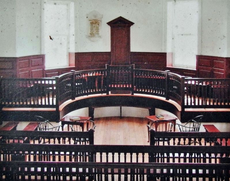
Marker detail: Courtroom
| 101 ► North Carolina, Chowan County, Edenton — 6 — 1767 Chowan County Courthouse — Edenton Historical Commission Museum Trail — |
| On East King Street at Colonial Avenue, on the right when traveling east on East King Street. | |||
| 102 ► North Carolina, Chowan County, Edenton — Joseph Hewes — |
| On East Water Street just west of Court Street, on the right when traveling west. | |||
| 103 ► North Carolina, Chowan County, Edenton — 3 — Joseph Hewes — Signed Declaration of Independence - Godfather of the US Navy — Edenton Historical Commission Museum Trail — |
| On East Water Street at Colonial Avenue, on the right when traveling west on East Water Street. | |||
| 104 ► North Carolina, Chowan County, Edenton — A-4 — Joseph Hewes — |
| On North Broad Street near West Church Street, on the right when traveling south. | |||
| 105 ► North Carolina, Chowan County, Edenton — 2 — Sea Port Fame Brings Famous Forefathers — Nation's Leaders, to Edenton — Edenton Historical Commission Museum Trail — |
| Near South Broad Street, 0.1 miles south of East Water Street, on the left when traveling south. | |||
| 106 ► North Carolina, Craven County, New Bern — Rev. John Knox Witherspoon — Educator & Minister — 1817 — |
| On New Street just west of Middle Street, on the right when traveling west. | |||
| 107 ► North Carolina, Granville County, Oxford — John Penn — |
| On Court Street at Main Street, on the right when traveling east on Court Street. | |||
| 108 ► North Carolina, Granville County, Stovall — G-1 — John Penn — —1740–1788— — |
| On U.S. 15 south of Cedar Lane (North Carolina Route 1430), on the left when traveling north. | |||
| 109 ► North Carolina, Guilford County, Greensboro — John Penn — |
| Near Old Battleground Road, on the right when traveling north. | |||
| 110 ► North Carolina, Guilford County, Greensboro — Signers Monument — |
| On Guilford Courthouse Auto Tour Road at Old Battleground Road, on the left when traveling west on Guilford Courthouse Auto Tour Road. | |||
| 111 ► North Carolina, Guilford County, Greensboro — Signers of the Declaration — Guilford Courthouse National Military Park — |
| Near Guilford Courthouse Auto Tour Road, on the left when traveling west. | |||
| 112 ► North Carolina, Guilford County, Greensboro — William Hooper — |
| Near Old Battleground Road, on the right when traveling north. | |||
| 113 ► North Carolina, New Hanover County, Wilmington, Riverfront — Here Stood the Residence of William Hooper — |
| On North 2nd Street north of Market Street, on the right when traveling north. | |||
| 114 ► North Carolina, New Hanover County, Wilmington, Riverfront — D-45 — William Hooper — |
| On North 3rd Street (U.S. 74) 0.1 miles south of Princess Street, on the right when traveling south. | |||
| 115 ► North Carolina, Orange County, Hillsborough — Nash-Hooper House — |
| On West Tryon Street, 0.1 miles west of North Churton Street, on the right when traveling west. | |||
| 116 ► North Carolina, Orange County, Hillsborough — G-4 — William Hooper — 1742 - 1790 — |
| On North Churton Street (Business U.S. 70) near West Tryon Street, on the left when traveling north. | |||
| 117 ► North Carolina, Orange County, Hillsborough — William Hooper Esquire — |
| Near West Tryon Street near North Churton Street. | |||
| 118 ► Ohio, Erie County, Sandusky — The Signers of the Declaration Of Independence — |
| On East Washington Row east of Columbus Avenue, on the right when traveling east. | |||
| 119 ► Ohio, Guernsey County, Cambridge — Signing of Declaration of Independence Memorial — 1776 - 1976 — |
| On Wheeling Avenue (Alternate Interstate 70) west of North 10th Street, on the right when traveling west. | |||
| 120 ► Pennsylvania, Berks County, Birdsboro — Bird Mansion — |
| On East Main Street (Pennsylvania Route 345/724) just east of North Mill Street, on the left when traveling east. | |||
| 121 ► Pennsylvania, Chester County, Lincoln University, Franklin Township — Thomas McKean — |
| On Newark Road (Pennsylvania Route 896) 0.1 miles south of Walnut Glen Road, on the right when traveling south. | |||
| 122 ► Pennsylvania, Chester County, Valley Forge — Benjamin Franklin Building — |
| 123 ► Pennsylvania, Chester County, Valley Forge — Independence Garden — Collection of Signers' Stones — |
| 124 ► Pennsylvania, Cumberland County, Carlisle — Carlisle Public Square — |
| On Hanover Street (Pennsylvania Route 34), on the right when traveling south. | |||
| 125 ► Pennsylvania, Cumberland County, Carlisle — Dr. Benjamin Rush — Founder of Dickinson College — |
| Near West High Street (U.S. 11) at North West Street. | |||
| 126 ► Pennsylvania, Cumberland County, Carlisle — Health Through History — Touring Local Parks and Green Spaces — |
| On North Pitt Street north of West High Street (U.S. 11), on the right when traveling north. | |||
| 127 ► Pennsylvania, Cumberland County, Carlisle — James Wilson — |
| On W. High Street at Pitt Street on W. High Street. | |||
| 128 ► Pennsylvania, Delaware County, Chester — John Morton — |
| Near 3rd Street near Ave. of the States. | |||
| 129 ► Pennsylvania, Delaware County, Chester — Old Swedish Burial Ground — |
| On 3rd Street at Ave. of the States, on the right when traveling north on 3rd Street. | |||
| 130 ► Pennsylvania, Delaware County, Norwood — Home of Morton Morton — Where Norwood Began — Circa 1750 — |
| Near East Winona Avenue, 0.1 miles south of Meadow Lane, on the right when traveling north. | |||
| 131 ► Pennsylvania, Delaware County, Norwood — Morton Morton House — |
| On East Winona Avenue, 0.1 miles south of Meadow Lane, on the right when traveling north. | |||
| 132 ► Pennsylvania, Delaware County, Prospect Park — Even History Changes — |
| On Wanamaker Avenue (Pennsylvania Route 420) 0.2 miles south of Lafayette Avenue, on the right when traveling south. | |||
| 133 ► Pennsylvania, Delaware County, Prospect Park — Morton Homestead — Morton Homestead State Park — Placed on the National Register of Historic Places - 1970 — |
| On Lincoln Avenue / Wanamaker Avenue (Pennsylvania Route 420), on the right when traveling south. | |||
| 134 ► Pennsylvania, Delaware County, Ridley Park — John Morton — |
| On E. Ridley Ave., on the right. | |||
| 135 ► Pennsylvania, Indiana County, Indiana — Indiana County — |
| On Philadelphia Street (Pennsylvania Route 954) 0.1 miles west of North 8th Street, on the right when traveling west. | |||
| 136 ► Pennsylvania, Lancaster County, Lancaster — George Ross — |
| On East King Street at Lime Street, on the right when traveling east on East King Street. | |||
| 137 ► Pennsylvania, Lancaster County, Lancaster — Patriots of St. James Church — |
| On Orange Street at N Duke Street when traveling west on Orange Street. | |||
| 138 ► Pennsylvania, Lancaster County, Lancaster — St. James' Church (Episcopal) — |
| On Orange Street at Duke Street, on the left on Orange Street. | |||
| 139 ► Pennsylvania, Lancaster County, Lancaster — The Revolutionary War — 1775-1783 — |
| On Penn Square. | |||
| 140 ► Pennsylvania, Lancaster County, Lancaster — This spot is marked in sacred memory of George Ross — |
| Near North Duke Street just south of East Marion Street, on the left when traveling south. | |||
| 141 ► Pennsylvania, Lehigh County, Allentown — Lehigh County — |
| On Hamilton Street at North 5th Street, on the right when traveling west on Hamilton Street. | |||
| 142 ► Pennsylvania, Lehigh County, Catasauqua — George Taylor — (1716-1781) — |
| On Lehigh Street at Poplar Street on Lehigh Street. | |||
| 143 ► Pennsylvania, Northampton County, Easton — George Taylor — |
| On South 4th Street at Ferry Street, on the right when traveling north on South 4th Street. | |||
| 144 ► Pennsylvania, Northampton County, Easton — George Taylor — In Memory Of — |
| 145 ► Pennsylvania, Northampton County, Easton — Iron in Colonial Pennsylvania — 1727 - 1791 — |
| On Hugh Moore Park Road, 0.1 miles south of Hill Road, on the left when traveling south. | |||
| 146 ► Pennsylvania, Philadelphia County, Philadelphia, Allegheny West — Thomas McKean — |
| Near Ridge Avenue, on the left when traveling north. | |||
| 147 ► Pennsylvania, Philadelphia County, Philadelphia, Fairmount Park — A Home for Patriots… and Tories… / Park Guards and Household Gear — Woodford — Fairmount Park Historic Houses — |
| On Greenland Drive south of Woodford Drive, on the right when traveling south. | |||
| 148 ► Pennsylvania, Philadelphia County, Philadelphia, Fairmount Park — Charles Carroll — |
| On Avenue of the Republic at States Drive, on the right when traveling east on Avenue of the Republic. | |||
| 149 ► Pennsylvania, Philadelphia County, Philadelphia, Fairmount Park — John Witherspoon D.D.L.L.D. — |
| On North Horticultural Drive east of Horticultural Drive, on the left when traveling east. | |||
| 150 ► Pennsylvania, Philadelphia County, Philadelphia, Fairmount Park — 204 — Rev. Dr. John Witherspoon — 1876 — Joseph Alexis Bailly (1825-1883) — |
| On North Horticultural Drive west of Horticultural Drive, on the left when traveling west. | |||
| 151 ► Pennsylvania, Philadelphia County, Philadelphia, Morrell Park — Benjamin Rush — (1745-1813) — |
| On East Keswick Road at Rayland Road on East Keswick Road. | |||
| 152 ► Pennsylvania, Philadelphia County, Philadelphia, Old City — Christ Church — |
| On North 2nd Street at Filbert Street, on the right when traveling south on North 2nd Street. | |||
| 153 ► Pennsylvania, Philadelphia County, Philadelphia, Old City — Christ Church — 1695 — |
| On North 2nd Street at Church Street, on the right when traveling south on North 2nd Street. | |||
| 154 ► Pennsylvania, Philadelphia County, Philadelphia, Old City — Christ Church — |
| Near 2nd Street. | |||
| 155 ► Pennsylvania, Philadelphia County, Philadelphia, Old City — James Wilson — |
| Near North 2nd Street. | |||
| 156 ► Pennsylvania, Philadelphia County, Philadelphia, Old City — Resting Place of Seven Signers of the Declaration of Independence — |
| Near North 2nd Street. | |||
| 157 ► Pennsylvania, Philadelphia County, Philadelphia, Old City — Robert Morris — |
| Near North American Street at Filbert Street when traveling north. | |||
| 158 ► Pennsylvania, Philadelphia County, Philadelphia, Rittenhouse Square — Benjamin Rush Medicinal Plant Garden — Signs generously provided by the Groff Family Memorial Trust |
| On South 22nd Street just north of Ranstead Street, on the right when traveling north. Reported permanently removed. | |||
| 159 ► Pennsylvania, Philadelphia County, Philadelphia, Rittenhouse Square — Benjamin Rush Medicinal Plant Garden — a living exhibit of the Mütter Museum — |
| Near South 22nd Street south of Ludlow Street, on the left when traveling south. | |||
| 160 ► Pennsylvania, Philadelphia County, Philadelphia, Society Hill — "Colors of the Human Family." — |
| On Lombard Street east of South 5th Street, on the right when traveling west. | |||
| 161 ► Pennsylvania, Philadelphia County, Philadelphia, Society Hill — 150 — Calder Statues — 1897 - 1899 — Presbyterian Historical Society — |
| On Lombard Street just east of South 5th Street, on the right when traveling west. | |||
| 162 ► Pennsylvania, Philadelphia County, Philadelphia, Society Hill — Dr. Benjamin Rush House Site — Independence National Historical Park — |
| On South 3rd Street (County Road 3006) west of South 3rd Street, on the right when traveling west. | |||
| 163 ► Pennsylvania, Philadelphia County, Philadelphia, Society Hill — Fort Wilson — |
| On Walnut Street (County Road 3006) west of South 3rd Street, on the left when traveling west. | |||
| 164 ► Pennsylvania, Philadelphia County, Philadelphia, Society Hill — Mother Bethel African Methodist Episcopal Church — |
| On Addison Street at Addison Street, on the right when traveling north on Addison Street. | |||
| 165 ► Pennsylvania, Philadelphia County, Philadelphia, Society Hill — Rose Garden — |
| On Walnut Street, on the left when traveling west. | |||
| 166 ► Pennsylvania, Philadelphia County, Philadelphia, University City — 1749 — A Revolutionary Institution — Founded by Benjamin Franklin — |
| Near Spruce Street west of South 34th Street, on the right when traveling west. | |||
| 167 ► Pennsylvania, Philadelphia County, Philadelphia, William Penn Annex East — Benjamin Rush, M.D. — 1745 - 1813 — |
| Near Arch Street, on the left when traveling west. | |||
| 168 ► Pennsylvania, Philadelphia County, Philadelphia, William Penn Annex East — Christ Church Burial Ground — 1719 — |
| On Arch Street at 5th Street on Arch Street. | |||
| 169 ► Pennsylvania, Philadelphia County, Philadelphia, William Penn Annex East — Chronology of Benjamin Franklin — |
| On Arch Street at 5th Street, on the left when traveling west on Arch Street. | |||
| 170 ► Pennsylvania, Philadelphia County, Philadelphia, William Penn Annex East — Declaration Chamber — |
| On Chestnut Street, on the right when traveling east. | |||
| 171 ► Pennsylvania, Philadelphia County, Philadelphia, William Penn Annex East — Francis Hopkinson — Signer of the Declaration of Independence — September 21, 1737 - May 9, 1791 — |
| Near Arch Street east of North 5th Street (County Road 2003), on the left when traveling west. | |||
| 172 ► Pennsylvania, Philadelphia County, Philadelphia, William Penn Annex East — Francis Hopkinson (Philadelphia Home) — |
| On Race Street. | |||
| 173 ► Pennsylvania, Philadelphia County, Philadelphia, William Penn Annex East — George Ross — Born: May 10, 1730 - New Castle, Del. — Died: July 14, 1779 - Philadelphia, Pa. — |
| Near Arch Street, on the left when traveling west. | |||
| 174 ► Pennsylvania, Philadelphia County, Philadelphia, William Penn Annex East — Independence Hall — |
| 175 ► Pennsylvania, Philadelphia County, Philadelphia, William Penn Annex East — Joseph Hewes — Born: January 23, 1730 — Died: November 10, 1779 — |
| Near Arch Street, on the left when traveling west. | |||
| 176 ► Pennsylvania, Philadelphia County, Philadelphia, William Penn Annex East — Robert Morris (1734 - 1806) — Financier of the Revolution — Independence National Historical Park, National Park Service, U.S. Department of the Interior — |
| Near Walnut Street. | |||
| 177 ► Pennsylvania, Philadelphia County, Philadelphia, William Penn Annex East — Signers of the Declaration of Independence — |
| Near Arch Street just east of North 5th Street (County Road 2003), on the left when traveling west. | |||
| 178 ► Pennsylvania, Philadelphia County, Philadelphia, William Penn Annex East — Signers Walk — |
| On Chestnut Street (County Road 3008) at South 6th Street, on the right when traveling west on Chestnut Street. | |||
| 179 ► Pennsylvania, Philadelphia County, Philadelphia, William Penn Annex East — The Signer — |
| Near Chestnut Street at 5th Street. | |||
| 180 ► Pennsylvania, Philadelphia County, Philadelphia, William Penn Annex East — The Signer — |
| On Chestnut Street (County Road 3008) just east of South Independence Mall East (County Road 2003), on the right when traveling east. | |||
| 181 ► Pennsylvania, Philadelphia County, Philadelphia, William Penn Annex East — The Signer — Independence National Historical Park — National Park Service — |
| On Chestnut Street (County Road 3008) just east of South Independence Mall East (County Road 2003), on the left when traveling west. | |||
| 182 ► Pennsylvania, Philadelphia County, Philadelphia, William Penn Annex East — The Signer — Independence National Historical Park — National Park Service — |
| On South Independence Mall East (County Road 2003) just south of Chestnut Street (County Road 3008), on the left when traveling south. | |||
| 183 ► Pennsylvania, Philadelphia County, Philadelphia, William Penn Annex East — The Signer — |
| On South Independence Mall East (County Road 2003) just south of Chestnut Street (County Road 3008), on the right when traveling north. | |||
| 184 ► Pennsylvania, Philadelphia County, Philadelphia, William Penn Annex West — Declaration of Independence Signators — |
| Near Germantown Avenue. | |||
| 185 ► Pennsylvania, Philadelphia County, Philadelphia, William Penn Annex West — In Commemoration of the Men of Irish Birth or Lineage — |
| On South 15th Street (Pennsylvania Route 611) at Market Street (Pennsylvania Route 3), on the left when traveling south on South 15th Street. | |||
| 186 ► Pennsylvania, York County, Hanover, West Manheim Township — The Mary Ann Forge and Furnace — |
| On Black Rock Road, on the left when traveling east. | |||
| 187 ► Pennsylvania, York County, Mount Wolf, East Manchester Township — Codorus Furnace — |
| On PA 24 at Codorus Furnace Road, on the right when traveling north on PA 24. | |||
| 188 ► Pennsylvania, York County, York — 42 South George — |
| On South George Street (Business Interstate 83) just south of West Mason Avenue, on the right when traveling south. | |||
| 189 ► Pennsylvania, York County, York — Colonel James Smith — |
| On East Market Street (Pennsylvania Route 462) just east of North Queen Street. | |||
| 190 ► Pennsylvania, York County, York — James Smith — |
| On E. Market Street, 0.1 miles east of Queen Street, on the left when traveling east. | |||
| 191 ► Pennsylvania, York County, York, Hellam Township — Codorus Furnace — |
| On Furnace Road at River Farm Road, on the left when traveling east on Furnace Road. | |||
| 192 ► Pennsylvania, York County, York, Manchester Township — Philip Livingston — |
| On N. George St. near Prospect Hill Cemetery entrance, on the left when traveling north. | |||
| 193 ► Rhode Island, Newport County, Newport — John Adams — 1735 – 1826 — |
| Near Lincoln Drive, on the right when traveling north. | |||
| 194 ► Rhode Island, Providence County, Providence, College Hill — Stephen Hopkins — 1707 - 1785 — Merchant and Ship Builder — |
| On Hopkins Street at Benefit Street, on the right when traveling east on Hopkins Street. | |||
| 195 ► South Carolina, Beaufort County, Beaufort — Thomas Heyward, Jr. — |
| 196 ► South Carolina, Charleston County, Charleston, French Quarter — Edward Rutledge — |
| Near Church Street north of Queen Street, on the right when traveling north. | |||
| 197 ► South Carolina, Charleston County, Charleston, French Quarter — 10-6 — St. Philip's Church — |
| On Church Street, 0.1 miles north of Queen Street, on the right when traveling north. | |||
| 198 ► South Carolina, Charleston County, Charleston, South of Broad — Laurens - Rutledge House — 117 Broad Street — |
| On Broad Street at Orange Street, on the right when traveling east on Broad Street. | |||
| 199 ► South Carolina, Charleston County, Charleston, South of Broad — Thomas Heyward, Jr. — House, circa 1803 — |
| On Meeting Street at Lamboll Street, on the right when traveling north on Meeting Street. | |||
| 200 ► South Carolina, Dorchester County, Summerville — 18-4 — Middleton Place / Arthur Middleton — |
| On Ashley River Road (State Highway 61), on the right when traveling north. | |||
236 entries matched your criteria. Entries 101 through 200 are listed above. ⊲ Previous 100 — The final 36 ⊳