On West Clinton Street (U.S. 129) at James Street (Georgia Route 18), on the right when traveling east on West Clinton Street.
On Nov. 15, 1864, after destroying Atlanta and cutting his communications with the North, Maj. Gen. W. T. Sherman, USA, began his destructive campaign for Savannah — the March to the Sea. He divided his army [US] into two wings. The Left Wing . . . — — Map (db m41449) HM
On Henderson Road at Griswoldville Road, on the right when traveling north on Henderson Road.
On Nov. 22 1864, the Right Wing (15th and 17th Corps) of Gen. Sherman’s army [US] marched southeast from the vicinity of Gray toward Gordon and Irwinton on its destructive March to the Sea. To protect the right against Wheeler’s cavalry [CS], Brig. . . . — — Map (db m98659) HM
On Henderson Road at Griswoldville Road, on the right when traveling north on Henderson Road.
On Nov. 22, 1864, the 1st Division, Georgia Militia (less the 1st Brigade), with the 1st and 2nd Regiments, Georgia State Line, and Anderson’s Georgia Battery attached, Brig. Gen. Pleasant J. Phillips commanding, marched from East Macon about 8:00 . . . — — Map (db m65517) HM
On Henderson Road at Griswoldville Road, on the right when traveling north on Henderson Road.
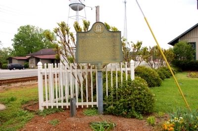
In 1862, to meet the pressing need of the Confederate States Army for revolvers of the Colt pattern, the Griswold Cotton Gin Company’s plant, on this site, was converted to a pistol factory. In March, the production of cotton gin machinery was . . . — — Map (db m98660) HM
On Henderson Road north of Griswoldville Road, on the left when traveling south.
Griswoldville is among the most severe examples of destruction during the March to the Sea. Nothing remains today of the industrial town that once occupied this crossroads. Named for Samuel Griswold (1790-1867), a Connecticut industrialist, . . . — — Map (db m127156) HM
On Old Garrison Road (Georgia Route 49) at Griswoldville Road, on the right when traveling north on Old Garrison Road.
On Nov. 22, 1864, the Right Wing (15th and 17th Corps) of Gen. Sherman’s army [US] moved SE from Clinton (near Gray) toward Gordon and Irwinton on its destructive March to the Sea. Walcutt brigade, with two guns of Arndt’s Michigan Battery, was . . . — — Map (db m41550) HM
On Irwinton Highway (Georgia Route 57) 0 miles east of Hidden Valley Road, on the right when traveling west.
On Nov. 22, 1864, the Right Wing (15th and 17th Corps) of Gen. Sherman’s army [US] moved SE from Clinton (near Gray) towards Gordon and Irwinton on its destructive March to the Sea. Walcutt’s brigade, with two guns of Arndt’s Michigan Battery, was . . . — — Map (db m25240) HM
On Georgia Route 49 at Pitts Chapel Road, on the right when traveling north on State Route 49.
On the night of Nov. 21, 1864, the headquarters and one division (Hazen’s) of the 15th Corps [US] of General Sherman’s army, which had left Atlanta on Nov. 15th on its destructive March to the Sea, camped here at the crossing of the . . . — — Map (db m41446) HM
Near Monticello Highway (Georgia Route 11) south of Jackson Road.
As part of a two-pronged Cavalry raid, on Wednesday, July 27 1864, Union Major General George Stoneman with over 2,100 troopers left the main Federal army then located near Atlanta. Stoneman's orders from Major General William T. Sherman, were to . . . — — Map (db m103205) HM
On West Oglethorpe Highway (U.S. 84) near Ryon Avenue, on the right when traveling south.
On Dec. 16, 1864, a detachment of the 7th Illinois Infantry (mounted) foraging near the right flank of Gen. Sherman's army (US) which was then closing in on Savannah, met here in Hinesville a detachment of cavalry from Brig. Gen. Alfred Iverson's . . . — — Map (db m15185) HM
Near Ocean Highway (U.S. 17) near Martin Street, on the right when traveling north.
On Dec. 13, 1864, Murray's brigade of Kilpatrick's cavalry division (USA), scouting in the right rear of Gen. Sherman's army, which was then closing in on Savannah, moved south into Liberty County. After driving back the 29th Georgia Cavalry . . . — — Map (db m41685) HM
On Savannah Highway (U.S. 25/301) at Fishing Road, on the right when traveling east on Savannah Highway.
On Dec 1, 1864, while General Sherman's army was on its destructive march to the Sea, the Fourth Brigade, Georgia Militia, Brig. Gen. H. K. McKay, reached Morgan's Lake (0.7 mile SE) to defend the Savannah and Gulf (ACL) RR bridge over the Altamaha . . . — — Map (db m4853) HM
On Brooklyn Avenue (U.S. 41) 0.1 miles South Bennett Street, on the right when traveling south.
On Nov. 16, 1864, Maj. Gen. G. W. Smith, CSA, reached Griffin (30 miles NW) after a night withdrawal from Lovejoy’s Station (13 miles N of Griffin) where he had been posted to support Iverson’s division of Wheeler’s cavalry [CS] which was watching . . . — — Map (db m25655) HM
On Georgia Route 42, 0.4 miles south of Old Indian Springs Road, on the left when traveling north.
On Nov. 17, 1864, Kilpatrick’s cavalry division [US], which was covering the right flank of Gen. Sherman’s army on its March to the Sea, moved from Bear Creek Station (Hampton) 31 mi. NW, down the north bank of Towaliga River to threaten Griffin and . . . — — Map (db m26947) HM
On West Main Street at Railroad Street / Parks Mill Road, on the right when traveling south on West Main Street.
On Saturday, November 19, 1864, Federal troops under Gen. Geary, Sherman’s 20th Army Corps, drove a small detachment of Confederate soldiers out of Buckhead, ate dinner and then destroyed the water tank, all railroad buildings and a large supply of . . . — — Map (db m16144) HM
On Wood Road, 0.9 miles east of Woods Road, on the right when traveling east.
This house, built in early 1800 and used as a stagecoach stop, was located on Seven Islands Road which ran from Philadelphia to New Orleans. On Nov. 20, 1864, Federal raiders under Gen. Geary destroyed the nearby mill and ferry. At the request of . . . — — Map (db m17265) HM
On Blue Springs Road, 0.2 miles west of Swords Road, on the left when traveling east.
On Nov. 15, 1864, after destroying Atlanta and cutting his communications with the North, Maj. Gen. W.T. Sherman, USA, began his destructive campaign for Savannah -- the March to the Sea. He divided his army [US] into two wings. The Right Wing . . . — — Map (db m16210) HM
Near Blue Springs Drive, 0.5 miles east of Fraction Bottoms Road.
Just below where the Apalachee River joins the Oconee River the Georgia Railroad constructed a massive bridge in the early 1840s, eventually connecting Augusta by rail to the newly-established town of Marthasville (now named Atlanta). It was "a . . . — — Map (db m113289) HM
On West Jefferson Street west of Thomason Road when traveling west.
The original foundation and some of the brick walls of the Madison Depot burned by Federal troops on Saturday, November 19, 1864, are still evident in the existing structure. It was one of the first brick depots on the Georgia Rail Road from . . . — — Map (db m103332) HM
On South Main Street (U.S. 278) 0 miles east of Foster Street, on the right when traveling east.
On Nov. 15, 1864, after destroying Atlanta and cutting his communications with the North, Maj. Gen. W. T. Sherman, USA, began his destructive campaign for Savannah -- the March to the Sea. He divided his army [US] into two wings. The Right Wing . . . — — Map (db m16162) HM
On Fairplay Street at West Main Street, on the right when traveling south on Fairplay Street.
In the early 1860s Rutledge was a community of about 200 citizens. It was named for a local family that had owned property through which the Georgia Railroad was built. Farms and plantations dotted the area around the railroad station and small . . . — — Map (db m103336) HM
On Atlanta Highway (U.S. 278) at Newborn Road, on the right when traveling east on Atlanta Highway.
On Nov. 15, 1864, after destroying Atlanta and cutting his communications with the North, Maj. Gen. W. T. Sherman, USA, began his destructive campaign for Savannah - the March to the Sea. He divided his army [US] into two wings. The Right Wing . . . — — Map (db m16163) HM
On Monticello Street SW south of Clark Street SW, on the left when traveling south.
On Friday, July 22, 1864, while the Battle of Atlanta raged about 25 miles to the west, Union Brigadier General Kenner Garrard and about 3,500 cavalrymen were in Covington. They had been ordered by Major General William T. Sherman to disrupt the . . . — — Map (db m103344) HM
On U.S. 278 at Georgia Route 142, on the right when traveling east on U.S. 278.
On Nov. 18, 1864, Hq. Military Division of the Mississippi [US], Maj. Gen. W.T. Sherman, were established here at “Harris´ Quarters,” the overseer’s house and negro cabins of a large plantation owned by Judge John Harris of Covington. . . . — — Map (db m34208) HM
On U.S. 278, 0 miles west of Elm Street NE when traveling west.
On Nov. 15, 1864, after destroying Atlanta and cutting his communications with the North, Maj. Gen. W. T. Sherman, USA, began his destructive campaign for Savannah -- the March to the Sea. He divided his army [US] into two wings. The Right Wing . . . — — Map (db m20480) HM
On Wesley Street at Fletcher Street, on the right when traveling north on Wesley Street.
Built in 1841 as a Methodist meeting house, Old Church was designed in the Greek Revival style with 14 rows of stark wooden pews and two separate front doors for men and women. During the Civil War, Old Church and several buildings on the Emory . . . — — Map (db m113296) HM
On West Marion Street (U.S. 16) 0 miles west of South Jefferson Avenue (Route 441), on the right when traveling east.
On Nov. 15, 1864, after destroying Atlanta and cutting his communications with the North, Maj. Gen. W.T. Sherman, USA, began his destructive campaign for Savannah -- the March to the Sea. He divided his army [US] into two wings. The Right Wing . . . — — Map (db m34604) HM
On Railroad Street NW at Stewart Alley NE, on the left when traveling south on Railroad Street NW.
Had you been standing near this spot at midday on Thursday, November 17, 1864, looking west along the railroad track, you would have seen Union Major General William T. Sherman ride into Conyers with Brigadier General William P. Carlin's 1st . . . — — Map (db m113309) HM
On West Hightower Trail west of Wilzman Trail, on the right when traveling west.
Just imagine, on Tuesday, November 15, 1864, you look west and see the smoke and red sky from the burning of Atlanta. In fear and apprehension you wonder where Union Major General William T. Sherman's army is heading next. Two days later, on . . . — — Map (db m113348) HM
On Green Street SW, 0 miles east of Travis Street SW, on the right when traveling east.
On the night of Nov. 17, 1864, Morgan’s division, 14th Corps, of the Left Wing of Gen. Sherman’s army [US], which had marched from Atlanta on the 15th on its destructive March to the Sea, camped in this immediate vicinity with headquarters in . . . — — Map (db m19820) HM
On Statesboro Highway (U.S. 301) at Scarboro Highway / Effingham Highway (State Highway 17), on the right when traveling south on Statesboro Highway.
On Nov. 15, 1864, after destroying Atlanta and cutting his communications with the North, Maj. Gen. W. T. Sherman, USA, began his destructive Campaign for Savannah -- the March to the Sea. He divided his army [Union] into two wings. The Left Wing . . . — — Map (db m8355) HM
On Old Louisville Road east of Oliver Highway (Georgia Route 24), on the left when traveling east.
Little Ogeechee Baptist Church is the oldest congregation in Screven County. Organized in 1790, its first two structures were composed of logs. During the Civil War members met in a white clapboard building with a high-pitched roof and an impressive . . . — — Map (db m128287) HM
On Effingham Hwy (State Highway 17) at Oliver Highway (State Highway 24), on the right when traveling south on Effingham Hwy.
On Nov. 28, 1864, Maj. Gen. H.C. Wayne, Adj. Gen. of Georgia, with a small force (CS) composed of the Corps of Cadets, Georgia Military Institute, Warthen`s Washington County militia company and Pruden`s battery, fell back from Millen and entrenched . . . — — Map (db m13093) HM
On Landmark Road (County Road 192) at Dell Goodall Lane (County Road 277), on the left when traveling north on Landmark Road.
Jacksonborough became the seat of government for Screven County in 1797. For fifty years it was a thriving community, but by 1847 it had declined and the county seat moved to Sylvania. According to legend an itinerant preacher named Lorenzo Dow . . . — — Map (db m128288) HM
On Effingham Highway (State Highway 17) at Jarrell Pond Rd, on the right when traveling south on Effingham Highway.
On the night of Dec. 4, 1864, Hq. Military Division of the Mississippi, Maj. Gen. W.T. Sherman, USA, and Hq. 17th Corps, Maj. Gen. F.P. Blair, USA were established at this point, 1 miles NE of Cameron (Station No. 5-1/2, CRR) and 1 mile S of Paris . . . — — Map (db m7882) HM
On Burton's Ferry Highway (U.S. 301) at Waynsboro Highway (State Highway 24), in the median on Burton's Ferry Highway.
On Dec. 5, 1865, Maj. Gen. Jeff. C. Davis` 14th Corps of Gen. Sherman`s army (USA), which had left Atlanta on Nov. 15th on its destructive March to the Sea, camped at Jacksonboro. Carlin`s and Morgan`s divisions had marched via Lumpkin`s Station . . . — — Map (db m7774) HM
On Baker Road, 0.6 miles east of Old Griswoldville Road, on the left when traveling east.
On Nov. 15, 1864, [US) Maj. Gen. W.T. Sherman left Atlanta on his devastating “March to the Sea.” His force divided into two wings and feinted toward
Macon and Augusta while on their way to the capital at Milledgeville. [CS] General . . . — — Map (db m11929) HM
On Main Street south of Stargel Road, on the right when traveling south.
In 1864, Centreville (now Jersey) was a small farming village located on Hightower Trail, a former Indian trading route. The village included several small stores and farm related businesses including a blacksmith shop and cotton gin. However, most . . . — — Map (db m113291) HM
Near West Hightower Trail west of North Cherokee Road (Georgia Route 11).
Originating in the 1820s, Social Circle became Walton County's rail center in 1845 as the Georgia Railroad advanced westward. Legend says the settlement received its name when a traveler, impressed by the hospitality of the little group of congenial . . . — — Map (db m103342) HM
On South Cherokee Road (Georgia Route 11) 0 miles south of Memorial Street, on the right when traveling south.
On Nov. 15, 1864, after destroying Atlanta and cutting his communications with the North, Maj. Gen. W. T. Sherman, USA, began his destructive campaign for Savannah -- the March to the Sea. He divided his army [US] into two wings. The Right Wing . . . — — Map (db m20193) HM
On State Highway 123 at Shoals Road, on the left when traveling south on State Highway 123.
First called Lexington, Shoals was the site of what was probably the first woolen mill and iron foundry in Georgia. In 1794, Col. William Bird, Revolutionary soldier from Pennsylvania, and Benjamin A. Hamp bought several thousand acres of land . . . — — Map (db m37372) HM
On Lewis Lake Road, 1.6 miles north of Bartow Road (Georgia Route 242), on the right when traveling north.
Union Major General William T. Sherman and the 17th Corps of his army's "Right Wing" left their encampment at New Hope Methodist Church on Tuesday morning, November 29, 1864. They marched generally southeast toward Tarver Place, Plantation. Their . . . — — Map (db m103357) HM
On Fenn's Bridge Road (Georgia Route 88) 0.5 miles south of Belmont Road, on the right when traveling north.
On Nov. 27, 1864, the Left Wing (14th and 20th Corps) of Gen. Sherman’s army [US] moved from Sandersville toward Louisville on its destructive March to the Sea. The 20th Corps (Williams) and Carlin’s division, 14th Corps (Davis), moved to Davisboro . . . — — Map (db m38008) HM
On New Hope Church Road at Heards Bridge Road on New Hope Church Road.
New Hope is the oldest Methodist Church still in existence in Washington County. Its early written church records are lost, but oral history relates that New Hope's original structure was built in the late 1700s. It was a one-room building with a . . . — — Map (db m103249) HM
On Georgia Route 24, 1 mile west of Main Street (Georgia Route 231), on the right when traveling east.
On Nov. 27, 1864, the Left Wing (14th and 20th Corps) of Gen. Sherman’s army [US] moved from Sandersville toward Louisville. Ward’s division, 20th Corps, and Carlin’s division, 14th Corps, with the artillery and trains of both corps, moved to . . . — — Map (db m49508) HM
On Georgia Route 68 at Georgia Route 272, on the left when traveling north on State Route 68.
On Nov. 26, 1864, the Right Wing (15th and 17th Corps) of General Sherman’s army [US], which had left Atlanta on Nov. 15th on its destructive March to the Sea, crossed the Oconee River at Ball’s Ferry (O.4 mi. N of Ga 57). The 17th Corps (Blair), . . . — — Map (db m35498) HM
On Georgia Route 272 at Ridgeview Drive, on the right when traveling south on State Route 272.
On Nov. 19, 1854, Maj. A. L. Hartridge, CSA, arrived from Savannah with 186 men and 2 guns [CS] to defend the railroad bridge against raiding parties from Gen. Sherman’s army [US], then on its destructive March to the Sea. Next day, he was joined by . . . — — Map (db m35456) HM
Near North Harris Street (Georgia Route 15) south of East McCarty Street, on the right when traveling north.
The Brown House was built about 1850 by Nathan Haynes. It was purchased by merchant and planter William Gainer Brown about 1851. During the 1850s portraits of William and Miriah Brown were painted by an itinerant artist for $75 plus room and board. . . . — — Map (db m103238) HM
On East McCarty Street (Georgia Route 24) 0.1 miles west of McDaniel Drive, on the left when traveling east.
On Nov. 24, 1864, the Left Wing of Gen. Sherman’s army [US], which had left Atlanta on Nov. 15th on its destructive March to the Sea, crossed the Oconee River at Milledgeville enroute to Sandersville. On the 26th, after delays caused by destruction . . . — — Map (db m24443) HM
On North Harris Street (Georgia Route 15) at Malone Street, on the right when traveling south on North Harris Street.
Washington, Georgia’s ninth county and first in the nation to be named for George Washington, was created in 1784 for granting land to soldiers for Revolutionary War services.
Court House Square, located on the old stage coach road from . . . — — Map (db m24690) HM
On Georgia Route 68, 0.1 miles north of Hurst Road, on the right when traveling north.
On Nov. 26, 1864, the Right Wing (15th and 17th Corps) of Gen. Sherman’s army [US], which had left Atlanta on Nov. 15th on its destructive March to the Sea, crossed the Oconee River at Ball’s Ferry (9 miles SW), on pontoon bridges, after two days of . . . — — Map (db m35509) HM
On Smith Street at East South Central Avenue, on the left when traveling south on Smith Street.
Late on Nov. 24, 1864, Lieut. Gen. Wm J. Hardee CSA, arrived in Tennille to consult with Maj. Gen. H.C. Wayne, Adj. Gen. of Georgia as to the advisability of further resistance along the line of the Oconee River, already reached by Gen. Sherman’s . . . — — Map (db m25268) HM
On Smith Street at West North Central Avenue on Smith Street.
Tennille was founded in 1837 as Franklinville for Sam O. Franklin who gave land for the railroad's right-of-way and the town's creation. Its name was changed in 1842 after a prominent local citizen, Francis Tennille. The following year Tennille also . . . — — Map (db m103239) HM
On Jackson Street at Macon Road, on the right when traveling west on Jackson Street.
Station Number 17 on the Central Railroad of Georgia, Gordon was named for. William W. Gordon, first president of the Central Railroad (and grandfather of Juliette Gordon Low, founder of the Girl Scouts of the USA). It was a strategic point . . . — — Map (db m103218) HM
On Macon Road at Jackson Street, on the left when traveling north on Macon Road.
J. Rufus Kelly, 18, was a member of Co. B, 14th Ga. Infantry, Confederate Army. At Jericho Ford, Va. when the 14th had orders to fall back, young Kelly kept advancing, waving his hat and rifle and urging his comrades to come on. When the retreat . . . — — Map (db m41743) HM
On Macon Road at Jackson Street, on the left when traveling north on Macon Road.
On Nov. 20, 1864, Maj. Gen. H. C. Wayne, Adjutant General of Georgia, found that telegraphic communications with Macon had been cut by the Right Wing of Gen. Sherman’s Army [US], which had left Atlanta on Nov. 15th on its destructive March to the . . . — — Map (db m41747) HM
On Macon Road at Jackson Street, on the left when traveling north on Macon Road.
On Nov. 21, 1864, with the arrival of Smith’s Division, 17th Corps, preceded by the 1st Alabama Cavalry [US] which met with only sporadic resistance, the Right Wing (15th and 17th Corps) of General Sherman’s army, which had left Atlanta on Nov. 15th . . . — — Map (db m41746) HM
On West Main Street (Georgia Route 57) at Macon Road, on the right when traveling west on West Main Street.
On the night of Nov. 23, 1864, Hq. 17th Corps [US], Maj. Gen. F. P. Blair, USA, was established at McIntyre (old Station No. 16, CRR), 2 miles NE, after moving forward from Gordon (old No. 17) where the Left Wing of Gen. Sherman’s Army had . . . — — Map (db m41811) HM
On East Main Street (Georgia Route 57) 0 miles east of Bacon Street, on the left.
On Nov. 15th, after destroying Atlanta and cutting his communications with the North, Maj. Gen. W. T. Sherman, USA, began his March to the Sea. His army [US] moved in two wings. The Left Wing marched east from Atlanta in two columns, to feint at . . . — — Map (db m41863) HM
Near Balls Ferry Road, 0.4 miles east of Georgia Route 57.
Ball's Ferry, named for John Ball, a Revolutionary War soldier, operated on the Oconee River from about 1806 until 1939. The quiet ferry crossing became a battleground in November 1864.
Henry C. Wayne, Georgia's Inspector and Adjutant General, . . . — — Map (db m127161) HM
On Irwinton Road (Georgia Route 57) at Main Street (County Route 112) on Irwinton Road.
Toomsboro on November 22nd 1864 the left wing (15th and 17th corps of Major O.O. Howard. USA) of the General Sherman's army which had left Atlanta on November 15th on its destructive march to the sea began moving from Gordon to the Oconee River the . . . — — Map (db m208060) HM
161 entries matched your criteria. Entries 101 through 161 are listed above. ⊲ Previous 100