Markers commemorating the history of the Lehigh Canal, which ran along the Lehigh River from Mauch Chunk (now Jim Thorpe) to Easton, Pennsylvania. The canal remnants are now part of the Delaware & Lehigh National Heritage Corridor.
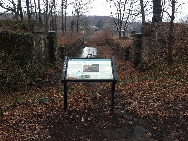
The outlet lock at this location was built to allow canal boats to pass between the Delaware & Raritan Canal and Pennsylvania's Delaware Canal. Canal boats loaded with coal from the Lehigh Valley would come down the Lehigh Canal to Easton, . . . — — Map (db m100644) HM
This bridge marks the western limit of Morris Canal property acquired by the state under agreement, November 29th 1922. The canal was chartered December 31st 1824, and opened for business in 1831. Two miles west of this point, at the Delaware River, . . . — — Map (db m30505) HM
First built as a grain sale and transfer station from the Morris to Lehigh Canal. Horse drawn trailers were driven into the store for grain loading. The grain was then put on canal boats and transported up the Lehigh. In the 1870's it was used as a . . . — — Map (db m30515) HM
“We used to trade a lot along the canal, people who had vegetables and things, we’d give them coal and they’d give us cabbages, tomatoes and things like that. Then there were lock tenders whose wives made good bread. We’d give them . . . — — Map (db m62626) HM
"The problem of getting coal from wagon to ark was solved by constructing an inclined loading chute at Mauch Chunk that extended downward from Mount Pisgah to a coal-loading house along the Lehigh River. The coal house projected over the river's . . . — — Map (db m138499) HM
"It should be borne in mind that in timber dams it is the weight of the stone ballast that keeps the structure in place, and not the bulk and combination of the timbers." Edwin F. Smith, Dam Building in Navigable and Other Streams . . . — — Map (db m138500) HM
“Our residents take pride and partner in their heritage — they understand the meaning of what we have and act to preserve it” Delaware & Lehigh National Heritage Corridor and State Heritage Park, Management Action Plan. . . . — — Map (db m153538) HM
“Our residents take pride and partner in their heritage — they understand the meaning of what we have and act to preserve it” Delaware & Lehigh National Heritage Corridor and State Heritage Park, Management Action Plan. . . . — — Map (db m153540) HM
"Since most of the land was donated to the railroads by the American public in the first place, we believe it should be returned to the public." David Burwell, President, Rails-to-Trails Conservancy, 1988 A Well-Worn Path The path you . . . — — Map (db m153536) HM
Welcome to Lehigh Gorge State Park. This 4,548-acre park stretches 32 miles along the Lehigh River from the Francis E. Walter Dam in the north to Jim Thorpe in the south. Carved by the power of the Lehigh River, the park's deep gorge, steep . . . — — Map (db m153550) HM
”So far back as 1827, the Company constructed down-grades on which loaded cars were run down to the Lehigh River by their own gravity.” —“Special Correspondent, New York Times, December 14, 1872, p 3.” Geography . . . — — Map (db m153422) HM
”My grandfather, Samuel Rice got a job as a watchman after the pipeline was built in 1886. In an emergency he could turn off the valve at either end of the bridge from his house. My mother, Ethel Rice Jenkins, tells how the house was in the . . . — — Map (db m153420) HM
"Built in 1850, the (inclined) planes were 1,200 feet long and 430 feet high. As a loaded car descended on one plane. it would draw an empty car up the other plane."
John Koehler, Railroad Historian, Weatherly
You are . . . — — Map (db m114632) HM
“We had been in many beautiful glens, but this was so unlike all others, so varied — grand and noble falls alternating with delightful rippling cascades, lovely moss covered grottos, marvelous combination — that we were led to . . . — — Map (db m153421) HM
First Marker:
The Self Made Man
"...there is no distinction to which any young man may not aspier, and with energy, diligence, intelligence, and virtue, obtain."
From Asa Packer's 1867 biography
"The Rich Men of the World and How . . . — — Map (db m32270) HM
"The first workers' whistle [at Packerton Yard] sounded at 5 a.m. as a wakeup call while the second at 7 a.m. was the signal for the men to start work."
Thomas D. Eckhart
The History of Carbon County, v. III
When the . . . — — Map (db m116344) HM
At the corner of Pine and Ludlow, an important part of the Switchback Gravity Railroad was completed around 1844. Upon returning from Mauch Chunk, empty mine cars began their Summit Hill descent east of town at the Mount Jefferson Plane. Passing . . . — — Map (db m128304) HM
A gravity railroad was built along this mountain in 1827 to carry coal from the mines near Summit Hill to the Lehigh Canal at Mauch Chunk. A back-track and two planes were added in 1844 for the return trip by gravity. Railroad crossed the highway . . . — — Map (db m125636) HM
How a Lock Works 1. Upper valves are opened and water in lock is raised to level of upstream canal. Upper gate is lowered and boat enters lock. Upper gate is closed. 2. Valves in lower gates are opened, allowing water to empty from . . . — — Map (db m153402) HM
”On June 10, 1838, a boat laden with forty tons of merchandise was carried through the Lehigh navigation from Mauch Chunk to White Haven in fourteen hours, and drawn by one set of horses, and that the locks on said navigation are of a capacity . . . — — Map (db m153403) HM
Naturalist and artist John James Audubon visited Rockport in 1829 and hiked the surrounding forests sketching native birds. Already, the transformation was in progress. "One full third of trees have already been culled," he wrote in his . . . — — Map (db m225719) HM
"Since most of the land was donated to the railroads by the American public in the first place, we believe it should be returned to the public." David Burwell, President, Rails-to-Trails Conservancy, 1988 A Well-Worn Path The . . . — — Map (db m225717) HM
Welcome to Lehigh Gorge State Park. This 4,548-acre park stretches 32 miles along the Lehigh River from the Francis E. Walter Dam in the north to Jim Thorpe in the south. Carved by the power of the Lehigh River, the park's deep gorge, steep . . . — — Map (db m114645) HM
Welcome to the Delaware and Lehigh National and State Heritage Corridor, a collection of people, places and events that helped shape our great nation. Come journey through five Pennsylvania counties bursting with heritage and brimming with outdoor . . . — — Map (db m114644) HM
As long as the Lehigh Canal prospered, so did Weissport. When the Lehigh Coal and Navigation Company located its primary boatyard here, it transformed both sides of the Canal into a bustling manufacturing complex.
Look around…imagine a planning . . . — — Map (db m133884) HM
From charcoal to “stone coal” During the late eighteenth and early nineteenth centuries, the Lehigh Valley, with its wealth of trees for charcoal fuel and substantial sources of ore, attracted many enterprising iron facilities to . . . — — Map (db m85224) HM
Entrepreneur Asa Parker founded the Lehigh Valley Railroad (LVRR) in 1853 to more efficiently transport anthracite coal to market. A freight and passenger station was constructed on this site in 1862. The LVRR Slatedale Branch opened in 1870 for the . . . — — Map (db m85695) HM
"Trees one after another were… constantly heard falling. In a century, the noble forests around should exist no more.”
John J. Audubon
Naturalist
In the woods next to the river are the ruins of the Lehigh . . . — — Map (db m114628) HM
"Whitehaven is situated at the head of the Lehigh Navigation, and some eight or ten miles above the commencement of the coal formation. Its trade is therefore confined to the running of lumber; and this, judging from the number of sawmills in the . . . — — Map (db m114617) HM
"The White Haven Lock is twenty three feet high, more than three times the usual height. It is entirely satisfactory. It takes two minutes to fill and two to empty. We can pass a boat in three minutes as I had promised myself, about as quick as . . . — — Map (db m225490) HM
How did a small city in the Lehigh Valley become home to one of America's largest steel producers? In the early decades of the company, Bethlehem's location near major cities, raw materials, and transportation routes positioned it for . . . — — Map (db m113926) HM
Easton is situated at the confluence of the Lehigh and Delaware Rivers. Founded in the early 1750s, it became an important river community and transportation junction. Opened by 1834, the Lehigh, Morris, and Delaware Canal systems carried . . . — — Map (db m109572) HM
This canal's 47 miles from Mauch Chunk to Easton were constructed 1827-1829. Here the Lehigh Canal connected with the Delaware Canal to Philadelphia, and with the Morris Canal to New York. Vital to the transport of anthracite coal and to the rise of . . . — — Map (db m29601) HM
Canallers You became a captain as young as sixteen by showing “The Company” what you could do. You demonstrate how to “snub” (slow down and brake for lock operations), keep accurate cargo records (pay based on number of miles hauled and coal . . . — — Map (db m86113) HM
The Lehigh Navigation, built by the Lehigh Coal and Navigation Company, was used to transport anthracite coal from mines in north eastern Pennsylvania to New York, Easton, Philadelphia, and beyond. Workers dug much of the canal by hand, constructing . . . — — Map (db m85561) HM
Completed in 1829 under the guidance of entrepreneur Josiah White, this 46 mile canal was constructed in only two years. Operated by the Lehigh Coal and Navigation Company, this hand dug canal contained 52 locks and 8 dams. Canal boats transported . . . — — Map (db m85529) HM
The Pennsylvania House and Slate Exchange Hotels provided lodging for railroad passengers and travelers on the Lehigh Canal. Phaon Bittner and Daniel Muse constructed the Pennsylvania House in 1868. After purchasing Muse’s interests, Bittner ran the . . . — — Map (db m219627) HM
Incorporated as a borough in 1909, Walnutport was originally a part of Lehigh Township. The area’s first settlers were from Germany, Switzerland, Ireland and Scotland. Walnutport was established as a boat repair center along the Lehigh Canal. The . . . — — Map (db m85517) HM