38 entries match your criteria.
Lehigh Canal Historical Markers
Markers commemorating the history of the Lehigh Canal, which ran along the Lehigh River from Mauch Chunk (now Jim Thorpe) to Easton, Pennsylvania. The canal remnants are now part of the Delaware & Lehigh National Heritage Corridor.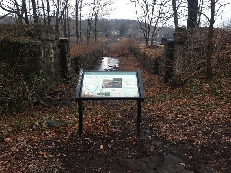
By Russell Galen, December 24, 2016
Lambertville Outlet Lock Marker
| 1 ► New Jersey, Hunterdon County, Lambertville — Lambertville Outlet Lock — |
| Near Delaware and Raritan State Park Trail. | |||
| 2 ► New Jersey, Warren County, Phillipsburg — Morris Canal Bridge No. 2 — |
| On S. Main Street at Carpentersville Road, on the right when traveling west on S. Main Street. | |||
| 3 ► New Jersey, Warren County, Phillipsburg — Stites - Thomas Store — Circa 1849 — |
| On South Main Street (County Road 678) north of Tyndall Avenue, on the right when traveling south. | |||
| 4 ► Pennsylvania, Bucks County, Bristol — Life Along the Canal — Delaware Canal State Park — |
| On Jefferson Avenue. | |||
| 5 ► Pennsylvania, Carbon County, Jim Thorpe — Coal Transport in Mauch Chunk — 1792-1921 — |
| Near Susquehanna Street (U.S. 209) 0.1 miles south of Race Street, on the left when traveling south. | |||
| 6 ► Pennsylvania, Carbon County, Jim Thorpe — Dams Made the Lehigh Canal — 1829-1951 — |
| Near Susquehanna Street (U.S. 209) 0.1 miles south of Race Street, on the left when traveling south. | |||
| 7 ► Pennsylvania, Carbon County, Jim Thorpe — Exploring The Corridor — 1828-1932 — |
| On Lehigh Gorge Trail, 1.7 miles west of Main Street, on the right when traveling north. | |||
| 8 ► Pennsylvania, Carbon County, Jim Thorpe — Exploring The Corridor — 1828-1932 — |
| Near Lehigh Avenue (U.S. 209) at Lehigh Gorge Trail. | |||
| 9 ► Pennsylvania, Carbon County, Jim Thorpe — From Rails to Trails — |
| Near Lehigh Avenue (U.S. 209) at Lehigh Gorge Trail. | |||
| 10 ► Pennsylvania, Carbon County, Jim Thorpe — Lehigh Gorge State Park — |
| On Lehigh Gorge Trail, 1.7 miles west of Main Street, on the right when traveling north. | |||
| 11 ► Pennsylvania, Carbon County, Jim Thorpe — Overcoming Geography — 1827-1937 — |
| Near Lehigh Avenue (U.S. 209) at Lehigh Gorge Trail. | |||
| 12 ► Pennsylvania, Carbon County, Jim Thorpe — Pioneer Pipeline — |
| On Lehigh Gorge Trail, 4 miles north of Main Street. | |||
| 13 ► Pennsylvania, Carbon County, Jim Thorpe — Railroad Intersection — |
| Near Lehigh Gorge Trail, 2.2 miles west of Main Street when traveling north. | |||
| 14 ► Pennsylvania, Carbon County, Jim Thorpe — Romance in the Woods — |
| On Lehigh Gorge Trail, 1.7 miles west of Main Street, on the right when traveling north. | |||
| 15 ► Pennsylvania, Carbon County, Jim Thorpe — The Self Made Man — View his Life from his Home — 1805 - 1879 — |
| On Packer Hill Road west of East Calawissa Street. | |||
| 16 ► Pennsylvania, Carbon County, Lehighton — Lehighton's Been Workin' on the Railroad! — |
| On Sgt Stanley Hoffman Boulevard (U.S. 209) north of North Main Lane, on the right when traveling north. | |||
| 17 ► Pennsylvania, Carbon County, Summit Hill — Backtrack Trestle — Renaissance Historic Site — |
| On Pine Street at East Ludlow Street, on the right when traveling north on Pine Street. | |||
| 18 ► Pennsylvania, Carbon County, Summit Hill — Switchback Railroad — |
| On East White Bear Drive (SR 3012). | |||
| 19 ► Pennsylvania, Carbon County, Weatherly — A Revolution in Canal Technology — 1838-1862 — |
| Near Rockport Road, 1 mile east of South Lehigh Gorge Drive. | |||
| 20 ► Pennsylvania, Carbon County, Weatherly — Engineering Marvel — |
| Near Rockport Road, 1 mile east of South Lehigh Gorge Drive. | |||
| 21 ► Pennsylvania, Carbon County, Weatherly, Lehigh Township — Audubon Spoke for the Trees — |
| Near Rockport Road, 1 mile east of South Lehigh Gorge Drive. | |||
| 22 ► Pennsylvania, Carbon County, Weatherly, Lehigh Township — From Rails to Trails — |
| Near Rockport Road, 1 mile east of South Lehigh Gorge Drive. | |||
| 23 ► Pennsylvania, Carbon County, Weatherly, Lehigh Township — Lehigh Gorge State Park — |
| Near Rockport Road, 1 mile east of South Lehigh Gorge Drive. | |||
| 24 ► Pennsylvania, Carbon County, Weissport — Exploring the Corridor — Weissport Lehigh Canal Park — 1828 -1932 — |
| On Main Road. | |||
| 25 ► Pennsylvania, Carbon County, Weissport — The Hub in its Heyday — Weissport Lehigh Canal — 1829-1942 — |
| On Main Road. | |||
| 26 ► Pennsylvania, Lehigh County, Alburtis — Lock Ridge Furnace — |
| On Church Street. | |||
| 27 ► Pennsylvania, Lehigh County, Slatington — Lehigh Valley Railroad Station — 1862 -1969 — |
| On Main Street. | |||
| 28 ► Pennsylvania, Luzerne County, White Haven — River Ran Black — |
| Near Tannery Road west of River Road (Pennsylvania Route 534) when traveling south. | |||
| 29 ► Pennsylvania, Luzerne County, White Haven — Thank Josiah White — |
| Near Main Street south of Berwick Street (Pennsylvania Route 940) when traveling south. | |||
| 30 ► Pennsylvania, Luzerne County, White Haven, Kidder Township — Workers From All Nations — |
| Near Delaware and Lehigh Trail just south of Tannery Road, on the left when traveling south. | |||
| 31 ► Pennsylvania, Northampton County, Bethlehem — 18 — The Flow Of Goods & Money — Bethlehem At The Crossroads — |
| 32 ► Pennsylvania, Northampton County, Easton — Easton & Nearby Heritage Attractions — 1829 - 1932 — |
| 33 ► Pennsylvania, Northampton County, Easton — The Lehigh Canal — |
| 34 ► Pennsylvania, Northampton County, Easton, Williams Township — Life Along The Canal — 1831-1932 — Delaware Canal — |
| On Delaware Drive (Pennsylvania Route 611) at Canal Road, on the left when traveling south on Delaware Drive. | |||
| 35 ► Pennsylvania, Northampton County, Walnutport — Floating From Mine to Market — The Lehigh Canal — 1829-1942 — |
| On Lehigh Street. | |||
| 36 ► Pennsylvania, Northampton County, Walnutport — Lehigh Canal — |
| On Main Street. | |||
| 37 ► Pennsylvania, Northampton County, Walnutport — Pennsylvania House Slate Exchange Hotel — |
| On Main Street. | |||
| 38 ► Pennsylvania, Northampton County, Walnutport — Walnutport — |
| On Main Street at Railroad Avenue on Main Street. | |||