33 entries match your criteria.
Susan B. Anthony Historical Markers
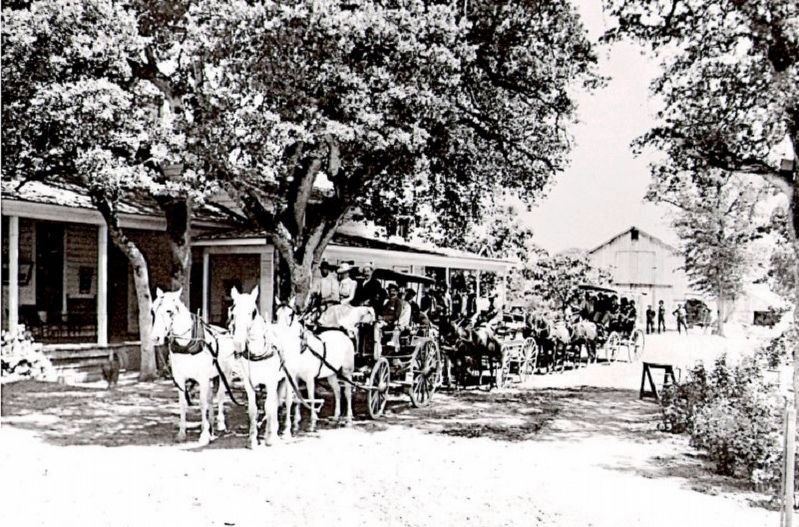
Ahwahnee Tavern
| 1 ► California, Madera County, Ahwahnee — Ahwahnee Tavern — |
| On Highway 49, on the right when traveling north. | |||
| 2 ► California, Santa Clara County, Palo Alto, Barron Park — 969 — Homesite of Sarah Wallis — Mayfield Farm — |
| On La Silva Drive, 0.2 miles south of Military Way, on the right when traveling south. | |||
| 3 ► Colorado, Chaffee County, Buena Vista — The Placers In Between — |
| On U.S. 24, 1 mile east of County Highway 397, on the left when traveling east. | |||
| 4 ► District of Columbia, Washington, Northwest Washington, Penn Quarter — Susan B. Anthony 1820 - 1906 — The Extra Mile — Points of Light Volunteer Pathway — |
| On G Street Northwest west of 13th Street Northwest, on the right when traveling east. | |||
| 5 ► Indiana, Marion County, Indianapolis, Downtown — Susan B. Anthony — (February 15, 1820 - March 13, 1906) — |
| On West Walnut Street east of North Pierson Street, in the median. | |||
| 6 ► Indiana, Monroe County, Bloomington — Susan B. Anthony Speech — |
| On North Walnut Street north of East Kirkwood Avenue, on the right when traveling north. | |||
| 7 ► Kansas, Leavenworth County, Leavenworth — 13 — The Anthonys — Historic Wayside Tour #13 — |
| On Esplanade Street near Pottawatomie Street, on the right when traveling north. | |||
| 8 ► Maryland, Prince George's County, Hyattsville — The Constitution / The 19th Amendment — |
| On Toledo Road just west of America Boulevard, on the left when traveling west. | |||
| 9 ► Massachusetts, Berkshire County, Adams — Friends Meeting House — |
| 10 ► Massachusetts, Berkshire County, Adams — Susan Brownell Anthony — February 15, 1820 - March 13, 1906 — Born Adams, Massachusetts — |
| On Park Street (Massachusetts Route 8) north of the Moosic River, on the left when traveling north. | |||
| 11 ► New Hampshire, Merrimack County, Concord — Nathaniel & Armenia White — Downtown Concord — Est. 1725 — |
| On North Main Street (U.S. 3) south of School Street, on the right when traveling north. | |||
| 12 ► New York, Fulton County, Johnstown — Elizabeth Cady Stanton & Susan B. Anthony — 1815 - 1902 1820 - 1906 — |
| On South William Street, on the right when traveling south. | |||
| 13 ► New York, Fulton County, Johnstown — Historic Johnstown — |
| On W.Main Street at N. Market Street on W.Main Street. | |||
| 14 ► New York, Monroe County, Rochester — Susan B. Anthony House — Headquarters of the Suffrage Movement — |
| On Madison Street, 0.2 miles north of West Main Street (New York State Route 33). | |||
| 15 ► New York, Monroe County, Rochester, Highland — Susan B. Anthony — |
| Near Mount Hope Road (New York State Route 15). | |||
| 16 ► New York, Monroe County, Rochester, Mayor's Heights — Susan B. Anthony Voted Here — |
| Near West Main Street (New York State Route 33) west of Canal Street, on the right when traveling east. | |||
| 17 ► New York, Montgomery County, Canajoharie — Canajoharie Academy — |
| On Otsego Street at Cliff Street, on the right when traveling north on Otsego Street. | |||
| 18 ► New York, Montgomery County, Fort Plain — Diefendorf Hall — |
| On Main Street (New York State Route 80), on the right when traveling east. | |||
| 19 ► New York, Onondaga County, Fayetteville — Matilda Joslyn Gage Home — |
| On Walnut Street at East Genesee Street (New York State Route 5), on the right when traveling south on Walnut Street. | |||
| 20 ► New York, Otsego County, Cooperstown — 493 — Susan B. Anthony — |
| On Pioneer Street at Elm Street, on the right when traveling north on Pioneer Street. | |||
| 21 ► New York, Seneca County, Seneca Falls — "Passage" — |
| On Bayard Street at Spring Street, on the right when traveling east on Bayard Street. | |||
| 22 ► New York, Seneca County, Seneca Falls — The Stanton House: Shaping a Reformer — Women's Rights National Historical Park — |
| On Washington Street, 0.1 miles south of Seneca Street, on the right when traveling north. | |||
| 23 ► New York, Seneca County, Seneca Falls — We Will Accomplish Wonders — |
| On Washington Street, 0.1 miles south of Seneca Street, on the right when traveling north. | |||
| 24 ► New York, Seneca County, Seneca Falls — When Anthony Met Stanton — |
| On East Bayard Street, 0.1 miles east of Ovid Street. | |||
| 25 ► New York, Washington County, Cambridge — 693 — Hubbard Hall — |
| On East Main Street (New York State Route 372) at Washington Street, on the right when traveling west on East Main Street. | |||
| 26 ► Ohio, Athens County, Athens — Ohio University's Distinguished Visitors — |
| 27 ► Ohio, Lake County, Painesville, Painesville Township — 12-43 — The Casement House / General Jack and Frances Jennings Casement — |
| Near Casement Avenue north of Woodsworth Avenue, on the left when traveling north. | |||
| 28 ► Pennsylvania, Philadelphia County, Philadelphia, Holmesburg — Torresdale / Holmesburg — Delaware River Trail — |
| On Pennypack Path, 0.5 miles south of State Road, on the right when traveling east. | |||
| 29 ► Pennsylvania, Philadelphia County, Philadelphia, Tacony — Tacony / Wissinoming — Delaware River Trail — |
| On K&T Trail at Levick Street, on the right when traveling east on K&T Trail. | |||
| 30 ► Pennsylvania, Philadelphia County, Philadelphia, Wissinoming — Tacony / Wissinoming — Delaware River Trail — |
| On K&T Trail north of Walbach Street, on the right when traveling north. | |||
| 31 ► Virginia, Fairfax County, Lorton — 1/2 — "Forward Out of Darkness" / Issuing a Call for Women's Rights — |
| Near Lorton Road at Ox Road (Virginia Route 123), on the left when traveling east. | |||
| 32 ► Virginia, Fairfax County, Lorton — 3/4 — Building a Political Movement / Testing Constitutional Amendments — |
| On Lorton Road, 1 mile south of Ox Road (Virginia Route 123), on the left when traveling east. | |||
| 33 ► Wisconsin, Green Lake County, Berlin — 362 — Lucy Smith Morris — (1850 – 1935) — |
| On East Huron Street (State Highway 116) at North Church Street, on the left when traveling east on East Huron Street. | |||