By Bradley Owen, March 29, 2024
Veterans Memorial
| On Elliott Avenue south of Watkins Street, on the left when traveling north. |
| On Gerrardstown Road (West Virginia Route 51) just north of Dominion Road, on the right when traveling north. |
| On Interstate 79 at milepost 48. |
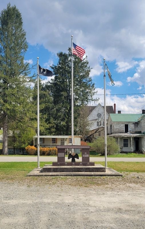
| On Main Street (West Virginia Route 2) at Raymond Street, on the right when traveling north on Main Street. |
| On Main Street (West Virginia Route 2) at Raymond Street, on the right when traveling north on Main Street. |
| On Main Street (West Virginia Route 2) at Raymond Street, on the right when traveling north on Main Street. |
| On Archer Hill Road at West Virginia Route 2, on the right when traveling west on Archer Hill Road. |
| On Military Drive at Marshaling Yard Drive, on the right when traveling south on Military Drive. |
| On Charles Street, on the left when traveling north. |
| On Main Street at Water Street, on the right when traveling west on Main Street. |
| On Water Street, on the left when traveling east. |
| On Central Avenue south of Musgrave Court, on the right when traveling north. |
| On Water Street at Main Street, on the right when traveling north on Water Street. |
| On Veterans Memorial Boulevard (U.S. 60) west of 13th Street, on the right when traveling west. |
| Near Interstate 64 at milepost 10 when traveling east. |
| On Main Street (West Virginia Route 5) at Market Street (West Virginia Route 5) when traveling west on Main Street. |
| On Main Street, on the right when traveling north. |
| On County Route 8, on the right when traveling west. |
| On West Maple Avenue, on the right when traveling west. |
| On Academy Court (County Road 8) at Park Drive, on the right when traveling east on Academy Court. |
| On West Maple Aenue, on the right when traveling west. |
| On Midland Trail, on the right when traveling west. |
| On Midland Trail, on the right when traveling east. |
| On U.S. 60 at West Virginia Route 41, on the right when traveling east on U.S. 60. |
| On N. Court Street, on the left when traveling north. |
| On Union Highway (West Virginia Route 42) 0.2 miles south of George Washington Highway (U.S. 50), on the right when traveling south. |
| On McElhenny Road (Local Route 60/9) 0.3 miles west of Church Street, on the right when traveling west. |
| On Legion Drive just east of Cold Stream Road (County Road 15), on the left when traveling east. |
| On Northwestern Turnpike (U.S. 50) just west of West Gravel Lane, on the right when traveling west. |
| On East Main Street (U.S. 50) just west of South Antigo Place, on the left when traveling west. |
| On Main Street (West Virginia Route 2) just north of Municipal Plaza, on the right when traveling north. |
| On Olivet Drive, 0.1 miles north of Paskell Hill Drive, on the left when traveling south. |
| On North Main Street (U.S. 220) just north of Kuykendall Lane, on the right when traveling north. |
| On East Main Street (West Virginia Route 55/259) south of High Street, on the right. |
| On Anmoore Road (County Route 58) east of Philippi Pike (County Road 23/9), on the left when traveling west. |
| On Northwestern Turnpike (U.S. 50) at East Philadelphia Avenue, on the left when traveling east on Northwestern Turnpike. |
| On Interstate 79, 4 miles south of West Virginia Route 279, on the right when traveling south. |
| On Jennings Randolph Highway (Interstate 79 at milepost 122), 1.1 miles north of Johnson Avenue, on the right when traveling north. |
| On West Main Street just east of South 3rd Street, on the left when traveling east. |
| On Clarksburg Park Way (West Virginia Route 98) 0.4 miles south of Milford Street (U.S. 19), on the right when traveling south. |
| On West Main Street at South 3rd Street, on the right when traveling east on West Main Street. |
| On Buckhannon Pike (West Virginia Route 20) at Thomas Avenue, on the left when traveling north on Buckhannon Pike. |
| On Pike Street (U.S. 19) at Clement Street, on the right when traveling north on Pike Street. |
| On Cost Avenue (West Virginia Route 58) 0.1 miles east of Grasselli Street, on the right when traveling east. |
| On West Virginia Route 2 east of Jackson Lane, on the left when traveling east. |
| On West Main Street (U.S. 33) at North Court Street, on the right when traveling west on West Main Street. |
| On Washington Street (Business U.S. 340) west of Polk Street, on the right when traveling west. |
| On W Washington Street, on the right when traveling west. |
| On George Street (West Virginia Route 115) north of Washington Street (West Virginia Route 51), on the right when traveling north. |
| On Hog Alley at Potomac Street, on the right when traveling north on Hog Alley. |
| Near Potomac Street, on the right when traveling west. |
| On Fillmore Street at Lancaster Street, on the right when traveling east on Fillmore Street. |
| On South Fairfax Boulevard (Route 115) at West 4th Avenue, in the median on South Fairfax Boulevard. |
| On East Dupont Avenue (U.S. 60) at Woodmont Cemetery Drive, on the right when traveling south on East Dupont Avenue. |
| On California Avenue, on the right when traveling east. |
| Near Greenbrier Street (U.S. 60) at Franklin Avenue, on the right when traveling north. |
| On California Avenue, on the right when traveling east. |
| On Henry C Hoppy Shores Drive south of Pennsylvania Avenue (U.S. 119), on the right when traveling south. |
| Near Kanawha Boulevard East, on the right when traveling north. |
| On Greenbrier Street (U.S. 60) at Washington Street East (U.S. 60), on the right when traveling north on Greenbrier Street. |
| Near Greenbrier Street (U.S. 60) at Washington Street North (U.S. 60), on the right when traveling north. |
| Near Fairlawn Avenue (West Virginia Route 25) 0.1 miles east of Barron Drive, on the right when traveling east. |
| On McCorkle Avenue (West Virginia Route 61) 0.1 miles east of 100th Street, on the right when traveling east. |
| On MacCorkle Avenue Southeast (Route 61) 0.1 miles east of 100th Street, on the right when traveling east. |
| On MacCorkle Avenue SW (U.S. 60) at G Street, on the right when traveling east on MacCorkle Avenue SW. |
| On Main Street (U.S. 19) north of Park Avenue, on the right when traveling north. |
| Near Jennings Randolph Highway (Interstate 79) 3 miles south of U.S. 19, on the right when traveling south. |
| On Center Avenue, 0.1 miles north of East 3rd Street (U.S. 119), on the left when traveling north. |
| On Center Avenue north of East 3rd Street (U.S. 119), on the left when traveling north. |
| On East 3rd Street (U.S. 33/119) at Center Avenue (U.S. 119), on the left when traveling west on East 3rd Street. |
| On Pike Street (County Route 250/32) at Mohawk Street, on the left when traveling north on Pike Street. |
| On Pennsylvania Avenue (U.S. 19) north of Murray Avenue, on the right when traveling north. |
| Near City View Terrace at State Street (County Road 64/13), on the left when traveling north. |
| On Artillery Drive west of Lafayette Street, on the left when traveling west. |
| Near City View Terrace at State Street (County Road 64/13), on the left when traveling north. |
| On Madison Street at Adams Street (U.S. 19), on the right when traveling south on Madison Street. |
| Near Maple Avenue, 0.3 miles east of Pennsylvania Avenue (U.S. 19), on the left when traveling east. |
| On Morgantown Avenue just west of Cochran Street, on the right when traveling west. |
| On Fairmont Avenue (U.S. 250) at 8th Street, on the left when traveling south on Fairmont Avenue. |
| On Adams Street (U.S. 19/250) at Jefferson Street (U.S. 250), on the left when traveling east on Adams Street. |
| On Fairmont Avenue (U.S. 250) just south of 8th Street, on the right when traveling north. |
| On Madison Street at Adams Street (U.S. 19), on the left when traveling north on Madison Street. |
| On Fairmont Avenue (U.S. 250) at 8th Street, on the right when traveling north on Fairmont Avenue. |
| On Airport Road, 0.5 miles north of Crosswinds Drive, on the right when traveling north. |
| On Catawba Road (County Route 74) at Jordan Road (County Route 74), on the right when traveling north on Catawba Road. |
| Near Maple Avenue at Anderson Street, on the left when traveling east. |
| On Main Street (County Road 17) west of Jefferson Street (State Route 218), on the right when traveling west. |
| On Mill Street (County Road 9/1) at Old State Route 250, on the left when traveling east on Mill Street. |
| On Straight Street north of Main Street (County Road 17), on the left when traveling north. |
| On Bridge Street (County Route 46) at Main Avenue, on the right when traveling north on Bridge Street. |
| On Main Street (U.S. 19) at Second Street, on the right when traveling north on Main Street. |
| On Main Street (U.S. 19) just west of High Street, on the right when traveling south. |
| On Railroad Street at Waynesburg Pike Road (U.S. 250), on the left when traveling west on Railroad Street. |
| On Railroad Street at Waynesburg Pike Road (U.S. 250), on the left when traveling west on Railroad Street. |
| On Tomlinson Avenue at South Park Street, on the right when traveling south on Tomlinson Avenue. |
| On Tomlinson Avenue south of 6th Street, on the right when traveling south. |
| On Tomlinson Avenue just north of 7th Street (County Road 250/88), on the left when traveling north. |
| On 2nd Street at Point Pleasant Biking & Walking Trail, on the left when traveling west on 2nd Street. |
| On Viand Street (West Virginia Route 2 Spur) just south of 6th Street (West Virginia Route 62), on the right when traveling north. |
206 entries matched your criteria. The first 100 are listed above.
Next 100 ⊳