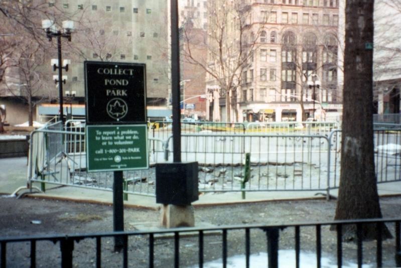
Located on Leonard Street between Centre and Lafayette Streets, this park occupies the eighteenth century site of Collect Pond. The pond was a large, 60-foot deep pool fed by an underground spring. The waters derived their name from seventeenth . . . — — Map (db m131757) HM
During the 1999 restoration of City Hall Park, archaeological excavations uncovered burials in this area believed to have been associated with a shelter and workhouse for the poor known as the First Almshouse (1736 – 1797), located where City Hall . . . — — Map (db m130084) HM
This medallion lies just beyond the edge of the African Burial Ground. Closed in 1794, the African Burial ground once covered more than 5 acres – about 5 city blocks. It is estimated that about 10,000 men, women and children of African . . . — — Map (db m130935) HM
Foley Square c. 1800 consists of a central medallion surrounded by four segments of three medallions.
Central medallion: Map of Foley Square c. 1800
Around the perimeter: We hold these truths to be self-evident, that all men are created . . . — — Map (db m128579) HM
The fragmentary remains of early New Yorkers were found by archeologists during construction in the vicinity of City Hall Park and reinterred at this site by the City in 2010. Multiple 18th-century burial grounds once existed here associated with . . . — — Map (db m130550) HM
In memory of Lieutenant Colonel Isaac Barre
Born 1726 - Died 1802
An ardent advocate of American liberties who in opposing the oppressive Stamp Act in the British House of Commons in 1765 declared that: "the Americans are Sons of Liberty" and . . . — — Map (db m130583) HM
The rediscovery of the burial ground revealed that Africans and their descendants buried loved ones with dignity and respect in the 17th and 18th centuries. More than 90 percent of the 419 human skeletal remains were rapped in shrouds (cloths) . . . — — Map (db m129984) HM
This window was originally part of the five story Sugar House built in 1763 at the corner of Duane and Rose Streets and used by the British during the Revolutionary War as a prison for American Patriots.
The Sugar House was demolished in 1892 and . . . — — Map (db m127672) HM
This Georgian style gray stone structure served as New York City’s largest prison. The name of the building came from a common 18th century English term for a jail. In 1776, when British forces occupied New York City, hundreds of captured American . . . — — Map (db m19684) HM
Near this spot in the presence of
General George Washington
The Declaration of Independence was read and published to the American Army
July 9th 1776 — — Map (db m130619) HM
INTRODUCTION In September 1609, Henry Hudson and some 20 seamen sailed their ship, the Halve Maen (Half Moon), into what is today New York harbor. The Dutch East India Company expected Hudson to find a passage to Asia. Instead, his . . . — — Map (db m127518) HM
The Colonial Dutch Settlement of Nieuw Haerlem
Long before Europeans arrived in North America, indigenous peoples had been living on the island of Manhattan which boasted forest, fertile land, fresh water streams, and easy access to the . . . — — Map (db m209664) HM
The Harlem River separates the Bronx from Manhattan, and crossing it has always presented a challenge. By 1667 small boats were ferrying people and goods across the river near here, but it was to the north and west near [unreadable] Street . . . — — Map (db m209697) HM
People enslaved by members of the congregations of the Stuyvesant Chapel and St. Marks Church-in-the-Bowery
People enslaved by the Dutch West Indies Corporation
A. Francisco •
Gasinte •
R. Antonio •
Diego or Jacob • . . . — — Map (db m241338) HM
In this Vault lies buried Petrus Stuyvesant late Captain General and Governor in Chief of Amsterdam in New Netherland now called New York and the Dutch West-India Islands, died Feby. A.D. 1672 aged 80 years. — — Map (db m41165) HM
This bust was given to the people of New York in trust of Saint Mark’s-in-the-Bowerie in 1915 by Wilhelmina Queen of the Netherlands --------------- From the Commissie Boek of the States General The States General of the United Netherlands to all . . . — — Map (db m41168) HM
Governor Peter Stuyvesant of legend and history, remembered for surrendering Nieuw Amsterdam to the English in 1664, had his farm, named in Dutch, the “Bouwerie,” in the area. Stuyvesant Street follows the line of the drive to the . . . — — Map (db m132920) HM
This late Georgian (1799) church replaced the chapel Peter Stuyvesant built in 1660 on his Bouwerie or Farm - making this Manhattan’s oldest site used for a place of worship. Not only is the last Dutch Governor-General buried here, but also seven . . . — — Map (db m148017) HM
The Slave Market: Wall street is an augmented reality (AR) sculpture installation that presents the 1711 slave market in New York City where enslaved African Americans and Native Americans were sold. This installation is part of a . . . — — Map (db m228448) HM
This building erected 1922 occupies part of the farm leased prior to 1658 and granted in 1644 by the Dutch West India Company to Jan Jansen Damen. Of the bounding streets Maiden Lane was called the Dutch Maegde Paetje. Nassau Street was named for . . . — — Map (db m146676) HM
Opened in 1796 by the Episcopal Parish of Trinity Church, St. Paul’s Chapel is the oldest public building in continuous use and the only remaining Colonial-era church in Manhattan. In 1789 George Washington prayed at St. Paul’s after his . . . — — Map (db m146813) HM
Opened in 1766 by the
Episcopal Parish of Trinity
Church, St. Paul's Chapel is
the oldest public building in
continuous use and the only
remaining Colonial-era
church in Manhattan. In
1789 George Washington
prayed at St. Paul's after . . . — — Map (db m199293) HM
ADRIAEN VAN DER DONCK’S HOME Location: Marketfield Street at Broad Street Dutch Name: Het Marckvelt Steegie In a house that stood a few feet from here lived lawyer Adriaen van der Donck (c. 1620 - c. 1655), author of the . . . — — Map (db m127313) HM
This tablet marks the site of the first habitations of white men on the island of Manhattan. Adrian Block commander of the "Tiger" erected here four houses or huts after his vessel was burned, November 1613. He built the Restless, the first vessel . . . — — Map (db m170018) HM
Gallatin served in Congress and as fourth Secretary of the Treasury under both Jefferson and Madison. He was also a diplomat, a founder of New York University and the American Ethnological Society, and president of the New York Historical Society. — — Map (db m127059) HM
Erected by the State of New York to honor the memory of the twenty three men women & children who landed in September 1654 and founded the first Jewish community in North America — — Map (db m127855) HM
ANDRIES REES’S TAVERN Location: William Street and Wall Street Dutch Name: Smit Straet Here, in 1660, Andries Rees ran a tavern serving his fellow colonists. Taverns were lively centers of social life in the Netherlands, and Dutch . . . — — Map (db m127522) HM
Wife of British member of Parliament and businessman John Barker Church. Intelligent and socially active, Angelica Church befriended and corresponded regularly with many of the prominent figures of her day, including Thomas Jefferson. — — Map (db m127052) HM
ASSER LEVY’S HOME Location: Stone Street at Mill Lane Dutch Name: Hoogh Straet (High Street) In a house on this site lived the Jewish trader and butcher Asser Levy. Possibly born in Lithuania, Levy probably came here from Amsterdam in . . . — — Map (db m127960) HM
BEAVER’S PATH Location: Battery Place at Greenwich Street Dutch Name: Bever Straet Here, on a sandyshore, Lenape Indians beached their canoes to trade beaver and otter pelts for Dutch cloth, kettles, and metal tools. To the Lenape, . . . — — Map (db m127312) HM
Birthplace of Columbia University
In 1752 Trinity Church gave a grant of land for a new college.
On July 17, 1754, the first class of King’s College, which was to become Columbia University, met in the schoolhouse of Trinity Church located . . . — — Map (db m127717) HM
The first public park to be established in New York, March 12, 1733.
“Resolved that the Corporation will Lease a Piece of Land lying at the lower End of Broadway fronting to the Fort to some of the inhabitants of the Said Broadway in Order to . . . — — Map (db m13735) HM
Bowling Green This little patch of green surrounded by grand Broadway office buildings survives as New York City’s oldest public park – Bowling Green. It served as a cattle pasture and a parade ground before being designated in 1733 as a . . . — — Map (db m147009) HM
Erected by the Common Council in 1771, this fence surrounds New York’s earliest park. The park was leased in 1733 for use as a bowling green at a rental of one peppercorn a year. Patriots, who in 1776 destroyed an equestrian statue of George III . . . — — Map (db m13728) HM
On this site, then 39 Queen Street, Robert Bowne, New York merchant, philanthropist, and educator, established Bowne & Company in 1775.
The company is New York’s oldest business concern operating under the same name since its founding.
Robert . . . — — Map (db m132532) HM
19 street panels along the path of the original Broad Street canal
1642: The Dutch create a canal south of Beaver Street by expanding a small rivulet known as “the ditch”. It is called the “Herre Graft”.
1642: Broad . . . — — Map (db m131079) HM
An Irish Patriot, MacNeven came to America in 1805. He was instrumental in staving off cholera and smallpox epidemics in New York City. He is buried on the Riker Farm in Astoria, Queens. His monument stands 35-feet high and features inscriptions . . . — — Map (db m115462) HM
This map, derived from a 1600 drawing, shows Stone Street, then the Dutch Hoog Straat. Its original line is indicated by brown paving stones & the lobby alignment. — — Map (db m47376) HM
This triangular greenstreet – a landscaped traffic island – stands at the southern juncture of Trinity Place and Greenwich Street a few blocks southwest of Trinity Church in lower Manhattan. It takes its name from the adjacent street to the . . . — — Map (db m127759) HM
What was here before?
The native Lenape called the land just south of here at the harbor kapsee or “rocky ledge.” Indigenous habitation yielded to Dutch occupation and the establishment of New Amsterdam in the 1620s, and then British rule in . . . — — Map (db m198546) HM
1633 The site of the first church built on Manhattan Island Evaradus Bogardus, Dominie This tablet erected by the Daughters of Holland Dames 1933 — — Map (db m20238) HM
The first Latin School of New Amsterdam was founded on this site in 1659 by Dr. Alexander Carolus Cursius Curtius, Lithuanian nobleman and scholar who came to the Dutch colony as Latin School Master upon the invitation of Governor Peter Stuyvesant. — — Map (db m20288) HM
On this site William Bradford appointed Public Printer April 10th A.D. 1693 established the first printing press in the Colony of New York.
Erected by the New York Historical Society April 10th A.D. 1893 in commemoration of the 200th . . . — — Map (db m41644) HM
This plaque marks the site of the former residence of Thomas Jefferson third President of the United States of America who on March 21 1790 as first Secretary of State under President Washington came to New York City then seat of the Federal . . . — — Map (db m57569) HM
Adjoining this site was the first Dutch fort on Manhattan Island known as Fort Amsterdam. The first house was erected here before 1664. In 1771 Captain Archibald Kennedy built here his residence which was used in 1776 by General George Washington as . . . — — Map (db m20275) HM
INTRODUCTION In September 1609, Henry Hudson and some 20 seamen sailed their ship, the Halve Maen (Half Moon), into what is today New York harbor. The Dutch East India Company expected Hudson to find a passage to Asia. Instead, his . . . — — Map (db m127314) HM
Near this site in 1707 Francis Makemie, a native of Ireland and Father of American Presbyterianism, challenged the edict of Lord Cornbury, Governor of the colony, forbidding him from preaching here. The services he conducted in William Jackson’s . . . — — Map (db m47313) HM
After the American Revolutionary War, on December 4, 1783, General George Washington bade an emotional farewell to his officers at a banquet held in the Long Room, located on the second floor of this tavern. Samuel Fraunces, a West Indian innkeeper, . . . — — Map (db m146130) HM
Samuel Fraunces in 1762 named his Queen’s Head tavern after Queen Charlotte, wife of King George III. His politics, however, were strictly patriotic, and his tavern hosted meetings of the radical Sons of Liberty and, later, the New York Provincial . . . — — Map (db m146131) HM
Honorable Thomas Addis Emmet
1764-1827
Irish patriot
An activist for an independent Ireland, Emmet came to America in 1803 and was New York State Attorney General from 1812-1813. He is buried at St. Mark’s Church in-the-Bowery. His monument . . . — — Map (db m115463) HM
Alberti, a native of Venice, settled near the Wall Street area of Manhattan and later in the Fort Greene section of Brooklyn.
Presented by The Italian Historical Society of America, The Columbus Citizens Foundation, The City of Venice.
The . . . — — Map (db m145884) HM
John Holt
1721-1784
Patriot printer
In 1766, Holt founded and published The New York Journal. It was later known as The Independent Gazette. — — Map (db m115608) HM
Named in honor of John Harpendingh, a tanner whose homestead was situated at the corner of Maiden Lane and Broadway.
He was a public-spirited citizen who owned considerable land in this vicinity – a portion of which he bequeathed to the . . . — — Map (db m127427) HM
The oldest continuous Methodist congregation in America, founded by Philip Embury and Barbara Heck in 1766, has served on this site since 1768. The present building, erected in 1841 and restored in 1965, is the successor to the original building . . . — — Map (db m13901) HM
John Street Church is the oldest Methodist Society in continental America and is the mother church of American Methodism. The Society was organized in New York in 1766 by Philip Embury, and ardent Irish Methodist and former Wesleyan preacher who . . . — — Map (db m19721) HM
LORDS’ CANAL Location: Broad Street Dutch Name: Heere Gracht Director-General Petrus Stuyvesant had workmen create the Gracht, or Canal, here on the site of a small creek during the 1650s. The canal stretched from near today’s Exchange . . . — — Map (db m127521) HM
This reach of the East River, from here to Rutgers Slip (1) is rich in maritime history. Peck Slip was one of the last and most important of New York harbor’s slips. The burgeoning population of European immigrants reclaimed new land from the . . . — — Map (db m134553) HM
Revolutionary War Soldier
A French officer who fought for American independence, Rochefontaine served under the French General Rochambeau during the Revolutionary War. He assisted in the capture of Lord Cornwallis and later commanded the Corps . . . — — Map (db m115431) HM
On the 22nd of April 1625 the Amsterdam Chamber of the West India Company decreed the establishment of Fort Amsterdam and the creation of ten adjoining farms. The purchase of the Island of Manhattan was accomplished in 1626. Thus was laid the . . . — — Map (db m13930) HM
This monumental flagstaff commemorates the Dutch establishment of New Amsterdam and the seventeenth century European settlement that launched the modern metropolis of New York City. Designed by Dutch sculptor H.A. van den Eijnde (1869-1939), the . . . — — Map (db m13927) HM
Under Peter Minuit, the settlers of the little city of New Amsterdam worked quickly. By about 1627 they had 30 wooden houses constructed along “The Strand”, facing the bluffed shore 500 yards across the water of what would soon be . . . — — Map (db m145643) HM
The Manhattanites were so focused on survival in the 1630s, that they might scarcely have noticed the changes. More sails appeared in the harbor bringing varied faces. Ebony faces from the highlands of Angola. Arab faces. An Italian, a Pole, a . . . — — Map (db m145645) HM
There was an actual deed for the sale of Manhattan but it vanished long ago. Fortunately, a Dutch official was on the dock in Amsterdam in 1626 when a ship from Manhattan arrived. The letter he wrote to his superior is, in effect, New York City’s . . . — — Map (db m145639) HM
Every reader of history knows the story: Peter Minuit bought Manhattan Island in 1626 from a group of Indians for 60 guilders worth of goods, or as a 19th century historian calculated it, 24 dollars. Of the thousands of transactions in which . . . — — Map (db m145642) HM
The English took over the Dutch colony in 1664, and New Amsterdam became New York. But the Dutch roots still thrive. Peter Minuit and his compatriots set Manhattan on course as a melting pot and business hub. The settlers weren’t motivated by . . . — — Map (db m128240) HM
By tens and twenties the settlers came in 1624 and 1625, pitching on the inhuman waves in frightfully vulnerable wooden ships. Two months it took to follow in the wake of the English explorer Henry Hudson, three if the winds failed. Hudson has . . . — — Map (db m145641) HM
As the settlers explored their island, they found it was wondrously varied: high hills, charging streams, ponds, stands of chestnut, poplar and pine. A brook flowed from the highlands in the area of 59th street and Fifth Avenue, about where the . . . — — Map (db m145644) HM
Peter Minuit arrived at a colony in turmoil. Some 150 miles upriver from the harbor, several Dutch soldiers were killed by Mohawk Indians. The settlers panicked. In 1626, they found their leader, Verhulst, guilty of mismanagement, removed him . . . — — Map (db m145640) HM
He had grown up speaking German, but his ancestry was French, so his name was pronounced in the French wat – Min-wee. He had no military training, but he was an individualistic, take-charge sort who would alter the course of history by . . . — — Map (db m127913) HM
On Wall Street, between Pearl and Water Streets, a market that auctioned enslaved people of African ancestry was established by a Common Council law on November 30, 1711. This slave market was in use until 1762. Slave owners wanting to hire out . . . — — Map (db m84899) HM
On this site from 1766 to 1856 stood the Brick Presbyterian Church used during the American Revolution as both a prison and hospital for American prisoners. This present structure was built by the New York Times beginning with a building five . . . — — Map (db m39717) HM
PETRUS STUYVESANT'S GREAT HOUSE Location: Whitehall Street between Pearl & State Streets Dutch Name: Opt Waeter Near this site stood the “Great House” of Petrus Stuyvesant (c. 1612-1672), Nieuw Nederland’s last director. A . . . — — Map (db m127311) HM
This Monument is erected by the order of CONGRESS 25th Janry 1776, to transmit to Posterity a grateful remembrance of the patriotism conduct enterprize & perseverance of Major General RICHARD . . . — — Map (db m38976) HM WM
Manhattan’s only remaining Colonial-era church. See George Washington’s pew; tombs of General Richard Montgomery (first U.S. memorial) and General Etienne Rochefontaine; and the Pierre L’Enfant altarpiece. — — Map (db m13738) HM
In 1653 the City of New Amsterdam erected a wall along the northern edge of town to protect the inhabitants from attack. This wall, five to six feet high, was constructed of heavy planks laid horizontally, and ran from the Hudson River to the East . . . — — Map (db m127942) HM
Manhattan’s only pre-Revolutionary church building has a remarkable history stretching from George Washington’s inauguration to the attack of September 11th. Built in the 1760s, on what was then the outskirts of town, St. Paul’s originally served . . . — — Map (db m148019) HM
This famous example of Georgian architecture built 1764-1766, with spire and portico added 1794-1796, is the only church structure surviving the colonial era of New York City. The design by Thomas mcBean closely followed that of St. . . . — — Map (db m148020) HM
Andrew Gauthier built St. Paul’s Chapel in 1766 – a perfect example of Georgian Classis Revival-style architecture. Once surrounded by farmland and orchards, this remote “country church” (belonging to the Parish of Trinity Church) accommodated . . . — — Map (db m148021) HM
STADT HUYS (CITY HALL) Location: Broad Street & Coenties Alley Dutch Name: Langs Straet (Along the Shore) New York’s first city government began meeting across the street in 1653, after the Dutch West India Company agreed to grant . . . — — Map (db m127523) HM
Stone Street Historic District The cluster of buildings along winding Stone, South William, and Pearl Streets and Coenties Alley forms one of Downtown’s last oases of early 19th-century New York. Stone Street’s stores and lofts were built for . . . — — Map (db m127710) HM
STREAM FOR WASHING LAUNDRY Location: Maiden Lane Dutch Name: ‘t Maagde Paatje Here, in the 1600’s, a stream ran into the East River, along the course of what is now Maiden Lane. A footpath brought Dutch “maidens” to wash . . . — — Map (db m127519) HM
The Archaeology of the Stadt Huys Block
The Excavation of the Stadt Huys Block
The first large scale archeological excavation in New York City was conducted on this block in 1979-80. The excavation yielded important cultural material from the . . . — — Map (db m127735) HM
On this site stood the first Huguenot Church in New York City
Église Francaise du Saint-Espirit
1688-1704
The Reverend Pierre Peiret, founding pastor
Rededicated by the Huguenot Society of America
1991 — — Map (db m127333) HM
The US Custom House stands on the same ground as Fort Amsterdam, which was occupied by the Dutch in 1626 to secure their control for trade in the increasingly valuable harbor. At that time, the Dutch depended upon the native people – not . . . — — Map (db m131243) HM
On this site on William Street formerly Horse-and-Cart Street stood The Rigging Loft where members of the first Methodist Society in America worshipped from 1767 - 1768. Among the original members were Philip Embury, Barbara Heck, Captain Thomas . . . — — Map (db m143509) HM
THE WALL Location: Wall Street Dutch Name: Langs de Wal Here, in 1653, Nieuw Amsterdam’s settlers built a wall running from the Hudson River to the East River to defend their town against attack. They feared invasion by England and her New . . . — — Map (db m125840) HM
This Ancient Cannon was exhumed in 1892 on the site of No. 55 Broadway on the corner of Exchange Alley or the highway leading to the fortification called Oyster Pasty 1695-1783 Presented to the City of New York by William Henry Mairs --------------- . . . — — Map (db m135249) HM
Designed by Richard Upjohn and completed in 1846, this Gothic Revival building is the third Trinity Church on this site. The first, erected in 1693 under the royal charter of King William III, was destroyed in the great fire of 1776. The second was . . . — — Map (db m13357) HM
Vietnam War Veterans Memorial All visitors, whether or not they are old enough to remember the Vietnam War, find this memorial a powerful experience. The simple 1985 granite and glass-block wall, 14 feet high by 70 feet long, is inscribed with . . . — — Map (db m128474) HM
Wall Street Palisade
1653-1669
Wall Street is named for a defensive wall of logs known as a palisade, erected in 1653 along the northern border of New Amsterdam. — — Map (db m127941) HM
Presented to the City of New York by the Conseil Provincial Du Hainaut in memory of the Walloon settlers who came over to America in the Nieu Nederland under the inspiration of Jesse de Forest of Avesnes then county of Hainaut, one of the XVII . . . — — Map (db m13924) HM
908 entries matched your criteria. Entries 301 through 400 are listed above. ⊲ Previous 100 — Next 100 ⊳