On Main Street at Hill Street, on the left when traveling north on Main Street.
Plaque 1 This structure is also known as the "Pilaster House" named for the flat columns on the exterior. It is historically significant for three reasons: • It was prefabricated in Cincinnati, Ohio, its pieces shipped by steamboat. It . . . — — Map (db m58823) HM
On Main Street at Hill Street, on the right when traveling south on Main Street.
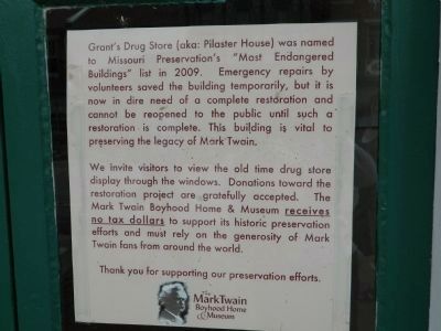
In 1846, Mark Twain's family fell on hard times and couldn't afford to live in their own home. The Grants invited the entire Clemens family to live with them in the rooms above their pharmacy. They shared their roof and their food, to allow Mr. . . . — — Map (db m150201) HM
On Main Street at Hill Street, on the right when traveling north on Main Street.
One of the first stores in Hannibal was opened by Henry Collins in a log cabin on this site. In 1839 he advertised "Country produce taken in exchange for goods." In 1851 Leer & Arrogast had a wholesale and retail tobacco store here and the . . . — — Map (db m58828) HM
On North Avenue at 3rd Avenue on North Avenue. Reported missing.
On this spot stood the house in which Huckleberry Finn (in Mark Twain’s famous book) was born and it was his home during his close friendship with Tom Sawyer. It was a hovel “vividly described” in the book. — — Map (db m96469) HM
On Main Street north of Bird Street, on the right when traveling north.
This building was constructed in 1836 by Joshua Mitchell. It was one of the first brick commercial store houses in Hannibal. Located on 2nd Street, now called Main St., the hub of commercial activity. It was purchased in 1844 by Zachariah Draper, . . . — — Map (db m58826) HM
On Main Street just south of Church Street, on the right when traveling north.
Mark Twain Hotel was originally built in 1905 as an up-scale hotel serving a booming Hannibal area. It was frequented by presidents and dignitaries. 2006 renovations converted the hotel into senior residential apartments using Sec. 42 tax credits. . . . — — Map (db m150217) HM
On Hill Street west of North Main Street, on the right when traveling west.
Mark Twain’s Boyhood Home has been designated a Registered National Historic Landmark Under the provisions of the Historic Sites Act of August 21, 1935 this site possesses exceptional value in commemorating and illustrating the history of . . . — — Map (db m131900) HM
On Hill Street just west of Main Street, on the left when traveling west.
Young Sam Clemens (Mark Twain) saw a dead man on the floor in here one night. Sam went out at a window, taking the sash along with him. "I didn't need the sash," he recalled, "but it was handier to take it than it was to leave it. So I took it. I . . . — — Map (db m58821) HM
On Main Street just north of Bird Street, on the left when traveling north.
This building built in c1840, was originally the McDaniel's Candy Store. Jimmy McDaniel, the owner's son and a friend of Sam Clemens, was the envy of all his friends. The building is on the National Register of Historic Places. — — Map (db m150224) HM
On Main Street north of Bird Street, on the right when traveling north.
W. C. Chenowith begs leave to announce to the citizens of Hannibal that he is now opening in this house a new & splendid assortment of goods. By 1852, this was the "Baltimore Cheap Cash Store." In the 1880's the building was remodeled by . . . — — Map (db m58827) HM
On Main Street north of Bird Street, on the right when traveling north.
This property has been
placed on the
National Register
of Historic Places
by the United States
Department of the Interior . . . — — Map (db m156550) HM
On North Street just west of Main Street, on the right when traveling west.
About the time young Sam Clemens played pirates by the river, this house was just a few years old. During the next 75 years the home had many owners. Then, in 1921 the Hatten family came to stay. The stories that surround this house make great . . . — — Map (db m150205) HM
The Beginnings
In 1803, the United States paid France $15 million for 828,000 acres of land west of the Mississippi River. Only 16 years later, the enterprising Moses Bates established the town of Hannibal, MO.
The Clemens Family
The . . . — — Map (db m156647) HM
On South Dickerson Street just south of Church Street, on the right when traveling south.
Speigle House
Built c.1850
has been placed on the
National Register
of Historic Places
by the United States
Department of the Interior — — Map (db m150340) HM
On Main Street (Missouri Route 87) east of High Street, on the left when traveling east.
The domed octagonal cupola, domed semicircular portico supported by curved brick columns of Corinthian order, 24-paned windows and fanlighted front door lend architectural interest to this classic revival-styled building completed in 1868. What . . . — — Map (db m62427) HM
On Main Street south of Virginia Avenue, on the right when traveling south.
Sketched in 1871 by A. R. Waud of Harper's Weekly, this drawings is the only known full sketch of the 1854 Courthouse. Built at a cost of $2,750 under the supervision of T. J. 0. Morrison, the wooden frame building was 45 by 60 feet (2,700 sq.ft.) . . . — — Map (db m179444) HM
On McCord Street near Washington Street, on the left when traveling east.
In 1898, Edward Haas built this four story warehouse to house his wholesale grocery. The warehouse has an electric belt driven elevator and automatic sprinkler system. His business was the center for the entire region for canning and shipping. The . . . — — Map (db m42915) HM
On Ohio Avenue (Missouri Route 750) south of 4th Street, on the left when traveling south.
Block of ground donated
by Gen. Geo. R. Smith
Building erected 1924
County Court
Presiding Judge J. L. McCurdy
Associate Judges G. W. Teeter
S. M. Williams
A. R. Barnes, Supt
-------------
Corner Stone Laid
Feb. 7, 1924 • A. L. . . . — — Map (db m85193) HM
On West 3rd Street just west of North Rolla Street, on the left when traveling west.
Phelps County Courthouse
1860-1994
has been placed on the
National Register
of Historic Places
by the United States
Department of the Interior — — Map (db m139745) HM
On Kingshighway (Business Interstate 44) 0.1 miles west of U.S. 63, on the right when traveling west.
John Webber established the first homestead in what is now in the city of Rolla on this site in about 1845. The one and one-half story, single-room log cabin he constructed stood just north of this plaque. The concrete marker that covers Webber's . . . — — Map (db m139760) HM
Want to find a little culture in Kansas City? Just look up. Our city is filled with extraordinary examples of architectural styles, from beaux-arts to modern. But our assortment of Art Deco-style buildings is our real claim to architectural fame. . . . — — Map (db m43182) HM
On Main Street near Short Street, on the right when traveling south.
Excellent example of porcelain-covered brick. Second floor living quarters. First floor used as a saloon, barber shop, doctor & dentist offices. — — Map (db m44538) HM
On Short Street at Main Street, on the left when traveling east on Short Street.
Lot sold to Elijah Cody for $7.50. As a boy, "Buffalo Bill" William Cody vacationed here with his uncle Elijah. McCalley residence since 1947. — — Map (db m44543) HM
On Main Street at Short Street, on the right when traveling south on Main Street.
Home of boot shop, living quarters below. Later housed newspapers, doctor, shoe repair, insurance. Tin roof, ornamantal tin ceiling. Front redone 1926. — — Map (db m44539) HM
On Main Street near Short Street, on the right when traveling south.
One of the original business buidings, survived Fire of 1853. Handmade brick with metal standing seam roof, known as How Boot and Shoe Store. — — Map (db m44533) HM
On Main Street near Short Street, on the left when traveling south.
Two story brick with cast iron front. Early use as grocery & provision store. Also housed bakery & confectionery, ice cream parlor, meat market & garage. — — Map (db m44532) HM
On Thomas Street near Main Street, on the left when traveling east.
Property first deeded to T.W. Mitchell by town of Weston for $13.49. Early day uses were shoe shop, law & dental offices. Rebuilt as medical building in 1939. — — Map (db m44530) HM
On Main Street near Short Street, on the left when traveling south.
Commercial building, brick porcelain facade added early 1900's. Used as a drug store until 1896. Home of Weston's first electric theatre in 1909. — — Map (db m44544) HM
On Main Street at Short Street, on the right when traveling south on Main Street.
Organized with 52 people in home of Jeremiah Wood April 7, 1838. Present building begun 1859, delayed by Civil War, completed 1867, dedicated Sept. 4, 1868. — — Map (db m44542) HM
On Washington Street at Spring Street, on the left when traveling south on Washington Street.
Present Victorian building dedicated in 1907 to replace brick Federalist style church built 1854. Memorial stained glass windows added since 1934. — — Map (db m44546) HM
On Thomas Street near Blackhawk Street, on the left when traveling east.
First jail, 1880's log, located upper Main St. This Thomas Street building erected next to first fire station. Ceased being used as jail in 1960's.
National Register of Historic Placses — — Map (db m44506) HM
On Main Street near Market Street, on the right when traveling south.
Two story brick, original ornamental tin ceilings - storefront chaned in 1890's. Housed early saloons, cafes, also Chevrolet & Ford agencies in the 1930's. — — Map (db m44528) HM
On Lynn Street at North Street, on the right when traveling north on Lynn Street.
Built of logs in pioneer days, used as a stage coach stop and a tavern of rest for weary travelers westward bound. In 1862 the building was comandeered by the Union Forces and used as a hospital for the duration of the Civil War. After the war . . . — — Map (db m21618) HM
On North Street at State Highway 17, on the right when traveling west on North Street.
The Talbot House is one of Waynesville's oldest homes. The home was constructed by Rev. Albert Washington Davis in 1885. After his death in 1888, his widow opened the family home to travelers as the "Pulaski House".
Dr. C.A. Talbot . . . — — Map (db m184887) HM
On High Street east of 1st Street, on the right when traveling east.
George Caleb Bingham Home
has been designated a
Registered National
Historic Landmark
under the provisions of the
Historic Sites Act of August 21, 1935
This site possesses exceptional value
in commemorating or illustrating . . . — — Map (db m246744) HM
Near Wells Drive west of Concourse Drive, on the right when traveling west.
The 1904 World's Fair Flight Cage was built by the Smithsonian Institution for the Louisiana Purchase Exposition in St. Louis - the 1904 World's Fair. At that time it was the largest bird cage ever built, and it proved to be one of the most . . . — — Map (db m189224) HM
Near Shaw Boulevard west of Tower Grove Avenue, on the left when traveling west.
Originally erected (1849 - 50) at Seventh and Locust Streets. In accordance with a provision of Mr. Shaw's will "carefully taken down and rebuilt" on this location in 1891. Southern half of building added in 1908. — — Map (db m219394) HM
Near Shaw Boulevard west of Tower Grove Avenue, on the left when traveling west.
The "townhouse" Barnett designed for Henry Shaw in 1849 was a three-story brick home, which stood in downtown St. Louis on the southwest corner of Seventh and Locust streets. In 1891, according to Shaw's will, the building was dismantled brick by . . . — — Map (db m219393) HM
The builder of the house, as well as its subsequent owners, were well-known and respected individuals, and the farm reflected their status in the St. Louis community. Modifications were made to the original two-story, four-room structure to . . . — — Map (db m124992) HM
Colonel Dent named the property White Haven after his family home in Maryland. Paint analysis indicated the home was painted various colors in the nineteenth century, including Paris Green with a dark green trim, as seen on this wall and . . . — — Map (db m124993) HM
White Haven was the name given to both the house and the estate. Typical of many large plantations, other houses on the property were built and occupied by family members and slaves. White residents gave their houses special names. The slaves, . . . — — Map (db m124999) HM
On Gerhardt Trail Park Rd, 0.3 miles Winnie Ln, on the right when traveling west.
Built by: Dr. Frederick Bates Jr. and Lavinia Meredith Bates, Original location: Directly across Olive Blvd. from Faust Park. Facts . Frederick Bates Jr. was the youngest son Frederick Bates, second governor of the state of Missouri.. After . . . — — Map (db m178856) HM
On West Sherwood Drive just south of Lackland Road, on the right when traveling north.
This large estate was purchased by Henry Laughlin in 1879. The Laughlin family used this property as a summer retreat from their home on Lucas Place in the city of St. Louis. Randolph, his son, built the mansion between 1904 & 1912, known as the . . . — — Map (db m145732) HM
On Main Street at Hunter Street, on the left when traveling north on Main Street.
Cellroom built before Civil War
Survived burning of Nevada 1863
Front part added 1871
Museum established 1965
Entered on the National Register
of Historic Places 1977 — — Map (db m36064) HM
On Cherry Street near Main Street, on the right when traveling west.
Constructed in 1908
Placed on the National Register
of Historic Places
on this day June 27, 1997
by the United States
Department of Interior — — Map (db m34310) HM
(Listing of keys matched to the annotations on the aerial photograph):
1) Union Cemetery
2) C.V. Estes, Bose H.P. Bennett, F. Hughes
3) Frank C. White, Nellie Polk
4) Wheeler W. Dennis, Whitner, Absheer
5) Amy H. Costner
6) . . . — — Map (db m209656) HM
Harriet Smith's two-story frame residence was located in the center of this property. Mrs. Smith's husband, Ed, was cashier of the Wayne County Bank and a partner in the Smith-Rhodes Mercantile Company. He died in 1926 and later Mrs. Smith . . . — — Map (db m230049) HM
171 entries matched your criteria. Entries 101 through 171 are listed above. ⊲ Previous 100