Cherokee County has a rich and varied history. Spanish and French explorers of the seventeenth century found Tejas and Hasinai Indians living in this area, and Spanish missions were established in the region.
Driven out of the United States, . . . — — Map (db m212151) HM
Built 1865 by C. Chaffee, a New Orleans promoter cotton-buyer. Served 1868-1883 as law office of S.A. Willson, member of 5-man commission to codify Texas law under Constitution of 1876; later judge in State Court of Appeals. In this building, . . . — — Map (db m232159) HM
In the late 1880s the Texas Prison System built a short rail line from the state penitentiary facility in north Rusk, southwestward to hardwood timber stands, where charcoal was made for use in firing the prison's iron ore smelting furnaces. The . . . — — Map (db m128990) HM
Ohio native Robert F. Mitchell came to Nacogdoches County, Texas, in 1837. Briefly associated with John Durst in a mercantile firm, Mitchell moved to Cherokee County in 1849 and, soon after, his land on the upland divide between the Neches and . . . — — Map (db m232120) HM
W.R. Hudson and J.M. Higgins, early pioneers in this area, came from Cherokee County in East Texas to settle here in 1853. They laid off a townsite in 1854 and named it Milford. The town developed steadily, and soon boasted homes, a school, post . . . — — Map (db m183587) HM
Established in 1847 as the city cemetery, Cedar Hill Cemetery is located at the south edge of Rusk in Cherokee County, atop a hill surrounded by a dense forest. Some of Rusk's oldest and most prominent residents have stone monuments in Cedar Hill . . . — — Map (db m232131) HM
South Carolina native John "Jack" Coker came to Texas in 1834 and fought in the Battle of San Jacinto. In gratitude for his service, Coker received from the Republic of Texas a one-third league, which totalled 1,920 acres and was situated along . . . — — Map (db m177119) HM
The first newspaper in Rusk was the short-lived Rusk Pioneer, which began in 1848 and moved to Palestine the following year. On February 27, 1850, the first issue of the Cherokee Sentinel was published. This is the publication to which . . . — — Map (db m289545) HM
Tennessee native John Joseph Bowman came to Texas with his family in 1822 and settled in Stephen F. Austin's colony on the Colorado. He later resided in Matagorda County, where, in 1835, he enlisted in the Texian Army, and served in the Texas War . . . — — Map (db m289562) HM
For Weary Travelers
During the height of travel along El Camino Real de los Tejas, this site was a frequent rest stop or paraje. It was known as Paraje el Cerrito or Place of the Little Hill. It was probably a popular stop . . . — — Map (db m232415) HM
The Caddo workers who built the earthen mounds gathered the necessary soil from excavations, or "borrow pits", and carried it in baskets. It took many trips from the pit to the village to significantly increase the height of any mound.
Along . . . — — Map (db m232383) HM
This burial mound was about 20 feet tall and 90 feet in diameter when the village was abandoned. A series of archeological excavations beginning in 1939 determined that it was built in successive stages over a period of about 700 years, ending . . . — — Map (db m232392) HM
A Corridor for Commerce, Culture, and Change - Past and Present
You are standing at one small point on a legendary network of roads that arc across Texas - El Camino Real de los Tejas. The main overland route from Mexico, through . . . — — Map (db m232403) HM
Big names and bigger dreams have contributed much to the history of Texas. Zebulon Pike, Stephen F. Austin, Davy Crockett, and others traveled along El Camino Real de los Tejas or stayed in the towns like Nacogdoches that grew up along it. They came . . . — — Map (db m232406) HM
This mound was originally at least three times its current length and reached 35 feet tall. It was the spiritual and political center of the village with buildings for worship or government. Archeological evidence suggests that periodically, the . . . — — Map (db m232376) HM
This Low Platform Mound did not have any buildings on it. Based on archeological evidence, it appears that there were important structures at the ground surface which were burned and then covered over to create a platform mound that was ramped . . . — — Map (db m232387) HM
The natural spring located near the village site feeds into the Neches River and is likely a primary reason the Caddo settled here. It provided a continuous supply of fresh water for the local residents. Village women collected water from the spring . . . — — Map (db m232372) HM
Along El Camino Real de los Tejas
On a good day, a Spanish carreta, or wooden freight wagon, could travel up to 18 miles before sunset along El Camino Real de los Tejas. In the 1750s, a driver might pass a group of Franciscan friars in charge . . . — — Map (db m232420) HM
The village surrounding Caddo Mounds was divided into two distinct living areas, one for the spiritual and cultural leaders and the other for the common villagers. The inner village surrounded the temple mounds and housed the village's spiritual and . . . — — Map (db m232374) HM
The Caddo village served as a major regional trade center, connected to other settlements by a series of long-distance trade routes. The people here exchanged goods with other groups nearby and from hundreds of miles away. The Caddo imported high . . . — — Map (db m232396) HM
Texas Ranger, T.C. Robinson once described him, “He kills men just to see them kick. He can take two six shooters and turn them like wheels in his hands and fire a shot from each at every revolution.” Others have described Fannin . . . — — Map (db m128660) HM
In loving memory of the pioneering spirit of James Newton Hampton, 1835-1890
and Malinda Winifred Coker Hampton, 1840-1929.
Malinda came with her parents, Joseph and Malinda Brown Coker from Alabama to Cherokee County Texas in 1846. James . . . — — Map (db m295582) HM
Settlement of the Earle's Chapel community began several years before the organization of Cherokee County. W. J. Ragsdale (1811-1884), a veteran of the Texas War for Independence, and his wife Patsy McAdams (1816-1898) had settled on Prairie Branch . . . — — Map (db m122852) HM
(front)
Civil War manufacturing, supply and military center. Field Transportation Bureau shop made and repaired wagons, saddles, harnesses. Gun factory produced "Mississippi rifles" and pistols. Two iron works cast plows, skillets, pots, . . . — — Map (db m95136) HM WM
James Henry Dishman was forced at the age of six to assume a man's role after his father's death in the Civil War in 1864. A native of Cherokee County in East Texas, he eventually moved to Kaufman County and developed a successful ranching . . . — — Map (db m261719) HM
William Patrick Williams (ca. 1818-1898) and his wife Elizabeth (Boles) (ca. 1822-1899) migrated to Texas from Mississippi during the Civil War. After a brief stay in Cherokee County, they settled in this area, arriving by wagon train. Their nearby . . . — — Map (db m94584) HM
Born in Kentucky of Scottish ancestry, Alfred Davenport Oliphint (1799-1880) married Jemima Allen in Mississippi around 1821, and the two became parents to several children. After Jemima's death in 1835, Oliphint married Martha Ann Causey . . . — — Map (db m290393) HM
Rev. Denman was born in Gumlock Creek, Franklin Co., Georgia on May 8, 1803 and moved to Cherokee County, Texas with his first wife, Elizabeth Randle (1805-1861), in 1849. There he established a large plantation and ran a general store with the help . . . — — Map (db m203301) HM
In 1901, a new townsite was laid out on the Texas & New Orleans Railroad. Promoted by brothers Lee D. and William T. Guinn, it was named Hubb for county surveyor Hubbard S. Guinn. It was renamed Ponta (an adaptation of the Latin Ponte, which . . . — — Map (db m107325) HM
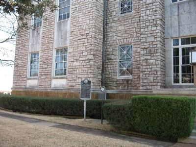
This courthouse, the fourth to serve the citizens of Cherokee County, was built in 1940-41 with the assistance of the Federal Works Progress Administration. Designed by the architectural firm of Gill & Bennett, the modern structure is built of . . . — — Map (db m40618) HM
Wyatt Thomas Norman and William Harrison Shook, both Cherokee County natives, opened a law office on the Courthouse Square in 1898. George Gibson became a partner in 1918. He later moved to Jacksonville and opened a branch there. Wyatt T. Norman's . . . — — Map (db m41085) HM
As the population increased in Angelina and Cherokee counties in the 1860s, a formal system of roads began to take shape. Until that time, roads were usually forged by farmers and other pioneers carrying goods to market or traveling to new homes, as . . . — — Map (db m28167) HM
Joseph H. Bowman, a veteran of the Texas War for Independence from Mexico, offered one hundred acres of land to the Rev. W.D. Lewis to come to Mt. Hope community and establish a Methodist church and cemetery. The Rev. Mr. Lewis agreed and the . . . — — Map (db m28138) HM
South Carolina native A. J. Hood (b. 1820) migrated to Cherokee County, Texas, about 1846. Ten years later, after representing that area during two terms of the state legislature, he moved his family here. Hood opened a law office in Weatherford . . . — — Map (db m189721) HM
Founded about 1870 as one of Calvert's first industries. The building is of county-made brick; iron facade came from St. Louis. Iron ore from local deposits and from Cherokee County (100 Mi. NE) was hauled here by horse-drawn wagons to be made . . . — — Map (db m168164) HM
Baxter Springs was named for John Baxter, the area's first European settler in 1849, and the springs on his homestead. A military surveying party who camped in the area in 1857 recounted springs rich in iron salts as rising in a "cone of red mud," . . . — — Map (db m174251) HM
Mother of child thought to have been first Anglo-American born in Texas, in 1804. Helena Kimble was born in Maryland. Married James Dill in 1786. Moved to Nacogdoches, then under Spanish rule, 1793. There he became an Indian trader and served as . . . — — Map (db m289556) HM
Elijah Earle (1804-1880) and his second wife, Mary Elizabeth Jarratt Tatum (1824-1904), set aside land for this graveyard in 1858. Elijah selected his own burial site at the time, marking it by carving his initials on a tree trunk. He was buried . . . — — Map (db m122853) HM
On March 31, 1846, the Dublin Post Office was established on the Byler Road in Fayette County to continue mail service when the Eldridge Post Office temporarily closed. Surley Dublin served as its first postmaster and was the office's namesake. . . . — — Map (db m310410) HM
Born near Rusk in Cherokee County, Thomas Mitchell Campbell was the son of Thomas Duncan and Rachel (Moore) Campbell. He financed his education by working for the County Clerk in Longview. In 1878 Campbell was admitted to the Bar and opened his law . . . — — Map (db m128941) HM
In 1855, brothers Thomas Jefferson “Jeff” (1832-1915) and Jasper (1830-1891) Landrum and others left Fayette County, Georgia, and settled in Cherokee County, Texas, five miles west of Alto. They obtained 640 acres and grew a self-sufficient farm . . . — — Map (db m289576) HM
Organized in 1891 at the Shiloh schoolhouse by members of the Baptist Church of Christ at Corinth, this church was originally called the Baptist Church of Christ at Shiloh. Charter members elected E. M. Carter as the first pastor. The church was . . . — — Map (db m31865) HM
Spivey Crossing is a farming community located along the Brazos River Valley. Established as early as 1854, Spivey Crossing was an old wagon trail crossing named for Temple Spivey, the first known settler of the Smith Bend community of Bosque . . . — — Map (db m161715) HM
The Wynne community of Canton is one of the oldest African American communities in Texas. Its namesake, Edmund Arnold Wynne, was born June 18, 1850, in Cherokee County to a family of slaves. His family moved to the Big Rock area of Van Zandt County . . . — — Map (db m247166) HM
When Route 66 first gained federal status in 1926, it traveled over Kansas roads already paved.
At a time when hard-surfaced roads were a rarity in Kansas, Cherokee County was an exception. Prior to the turn of the century, engineers had . . . — — Map (db m81117) HM
Thin black lines indicate changes in relevance. Between each pair of lines entries are ordered geographically but all have the same relevance.
* Inflectional forms of words are their plurals, singulars, and possessives as well as gramatical tenses and similar variations.