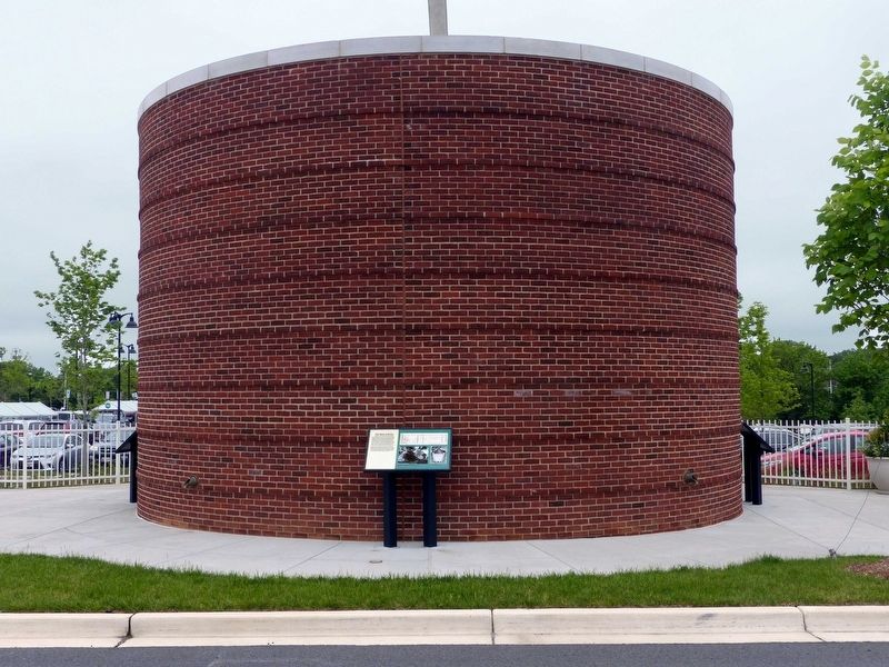
You are standing near the remains of a 19th century icehouse.
What is an icehouse? An icehouse is an underground facility designed to store ice during times of year when it is not easily available. Icehouses use the natural insulating qualities of . . . — — Map (db m117925) HM
Commemorating the local history of the Maryland and Pennsylvania Railroad that traveled along this path connecting with the Spenceola CanneryCommissioned by The Harford County Cultural Arts BoardFunded through "Public Art Project Grant" Maryland . . . — — Map (db m96734) HM
Founded in 1671 at Gravelly, where original wooden structure no longer stands (about 2 miles southeast, on Aberdeen Proving Ground). Parish moved here in 1718. Present church, erected in 1851, is third on this site. Brick Vestry House here dates . . . — — Map (db m146952) HM
Count Rochambeau’s troops camped here September 9, 1781 after having crossed the Susquehanna River on their way to the siege of Yorktown, VA. — — Map (db m146941) HM
The King and Queen Seat to your right is a natural 190-foot rock outcrop that overlooks Deer Creek Valley. This cliff towers directly above Deer Creek and affords a spectacular view of the rolling hills and farmland of Harford County
During the . . . — — Map (db m79731) HM
Forty-three years ago this week, horses crossed the finish line for the last time at the Havre de Grace Race Course. Charlight, ridden by Moose Peters, etched a place in Maryland racing history as the track's last winner.
It's unlikely that . . . — — Map (db m262610) HM
Signer of the Declaration of Independence. Born October 31, 1740 on Chilberry Hall Farm 1¼ miles south of here. Died October 27, 1799. — — Map (db m129956) HM
What caused the “great excitement” in Harford County during the summer of 1864? It was the arrival of a detachment of the Confederate cavalrymen led by partisan Major Harry Gilmor. He and his trooper, mostly Marylanders, were part of a 12,000-man . . . — — Map (db m158692) HM
A ridge of high quality slate running from southeastern Pennsylvania into Harford County, Maryland, was quarried on a limited scale as early as 1734. Production increased in the 1840s when the opening of the Susquehanna and Tidewater Canal offered a . . . — — Map (db m169259) HM
Railroad service came to Forest Hill circa 1883, when the Maryland Central Railroad laid narrow gauge track from Baltimore to Delta, PA. The MCR suffered financial difficulties and emerged as the Maryland Central Railway Company in 1888. Interested . . . — — Map (db m187768) HM
Post card image of the Bel Air station circa 1907.
The 77.2 mile route of the Ma & Pa ran from Baltimore to York. While significantly longer than other railroads, the Ma & Pa passed through the center of Harford County. This is the . . . — — Map (db m173926) HM
At the corner of Lapidum and Stafford Roads stood a three-story Victorian building known as the Susquehanna Hotel, built by Conrad Baker in 1868. It was constructed of stone and brick and had several large porches. Other buildings -- a church, a . . . — — Map (db m188603) HM
Largest colonial landowner in this part of Maryland. Deputy Surveyor-General of Baltimore (then including Harford) County. Father of Bishop William White, first presiding Bishop of the Episcopal Church and Chaplain of the Continental Congress. — — Map (db m1281) HM
In 1994, Harford County Department of Parks & Recreation helped to found the MA & PA Heritage Trail, Inc. to revitalize the former Maryland & Pennsylvania Railroad into a pedestrian greenway that will ultimately stretch from Fallston to Forest Hill. — — Map (db m96741) HM
Constructed in 1865 to connect the mill towns of Jerusalem Mill and Franklinville. This timber burr arch through truss bridge is the last of its kind in Baltimore and Harford counties and one of the few surviving covered beridges in Maryland. . . . — — Map (db m271948) HM
Home of William Paca, signer of the Declaration of Independence and twice Governor of Maryland. Born at Chilbury Hall, Harford County 1740. Died and lies buried here, 1799. The unusual house probably dates about 1740. — — Map (db m3137) HM
(preface)
In June 1864, Confederate Gen. Robert E. Lee sent Gen. Jubal A. Early’s corps from the Richmond battlefields to the Shenandoah Valley to counter Union Gen. David Hunter’s army. After driving Hunter into West Virginia, . . . — — Map (db m188720) HM
The History of the MA & PA Trail
The MA & PA Railroad stretched between Baltimore at North Avenue & Howard Streets, on to Towson, through Long Green Valley into Harford County. It ended at Market Street in York, Pennsylvania. Even by the . . . — — Map (db m104553) HM
Alfred B. Hilton was born between 1837 and 1842, in the area then known as Hopewell Crossroads (now Level, Maryland). He was the son of Isaac and Harriet Hilton, free citizens who were formerly enslaved in Harford County. Alfred grew up in a . . . — — Map (db m268889) HM
Built in 1827 of Port Deposit granite by local contractor John Donahoo, who built thirteen of the earliest lighthouses on the Chesapeake Bay. Originally lit with 9 whale oil lamps; a Fresnel lens was installed in 1854. The first keeper, John . . . — — Map (db m137129) HM
Covered bridge: Originally constructed in 1865, the Jericho Covered Bridge is the last remaining covered bridge in Baltimore and Harford counties, and one of only six remaining in Maryland. It has a Burr Arch through truss design, . . . — — Map (db m271947) HM
Here beside Bush River was county seat of Baltimore County, then largely wilderness including what is now Harford County. By 1676 Courthouse had been built. About ¼ mile south of surviving cemetery of Phillips family. (Here is buried Martha Paca . . . — — Map (db m149109) HM
In operation from 1912 to 1950 and nicknamed “The Graw.” The Harford Agricultural and Breeders Association racetrack was one of four one-mile thoroughbred racecouses in Maryland and reflected Harford County’s status as a breeding center for . . . — — Map (db m1269) HM
In 1920, the Keeper's House and property were sold by the U.S. Government. The light had been automated and a keeper was no longer necessary. The building became a boarding house until the mid-1930s. It then became a bar, dance hall and . . . — — Map (db m164986) HM
County seat of Harford County from its origin March, 1774, until March, 1783. Here the first Declaration of Independence ever adopted by an organized body of men duly elected by the people was proclaimed on March 22, 1775. — — Map (db m129963) HM
1827-1920. Constructed by John Donahoo of Havre de Grace; Builder of Twelve Maryland Lighthouses
The house and property were sold by the U.S.
Government in April 1920 as the light had been automated and a resident keeper was no longer . . . — — Map (db m164821) HM
The 45-mile long Susquehanna (PA) and Tidewater (MD) Canal ran from Wrightsville, Pennsylvania to Havre de Grace, Maryland. The canal was built between 1835 and 1839 in order to improve commerce on the Susquehanna River. The new canal would . . . — — Map (db m211127) HM
Listen, and you can almost hear the jazz music and smell the roasting duck. Edward F. Piersol conceived the idea for the Bayou Hotel and was the first owner. The hotel, considered lavish for a small town, was built with field stone from Harford . . . — — Map (db m161519) HM
William Baker
abt. 1815 - Harford County, MD
14 May 1892 - Allentown, PA (buried in Lebanon, PA)
Harriet Ann (Cole) Baker
abt. 1829 - Havre de Grace, MD
01 Mar 1913 - Allentown, PA (buried in Greenwood Cemetery)
William . . . — — Map (db m241493) HM
About four miles southeast is the site of the American Revolutionary Battle of Long Cane. On December 12, 1780, Lieutenant Colonel Isaac Allen and a British force of 400-500 men defeated Colonel Elijah Clarke and 100 Americans, an advanced . . . — — Map (db m241074) HM
On July 31, 1861, 300 men from the 12th Pennsylvania Infantry under Capt. Daniel Leasure marched into Bel Air to arrest Southern sympathizers and confiscate weapons from local militia units. The troops halted at the courthouse square, then dispersed . . . — — Map (db m156302) HM
The monument is in tribute to and honors families who lost one or more loved ones serving in the Armed Forces of the United States.
The first panel depicts their homeland Harford County and Havre de Grace Maryland of the United States of . . . — — Map (db m164066) WM
The monument is in tribute to and honors families who lost one or more loved ones serving in the Armed Forces of the United States.
The first panel depicts their homeland Harford County and Havre de Grace Maryland of the United States of America. . . . — — Map (db m200270) WM
African American Medal of Honor Recipients Memorial
The Medal of Honor takes its place in our country as the highest award for military valor. The honor, awarded by the President in the name of Congress, may only be accorded an . . . — — Map (db m173924) HM WM
Brother's Lot, Wilton Farm, Greenway Farm, Allenwood Farm. Swan Harbor - many different names, many different families, each calling this farm home.
It began in 1659 when Colonial Nathaniel Utie received a land grant from Lord Baltimore for a . . . — — Map (db m213680) HM
Construction began on the Bayou in 1917. Built with solid 18" thick Harford County fieldstone walls and 14" thick wooden beams, it took four years to complete.
The Bayou Hotel opened for business in 1921. It's stunning facilities included a . . . — — Map (db m152374) HM
At the very spot where you're standing, Harford County's past and present converge in an exciting way! The Ma and Pa Railroad, which is short for Maryland and Pennsylvania Railroad, was at one time an integral part of Harford County's . . . — — Map (db m97824) HM
The Rock Run Mill was built in 1794 by John Stump, a prominent businessman, on land originally known as “Land of Promise.” The mill was in continuous operation until 1954. It is one of the oldest mills still standing in Harford County.
The . . . — — Map (db m188608) HM
This fishing houseboat dates from c. 1900, and measures approximately 8 feet wide by 20 feet long. It is a simply constructed wooden "scow" similar to a barge with a small one room un-insulated house (or shanty) atop the base. These boats were used . . . — — Map (db m138207) HM
On July 31, 1861, Capt. Daniel Leasure and 300 men from his 12th Pennsylvania Infantry halted here at Bel Air's courthouse square. War had begun in earnest, the First Battle of Bull Run was fought on July 21, and many residents of Harford County . . . — — Map (db m248758) HM
Thin black lines indicate changes in relevance. Between each pair of lines entries are ordered geographically but all have the same relevance.
* Inflectional forms of words are their plurals, singulars, and possessives as well as gramatical tenses and similar variations.