How did people navigate this coastline before lighthouses and GPS?
Comment les gens naviguaient-ils le long de la côte avant les phares et le GPS?
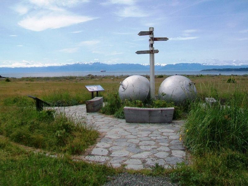
————————————— . . . — — Map (db m99204) HM
Prior to 1910. the Royal Navy provided maritime defence of British North America and for the Dominion of Canada from 1867. With World War I brewing in Europe early in the 20th century, Great Britain redistributed the British fleet and reduced its . . . — — Map (db m49075) HM
This building is a good example of Edwardian commercial architecture. It was built for William James Marble as a carriage factory, replacing the original wooden structure from 1885. Early painted signage is still visible on the east façade. In 1938, . . . — — Map (db m48748) HM
[English] Amor De Cosmos (Lover of the Universe) was the name adopted by William Smith of Windor, Nova Scotia, while in the California goldfields. In 1858 he arrived in Victoria and founded the opposition journal, the Colonist. For over two decades . . . — — Map (db m49079) HM
On Government Street just north of Belleville Street, on the right when traveling north.
The only native broadleaf evergreen tree in Canada, the Arbutus is found from the southern coastline of BC to California. In BC the Arbutus grows in a narrow band along the south coast line, generally within 5 kilometers (3 miles), of the ocean. . . . — — Map (db m74403) HM
You are standing in Bastion Square, a public space dating back to the Victorian Era.
There are many alleys and walkways to explore, connecting Bastion Square to nearby streets to see the heart of Victoria’s Old Town Historical Site.
Chancery Lane . . . — — Map (db m49226) HM
On Pandora Street at Government Street on Pandora Street.
The cast iron panels on this fence are from the Driard Hotel, built in 1892 and designed by architect John Teaque. It was Victoria’s most prestigious hotel prior to the construction of the Empress Hotel. A reconstructed portion of the original hotel . . . — — Map (db m48477) HM
On Pandora Street at Government Street on Pandora Street.
For many years the building on the near left side of this photograph (where you are standing) was a Chinese general store. It was taken down in the early 1960s to enlarge the intersection. You can see a streetcar on Johnson Street crossing . . . — — Map (db m49154) HM
On Blanshard Street at Pandora Avenue, on the right when traveling north on Blanshard Street.
The Congregation Emanu-El Synagogue was built in 1863, just five years after the arrival if the first members of Victoria's Jewish community during the Fraser River gold rush period. Its opening was widely celebrated in Victoria for, despite their . . . — — Map (db m72875) HM
On Government Street at Courtney Street on Government Street.
[English]
The 1957 portion of the building was renovated to provide retail space and a heritage facade compatible with the original 1914 section.
This project was completed by Public Works Canada as a contribution to the historical preservation . . . — — Map (db m48544) HM
During this district’s boom of 1881 – 1884, sixteen thousand Chinese established themselves within this area of Victoria. Thus emerged six blocks of businesses, theatres, a hospital, schools, churches, temples, opium factories, gambling dens . . . — — Map (db m49155) HM
[English] This hotel was built between 1904 and 1908, and has since been enlarged twice. The architect, Francis M. Rattenbury, followed the practice of the Canadian Pacific Railway in employing the Chateau style, identifiable by the steep slate . . . — — Map (db m49238) HM
On Pandora Street at Government Street on Pandora Street.
The Fifth Regiment of Garrison Artillery marches down Government Street in December 1915 on their way to the Inner Harbour, where they boarded a steamer to Vancouver. They would join other Canadian troops fighting in Europe in World War I. The tall . . . — — Map (db m49153) HM
On Government Street at Fort Street on Government Street.
On this site Rev. R.J. Staines and wife opened the first British Columbia School in 1849. In the same building of Fort Victoria the first Legislative Assembly met August 12th 1856.
[Plaque below]
This plaque unveiled by Honorable Nancy Hodges, . . . — — Map (db m48521) HM
[English] Opened in 1889, the Victoria Law Courts was the first major public building constructed by the provincial government after union with Canada. Previously, court sessions had been held in one of the colonial administration buildings located . . . — — Map (db m49098) HM
On Wharf Street at Fort Street, on the left when traveling north on Wharf Street.
The mooring rings on the rocks below are the only surviving fragment of Fort Victoria built by the Hudson’s Bay Company in 1843. From 1846, when the Oregon boundary was drawn at the 49th parallel, this post served as grand depot and headquarters of . . . — — Map (db m9195) HM
On Government Street at View Street on Government Street.
The pavement design near this marks the location of the bastion that stood at the northeast corner of Fort Victoria. From here the stockade ran southward past the gateway at Fort Street, and westward toward the harbour. Each brick within the bastion . . . — — Map (db m48509) HM
On Government Street at Fort Street on Government Street.
The pavement design near this plaque marks the location of the east gate of Fort Victoria, built in 1843. From here the wooden stockade stretched northward to the bastion and southward toward what is now Broughton Street. The plaques in the pavement . . . — — Map (db m48520) HM
On Government Street at Broughton Street on Government Street.
Founded by the Hudson’s Bay Company in 1843, Fort Victoria became, after 1846, the head-quarters of the Company’s trade in British territory west of the Rocky Mountains. When the Colony of Vancouver Island was formed in 1849 Victoria was the . . . — — Map (db m48542) HM
Near Douglas Street / Trans-Canada Highway (National Highway 1), on the right when traveling south.
On April 22, 1942, 273 men, women and children of Japanese ancestry were exiled from their homes in the Greater Victoria area. None of the survivors of this event ever returned to Victoria to re-establish a home.
On August 4, 1992, 67 . . . — — Map (db m49127) HM
[Chinese, not transcribed]
[English]
Lee Mong Kow (1863-1924) was born in Panyu County, Guangdong Province, China. As an interpreter in the Canadian Customs House and Immigration Office he helped facilitate communication between Chinese . . . — — Map (db m49157) HM
On Yates Street at Waddington Alley on Yates Street.
Simon Leiser & Co., Wholesale Grocers, was the largest business of it kind in British Columbia when this warehouse was built. The building featured a central electric elevator with tracks radiating from the elevator on each floor for ease of . . . — — Map (db m49101) HM
This historic fountain was originally erected near the turn of the century at the “edge of town” known as the Five Corners: Government, Douglas, Gorge and Hillside Streets.
The three-level fountain provided water for parched travellers . . . — — Map (db m48478) HM
Named in Honour of
Thomas Shanks McPherson
Born Airdrie, Scotland, prominent business man, philanthropist and citizen of Victoria for fifty-three years, who died at the age of 89 years on 3rd, December 1962, and under whose will a bequest . . . — — Map (db m49129) HM
Presented to the City of Victoria
by the
Maritime Museum of British Columbia
28th July, 1966
H.M.S. Algerine was the last ship of the Royal Navy to be based in Esquimalt, 1908-1914. Transferred to the Royal Canadian Navy, she served as Depot . . . — — Map (db m49081) HM
On Wharf Street at Broughton Street on Wharf Street.
(English) Completed in 1875 in the Second Empire style, Victoria’s original Custom House is a distinguished example of the buildings erected by the new Federal Government after Confederation. It regulated the trade of the West Coast’s busiest port . . . — — Map (db m49077) HM
[English]
Percy Leonard James was born in London, England, where he trained and first practiced as an architect. In 1908, he settled in Victoria, British Columbia, where he obtained his first commission and practiced his profession until . . . — — Map (db m48480) HM
This is one of the earlier brick warehouse in the area, replacing previous wooden construction.
Sidney Pitts, like other businessmen on Yates Street, operated a wholesale grocery, provision and produce business.
Stuccoed for may years, the . . . — — Map (db m49102) HM
On Yates Street, on the right when traveling west.
This two-story brick building in the Italianate style was one of several shop/warehouses in Victoria’s warehouse district. Originally occupied by W.J. Jeffree, pioneer clothier, the building later housed F.R. Stewart & Co. Provisioners.
The . . . — — Map (db m49124) HM
[English] Begbie practised [sic] law in England for fourteen years before his appointment in 1858 as the first judge of the mainland Colony of British Columbia. During the gold rush, he won the respect of lawless miners of the Fraser River and . . . — — Map (db m49082) HM
On Blanshard Street, on the right when traveling south.
Soaring skywards with its bold array of coloured brick, stone and slate, St. Andrew's Roman Catholic Cathedral displays the confident spirituality that characterizes the best religious architecture of the High Victorian Gothic style. Designed in . . . — — Map (db m70881) HM
Founded in 1910, Canada’s Naval Service wore the same uniform as the Royal Navy. The traditional “sailor suit” included bell bottom trousers, jumper, flannel ‘gun shirt”, and square collar. The uniform was completed with a lanyard, . . . — — Map (db m49076) HM
This tree and anchor dedicated to the City of Victoria celebration of the 75th Anniversary of the Canadian Navy by HMCS Malahat 21 April 1985.
Rededicated on 3 May 1998 in celebration of the Naval Reserves’s 75th Anniversary
This historic . . . — — Map (db m49078) HM
On Government Street at Fort Street on Government Street.
When the building opened, it was the second largest in Victoria with a total area 5,230 square feet. The original drawings came from London, England.
Using brick on a stone foundation, Mr. Williams combined cast iron columns, lintels, and sills . . . — — Map (db m48522) HM
On Government Street at View Street on Government Street.
This tablet marks the site of the bastion which stood at the north east corner of Fort Victoria. The fort was erected by the Hudson’s Bay Company in 1843.
Erected by Miller, Court & Co. Ltd. For the British Columbia Historical Assn. A.D. 1928 — — Map (db m48511) HM
On Government Street at View Street on Government Street.
You are standing at the entrance to Bastion Square
Bastion Square is a legacy of Fort Victoria whose two log towers or “Bastions” were located near here.
The Hudson’s Bay Company, which remains as a store across the street, built the . . . — — Map (db m48519) HM
On Langley Street at Bastion Square on Langley Street.
You are standing in Bastion Square. The Hudson’s Bay Company, whose legacy continues at the store on Government Street, established Fort Victoria here in 1843.
Acting on behalf of the British Columbia Government, the company sold the surrounding . . . — — Map (db m49227) HM
On Blanshard Street at Humboldt Street, on the right when traveling south on Blanshard Street.
This picturesque building is one of the finest expressions in wood of the Gothic Revival style in Canada. It was constructed in 1875 for the Reformed Episcopal church in Victoria by the Reverend Edward Cridge. Architect John Teague enhanced the . . . — — Map (db m72884) HM
On Yates Street, on the right when traveling west.
This building first housed Moore’s Music Hall (Victoria’s earliest existing theatre) upstairs, above Nathanial Moore’s dry goods store.
In 1885, a new facade was constructed to match the new building next door, with identical cast iron . . . — — Map (db m49125) HM
William McKeon operated the Oriental Saloon on this site, at the corner of Oriental Alley, prior to 1883. That year, he commissioned architect John Teague to build the Oriental Hotel on the lot next door. Teague doubled the size of the hotel in . . . — — Map (db m49103) HM
You are standing in Bastion Square. The Hudson’s Bay Company, whose legacy continues at the store on Government Street, established Fort Victoria here in 1843. — — Map (db m49080) HM
Thomas Earle was a local wholesale grocer and provision merchant whose business dated back to 1869.
This building, constructed for $10,000 and designed by architect Thomas Hopper, features a large brick arch and two finials flanking a central . . . — — Map (db m49099) HM
On Pandora Avenue, on the right when traveling west.
The Tiger Company was one of three volunteer fire companies dedicated to protecting Victoria's growing business district during the late 1800s. By the 1870s, there was a need to replace the Tiger's original fire hall on Johnson Street but it was not . . . — — Map (db m72885) HM
On Broughton Street at Government Street on Broughton Street.
[Three 'markers' a part of this mural. They are entitled: Pemberton Family, Vancouver Island, and Fort Victoria.]
Pemberton Family
J.D. Pemberton, engineer and surveyor for the H.B.C., arrived in 1851 by canoe in the last stages of his . . . — — Map (db m48543) HM
Near Douglas Street / Trans-Canada Highway (National Highway 1), on the right when traveling south.
Victoria’s first city hall was designed in 1875. The building was begun three years later and completed in 1890. The designer was John Teague, an Englishman long resident in Victoria, who was responsible for planning many of the city’s . . . — — Map (db m49126) HM
Near Douglas Street / Trans-Canada Highway (National Highway 1), on the right when traveling south.
You are near the site of the Victoria Fire Department Headquarters, which served downtown Victoria from 1899 to 1959.
History
Victoria’s central business district grew dramatically during the 1880s and 1890s. More “modern’ buildings . . . — — Map (db m49128) HM
Fort Victoria had its start in 1843, centered on Fort Street and present-day Bastion Square. Most of Victoria’s Old Town however was constructed during the great building boom of 1886-1892.
During that period the red-brick character of . . . — — Map (db m49225) HM
On Fisgard Street at Fan Tan Alley on Fisgard Street.
[English] This district, first settled in 1858, is the oldest and most intact Chinatown in Canada, representing an important chapter in the long history and heritage of Chinese Canadians. As the major immigrant port of entry on the west coast in . . . — — Map (db m52980) HM
On Yates Street at Waddington Alley on Yates Street.
Built by B.C. pioneer Alfred Waddington, this alley was intended to maximize access to, and use of, three privately-owned lots during the Fraser River gold rush of 1858.
Initially, “a number of cheap shops” were erected which, by 1863, . . . — — Map (db m49100) HM
On Broad Street at Pandora Street on Broad Street.
Upon this site stood Pandora Ave. Wesleyan Methodist Church, the corner-stone of which (the first in British Columbia) was laid by His Excellency Governor Sir James Douglas, August 15th 1859.
Erected by Metropolitan United Church, Feb. 11, 1934. — — Map (db m49152) HM
On Government Street at Courtney Street on Government Street.
The Windsor Hotel was originally called the Victoria Hotel when it opened in 1858, and boasted the city’s first brick building. It still stands across the street from here, with bricks now covered in stucco, at the corner of Government and Courtney. . . . — — Map (db m48717) HM
Came with their five children from Papa Westray, Orkney Isl[ands]. aboard the sailing ship Knight Bruce via Cape Horn. Arrived at Victoria on 24 Dec 1864 after 180 days at sea. — — Map (db m74706) HM
She came here in 1843 with her husband, Chief Trader Charles Ross, who was in charge of building Fort Victoria. After his death she bought the land upon which you are standing for a farm. By so doing she became the first woman to own land in . . . — — Map (db m74825) HM
This memorial commemorates the 150 Victorians of Japanese descent who are buried in this historic cemetery, beginning in 1887.
During the 1940's, when no person of Japanese descent was allowed to remain within 100 miles of the West Coast, . . . — — Map (db m74695) HM
Born in New Bedford
Massachussets [sic] in 1814
Died in Victoria in 1912
while a resident of
the Old Men's Home
He came to Victoria from California in 1858 and was appointed by Governor James Douglas as a police constable but racial . . . — — Map (db m74829) HM
Born near Levis, Demers was trained at the Seminary of Quebec, ordained in 1836 and sent in 1838 as a missionary to the Columbia. His ministry extended from the interior of British Columbia to Oregon. First pastor of St. John's Church of Oregon . . . — — Map (db m72879) HM
First Bishop of British Columbia
who resigned after completing
nearly 34 years of untiring and
laborious work in this colony
He died at Parham Vicarage,
Suffolk, England
on December 10th 1895
and was buried 14th December
in the . . . — — Map (db m74752) HM
On Broughton Street at Blanshard Street, on the right when traveling east on Broughton Street.
Constructed in 1912-1913 during the Victoria building boom, this structure originally opened as the Royal Victoria Theatre, owned by a group of local entrepreneurs. Theatres of this type, presenting live dramatic, musical and vaudeville . . . — — Map (db m72881) HM
For over a century, St. Ann's played an important role in the educational life of Western Canada. It served as the regional motherhouse for the Sisters of St. Ann, the major female Roman Catholic teaching and nursing order in British Columbia, which . . . — — Map (db m72883) HM
Baptized: March, Cambridgeshire, England
June 7 1817
Died: Victoria, B.C., Canada
July 11, 1894
On August 17 of 1862, Barker struck gold at 52 feet on Williams Creek, Cariboo. The town of Barkerville bears his name. Like many miners he . . . — — Map (db m74827) HM
127 Feet, 7 Inches
Carved by Mungo Martin • David Martin • Henry Hunt
Dedicated July 2, 1956
Percy B. Scurrah, Mayor of Victoria
Hon. Ray Williston, Minister of Education
Stuart Keate, Sponsor
Raised by public subscription through the . . . — — Map (db m49250) HM
On Fairfield Road at Shotbolt Road, on the left when traveling east on Fairfield Road.
Peggy Pemberton-Carter met Prince Nicholas Abkhazi, in Paris in 1922. Prince Nicholas, the last surviving son of an ancient line of kings of Abkhazia on the Black Sea, had been living there in exile since escaping the Bolshevik . . . — — Map (db m75253) HM
On Douglas Street (National Route 1 at milepost 0), at Dallas Road, on the right when traveling north on Douglas Street.
The Elks and Royal Purple
of Canada
commemorate
Al Howie's record setting
"Tomorrow Run 91"
Began at Mile 0 St. John's Nfld.
June 21 and ended September 1, 1991 at
Mile 0 Victoria B.C.
72 days - 10 hours later.
Our . . . — — Map (db m244058) HM
On Douglas Street (at milepost 0), at Dallas Road on Douglas Street.
In commemoration of Stephen Fonyo’s run across Canada to raise money on behalf of the Canadian Cancer Society, for cancer education, patient care and research.
His “Journey For Lives” covered nearly 8,000 kilometers, starting in St. John’s, . . . — — Map (db m49230) HM
On Superior Street, on the right when traveling west.
The Legislative Buildings for the Colony of Vancouver Island were built on these grounds in 1859. Nicknamed “The Birdcages” because of their quaint style, they were replaced in 1894-97 by the present buildings. The original Legislative . . . — — Map (db m9196) HM
ca. 1860
[Photo caption reads] A detail of the View of Victoria, 1860.
Major Bay is largely undeveloped.
BC Archives POP01538
1878
[Photo caption reads] Bird's-Eye View of Victoria, Vancouver Island, B.C. 1878, detail.
Drawn . . . — — Map (db m74383) HM
Death, life and happiness are in the story of Beacon Hill.
On these headlands, where an ancient race once buried their dead, early settlers erected beacons to guide mariners past dangerous Brotchie Ledge.
Here, too, ever since Victoria was . . . — — Map (db m49255) HM
When Victoria was settled in 1843, this area was a natural park. It was reserved in 1858 for a park by Sir James Douglas, Governor of the Colony of Vancouver Island and given in trust to Victoria by the Province of British Columbia. In 1882 it was . . . — — Map (db m244082) HM
On Belleville St at Menzies Street, on the right when traveling west on Belleville St.
This building was constructed in 1924 as the
Canadian Pacific Marine Terminal building.
Designed by the architectural partnership
of F.M. Rattenbury and P.L. James it became
headquarters for the Canadian Pacific
British Columbia Coast . . . — — Map (db m118545) HM
On Douglas Street at Belleville Street on Douglas Street.
Born on October 24, 1834, Cecilia was the eldest daughter of James and Amelia Douglas.
“The room of Mr. Douglas, partly an office and partly domestic, stood open and there I saw Cecilia his eldest daughter flitting about, active as a little . . . — — Map (db m48928) HM
[English]
The province of British Columbia was created on July 20, 1871. Formerly a crown colony established by the union in 1866 of Vancouver Island with the mainland colony of British Columbia, the addition of the Pacific coast province made . . . — — Map (db m49038) HM
John Sebastian Helmcken was born in London in 1924. He trained to be a doctor at Guys Hospital, London.
He arrived in Victoria as a surgeon and clerk for the Hudson Bay Company on March 24, 1850.
Dr. Helmcken entered politics in 1856, becoming the . . . — — Map (db m48865) HM
Dr Helmcken earned acclaim for his work as a physician, colonial legislator and negotiator of British Columbia’s entry into Canada.
This statue, created by Armando Barbon and Gabriele Vicari, was donated to the Royal BC Museum by the family of Yole . . . — — Map (db m48992) HM
This area, designed and laid out by the landscape branch of the Provincial Department of Public Works in 1975, has been named Elliot Street Square, in memory of Andrew Charles Elliot, barrister, judge, gold commissioner, police magistrate, and . . . — — Map (db m48765) HM
On Government Street at Simcoe Street on Government Street.
[English] Artist and author Emily Carr was born here and lived most of her life in this neighbourhood of Victoria where she died. Her compelling canvases of British Columbia landscape offer a unique vision of the forest an shore, while her . . . — — Map (db m49241) HM
On Government Street at Belleville Street, on the right when traveling north on Government Street.
Victoria-born Emily Carr is British Columbia's most famous artist. Her art and writings are recognized across Canada. Emily grew up with a passion for art and a love of nature, especially animals. After high school she studied art in San . . . — — Map (db m74400) HM
[Medallions, top row]
Milton – Sophocles – Shakespeare – Socrates – Dante – Homer
[Statues, anti-clockwise from the top left]
Colonel R.C. Moody
1813-1887
Commander of Royal Engineers in 1858, erected New . . . — — Map (db m49045) HM
Named after Roderick Finlayson Chief – Factor Hudson’s Bay Company at Victoria 1844 – 1872.
Before the arrival of white men this was the site of an ancient fortified Indian Village.
A battery of two 64 pound wrought iron rifled guns . . . — — Map (db m49244) HM
A sports field served James Bay for many years until the Community envisioned a new park space. On August 27th, 2009 City Council adopted the Fisherman's Wharf Management Plan. The plan was completed in two phases and the Mayor celebrated the . . . — — Map (db m74385) HM
On Circle Drive just east of Chestnut Row, on the right when traveling east.
Gaze up into a Giant sequoia. Let your imagination soar. Fully grown, they are the largest living things on the planet. Their ancestors stood among dinosaurs. Today, the Giant sequoia is found naturally in fewer than 100 groves in the Sierra . . . — — Map (db m74141) HM
John Sebastian Helmcken arrived in Fort Victoria in 1850 to work as a physician for the Hudson’s Bay Company.
He remained here for the rest of his life, marrying Cecilia Douglas, the eldest daughter of Governor James Douglas. The young couple has . . . — — Map (db m96724) HM
[English]
In Commemoration of the Treaty Between Great Britain and the Russian Empire, 28 February 1825, Demarcating Canada’s Western Boundary
[Ukranian]
у Відзначення . . . — — Map (db m48937) HM
On Belleville Street at Oswego Street on Belleville Street.
Captain in the Spanish Royal Navy. Explorer of the West Coast of North America and Governor of the Spanish settlement at Nootka, Vancouver Island.
In honor of their meeting and the ensuing friendly association, Captain George Vancouver named this . . . — — Map (db m49036) HM
On Belleville Street at Menzies Street on Belleville Street.
Carved by Master Carver Cicero August and his sons Darrell and Doug August for the Cowichan Tribes, on the occasion of the closing of the XIV Commonwealth Games in Auckland, New Zealand and the beginning of Victoria’s role as host of the XV . . . — — Map (db m49043) HM
Les ancêtres de la famille Côté son arrives au Québec en 1634. En 1945, Joseph Napoléon Côté et son épouse Ida Camille Demers, accompagnés de leur fils Joseph Henri Côté et son épouse Anne-Marie Forcade s’establissent à Victoria.
Le . . . — — Map (db m49228) HM
As the Helmcken family grew, so did this house. You can see three stages in the structure.
[Right section]
The original 1852 log cabin was built in a fur trade post-in-sill style with hand hewn squared logs and cedar shingles. Hearths in three . . . — — Map (db m48866) HM
This cairn commemorates the feat of Miss Marilyn Bell who landed in this bay 23rd August 1956 to become the first woman and first Canadian to swim Juan de Fuca Strait from Port Angeles, U.S.A. to Victoria, Canada — — Map (db m49247) HM
Family home of William J. Pendray
Built 1897
Known as Loretto Hall
1940-1966
Restoration by William and Florence Prior
1970
Topiary gardens replanted by descendants of Mr. Pendray
1980
[Marker below, French]
Ancienne . . . — — Map (db m96725) HM
There are messages in the landscape here, surviving traditional place names, and the soil itself preserves ancient stories waiting to be told.
This is the land of the Lekwungen People, known today as the Esquimalt and Songhees Nations. As . . . — — Map (db m74378) HM
On Douglas Street at Belleville Street on Douglas Street.
[English]
Justifiably described as “the father of British Columbia”, Douglas was born in Demerara. He joined the North West Company in 1819, serving at Fort William and Ile a la Crosse where he was taken into the Hudson’s Bay Company. . . . — — Map (db m48769) HM
[English] St. Ann’s schoolhouse was purchased by Bishop Demers for the four sisters of the order of St. Ann who came from Quebec in June, 1858, to teach in Victoria. It is believed to be the oldest building in Victoria which is still in use, . . . — — Map (db m48864) HM
On Douglas Street at Belleville Street on Douglas Street.
This log cabin is one of the oldest buildings in western Canada. It was built in the French-Canadian fur trade post and sill style between 1843 and 1852.
Bishop Modeste Demers purchased it from carpenter Leon Morel in 1855 and transferred it to the . . . — — Map (db m48768) HM
Terry Fox was born in Winnipeg, Manitoba, and raised in Port Coquitlam, British Columbia, a community near Vancouver on Canada’s west coast. An active teenage involved in many sports, Terry was only 18 years old when he was diagnosed with osteogenic . . . — — Map (db m49229) HM
Soon after the Helmckens moved into their new log house in 1853, Cecilia gave birth to a baby boy ‘before the doors had been hung”, as Dr Hemcken later recalled.
Later Dr Helmcken wrote: “ When he was about a month or two old we found . . . — — Map (db m48930) HM
This monument commemorates the gallant men and women of British Columbia and Canada who offered their lives to defend the principles of democracy and served as the Mackenzie-Papineau Battalion of the International Brigades in defence of the Republic . . . — — Map (db m49040) HM
4570 entries matched your criteria. Entries 301 through 400 are listed above. ⊲ Previous 100 — Next 100 ⊳