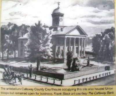
The Civil War divided Missouri, but in Callaway County more soldiers served with the pro-Southern Missouri State Guard (MSG), the Confederate Army or irregular partisans. The MSG was a state-sanctioned force, organized in May 1861 to defend . . . — — Map (db m70386) HM
Cole County, Missouri
Established November 16, 1820
Dedicated in this bicentennial year to those who have given life to Cole County, from the generations of Ancient Ones before the settlers of European and African lineage who formed our . . . — — Map (db m169397) HM
Here at the North Jefferson Trail Head, on Sept. 29, 1996, the east and west sections of the Katy Trail were joined, forging the final link uniting St. Charles and Sedalia via Katy Trail State Park. — — Map (db m169404) HM
"The Columns" atop this hill are the venerated remains of Westminster College's original academic building, Westminster Hall, destroyed by fire in 1909. Founded in 1851, Westminster was one of the few Missouri colleges to function in some fashion . . . — — Map (db m70437) HM
To protect and ensure the city's prosperity, in 1893 a special committee of the local Commercial Club organized to raise money to build a bridge. Businessmen and property owners formed a corporation and raised the entire $225,000 to finance the . . . — — Map (db m297015) HM
Sacred to the memory of
Captain James Callaway,
who sacrificed his life in the defense of his
country, and who fell in the same battle in which
McMullin, McDermid and Houchins were killed.
Captain James Callaway,
raised and . . . — — Map (db m70383) HM WM
In honor of Sterling Price Reynolds to whom this park is dedicated on his 100th birthday November 9th, 1961 Born in Callaway County, Missouri. Graduated from University of Missouri, 1883, with highest honors. Settled in Caruthersville in 1896. . . . — — Map (db m36389) HM
1826
Cedar City's Prosperity
The town Hibernia exists in post office records from 1825. A wilder and wider Missouri River was a half mile closer then, and many people arrived by steamboat. While laying out a new town in 1872, David Kenney . . . — — Map (db m169401) HM
Kingdom City's name alludes to the Kingdom of Callaway. How Callaway County came to be called a kingdom is a story dating to the early months of the Civil War.
In Fall 1861, the Union controlled the St. Louis area but the rest of the state . . . — — Map (db m299140) HM
Williamsburg and its rural neighborhood, including the Loutre River valley to the east, were home to several famous, even notorious Southern guerrillas.
One such was Capt. Alvin Cobb of "Cobbstown," in western Montgomery County, Mo. A large, . . . — — Map (db m212623) HM
This is a two sided markerSide A:
Fulton was founded here in the Little Dixie Region of Missouri, 1825, to replace the poorly located Elizabeth as seat of Callaway County. Named for a grandson of Daniel Boone and War of 1812 . . . — — Map (db m78757) HM
When former Confederate president Jefferson Davis accepted an invitation to speak at the Callaway County agricultural fair ten years after the Civil War, he knew that he would be coming to a community with many Southern sympathizers and former . . . — — Map (db m252724) HM
1808…
A Hill Without Design
Cote Sans Dessein, French for "hill without design," stands near Tebbetts on the banks of the Missouri River. The hill is notable for (and gets its name from) the fact that it stands alone, separate from . . . — — Map (db m272665) HM
1818.........
Smith's Landing
Thomas Smith, a private with Callaway's Rangers, founded a
small town along the Missouri River in 1818. The town, dubbed
Smith's Landing, was based around steamboat commerce. In
addition to goods being . . . — — Map (db m252810) HM
Thomas Ransdell Brite was born in 1824 in Callaway County, Missouri. His family moved to Bastrop County when he was 16. In 1842, when Mexican armies invaded Texas, Thomas volunteered to serve in the Vasquez, Woll and Somervell campaigns in the . . . — — Map (db m260134) HM
Mexico and Audrain County have some rich history, tied into the Civil War. This area was of vital strategic importance to both sides, politically and militarily, during the War. Politically, Southern sympathies ran deep in this area, the heart of . . . — — Map (db m288549) HM
The July 28, 1862, Battle of Moore's Mill opened about one-eighth mile south along the Moore's Mill-Galbreath Mill road, near today's State Road JJ. This area then was heavily timbered.
Lying in ambush east of the road were about 260 . . . — — Map (db m207957) HM
Thin black lines indicate changes in relevance. Between each pair of lines entries are ordered geographically but all have the same relevance.
* Inflectional forms of words are their plurals, singulars, and possessives as well as gramatical tenses and similar variations.