The Great Chicago Fire of October 1871 destroyed 17,000 buildings in Chicago over an area covering more than 3 square miles. In the 150+ years since, some of the few man-made structures to survive the Fire were replaced; today, only a limited number remain standing. This series is only for historical markers within the city limits of Chicago related to man-made structures that predate 1871 and are still standing today.
On West Ohio Street at North Waller Avenue, on the left when traveling east on West Ohio Street. Reported missing.
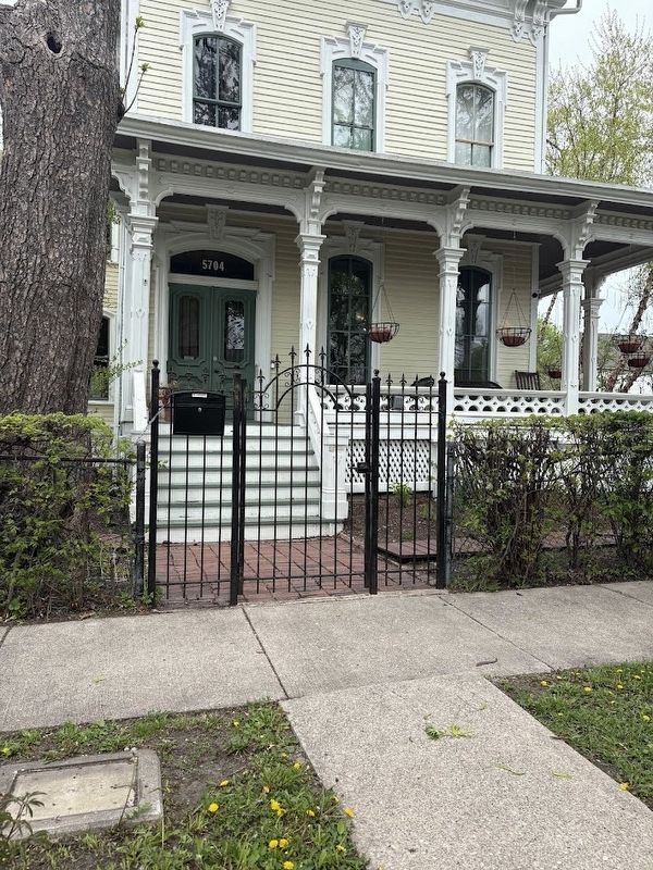
When this house was built, Austin was an independent suburb, accessed from Chicago by commuter railroad. One of the oldest houses in the community, it was built for Charles Hitchcock, an executive of a railroad parts manufacturing company. Its tall . . . — — Map (db m271638) HM
This Illinois - Indiana state boundary marker is one of the oldest landmarks in the Chicagoland area. It was constructed in 1838 under the direction of the United States Surveyor General to commemorate the establishment of the common boundary . . . — — Map (db m237902) HM
On West La Salle Street at North Stockton Street, on the right when traveling east on West La Salle Street.
This stone vault is the oldest structure standing within the Chicago Fire zone. It was erected in 1858 for Ira Couch, a wealthy hotelier who died at age 50 while wintering in Cuba. Though some theories exist, there is no official answer as to why . . . — — Map (db m10664) HM
In Memory of
Members of the
Volunteer Fire Department
——————————
Firemens Benevolent Association
Organized 1847
Chartered 1852
——————————
This monument was
erected in 1864
to honor all the courageous
Volunteer . . . — — Map (db m94343) HM
On North Ravenswood Avenue near West Rosehill Drive, on the right when traveling south.
Founder of the United States Railway Mail Service. Put his first railway postal car in use on the Chicago and Northwestern Railway between Chicago, Ill and Clinton, Iowa, August 28th, 1864, under authority from Postmaster Gen. Montgomery Blair. . . . — — Map (db m81514) HM
On Ravenswood Avenue at Rosehill Drive, on the left when traveling north on Ravenswood Avenue.
Designed by the architect of the Old Chicago Water Tower and predating it by five years, the Rosehill Cemetery Entrance is a rare Midwestern example of castellated Gothic architecture. Many prominent Chicagoans are buried here in plots marked by . . . — — Map (db m94331) HM
On South Halsted Street, on the right when traveling south.
Jane Addams' Hull House
has been designated a
Registered National
Historic Landmark
under the provisions of the Historic Sites Act of August 21, 1935. This site possesses exceptional value in commemorating or illustrating the history . . . — — Map (db m99710) HM
On South Halsted Street at West Polk Street, on the right when traveling south on South Halsted Street.
Here, in 1899, Jane Addams and Ellen Gates Starr started what became the most influential social settlement in America. It eventually consisted of several buildings around this house which had been built in 1856 by Charles Hull. The Dining Hall . . . — — Map (db m61819) HM
On South Calumet Avenue south of East Cullerton Street, on the right when traveling south.
A rare survivor of the stately mansions built on the Near South Side prior to the Great Chicago Fire of 1871, this also ranks as one of the city's best examples of Second Empire architecture. Built by banker Calvin Wheeler, it was remodeled in the . . . — — Map (db m69591) HM
On Canfield Road 0.1 miles north of Talcott Avenue, on the right when traveling north.
John Wingert was one of a number of immigrants who, seeking refuge from religious persecution in Germany, created a settlement called Canfield on the prairie frontier. One of the few surviving early farmhouses, within the Chicago city limits, the . . . — — Map (db m255127) HM
Near Newark Avenue north of Bryn Mawr Avenue. Reported missing.
This house documents the evolution of Norwood Park, from a farm community to a residential neighborhood. The small south wing had its origins as the home of Mark Noble, one of the first settlers in the area. An Italianate-style addition and other . . . — — Map (db m239935) HM
On West Grace Street east of North Kostner Avenue, on the right when traveling west.
John and Phebe Gray were distinguished by their generosity and social conscience. In 1857 they donated land to build a township hall at Milwaukee and Irving Park Road. In 1888, they donated land to build St. John's Episcopal Church one block north . . . — — Map (db m309130) HM
On West Grace Street east of North Kostner Avenue, on the right when traveling west.
Constructed around 1856, this farmhouse was built by Phebe and John Gray on what was once a large farmstead in Jefferson Township, prior to annexation by the City of Chicago. The Grays were early settlers to the area who moved to Illinois from . . . — — Map (db m309067) HM
[Text on the front of the base of the statue:]
St. Michael Archangel assist us in our battles against the evils of the day
Our dead are not unknown soldiers ✞ We know who they are and whither they seek to go
[Text on the rear of . . . — — Map (db m261148) WM
On East 18th Street west of South Prairie Avenue, on the right when traveling east.
During the last three decades of the 19th century, a six-block stretch of Prairie Avenue between Sixteenth Street and Cermak Road reigned as Chicago's premier residential street, and it remains one of Chicago's most historic neighborhoods.
. . . — — Map (db m308689) HM
On South Prairie Avenue south of East 18th Street, on the right when traveling south.
"These residences are characterized by a much higher degree of taste and appreciation of the true principles of residential architecture than has been characteristic of the West or the Western continent."
Everett Chamberlin, 1874
The . . . — — Map (db m308723) HM
On South Prairie Avenue near East 18th Street, on the right when traveling south.
The Prairie Avenue area has witnessed every significant period in the growth of Chicago from the establishment of Fort Dearborn through the residential rebirth of the central area in the 1990s. The years following the close of the Civil War were . . . — — Map (db m308721) HM
On East 18th Street east of South Indiana Avenue, on the right when traveling east.
Chicago Women's Park and Gardens celebrates the accomplishments of Chicago women throughout the city's history. Established by the City of Chicago in 1997, the park was designed by landscape architect Mimi McKay and architect Tannys Langdon. Their . . . — — Map (db m308686) HM
On East 18th Street east of South Indiana Avenue, on the right when traveling east.
Clarke House
The Henry B. Clarke family built their house in the Greek Revival style in 1836 near what is now 1625 S. Michigan Avenue. In 1872 the house was sold and moved to 4526 S. Wabash. It was relocated to its present site in 1977 and . . . — — Map (db m308687) HM
On South Prairie Avenue south of East 18th Street, on the right when traveling south.
Chicago's three wealthiest men-Marshall Field, Philip Armour and George Pullman all resided on Prairie Avenue by the mid-1870s, firmly establishing it as Chicago's premier residential district. Leading architects were hired to design fashionable . . . — — Map (db m308707) HM
On South Indiana Avenue south of 18th Street, on the right when traveling south.
Known as the Widow Clarke's house, this is Chicago's oldest building and its only surviving example of the Greek Revival style fashionable in the early 1800s. — — Map (db m69587) HM
On South Prairie Avenue south of East 18th Street, on the right when traveling south.
Three additional residences remain standing outside the formal boundaries of the Historic District. In addition, the Second Presbyterian Church, attended by many of the Prairie Avenue families, stands as a lone survivor of the religious history of . . . — — Map (db m308724) HM
On South Prairie Avenue at East 18th Street, on the right when traveling north on South Prairie Avenue.
This district contains the oldest remaining structure in the city, the Henry B. Clarke house, and was the city's most fashionable residential street from the 1870s through the early 1890s. The area was also the site of the Fort Dearborn Massacre of . . . — — Map (db m308322) HM
On South Prairie Avenue south of East 18th Street, on the right when traveling south.
The effort to save Glessner House broadened into the creation of a historic district in the 1970s, Restoration of the Clarke House and the opening of the National Vietnam Veterans Art Museum and Chicago Women's Park and Gardens increased local . . . — — Map (db m308702) HM
On North Michigan Avenue near East Chicago Avenue.
In this its centennial year the Chicago Water Tower has been designated the first American Water Landmark “because of its significance in the development of Chicago’s water resources and its symbolic identity with the spirit of . . . — — Map (db m47575) HM
On North Michigan Avenue at East Chicago Avenue on North Michigan Avenue.
This water tower, completed in 1869, marks establishment of Chicago’s second water works. Although most other buildings of pumping system were burned it stands as a principal memorial of 1871’s great fire.
Erected by
Chicago’s Charter . . . — — Map (db m47576) HM
On East Chicago Avenue at North Michigan Avenue, on the left when traveling east on East Chicago Avenue.
The Chicago Water Tower was erected in 1869 and housed a 138-foot-high standpipe, three feet in diameter, which equalized pressure and controlled the water flowing through the mains throughout the City. Fortunately, the tower was solidly constructed . . . — — Map (db m81430) HM
Near West Roosevelt Road west of South Blue Island Avenue, on the right when traveling west.
The culmination of Father Arnold J. Damen, S.J.'s work in Chicago, this building was opened in 1870 as St Ignatius College. Loyola University originated from this institution; but, since 1922, St. Ignatius has operated solely as a college . . . — — Map (db m249223) HM
On West Adams Street at Des Plaines Street, on the right when traveling west on West Adams Street.
Oldest Church in Chicago
Erected 1856
Rt. Rev. Anthony O'Regan D.D.
Archbishop
Rt. Rev. Dennis Dunne, D.D. Pastor
Renovated
1912
Rev. William J. McNamee, Pastor
1933
Rev. Thomas J. Hayes, Pastor
1946
Rev. Richard F. Wolfe, . . . — — Map (db m258631) HM
On West Adams Street at Des Plaines Street, on the right when traveling north on West Adams Street.
This property has been
placed on the the
National Register
of Historic Places
by the United States
Department of Interior
St. Patrick's Churchconstructed during the period 1852 to 1856 St. Patrick's is the oldest church building . . . — — Map (db m99770) HM