[1.] Water turbines
the power that ran the mill
This illustration shows one type of
setup for a turbine driven gristmill.
Illustration from "the Red Mill Reborn".
Used with permission of
'Lou Robertella, . . . — — Map (db m108181) HM
You can see where some of the rock
has been removed to make a millstone
Located at Kennedy Hill, Central New Annan
Donated by Mr. William Woodlock — — Map (db m108169) HM
This turbine came from a sawmill
located a few hundred yards
upstream of our mill
The saw mill was built ca 1886 by brothers James and Alexander Sutherland. Another brother Robert, built a blacksmith shop on the same property. The mill . . . — — Map (db m108182) HM
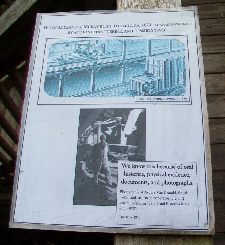
Turbines began to become commonplace in the mid-1800's and had virtually replaced vertical waterwheels by the mid 1860's.
Below are a number of illustrations showing typical mill setups and power transfer.
In 1881 the Schoellkopf Power Station . . . — — Map (db m108183) HM
On Sunrise Trail (Nova Scotia Route 6) just west of Route 326, on the left when traveling east.
Within this iron fence lies
Duncan MacLanders
1788 - 1870
and
Johanne Faulkner
1788 - 1876
First of the line to leave the
shores of Scotland and seek a freer
and fuller life in the New World.
Erected by descendants in . . . — — Map (db m108165) HM
On Glooscap Trail (National Route 2) 0.5 kilometers west of Belmont Road/Fort Belcher Road, on the right when traveling west.
English: This was the chief route of the French and Indians from Cobequid to Isle St. Jean and Louisbourg and later of the British from Halifax to Charlottetown.
Français: C’était la route principale des Français . . . — — Map (db m139192) HM
On Tidal Bore Road 0.6 kilometers north of Glooscap Trail ( Route 236), on the left when traveling north.
In 1760-62 near this Head of Cobequid Bay the first English speaking settlers of the Townships of Onslow and Truro landed. Of Ulster Irish, Scottish and English stock, these pioneers were among those brought to Nova Scotia from New England by the . . . — — Map (db m108717) HM
On Main Street (Nova Scotia Route 6) at Church Street, on the left when traveling west on Main Street.
In this harbour Capt. David Donahew of New England with three armed vessels surprised Lieut. Paul Marin's allied force en route from Annapolis Royal to Louisbourg. He drove them ashore, disheartened the Canadian Indians and prevented the French . . . — — Map (db m108133) HM
On Main Street at Church Street, on the right when traveling east on Main Street.
In memory of those
who gave their lives
in the Great War
1914 - 1918
Alexander Henderson • George McIntosh
Freeman McLellan • Harry McLellan
George Powers • Arthur Rose • William Tattrie
Roy Weatherby • George Weatherby
Orrin F. . . . — — Map (db m108154) WM
On Nova Scotia Route 311 at Balmoral Road ( Route 256), on the left when traveling north on Nova Scotia Route 311.
The land for the church was
donated by
Mr. John R. Hayman
and was contracted to be
built for the sum of one
thousand, four hundred
thirty two dollars.
The closing service for
St. Andrew's Presbyterian
Church was held
December . . . — — Map (db m108184) HM
On Prince Street just east of Lorne Street, on the left when traveling east.
Legend
This plaque commemorates
The centennial of the formation of the Presbyterian Church in Canada in 1875;
The ministry of the Rev. Daniel Cock (1771-1805) of Greenock, Scotland, and the Rev. David Smith (1771-1795) of St. Andrew's, . . . — — Map (db m108220) HM
On Prince Street just east of Louise Street, on the right when traveling east. Reported permanently removed.
The Lumber Jack represents the exciting role Truro has played in development of forestry in Nova Scotia. Truro has always been, and still is today, a centre of forestry activity. The forest industry continues to be the backbone of the local and . . . — — Map (db m108243) HM
On Prince Street at Lorne Street, on the left when traveling east on Prince Street.
This building, opened in 1884, was erected to house the Post Office, Customs and Internal Revenue. Designed under the supervision of federal Chief Architect Thomas Fuller, the Truro Post Office was part of a nation-wide programme to house federal . . . — — Map (db m108244) HM
On Prince Street at Forrester Street, on the right when traveling east on Prince Street.
Erected by the
Citizens of Truro
In Honor of the Men
who during
The Great War
1914 - 18
nobly upheld the
honor of the Empire
in France and Flanders
and gave their lives
that right shall prevail
[World War II] 1939 - 45 . . . — — Map (db m108214) WM
On Victoria Street East (Nova Scotia Route 6) just south of Havelock Street ( Route 2), on the right when traveling west.
Born in Amherst, Chandler was called to the New Brunswick bar in 1823. He represented Westmorland in the legislature (1827-36), was a Legislative Councillor (1836-78) and a member of the Executive Council almost continuously between 1844 and 1858. . . . — — Map (db m107018) HM
On Victoria Street East (Nova Scotia Route 6) just south of Havelock Street ( Route 2), on the right when traveling south.
Born in Cumberland County, N. S., McCully practised law in Amherst and was appointed to the Legislative Council of Nova Scotia in 1848 serving as Solicitor General and Government leader in the Council (1860-62). As editor of the Halifax Morning . . . — — Map (db m108034) HM
On Victoria Street East (Nova Scotia Route 6) just south of Havelock Street ( Route 2), on the right when traveling west.
Born in Amherst, educated at Windsor Academy, and called to the bar in 1834, Dickey practiced law in Amherst and sat in the Legislative Council of Nova Scotia (1858-67). A Father of Confederation, he attended both the Charlottetown and Quebec . . . — — Map (db m107017) HM
On Victoria Street East (Nova Scotia Route 6) just south of Havelock Street ( Route 2), on the right when traveling south.
Born at Amherst and educated in medicine, Tupper was elected in 1855 to the Nova Scotia Assembly, becoming Premier in 1864. In alliance with John A. Macdonald, he skilfully manoeuvered unwilling Nova Scotians into Confederation. Having held . . . — — Map (db m108038) HM
On Victoria Street East (Nova Scotia Route 6) just south of Havelock Street ( Route 2), on the right when traveling south.
Erected by
Senator and Mrs. Curry
in memory of their son
Captain Leon Hall Curry
and his Brothers in Arms
from
Cumberland County
who gave their lives
to their country
in the Great German War
1914 - 1918
[Roll of Honored . . . — — Map (db m108029) WM
A Manufacturing Town
All major roads and rail-lines run through Amherst, making it a natural gateway into Nova Scotia. The town is also in the middle of a rich agricultural and coal-mining area.
Amherst became a major manufacturing town in . . . — — Map (db m112104) HM
[Face]
The Acadian village of Beaubassin on this site was founded by settlers from Port Royal around 1672. Upon the arrival of Major Charles Lawrence with British troops in April 1750, the French authorities had the village destroyed in . . . — — Map (db m106953) HM
This area was the site of the Acadian village of Beaubassin, first known Bourgeois settlement. Raided in 1696 and again in 1703 by a force from Boston under Captain Ben Church. Occupied by French troops in 1746 who travelled on snowshoes in . . . — — Map (db m106951) HM
The First Nations
Native peoples have lived around the Chignecto Isthmus for thousands of years. Travelling in family groups and small nomadic bands, they moved from area to area harvesting seasonal food sources.
Early French explorers . . . — — Map (db m112112) HM
Fort Lawrence
In the 18th century, the Chignecto Isthmus played an important role in the struggle between France and Britain for North American supremacy. In 1713 the Treaty of Utrecht had failed to clearly establish the border of Nova . . . — — Map (db m112110) HM
Geology
This area is located in the Carboniferous Lowlands of Nova Scotia. The underlying bedrock is sedimentary with varying proportions of sandstone and mudstone. In some areas where the bedrock has been folded, the sandstone has been . . . — — Map (db m108707) HM
Formal opening of the Nova Scotia portion of the Trans Canada Highway from the New Brunswick border to terminals at Caribou and North Sydney, a distance of 279 miles, took place November 22, 1968, at this point; having been constructed as a joint . . . — — Map (db m106956) HM
Fondateur, vers 1672, de Beaubassin premier établissement dans la région de la rivière Missagouèche et initiateur de l'agriculture maraîchère en Acadie
Jacob Bourgeois arriva à Port-Royal en 1641 à titre de chirurgien pour la colonie . . . — — Map (db m107012) HM
On Sunrise Trail (Nova Scotia Route 6) just east of Kerrs Mill Road, on the right when traveling east.
Born at Wallace Bridge, Newcomb moved to the United States in 1853. Graduating from Harvard he became Professor of Mathematics in the U.S. Navy and was assigned to the Naval Observatory. He was soon recognized as an authority on mathematical . . . — — Map (db m108085) HM
On Sunrise Trail (Nova Scotia Route 6) just east of Kerrs Mill Road, on the right when traveling east.
Bill was from Wallace, where his grandfather worked in the quarry and kept the lighthouse. His father was the village doctor until their move to the backwoods of northern Quebec. While there, Bill was home schooled by his mother until age 14, when . . . — — Map (db m108089) HM
On Durham Street at Water Street, on the left when traveling west on Durham Street.
Pugwash sits on top the largest salt deposit in Atlantic Canada. The train tracks, bridges, and wharves that defined the tapestry of the village infrastructure changed significantly over the decades as local industry evolved, including the . . . — — Map (db m108068) HM
On Water Street at Victoria Street, on the left when traveling north on Water Street.
While lobster boats have filled the local wharves for generations, the community's most unique feature may have been the 130 ft. (39.6m) smoke stack belonging to Nova Scotia Clayworks on the opposite side of the harbour. Started in 1889, the . . . — — Map (db m108078) HM
On Water Street at Victoria Street, on the left when traveling north on Water Street.
The deep harbour of Pugwash has a long and storied seafaring heritage, with many eras of ships carrying lumber and raw materials up and down the Eastern Seaboard.
[Historic Pugwash photos]
"Peace cannot be kept by force; it can only be . . . — — Map (db m108080) HM
On Durham Street (Nova Scotia Route 6) just west of Russell Street, on the left when traveling west.
The Pugwash Railway Station, completed in 1892, is one of only two stations designed by Sir Sandford Fleming that is still standing in Nova Scotia. The station is also famous for its part in the 1957 "Thinkers Conference" where Pugwash native . . . — — Map (db m108069) HM
On Water Street just north of Victoria Street, on the right when traveling north.
Historically, the main streets were lined with hotels, merchants, and services one would expect of a long-standing port village. The village endured seven devastating fires between 1877 to 1929 that permanently changed the street-scape forever. . . . — — Map (db m108083) HM
On Durham Street (Nova Scotia Route 6) just west of Russell Street, on the left when traveling west.
The station was built in 1888. Rail service to Pugwash commenced in 1890 and ceased in 1993. Five miles of track linked Pugwash to the Shortline at Pugwash Junction. The Shortline ran from Pictou to Oxford Junction linking it with the rail track . . . — — Map (db m108070) HM
On Water Street at Victoria Street, on the right when traveling north on Water Street.
All of the community celebrations culminate on Water Street. Canada Day has been celebrated in Pugwash since 1951 with festivities called "The Gathering of the Clans" paying homage to some of its founding settlers. This is also the reason many of . . . — — Map (db m108076) HM
On Durham Street (National Route 6) 0.2 kilometers south of Irishtown Road, on the right when traveling south.
The Mary Crowley monument is the first public monument in honour of a Canadian-born female. It was erected in 1870 following a unanimous vote of the Nova Scotia Legislature. "Mary E. Crowley lies beneath this sod, a victim to fraternal love, . . . — — Map (db m140763) HM
On Victoria Street just east of Water Street, on the right when traveling east.
The Pugwash Conferences on Science & World Affairs
The Pugwash Conferences take their names from the location of the first meeting, held in 1957, in the village of Pugwash, Nova Scotia, birthplace of their host, American philanthropist Cyrus . . . — — Map (db m108075) HM
Near Water Street at Queen Street, on the left when traveling north.
”There Can Be No Winners in a Nuclear War.” Russell — Einstein Manifesto, July 9, 1955 A Welcome Retreat In 1955, Cyrus Eaton began hosting meetings of scholars, educators and social reformers in Pugwash. He . . . — — Map (db m150367) HM
Near Water Street at King Street, on the left when traveling north.
English:
In 1957, at the height of the Cold War, the first Pugwash Conference on Science and World Affairs took place in this serene setting. Hosted by philanthropist Cyrus Eaton, top-level scientists from both sides of the Iron . . . — — Map (db m140759) HM
On Water Street at Durham Street, on the right when traveling north on Water Street.
[Great War Honored Dead]
Douglas Langille • Harold Esty Benjamin
Percy Erle Benjamin • William McLean Borden
Cecil Raymond Richards • Frederick Elias King
Frank Demings • Harry Hector McLellan
Andrew Gray McPherson • George Selig . . . — — Map (db m108059) WM
On Sunrise Trail (Nova Scotia Route 6) at Church Street, on the left when traveling west on Sunrise Trail.
World War I
1914 - 1918
William Baird • James Bathgate • Alexander Craib
James Crooks • Kenneth Hape • Charles MacNutt
Elmer MacNutt • Wellsley McCann • Daniel Reeves
Chester Slack • Harold Slack • Gordon Tingley
Renton Fisher • . . . — — Map (db m108094) WM