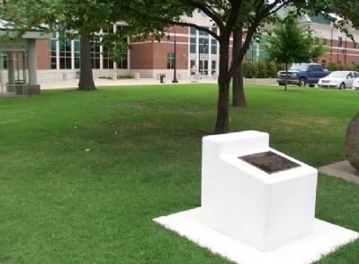
On Adair Street at NE 1st Street, on the right when traveling north on Adair Street.
Pryor Creek was named in honor of Nathaniel Hale Pryor. Captain Pryor was a member of the Lewis and Clark Expedition, a veteran of the war of 1812 and was a Captain at the Battle of New Orleans, January 8, 1815. In June he was honorably discharged . . . — — Map (db m68099) HM
On Rockfish Gap Turnpike (U.S. 250) east of Afton Mountain Road (Virginia Route 6), on the right when traveling west.
Albemarle County. Albemarle County was formed in 1744 from Goochland County and named for William Anne Keppel, the second Earl of Albemarle, titular governor of Virginia from 1737 to 1754. A portion of Louisa County was later added to . . . — — Map (db m4030) HM
On Thomas Nelson Highway (U.S. 29) east of State Route 6, on the right when traveling west.
Nelson County. In the foothills of Virginia’s Piedmont,
Nelson County was formed in 1807 from Amherst County. The county was named for Thomas Nelson, Jr., governor of Virginia from June to November 1781. The county seat is Lovingston. The . . . — — Map (db m44042) HM
On Patrick Henry Highway (Route 151) north of Warrick Barn Road, on the right when traveling south.
Nelson County. In the foothills of Virginia's Piedmont, Nelson County was formed in 1807 from Amherst County. The county was named for Thomas Nelson Jr., governor of Virginia from June to November 1781. The county seat is Lovingston. The . . . — — Map (db m295854) HM
On James River Road (State Highway 56), on the right when traveling north.
Buckingham County. Buckingham County was formed from Albemarle County in 1761. The county seat is Buckingham, originally known as Maysville. In 1822 a courthouse, Virginia's first temple-form porticoed courthouse, was constructed there based . . . — — Map (db m31757) HM
On Rio Mills Road (County Route 643) at Seminole Trail (U.S. 29), on the right when traveling west on Rio Mills Road.
Near here, on both sides of the Rivanna River, was located the Monacan Indian village of Monasukapanough. This village was one of five Monacan towns that Captain John Smith recorded by name on his 1612 Map of Virginia, though many more . . . — — Map (db m106829) HM
On East River Road (Virginia Route 6) 0.9 miles east of Bremo Road ( Route 656), on the right when traveling east.
Rassawek, the principal town of the Monacan Indians, stood nearby, according to Capt. John Smith's 1612 map of Virginia. Several smaller satellite villages were located within a few miles of Rassawek. The Monacans, who belonged to the Siouan . . . — — Map (db m31603) HM
On Seminole Trail (U.S. 29) north of Frays Mill Road / Burnley Station Road, in the median. Reported missing.
Albemarle County. Albemarle County was formed in 1744 from Goochland County and named for William Anne Keppel, the second Earl of Albemarle, titular governor of Virginia from 1747 to 1754. A portion of Louisa County was later added to . . . — — Map (db m21585) HM
On Louisa Road (Virginia Route 22) 0.1 miles west of Whitlock Road ( Route 616), on the left when traveling west.
Albemarle County. Albemarle County was formed in 1744 from Goochland County and named for William Anne Keppel, the second Earl of Albemarle, titular governor of Virginia from 1737 to 1754. A portion of Louisa County was later added to . . . — — Map (db m22780) HM
On Kenmore Road (County Route 643) just east of Matohe Road and Father Judge Road (County Route 655), on the left when traveling west.
Bear Mountain is the spiritual center of the
Monacan community. The Bear Mountain Indian
Mission School, ca. 1868, was originally built for
church services and is listed on the National
Register of Historic Places. Virginia’s racial
segregation . . . — — Map (db m104369) HM
This map shows Lynchburg during the Civil War Battle of Lynchburg, June 1864. The “Public Burying Ground,” also known as the Old Methodist Cemetery or Old City Cemetery, was located at the edge of town.
By 1860 three major . . . — — Map (db m74077) HM
Near Taylor Street 0.1 miles north of 4th Street, on the right when traveling south.
These apple trees are antique varieties which are significant in the history of the State of Virginia as well as in apple propagation and development. They continue to be valued today for their hardiness, longevity and delicious fruit.
Duval . . . — — Map (db m179826) HM
On Breckenridge Lane (State Road 1932) at Hillsboro Road, on the right when traveling south on Breckenridge Lane.
Grave of John Floyd, near here. Pioneer and surveyor. Born Amherst County, Virginia, 1750. Killed when ambushed by Indians in Jefferson County, District of Kentucky, 1783. Colonel of Militia and County Lieutenant of Jefferson County. — — Map (db m161996) HM
Near Taylor Street north of 4th Street when traveling north.
Joseph Parker was a Confederate veteran of the Civil War. He was one of the original enlistees in the 43rd Battalion, Virginia Cavalry, better known as Mosby's Partisan Rangers. It was John Singleton Mosby, most trusted scout of Confederate . . . — — Map (db m179675) HM
On Thomas Nelson Hwy (Virginia Route 29) at Cooperative Way, on the right when traveling south on Thomas Nelson Hwy.
In 1803, the Virginia General Assembly established Cabellsville one mile west of here on the Old Stage Road, on 25 acres owned by Congressman Samuel Jordan Cabell. The village was platted before Nelson County was formed from Amherst County in 1807, . . . — — Map (db m18829) HM
The dates beneath each carver’s name represent the span of his gravestones in the cemetery.
The Fieldstone Carver
First Gravestone Carver in Lynchburg
1811-1849
The fieldstone carver is the oldest professional carver of . . . — — Map (db m74095) HM
On Missouri Route 5 at Katy Trail, on the right when traveling south on Missouri Route 5.
There is evidence that around the year 1800, Daniel Boone or his sons, Daniel Morgan and Nathan, discovered a salt lick in what is now western Howard County. The lick became known as Boone's Lick, and the trail he blazed, believed to be parts of old . . . — — Map (db m252432) HM
On Lexington Turnpike / Midland Trail (U.S. 60) at Blue Ridge Parkway and Panther Falls Road, on the right when traveling east on Lexington Turnpike / Midland Trail.
Amherst County. Area 470 Square Miles. Formed in 1781 from Albemarle, and named for Jeffrey, Lord Amherst, British commander in the French and Indian War. Balcony Falls are in this county.
Rockbridge County. Area . . . — — Map (db m49888) HM
On Richmond Highway (U.S. 60) west of Pidemont Road, on the left when traveling east.
Nelson County. Area 473 Square Miles. Formed in 1807 from Amherst, and named for General Thomas Nelson, Governor of Virginia, 1781. Oak Ridge, an old home, is in this county.
Amherst County. Area 470 Square . . . — — Map (db m86235) HM
On Elon Road (U.S. 501) 3 miles east of Virginia Route 130, on the right when traveling east.
Amherst County. Area 470 Square Miles. Formed in 1781 from Albemarle, and named for Jeffrey, Lord Amherst, British commander in the French and Indian War. Balcony Falls are in this county.
Rockbridge County. Area . . . — — Map (db m307447) HM
This Chesapeake & Ohio Railway Station was in use at Stapleton in Amherst County, Virginia, from 1898 until 1937. It is the only remaining C&O “Standard Station” of its size and style.
In 1999-2001 the badly-deteriorated Station was . . . — — Map (db m74036) HM
Near Missouri Route 5 at Katy Trail, on the right when traveling south.
William Becknell was born in Amherst County, Virginia. He married Jane Trussler in 1807 and in
1810 moved to St. Charles. In the War of 1812 he joined Daniel Morgan Boone's company of U.S. mounted rangers and later participated in Major Zachary . . . — — Map (db m252449) HM
On U.S. 378 at Holiday Road (State Highway S-33-7), on the left when traveling west on U.S. 378.
(obverse)
Edmunds Family History
1710-1961
Burial Ground 1.3 Miles S.E. —›
Officers:
Will Tom Edmunds, Pres.
Joe F. Edmunds, Vice Pres.
Robert J. Edmunds, Sec. & Treas.
Mary Edmunds, Historian
The first record is of . . . — — Map (db m41791) HM
On South Main Street (Business U.S. 29) just north of Star Street, on the right when traveling south.
The Museum, working with the Virginia Department of Transportation, arranged for the Museum's acquisition of this rare highway milepost.
In May 2003, the cast concrete obelisk, approximately 2 feet tall and 10 inches square, was moved from . . . — — Map (db m179524) HM
On Rockfish Gap Turnpike (U.S. 250) at Skyline Drive and Blue Ridge Parkway, on the right when traveling east on Rockfish Gap Turnpike.
Nelson County. Nelson County was named for Thomas Nelson, Governor of Virginia from June to November, 1871. It was formed in 1807 from Amherst County. Oak Ridge, birthplace of William Cabell Rives and later the residence of Thomas Fortune . . . — — Map (db m21701) HM
On Five Points-Fincastle Road (County Road 82) 0.2 miles west of James A Rhodes Appalachian Highway (State Route 32), on the right when traveling east.
Gist Settlement
Through the terms of his will. British absentee landowner Samuel Gist (c. 1723-1815) freed his 350 Virginia slaves and provided funds for their relocation. the purchase of land, and the establishment of schools and homes. The . . . — — Map (db m272722) HM
On Court Street at Ninth Street, on the right when traveling west on Court Street.
This area became known as Court House Hill when the first courthouse was built here in 1813. The district contains a variety of architectural styles and notable churches, as well as the city’s 1855 Old Court House, now the Lynchburg Museum. There . . . — — Map (db m54494) HM
Near Patrick Henry Highway (Virginia Route 151) 0.4 miles south of Firehouse Road ( Route 675), on the left when traveling south.
The Tye and Piney Rivers provide recreation, wildlife habitat, and scenic value to this region of Central Virginia. Fishing, camping, canoeing, and kayaking are all popular activities.
Both rivers begin in the Blue Ridge Mountains and . . . — — Map (db m92928) HM
Near East Court Street at Goodwin Street when traveling east.
Confederate Soldiers
1861 - 1865
To the memory of
The Sons of Amherst County
who from 1861 to 1865
upheld in arms the cause
of Virginia and the South,
who fell in battle
or died from wounds,
and survivors of the war
who as . . . — — Map (db m67324) WM
Thin black lines indicate changes in relevance. Between each pair of lines entries are ordered geographically but all have the same relevance.
* Inflectional forms of words are their plurals, singulars, and possessives as well as gramatical tenses and similar variations.