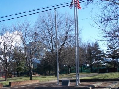
On 2nd Street at Penn St., on the right when traveling north on 2nd Street.
Discovered by the Dutch, settled by the Swedes. Granted to William Penn by King Charles II of England, Delaware County is the site of Penn's first landing in Pennsylvania. Here the first assembly met and adopted the frame of government honored in . . . — — Map (db m14957) HM
On West Baker Street at South Orange Street, on the right when traveling east on West Baker Street.
Locations of Interest
🄰 Armory
12 East State Street
Former site of the Pennsylvania National Guard, currently houses the Pennsylvania Veterans Museum.
🄱 Central Business District
From Gayley to . . . — — Map (db m205512) HM
On North Olive Street at West Front Street, on the right when traveling north on North Olive Street.
Locations of Interest
🄰 Armory
12 East State Street
Former site of the Pennsylvania National Guard, currently houses the Pennsylvania Veterans Museum.
🄱 Central Business District
From Gayley to . . . — — Map (db m205560) HM
On East State Street at Church Street, on the right when traveling east on East State Street.
Locations of Interest
🄰 Armory
12 East State Street
Former site of the Pennsylvania National Guard, currently houses the Pennsylvania Veterans Museum.
🄱 Central Business District
From Gayley to . . . — — Map (db m205576) HM
On East State Street just east of South Monroe Street, on the right when traveling east.
Locations of Interest
🄰 Armory
12 East State Street
Former site of the Pennsylvania National Guard, currently houses the Pennsylvania Veterans Museum.
🄱 Central Business District
From Gayley to . . . — — Map (db m205581) HM
On Commission Street west of Avenue of the States, on the right when traveling east.
Ethel Waters
Born to a young mother and raised in poverty, Ethel Waters overcame a difficult childhood to become an accomplished singer, radio host, and actress, having had roles in movies, on Broadway and on television. She was born in . . . — — Map (db m306696) HM
On Glen Mills Road at Thornton Road, on the right when traveling east on Glen Mills Road.
A crossroads village. Thornton served as a rest stop for travelers between York and Philadelphia, providing livery, blacksmith, and wheelwright services as well as Inn accommodations at the Historic “Yellow House” built by George Gray, circa 1750. . . . — — Map (db m45532) HM
On Wilmington Pike (U.S. 202) at Stateline Road, on the right when traveling north on Wilmington Pike.
Founded 1681 by William Penn
as a Quaker Commonwealth.
Birthplace of
The Declaration of Independence
and
The Constitution of
The United States — — Map (db m259455) HM
On North Walnut Street at North Walnut Street & East Biddle Street, on the right when traveling north on North Walnut Street.
(East Side): Erected by the Surviving Members of the Ninety Seventh Regiment Pennsylvania Volunteers to the Memory of Its Dead. Dedicated October 29, 1887
(North Side): Field and Staff Officers at the organization of the . . . — — Map (db m41062) HM
On West River Street at Old Brockway Road, on the right when traveling west on West River Street. Reported unreadable.
Originally built in October 1948 by Kullman Diner Co. Newark, New Jersey and shipped to West Chester, PA. known as the “Birmingham Grill” where it continually operated until purchased by the Carey Family in 1992. On July 26, 1995 the diner . . . — — Map (db m309884) HM
On Avenue of the States at West 4th Street, on the right when traveling south on Avenue of the States.
The Old Civic Square
Chester's old court house (pictured above) was built ca. 1724, making it the oldest building currently standing in downtown Chester, and one of the oldest remaining public buildings in the nation. The structure served . . . — — Map (db m310987) HM
Formed September 26, 1789 out of Chester County. Named for the Delaware River and site of William Penn's first entry into Pennsylvania, 1682. Old Chester Courthouse (1724) is one of America's early public buildings. County seat, Media, incorporated . . . — — Map (db m83368) HM
Woodcrest
circa 1901 - 1903
has been placed
on the
National Register
of Historic Places
by the
United States Department
of the Interior — — Map (db m28108) HM
On Post Road (U.S. 13) at Bishop Street, on the right when traveling west on Post Road.
Beginning in 1892 with the establishment of the Bear Creek Refining
Company in Marcus Hook, the refining industry has long been a major influence
on the Delaware River and the riverfront communities. The area's access to road,
rail, and deep . . . — — Map (db m225277) HM
On Camp Linden Road, on the right when traveling east.
September 11, 1777, while on the march
to the Battlefield of Brandywine,
the British Army under Howe
and Cornwallis crossed the
Brandywine at the ford just
south of this point.
__________
Erected by
The Pennsylvania . . . — — Map (db m198354) HM
On Thornton Road, on the right when traveling south.
On the evening of September 11, 1777, from approx. 6-8 pm, this small crossroads village of Thortonville (Thornton) witnessed a component of the American Strategic Retreat ordered by General George Washington from the Battle of Brandywine. After a . . . — — Map (db m180039) HM
On 9th Street 0.1 miles west of Simpson Street, on the right when traveling east.
Originally part of Ridley Township, Eddystone was incorporated as a borough
in 1880. First developed by the Simpson family in the 1870s as the home of their
print works, the town's name was inspired by the Eddystone Lighthouse in Devon,
England. . . . — — Map (db m159243) HM
On Baltimore Pike (U.S. 1), on the right when traveling south.
The American Light Infantry near this place vigorously resisted the advance of the British at the battle of Brandywine September 11, 1777 — — Map (db m228034) HM
On Old Wilmington Pike at Brintons Bridge Road, on the left when traveling south on Old Wilmington Pike.
Dilworthtown
The Battle of Brandywine,
September 11, 1777, ended a short
distance southeast of this place.
__________
Erected by
The Pennsylvania Historical Commission
and the Chester and Delaware
County Historical Societies . . . — — Map (db m183166) HM
On Penn St. at Front Street, on the left on Penn St..
First lodged in America in "Essex House" on this site October 28, 1682 the guest of Robert Wade Here the earliest Quaker settler on this side Delaware River, 1676, purchaser of the property, then called "Printzdorp," from the earlier occupant, . . . — — Map (db m14967) HM
On East 10th Street (Route 13) at Plaza Street, on the left when traveling east on East 10th Street.
Best known as the company that developed “artificial silk,” later known as “rayon,” the American Viscose Company began construction of its Marcus Hook operation in 1912. Patented by English chemists in 1894, rayon was used extensively for both . . . — — Map (db m146225) HM
On Goshen Road at Boot Road, on the left when traveling west on Goshen Road.
Built by Ferdinand Wood
Designed that the portals be
“Hi and wide as a load of hay”
Cost shared by Delaware and Chester Counties
Named for Mordecai Bartram
— — Map (db m92214) HM
On 2nd Street at Lagrange Ave., on the right when traveling north on 2nd Street.
A rare surviving example of a quarantine station, the Lazaretto was the introduction to America for many immigrants. Established in 1799 in reaction to a yellow fever epidemic, it operated until 1893 to inspect cargo and passengers for infectious . . . — — Map (db m14759) HM
Delaware County was constituted September 26, 1789. This courthouse was built in 1850 and rebuilt in 1913. It is the sixth of this judicial district in line of direct succession from the first court house in Pennsylvania. — — Map (db m83371) HM
On Rose Valley Road at Traymore Lane, on the right when traveling south on Rose Valley Road. Reported missing.
Minquas or Susquehanna Indians Susquehanna to the Schuylkill crossed Ridley Creek at Long Point 484 yards to the south. Thousands of beaver skins yearly were carried down to the first Dutch and Swedish Settlers on the Delaware. — — Map (db m72383) HM
Near Cheyney Road, on the left when traveling south.
"Chester's Mother"
During the 1780s squabble over removing the county seat
to West Chester, both sides ranted in the newspapers. This
excerpt from the ditty, "Chester's Mother," satirises Chester
citizens who feared losing their public . . . — — Map (db m188213) HM
Even History Changes
Morton Homestead was first identified as an historic site in 1862 by George Smith in his volume The History of Delaware County. The Morton Homestead was completely dismantled during its preservation in 1938. Later, it . . . — — Map (db m295908) HM
On West Chester Pike (Pennsylvania Route 3) at Darby Road, on the right when traveling west on West Chester Pike.
The rail lines that met and crossed at Llanerch Junction in the 19th century transformed fields into suburban neighborhoods. In the 20th century, the corner where West Chester Pike and Darby Road meet was a gas station and car dealership, before . . . — — Map (db m102755) HM
On Bishop Hollow Road, on the right when traveling west.
Daniel acquired 450 acre tract From Thomas Rudyard in 1692, Main House built in three sections, 1692, 1794, 1801. East end oldest. Huge walk in fireplace — — Map (db m96011) HM
On Thornton Road north of Glen Mills Road, on the right when traveling north.
In the 1700's, Chester Creek drove Thornbury Township's economy. Water-powered mills ground flour, cut lumber, and made other goods to supply local farmers. Only remnants of those mills still exist.
At John Taylor's ironworks, Sarum Forge, . . . — — Map (db m232104) HM
On Thornton Road north of Glen Mills Road, on the right when traveling north.
The English explorer Henry Hudson became the first European to see this area in 1609. He paved
the way for Dutch, Swedish, and English settlers. Settlers named the Delaware Valley for Lord de la Warr, the governor of the Virginia colony.
In . . . — — Map (db m232100) HM
Originally part of the farm property of Sarah Briggs in 1848. The site was laid out by Joseph Fox and purchased by the Delaware County Commissioners in 1849 for the erection of a courthouse. The structure, whose construction plans cost $50, was . . . — — Map (db m83369) HM
On Georgetown-Bridgeville Road (Delaware Route 404), on the right when traveling east.
Detached from Northwest Fork Hundred by Act of General Assembly, 1869. Northwest Fork Hundred, originally claimed by Maryland, then embraced all territory west of Northwest Fork. Delaware obtained undisputed title in 1775, upon confirmation of Mason . . . — — Map (db m48997) HM
On John J. Williams Highway (Delaware Route 24) near Jersey Road, on the right when traveling north.
So named in 1706. This hundred together with Lewes and Rehoboth, Broadkill, and Cedar Creek Hundreds, formed what the early settlers called “Old Sussex.” — — Map (db m48583) HM
On West Baltimore Avenue near Runnemede Avenue, on the right when traveling west.
The "Lansdown Park" Historic District includes 101 Victorian era homes on a 33 acre site to the north of Baltimore Avenue. This property, with the original and existing 1732 farmhouse on Owen Avenue, was developed between 1887 and 1912 and is . . . — — Map (db m290141) HM
Near NW Railroad Street near NW Curtis Street, on the left when traveling west.
Delaware, 1st State
December 7, 1787
1609 • Henry Hudson visited Delaware Bay
1638 • Swedish colonists established Fort Christina, Delaware's first permanent settlement, and founded the colony of New Sweden
1655 • Dutch captured New . . . — — Map (db m47214) HM
On New York State Route 30 at Bridge Street, on the right when traveling north on New York State Route 30.
In 1852, John B. Gould purchased a "tin shop” in this original structure built in 1840. His son, Jason "Jay” Gould, born in Roxbury in 1836, became a partner with his father in the shop at age 16. The younger Gould was sent to New York . . . — — Map (db m133799) HM
Near Pensylvania Avenue at Berne Street, on the right when traveling west.
Side A The Delaware County Fairground June 28, 1833 a meeting of the citizens of Delaware County convened under an act of the Ohio Legislature to establish The Delaware County Agricultural Society. Officers were elected with Milo Pettibone . . . — — Map (db m18301) HM
On Starke Avenue at Dunker Church Road, on the right when traveling west on Starke Avenue.
Colonel Joseph W. Hawley
(Right Plaque):
Sept. 17, 1862
Antietam
Chancellorsville
May 1-2-3, 1863
(Lower Right Inscription):
Recruited in Chester and Delaware Counties August 1862 for Nine Months Service
(Rear . . . — — Map (db m6134) HM
Near Glen Mills Road 0.2 miles east of Thornton Road, on the right when traveling west.
Preserving Our Past for the Future
Thornbury Delaware County Historical Commission
Historic Resource Property #097 Wilamar / Black Bell Farm
This spring house sits on
property once owned by
George Peirce II, one . . . — — Map (db m188703) HM
On Bullens Lane at Glen Road, on the right when traveling east on Bullens Lane.
Built, 1809-10, by Thomas Leiper; surveyed by John Thompson. It was the first railway in Pennsylvania, and the first in America to be surveyed. The railway was used to transport stone from quarries on Crum Creek to the landing on Ridley Creek, a . . . — — Map (db m51805) HM
Thin black lines indicate changes in relevance. Between each pair of lines entries are ordered geographically but all have the same relevance.
* Inflectional forms of words are their plurals, singulars, and possessives as well as gramatical tenses and similar variations.