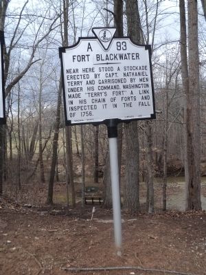
On Virgil H. Goode Hwy. (U.S. 220) south of Virginia Route 635, on the right when traveling south.
Near here stood a stockade erected by Capt. Nathaniel Terry and garrisoned by men under his command. Washington made “Terry’s Fort” a link in his chain of forts and inspected it in the fall of 1756. — — Map (db m63202) HM
On Franklin Street (Virginia Route 40) just south of North Main Street (Business U.S. 220).
Franklin County. Welcome to Franklin County, the eastern gateway to The Crooked Road, a journey through Southwest Virginia's musical heritage that winds through the Appalachian Mountains for 265 miles. Franklin County has always been a cultural . . . — — Map (db m71564) HM
Near Drake Road 0.5 miles east of Illinois Route 166.
Two Revolutionary War soldiers are buried in the Northwest corner of this cemetery. John Damron was born in 1757 in Northumberland County, Virginia. He enlisted in the army in 1776, and served in the 9th Virginia Regiment of the Continental Line. In . . . — — Map (db m167453) HM WM
On South Main Street (Business U.S. 220) near Old Furnace Road, on the right when traveling south.
Here stands the furnace and ironmaster’s house of the Washington Iron Works, Franklin County’s first industry. Originally established in 1773 by Col. John Donelson, father-in-law of President Andrew Jackson, the iron plantation was acquired in 1779 . . . — — Map (db m65983) HM
On Riner Road (County Route 8) just south of Homestead Road.
Floyd County. Floyd County was named for John Floyd, governor of Virginia from 1830 to 1834. The county was formed from Montgomery County in 1831, with a portion of Franklin County added later. The county seat is Floyd, formerly Jacksonville. . . . — — Map (db m104299) HM
On South Kanawha Streeet (West Virginia Route 210) at Cemetery Street, on the right when traveling south on South Kanawha Streeet.
There are many tales surrounding Ferguson rock, the oldest known landmark in Beckley, Raleigh County. One popular story holds “S. Ferguson” to have been an “old pioneer” who came to grief in 1814 while traveling from Virginia to the Kanawha . . . — — Map (db m177086) HM
On Shoal Creek Church Road (County Route 245) 0 miles south of Bill Lucas Road, on the right when traveling north. Reported missing.
Parkertown was founded in 1832 in what was then Franklin County, now Hart County, by Joseph A. Parker who was born in Virginia in 1774 and moved to Elbert County, Ga. in 1796. He later moved to Big Shoal Creek where Jacob Parker & Co. founded by his . . . — — Map (db m45081) HM
On West Broad Street (U.S. 40) at North Gift Street, on the right when traveling west on West Broad Street.
Thomas Jefferson was president when the original two-story Federal-style brick building was built in 1807. The house is located on the east half of in-lot 123, a part of Franklinton since its beginning. Surveyed by Nathanial Massie on October 28, . . . — — Map (db m170438) HM
On Main Street (U.S. 11) at Lincoln Way (U.S. 30), in the median on Main Street.
Erected in memory of the Soldiers of Franklin County who fought for the Union in the War Between the States 1861-1865 Dedicated July 17th, 1878 ---------- Approximately 40 feet southwest of this tablet, Generals Robert E. Lee and A. P. Hill met . . . — — Map (db m45160) HM
On 1st Avenue SE (Business U.S. 64) at South Jefferson Street, on the left when traveling east on 1st Avenue SE.
In memory of COLONEL JAMES LEWIS Born April 6, 1756 Albemarle County Virginia Died February 21, 1849 Franklin County Tennessee Served with distinction in the Revolutionary War. Participated in the Battles of White Plains, Trenton, . . . — — Map (db m31647) HM
On North Main Street north of Rye Cove Road, on the right when traveling south.
We are Virginia's Moonshine Heritage Trail
Our moonshine heritage has deep roots, tracing back to the region's early settlers who relied on the production of illicit distilled spirits as a means of survival and income. While its perception . . . — — Map (db m271604) HM
On Broad Street (U.S. 40) at West Innerbelt (State Route 315), on the right when traveling east on Broad Street. Reported missing.
This tablet is placed to mark the home of
Lucas Sullivant
who under authority from Virginia came to an unbroken wilderness and with twenty men surveyed this portion of the Virginia Military Lands. Later he returned and in 1797 laid out the . . . — — Map (db m13066) HM
On East Main Street Old National Road (U.S. 40) at Lancaster Avenue (Ohio Route 256), on the right when traveling east on East Main Street Old National Road.
The eastern portion of Franklin County began to be settled about 1812 when Ohio was still a vast forested wilderness. Transportation moved at a snail’s pace over old Indian trails and natural waterways. 1n 1818 the National Road reached the Ohio . . . — — Map (db m96296) HM
On Short Street west of Mechanic Street South, on the left when traveling west.
Lynchburg was a mere crossroads village in 1861, but the war and the years that followed it transformed this place. By the end of April 1861—six weeks before Tennesseans formally voted to secede—local men had formed Co. E (Lynchburg Rangers), 1st . . . — — Map (db m152104) HM
Near Booker T Washington Highway (Virginia Route 122) east of Lost Mountain Road ( Route 636), on the right when traveling east.
The Burroughs' farm was one of many tobacco plantations that dominated the 1800s landscape of Southside Virginia. Cash or credit from a few acres of tobacco financed the purchase of necessities and some luxuries. Subsistence crops of corn, wheat, . . . — — Map (db m298744) HM
On Booker T. Washington Highway (Virginia Route 122) at Smith Mountain Lake, the county line, on the right when traveling south on Booker T. Washington Highway.
Appalachian Power Company built Smith Mountain and Leesville Dams between 1960 and 1963 to generate hydroelectric energy. West of Smith Mountain Dam, the waters of the Roanoke and Blackwater Rivers formed Smith Mountain Lake, covering 20,600 acres . . . — — Map (db m104438) HM
Near Kanawha Boulevard East (U.S. 60) 0.1 miles east of Greenbrier Street.
Famous educator, author, lecturer and advocate of the doctrine of interracial cooperation.
Booker T. Washington was born near Hale's Ford, Franklin, County, VA. He spent his early life here in Malden, West Virginia. He was employed in the . . . — — Map (db m269242) HM
Near Champion Road 0.5 miles south of Blue Oak Drive, on the right when traveling south.
Education is not a thing apart from life-not a "system”,
nor a philosophy; it is direct teaching
how to live and how to work.
There are two ways of exerting one's strength;
one is pushing down, the other is pulling up.
No race can . . . — — Map (db m248901) HM
On Market Street at Avenue F, on the left when traveling north on Market Street.
During the 1830's, when the cotton port of Apalachicola was rapidly expanding, David G. Raney built a rather plain, Federal style house at this site. Around 1850, A two - story portico and other features of the then popular Greek Revival . . . — — Map (db m26663) HM
On Wilkinson Boulevard, on the right when traveling south.
Between 1776 and 1780 Kentucky was a single county of the
commonwealth of Virginia. In 1780 the Virginia legislature divided
Kentucky County into three smaller counties–Fayette, Jefferson
and Lincoln. These became Kentucky's first three counties . . . — — Map (db m194233) HM
On Virginia Avenue (U.S. 220) at Oak Forest Road ( Route 984), in the median on Virginia Avenue.
Franklin County. Area 697 Square Miles. Formed in 1785 from Henry and Bedford and added to from Patrick. Named for Benjamin Franklin. General Jubal A. Early lived in this county.
Henry County. Area 444 Square . . . — — Map (db m63193) HM
On London-Groveport Road (Ohio Route 665) at Jackson Pike ( Route 104), on the left when traveling east on London-Groveport Road.
The Borror Family. Jackson Township Pioneers. In 1809-1811, Magdalene Strader Borror, widow of Revolutionary War veteran Jacob Borror, Jr., moved to this area from Virginia with her seven children (Martin, Jacob, Myomi, . . . — — Map (db m12908) HM
From the Blue Ridge Mountains to the Coalfields region, southwest Virginia is blessed with historic and contemporary music venues, musicians, and fretted instrument markers. Historically isolated, the region retained its strong musical legacy by . . . — — Map (db m90701) HM
Silas Green was born into slavery around the year 1845 on a plantation in Franklin County, Virginia. According to local legend, soon after the beginning of the Civil War, Green voluntarily enrolled in the Confederate army. His owner considered him . . . — — Map (db m74059) HM
On East Main Street (U.S. 40) at Rosemore Avenue, on the right when traveling east on East Main Street.
The Underground Railroad (UGRR) was neither underground nor a railroad, but a system of loosely connected safe havens where those escaping the brutal conditions of slavery were sheltered, fed, clothed, nursed, concealed, disguised, and instructed . . . — — Map (db m189451) HM
On West Jefferson Street at S Commerce Alley, on the left when traveling west on West Jefferson Street.
William Jones Petty
Born 1885 in Tennessee. Brought to Waxahachie, Texas by his parents C.R. & Selassie Peevler Petty 1896.
In 1907 he stepped off the stage at Hollis seeing a hustling bustling town, and cast his lot to stay the rest of his . . . — — Map (db m288713) HM
On Charmian Road just east of Buchanan Trail East (Pennsylvania Route 16), on the right when traveling east.
Before the French and Indian War in 1754, lands west of South Mountain was considered a wilderness. With the outbreak of war, several settlements in this area were raided by the Indians.
In 1756, two Indian raids occurred, with one man taken . . . — — Map (db m192351) HM
On 1st Avenue NW at South High Street, on the left when traveling west on 1st Avenue NW.
When Tennessee failed to secede from the Union on February 9, 1861, Franklin County residents met here at the courthouse. They listened to attorney Peter Turney’s forceful speech offering resolutions in favor of secession and reportedly adopted them . . . — — Map (db m75226) HM
This brick home was built in 1856 by John McDannald, son of Samuel and Bell (Craig) McDannald who came from Virginia in 1813. The McDannalds were prominent in the development of Blendon Township, The Central College of Ohio, and The Central College . . . — — Map (db m51902) HM
Near South Bedford Street just north of East Willow Street, on the right when traveling north.
The U.S. Civil War played out part of its tumultuous history along the banks of the LeTort Spring Run during the summer of 1863. While many in the North initially expected a quick and decisive victory, by June of 1863 bloody battles had raged for . . . — — Map (db m259228) HM
On South Main Street (U.S. 11) just south of Lincoln Way West (U.S. 30), on the right when traveling south.
With its Southern border on the Mason-Dixon Line, and located in the middle of the Great Valley that stretched back through Maryland to Virginia, Franklin County became a Civil War hotspot.
Even before war came this way, abolitionist John . . . — — Map (db m242171) HM
On Bluff Street at Dinah Shore Boulevard (Tennessee Route 50), on the right when traveling north on Bluff Street. Reported permanently removed.
From June 24th to June 27th, the Union Army of the Cumberland had moved flawlessly to maneuver the Confederate Army of Tennessee out of its position south of the Highland Rim. As Rosecrans would later say, only heavy rains had prevented a complete . . . — — Map (db m207282) HM
Near North Center Street just south of East Mulberry Street, on the right when traveling north.
In July of 1866, Collierville, like much of the South, was beginning to recover from the ravages of war. Three years earlier, "Mister Collier's Village" consisting of several homes and a general store a few hundred yards east of the square on Mt. . . . — — Map (db m149075) HM
On Franklin Street (Virginia Route 40) just west of North Main Street (Business U.S. 220).
One in a class of 200 built by International Railway Car Company, Kenton, Ohio between December, 1968 and
February, 1970. The “P” denotes pool service and meant the caboose could travel any portion of the N & W System.
Before air brakes, . . . — — Map (db m71566) HM
Near Court Place at Whittle Street. Reported unreadable.
Beneath this bridge is the upper Cherrystone Spring. At the base of this hill is the lower Cherrystone Spring, the site of the Cherrystone, Meeting House community. In 1777 the new Virginia General Assembly divided Pittsylvania County to form Henry, . . . — — Map (db m299877) HM
On Green Hill Cemetery Road 0.1 miles east of Atwood Avenue, on the right when traveling north.
Officially, 23,703 African Americans in Kentucky responded to the call to arms by President Lincoln and Frederick Douglass to join the ranks of the newly organized United States Colored Troops. Units were organized with men from across the . . . — — Map (db m84675) HM
On Sheridan Road 0.3 miles east of Telegraph Road (Missouri Route 231), on the left when traveling east. Reported missing.
The Jefferson Barracks National Cemetery was established by joint resolution of Congress in 1866, among the first burial grounds officially designated in the wake of the Civil War. Under the care of the Veterans Administration, the facility is . . . — — Map (db m124986) HM
On North Pitt Street north of West High Street (U.S. 11), on the right when traveling north.
Vale-Himes Park
The ground you are now standing on is the Cumberland County Historical Society's Pocket Park. A one-story building that served as a barber shop existed on this site before 1909. Over the years, the building on this . . . — — Map (db m217332) HM
Frontier Nashville
European exploration of the Middle
Tennessee region began as early as the 16th
century with the expedition of Spaniard
Hernando de Soto. By the early 18th
century French traders were exchanging
furs with the area's . . . — — Map (db m207197) HM
On Mountain Valley Road (Virginia Route 39) just west of Edgewood Lane, on the left when traveling west.
The community of West Warms Springs was settled in the 1870s by Black residents who purchased
tracts of land on the west side of Little Mountain. A road that extended over the mountain connected
West Warm Springs with the pools. Many of the early . . . — — Map (db m208526) HM
Thin black lines indicate changes in relevance. Between each pair of lines entries are ordered geographically but all have the same relevance.
* Inflectional forms of words are their plurals, singulars, and possessives as well as gramatical tenses and similar variations.