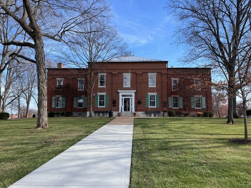
On South Main Street south of Mill Street, on the left when traveling south.
In Memory of the Revolutionary Patriots of Monroe County, Illinois
William Biggs • Shadrach Bond, Sr. • Ebenezer Bourn • John Doyle • James Garretson • Pierre Giradot • Andrew Hilton • William Howard • Jacob Judy • Robert Kidd • James Lemen . . . — — Map (db m173568) WM
On North Main Street south of First Street, on the left when traveling south.
Colonel William R. Morrison
One of Waterloo's most renowned and distinguished citizens was Colonel William R. Morrison, to whom the city owes its library.
The library building at the corner of Library and Park Streets was Colonel . . . — — Map (db m219967) HM
Near S Church Street, on the right when traveling south.
Bellefontaine was one of the first settlements made by Americans in what is now Illinois. The earliest settlers included families of Revolutionary War veterans who had served with George Rogers Clark. Captain James Moore brought a band of pioneers . . . — — Map (db m140335) HM
On Lakeview Drive (Illinois Route 7) at South Library Street, on the left when traveling west on Lakeview Drive.
From the
people of
Monroe
County
Illinois
In honor
of those
who perished
In tribute
to those
who served
In gratitude
to those
now serving
— — Map (db m143503) WM
Salt Lick Point marks the place where the manufacture of salt was carried on in early time. The Indians probably used this point to obtain their salt. This saline trade was one of the earliest established in the West. Gen. John Edgar, of . . . — — Map (db m280522) HM
Near Brittany Court 0.1 miles south of Kasey Lane, on the right when traveling south.
This stone arch bridge dates back to 1877 when it was built by Charles Liebheit and Christian Hartmann. It extends over a tributary of Fountain Creek, called Moore's Run (named after James Moore, one of the founders of Waterloo). This bridge is . . . — — Map (db m143476) HM
On North Main Street south of First Street, on the left when traveling south.
The Moore family left a distinguished mark on Waterloo's history.
Some time after settlement at Bellefontaine had been made, Captain James Moore, having established to some degree amicable relations with the Indians, took steps toward . . . — — Map (db m219950) HM
On Illinois Route 3 at Gall Road, on the right when traveling south on Illinois Route 3.
Historic Shoemaker School
In 1851, a leg school building was built by Hammond Shoemaker on his form south of Columbia for his children and the families of his neighbors. Shoemaker was the only doctor along the Kaskaskia Cahokia Trail, the . . . — — Map (db m204821) HM
On Gall Road just south of Old Route 3, on the right when traveling south.
Shoemaker School became a part of the Columbia School District in 1950. Since the school's directors had already contracted Marian Maag to teach for the 1950-51 term prior to this consolidation, the old school was kept open for one final year. In . . . — — Map (db m144933) HM
On North Main Street 0.1 miles north of Magnolia Avenue, on the left when traveling north.
Ditch Tavern…
…was the first hotel in Waterloo located on North Main Street, and run by David and Hannah Ditch. David H. Ditch owned the land on which Waterloo was built until it was purchased by George Forquer in 1818.
The Old Tavern . . . — — Map (db m148322) HM
On West Mill Street at South Main Street, on the left when traveling west on West Mill Street.
January 6, 1816 — An Act of the legislature of the Illinois Territory was enacted to form a new county out of Randolph and St. Clair Counties to be called Monroe County named after then U.S. Secretary of State James Monroe who would be elected . . . — — Map (db m205551) HM
On Old Bluff Road at Dd Road, on the right when traveling north on Old Bluff Road.
Sand Bank School ha a history dating to 1800, The first log school was built only a few feet east of the Kaskaskia-Cahokia Trail. The log one - room school on the sand hill served the settlers living near Captain James Piggot's Fort Great Run . . . — — Map (db m246405) HM
On Walnut Road (State Road 156) 0.5 miles north of Harris Road, on the right when traveling south.
The Mississippi River was a major superhighway throughout history, Native Americans traveled extensively on the waterway, and early settlers settled the Midwest by entering the port of New Orleans and traveling north on the river. During the . . . — — Map (db m226556) HM
Near South Washington Street south of West Hillside Road, on the right when traveling south.
John Dudley was born February 25, 1758 in Old Saybrook, Connecticut. In 1776 at the age of 18, he enlisted in the New Hampshire militia and served at Fort Ticonderoga in Colonel Reed's Regiment. There Dudley and the rest of the American troops . . . — — Map (db m230990) HM WM
Near Rogers Street 0.2 miles south of Hamacher Street (County Route 2), on the right when traveling south.
To honor the soldiers who fought in the American Civil War, Shane Douglas marked the graves of 99 Veterans buried in the City of Waterloo for his Eagle Scout Project. There are 67 buried in Waterloo City Cemetery, 31 buried in St. Peter & Paul . . . — — Map (db m146844) WM
Kaskaskia-Cahokia Trail: 40 Miles to Kaskaskia
20 Miles to Cahokia Here passed the ancient trail trod first by buffaloes and Indians, then by explorers, traders and French settlers of Kaskaskia and Cahokia. Revolutionary War soldiers with . . . — — Map (db m140364) HM
On North Main Street south of First Street, on the left when traveling south.
The first French people came to Illinois during the seventeenth century because of political instability in France. The settlers took a trail from Kaskaskia to Cahokia called the "Hill Trail" Along this trail, just south of Waterloo, is a spring . . . — — Map (db m219731) HM
Near G Road 3 miles south of KK Rd, on the right when traveling south.
Armin Henry Krueger, 1914-1996, served as caretaker of Illinois Caverns for 45 years. His constant presence and willingness to share his affection for underground Monroe County enhanced the experience for countless visitors to the cave. His . . . — — Map (db m175246) HM
On North Main Street just south of First Street, on the left when traveling south.
The first roads through the town of Waterloo were Indian trails created by buffalo going from one hole to another. The first trails were made for foot travel and horses traveling in single file. trails were later widened by the use of axes and . . . — — Map (db m220257) HM
Mexico and Audrain County have some rich history, tied into the Civil War. This area was of vital strategic importance to both sides, politically and militarily, during the War. Politically, Southern sympathies ran deep in this area, the heart of . . . — — Map (db m288549) HM
On LL Rd 0.2 miles south of Sportsman Road, on the right when traveling south.
This small community is located in the southern part of New Design Precinct. It was settled in the late 1830's by immigrants from Tipperary, Ireland. The press of economic and political circumstances caused many Irish to immigrate to Monroe . . . — — Map (db m283180) HM
Near Park Street (Illinois Route 156) at South Library Street, on the left when traveling east.
William R. Morrison, destined to be elected a Colonel during the American Civil War, was of Scotch-Irish descent, born on September 14, 1824. Although raised on a farm, upon his father's remarriage following the death of William's mother, they . . . — — Map (db m136540) HM
On North Main Street south of First Street, on the left when traveling south.
When the early settlers came up the Mississippi River to Kaskaskia and north to Bellefontaine in 1781, they were under the government of the French. Their only elected officer was a justice of the peace. The first court was held at the Ditch . . . — — Map (db m219730) HM
On South Main Street just south of West Mill Street, on the left when traveling north.
This property, 107 South Main Street, is officially known as Tax Lot 11 in Block 12 of Old Town, now City of Waterloo, Monroe County, Illinois. Property deeds date back to 1867, when its first owners, John and Mary Harms sold the property to . . . — — Map (db m156248) HM
On North Meridian Street at East Commerce Street, on the right when traveling north on North Meridian Street.
Front
In 1940 singer-guitarist Booker “Bukka” White, who lived in Aberdeen during the 1920s and ‘30s, recorded the blues classic “Aberdeen Mississippi Blues.” Twenty-three years later the song’s title enabled blues researchers to . . . — — Map (db m102609) HM
Near Virginia Street 0.1 miles east of South Ann Street.
National Cemetery
Mobile National Cemetery was established in May 1866 on 3 acres of land in Magnolia Cemetery. The City of Mobile donated the land to the federal government. The Cemetery was divided into four sections with a central . . . — — Map (db m86914) HM
On South Main Street at East Cherry Street, on the left when traveling south on South Main Street.
The Miller Fiege house was built was built in 1850 by Johannes Dahmer. It is a vernacular German cottage with Italianate influences; a brick house on a limestone foundation, one and a half stories in height; with segmental - arched brick lintels . . . — — Map (db m291420) HM
On West Main Street (Road 156) 0.1 miles east of Lake Street (County Road 6), on the right when traveling west.
The rich soil and abundant food sources of the American Bottom made this area ripe for development, Native Americans living here could harvest crops, fish and wildlife from the floodplain, while gathering nuts and berries from the neighboring . . . — — Map (db m227109) HM
On Veterans Dvive 0.1 miles east of Monroe St, on the right when traveling east.
In January 1946, several overseas veterans of Monroe County began talking about the possibilities of organizing a Veterans of Foreign Wars Post in Monroe County. Raymond Oestreich, Frank Eichelmann and William Emick were among these men, and that . . . — — Map (db m179272) HM WM
On South Main Street just north of West 3rd Street, on the left when traveling north.
Hubert Küenster immigrated to America from Germany in May 1852. He came to St. Louis, where he was a clerk in Dr. Berghoff’s drug store for a year. Some of his countrymen were residents in the neighborhood of Waterloo, and at their request, Küenster . . . — — Map (db m143986) HM
On West 4th Street (Illinois Route 156) just east of South Church Street ( Route 156), on the left when traveling west.
The Waterloo City Hall is situated on Lots 75 and 76 at 100 West Fourth Street in the southerly block between Main Street and Church Street.
In 1816, George Forquer purchased a tract of land that is now part of the City of Waterloo. Forquer and . . . — — Map (db m144219) HM
Near Adams Drive at Adams Drive, on the left when traveling east.
To honor the brave soldiers who fought in World War I, Sam Thomas marked the graves of WW I Veterans buried in the City of Waterloo that did not already have a military recognition. There are 25 in the Waterloo City Cemetery and 18 in St. Peter . . . — — Map (db m146821) WM
On College Street South south of Main Street, on the left when traveling south.
On November 4, 1863, to divert Federal forces from Chattanooga, Confederate Gen. James Longstreet led two reinforced divisions from the city to attack Union Gen. Ambrose E. Burnside’s garrison in Knoxville. Burnside confronted Longstreet . . . — — Map (db m69379) HM
Near D Road 0.2 miles south of Hh Road, on the right.
Stephen W. Miles was born in New York and came to this area in 1819. He was a successful businessman and acquired large tracts of land. He would stand on the bluff and say, "For miles and miles, it all belongs to Miles." He would eventually . . . — — Map (db m233012) HM WM
On Stringtown Road (Illinois Route 155) at Kaskaskia Road, on the left when traveling west on Stringtown Road.
The town of Kidd was named after Robert Kidd, who had been a soldier
serving under Colonel George Rogers Clark. Kidd was in the original group of
settlers who came to what is now Monroe County in 1782 with the intention of
permanently settling . . . — — Map (db m163635) HM
On Church Street 0.5 miles south of Ivy Rd., on the left when traveling south.
The Village of Fults, formerly known as Brownsburg, had its beginnings in the
early 1900's with the construction of the St. Louis Iron Mountain and Southern
Railroad line through the Monroe County Bottoms. In
1902, the Nanson Commission Co. . . . — — Map (db m198125) HM
Thin black lines indicate changes in relevance. Between each pair of lines entries are ordered geographically but all have the same relevance.
* Inflectional forms of words are their plurals, singulars, and possessives as well as gramatical tenses and similar variations.