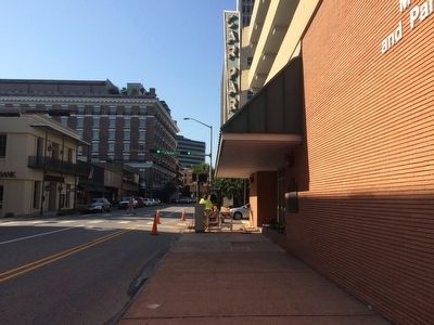
On North Royal Street at St Michael Street, on the right when traveling south on North Royal Street.
Here played the great of the American and British stage, among them: James Wallack, Fanny Kemble, Ole Bull, Joseph Field, Joseph Jefferson, James H. Hackett, William Macready, Charlotte Cushman, Edwin Forrest, Julia Dean, Junius Booth, Anna Mowatt, . . . — — Map (db m86352) HM
On Fort Tejon Road west of Interstate 5. Reported missing.
This memorial plaque placed in memory of Lieutenant Edward Fitzgerald Beale,
first Superintendent of Indian Affairs in California, appointed
by President Millard Fillmore.
Sanctioned by the United States
government, the Tejon Indian . . . — — Map (db m147357) HM
On Rosecrans Street at Guijarros Road on Rosecrans Street.
President Millard Fillmore's executive order of 1852 created a U. S. Preserve on Point Loma. From 1870 to 1873 the coast artillery corpsmen evicted whalers from the site in order to begin the military installation. In 1899 it was named for William . . . — — Map (db m81222) HM
Near South Governor's Avenue 0.1 miles south of W North Street, on the right when traveling south.
Born in Dagsboro, Delaware, 1796. Graduate of Yale College 1815. Member of Delaware House of Representatives 1824. Secretary of State of Delaware 1826-1828. United States Senator 1829-1836, 1845-1849 and 1853 until his death, 1856. Chief Justice of . . . — — Map (db m4748) HM
On Pennsylvania Avenue Northwest at 14th Street Northwest (Highway 1), on the right when traveling west on Pennsylvania Avenue Northwest.
Site of
Joshua Tennison's Hotel 1818. John Strother 1821. Basil Williamson 1824. Frederick Barnard 1828. Proprietor of Mansion Hotel, Azariah Fuller American House 1833. City Hotel 1843. Willard's Hotel 1847-1901.
Distinguished Guests . . . — — Map (db m6618) HM
On Martin Luther King Jr. Avenue Southeast north of Pomeroy Road Southeast, on the right when traveling south.
The fence and wall ahead of you, on either side of Martin Luther King Jr. Avenue, enclose historic St. Elizabeths Hospital. The pioneering facility opened in 1855 to treat mentally ill members of the armed forces and DC residents. At a time . . . — — Map (db m100694) HM
These cannon, which were captured when Lord Cornwallis surrendered at Yorktown in the American Revolution, were a gift to the Chatham Artillery by President George Washington - a mark of his appreciation for the part the local military company . . . — — Map (db m5517) HM
On 1st Avenue at 12th Street, on the left when traveling north on 1st Avenue.
On this corner stood the Oglethorpe House, widely known ante-bellum hotel. Built in 1836, the old building was the scene of gala receptions, honoring famous visitors to Columbus. Among these were two Presidents, James K. Polk and Millard Fillmore, . . . — — Map (db m101277) HM
On 18th Avenue 0.1 miles south of St. Elmo Drive, on the left when traveling south.
“St. Elmo,” one of the most exquisite examples of the classic houses of America, stands in view of this point. It was built on the old Stagecoach Road, by Colonel Seaborn Jones, for his wife, Mary Howard Jones. Completed in 1833, it was . . . — — Map (db m43119) HM
Near Kentucky Route 114 0.1 miles east of Route 404, on the right when traveling east.
The Union and Confederate forces were led by two very different men. Humphrey Marshall was a Kentucky blue blood and a representative of one of the state's leading families. James A. Garfield was a self-made man born in a log cabin on his father's . . . — — Map (db m69138) HM
Near West Mount Vernon Place, in the median. Reported permanently removed.
This fountain was installed during the creation of Mount Vernon Place so that those wealthy enough to own wooden teeth could rinse and wash them in the park. These teeth cleaners were common all over America in the 1800s. At the time, it was thought . . . — — Map (db m7725) HM
On Franklin Street, on the right when traveling west.
Here on February 16, 1851, Jonathan and Frances Drake participated in the rescue of the fugitive slave Shadrach Minkins. The case attracted national attention and the rebuke of President Millard Fillmore. Undeterred, abolitionists like the Drakes . . . — — Map (db m101543) HM
Near Old Minnesota Avenue west of Minnesota Avenue (U.S. 169).
Near this place on July 23, 1851, the Sisseton and Wahpeton bands of the Dakota sold 21 million acres of land to the federal government for $1,665,000—about 7.5 cents per acre. The Dakota, hoping to ensure a future for their children, . . . — — Map (db m71152) HM
On G Street at North 9th Street, on the right when traveling east on G Street.
The first homesteads were filed in 1866 by William O. Bussard and William C. Whitaker along the West Fork of the Blue River. Mrs. E. A. Whitaker, the first white woman, came in 1867. The first white children, Emma Whitaker Hall and Arthur Dixon . . . — — Map (db m206666) HM
On North Plaza at South Plaza, on the left when traveling west on North Plaza.
Welcome visitors and Taosenos! You are invited to explore the diversity of this region through a self-guided tour. The two-hundred- year-old Taos Plaza, including the streets that radiate from it like spokes, forms the National Historic District . . . — — Map (db m66702) HM
On Delaware Avenue (New York State Route 384) at Trinity Place, on the right when traveling south on Delaware Avenue.
Founded 1867, with Millard Fillmore 13th President of U.S., as its first president. Another U.S. President, Grover Cleveland, was a member from 1881-1908. In 1901, after President McKinley's assassination, the club was used as headquarters by his . . . — — Map (db m75836) HM
Near Main Street (New York State Route 5) at West Delavan.
Burial place of Millard Fillmore, Samuel Wilkeson, Red Jacket and other famous Buffalonians, including veterans of seven wars. Site of homestead of Erastus Granger, first Indian Agent. — — Map (db m81167) HM
Near Main Street (New York State Route 5) near Delaware Avenue.
13th President of the United States of America
Born January 7, 1800. Died March 8, 1874
Dedicated by The Millard Fillmore Republican Women's Club
Memorial Day May 30, 1932 — — Map (db m65479) HM
On Franklin Street at West Eagle Street, on the right when traveling south on Franklin Street.
This building was erected in 1833 by the First Unitarian Congregational Society of Buffalo which worshipped here until 1880. Abraham Lincoln in February 1861, attended church services here and sat in the pew of his host Millard Fillmore. — — Map (db m92879) HM
From Frontier to Major City
In the early 1800s, Buffalo was a sleepy village known as New Amsterdam, on the edge of America's then western frontier. Holland Land Company surveyor Joseph Ellicott, inspired by Pierre L'Enfant's radial . . . — — Map (db m92798) HM
Near Niagara Square at Delaware Avenue ( Route 384), in the median.
Conceived in 1804 by Joseph Ellicott (right), Niagara Square was the beginning of what renowned landscape architect Frederick Law Olmsted would in mid-century call "the best planned city as to its streets, public places, and grounds in the United . . . — — Map (db m92820) HM
On Museum Court at Nottingham Terrace, on the left when traveling south on Museum Court.
1655: Seneca Indians win control of Niagara Region from Erie tribes. 1678-79: French explorer Rene-Robert Cavelier, Sieur de la Salle, claims the region for France. He builds a sailing ship, Griffon, on the bank of the Niagara River and . . . — — Map (db m80361) HM
Near Shearer Avenue 0.1 miles north of Main Street (U.S. 20A), on the right when traveling north.
In 1825, Millard Fillmore, 13th President of the United States, helped build this house to which he brought his bride, Abigail Powers, in 1826, residing here until 1830. Moved from original Main Street site 1930. Tablet placed by Abigail Fillmore . . . — — Map (db m74669) HM
Near State Street, on the left when traveling north.
In 1790 the Common Council of the City of New York authorized the removal of stone and soil from Fort George and the Grand Battery to fill in the pier line along the Battery. Beginning in 1808, the defenses of the city were extended out into the . . . — — Map (db m148098) HM
The historic Arsenal is one of two buildings in Central Park predating the park. It was designed by esteemed architect Martin T. Thompson (1786-1877) and built between 1847 and 1851 by the State of New York as a storage repository for the storage . . . — — Map (db m137070) HM
On East Washington Street west of Montgomery Street, on the right when traveling west.
”It is treason, treason, TREASON, and nothing else.” - Daniel Webster, about refusing to carry out the Fugitive Slave Law, 1851.
On September 18, 1850, President Millard Fillmore signed the Fugitive Slave Act, requiring federal marshals . . . — — Map (db m138795) HM
On Lower Main Street (County Route 133) at the connector to Upper Main Street, on the right when traveling west on Lower Main Street.
Welcome Iron Horse
The Erie Railroad Company was incorporated on the 24th of April 1832. Active work began in 1836 but with rugged hills, mountain barriers, spanning rivers and deep ravines with bridges and viaducts, political opposition, the . . . — — Map (db m121835) HM
On Front Street (New York State Route 17C) at Church Street, on the left when traveling west on Front Street.
Owego was the site of the Iroquois Indian village "Owagea" destroyed by American forces under Generals James Clinton and John Sullivan in 1779, during the Revolutionary War. The Susquehanna River played an important part in the history of Owego. The . . . — — Map (db m141832) HM
Near Council Grounds Access Road 0.2 miles west of Park Road.
William Pryor Letchworth first became interested in Native American culture after hearing his father's stories about Cornplanter, the Seneca Chief, meeting with Letchworth's great-uncle, John Letchworth, a Quaker preacher in Philadelphia. Sensitive . . . — — Map (db m76005) HM
On South Broad Street (U.S. 62) at Newton Square Drive, on the right when traveling south on South Broad Street.
Side A:
On this site stood the home of Elisha and Polly Mygatt Whittlesey and their ten children. Also here was his law office and a records office that was moved in 1965 to Pioneer Village at the Canfield Fairgrounds. Already an attorney in . . . — — Map (db m65433) HM
On Northwest Skyline Boulevard 0.4 miles west of West Burnside Road, on the left when traveling west.
This short trail leads to the Willamette Stone, the surveyor's monument that is the point of origin for all public land surveys in Oregon and Washington. The landmark was established on June 4, 1851 by John B. Preston, Oregon's first Surveyor . . . — — Map (db m38400) HM
On Lebanon Pike (U.S. 70) at Rachels Lane, on the right when traveling east on Lebanon Pike.
Designed by Jos. Reiff, who was also builder of the Hermitage, this house was built in 1836 for Andrew J. Donelson, Jackson's namesake and secretary. A West Point graduate, Donelson was at one time minister to Prussia, and held other offices. In . . . — — Map (db m147680) HM
On N Main Street (U.S. 11), on the right when traveling north.
This house is a fine example of the Valley Federal style with elegant detailing including the fanlight over the front door and a molded brick cornice. When the streets were lowered in 1851, the entrance was reoriented to the side. The Ruff Family . . . — — Map (db m58732) HM
Near Smithfield Plantation Road 0.1 miles south of Smithfield Road.
This is Smithfield, the birthplace of William Ballard Preston (1805-1862). On April 16, 1861, in the Virginia Convention, he reluctantly introduced the formal resolution to secede from the Union.
Preston served in the Virginia House of . . . — — Map (db m84776) HM
On Crawford Street south of Queen Street, on the left when traveling north.
Erected 1835 by J.W. Collins, Portsmouth’s first five-story building and for many years a leading hotel. Presidents Van Buren, Tyler, and Fillmore were entertained here. — — Map (db m20461) HM
Built in 1834-1835 by Stephen Henderson First Summer White House Occupied by Martin Van Buren John Tyler Millard Fillmore Franklin Pierce James Buchanan — — Map (db m85210) HM
Near 3rd Avenue south of Water Street, on the left when traveling south.
The 1849 Ojibwe delegation to Washington, D.C. carried this pictograph depicting Ojibwe clans with their eyes and hearts connected to the chain of wild rice lakes south of Lake Superior. Drawing by Seth Eastman from Henry Schoolcraft's . . . — — Map (db m75477) HM