On Newcastle Street north of Mansfield Street, on the right when traveling north.
British humanitarian, leader and military commander, James Edward Oglethorpe (1696-1785), is credited as the founder of Georgia. His plan for the city of Savannah, later adapted for the design of Brunswick, included ample public green space. His . . . — — Map (db m212676) HM
On Riverview Drive near Major Horton Drive, on the right when traveling south.
This burying ground contains the bodies of several members of the du Bignon family, descendants of Le Sieur Christophe Poulain de la Houssaye du Bignon, native of Saint-Malo in Brittany. One of four Frenchmen, former residents of Sapelo Island, who . . . — — Map (db m17509) HM
On Albany Street near H Street, on the right when traveling north.
Brunswick's first public school for African Americans opened in 1870 as the Freedmen's School, later changed to Risley School to honor Captain Douglas Gilbert Risley, who raised funds for the school's construction. In 1923 the adjacent building, . . . — — Map (db m24680) HM
On G Street at Union Street, on the left when traveling east on G Street.
Glynn County, one of the eight original Counties of Georgia, was organized under the 1777 Constitution of the State of Georgia. It was named in honor of John Glynn, a member of the British House of Commons who defended the cause of the American . . . — — Map (db m12226) HM
Hanover Square, also referred to as Hanover Park, is one of the two major squares in Brunswick that retained their original size and shape. It was named to honor Britain’s ruling House of Hanover during the reign of King George II, when the Colony . . . — — Map (db m193685) HM
Hanover Square, also referred to as Hanover Park, is one of the two major squares in Brunswick that retained their original size and shape. It was named to honor Britain’s ruling House of Hanover during the reign of King George II, when the Colony . . . — — Map (db m193659) HM
Near Beach View Drive 0.1 miles north of South Riverview Drive.
1 African was owned by a free black barber in Augusta, GA. 1 African, known as the "Wild African Boy" was arrested from John duBignon's land and taken to a slave hostel in Savannah owned by George Wylly where he attracted many onlookers for . . . — — Map (db m168401) HM
Hanover Square, also referred to as Hanover Park, is one of the two major squares in Brunswick that retained their original size and shape. It was named to honor Britain’s ruling House of Hanover during the reign of King George II, when the Colony . . . — — Map (db m193608) HM
On East Gordon Street near Abercorn Street, on the right when traveling north.
Massie School is the only remaining building of Georgia's oldest chartered school system. Constructed in 1855-56 and opened for classes on October 15, 1856, the Greek Revival building is listed on the National Register of Historic Places. Peter . . . — — Map (db m5503) HM
On Newcastle Street (U.S. 25) north of Gloucester Street, on the right when traveling north.
Service to the Community
Bernice Echols Grant came to Brunswick as Glynn County’s Extension Agent in 1927. She was instrumental in reorganizing the county’s garden club program, and provided design guidance for the landscape of the Historic . . . — — Map (db m155743) HM
On Egmont Street just north of George Street, on the left when traveling south.
Wright Square, one of the two largest of the original 14 squares of Brunswick, was named after Georgia’s last Colonial Governor, Sir James Wright (1716-1785). Well-respected and fair, Wright held his office from October 13, 1760 until the end of . . . — — Map (db m212684) HM
Near Beachview Drive North 0.2 miles north of Ben Fortson Parkway (Georgia Route 520), on the right when traveling north.
The ocean is teeming with a diverse amount of life. All of the plant and animal life found in the ocean's waters require a healthy environment. The sediment in the water that you encounter on the beaches of Jekyll Island is a good thing. This is an . . . — — Map (db m310885) HM
On 12th Street south of Beachview Drive, on the right when traveling south.
The Lighthouse and Keeper's Dwelling were completed in 1872, replacing the Lighthouse destroyed during the Civil War. Orlando Poe, chief engineer for the U.S. Lighthouse Board, supervised the design. Charles Cluskey, the architect of many . . . — — Map (db m106303) HM
Near State Street at Hoyt Street, on the right when traveling north.
Origins of Formal Parterre Gardens Formal gardens originated in France in the 1400s and reached their peak in Europe in the 1600s. They were originally a way for the rich to display their wealth and status.
The “parterre” garden is a type of . . . — — Map (db m199962) HM
On Newcastle Street south of Gloucester Street, on the right when traveling north.
Jekyll Square, originally called “Jekyll Place,” was named after Sir Joseph Jekyll (1663-1738), a member of British parliament. He was a friend of General Oglethorpe – founder of Georgia – and a financial supporter of the . . . — — Map (db m155627) HM
On Newcastle Street south of Mansfield Street, on the right when traveling north.
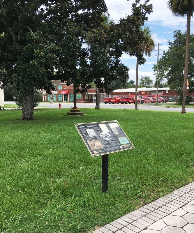
Queen Square was named by Colonial era founders of the city to honor the ruling queens of England. The southeastern quadrant of Queen Square was home to the Brunswick Fire Department from 1876 to 1932.
Tinderbox Town
Brunswick’s . . . — — Map (db m155558) HM
Near Newcastle Street at George Street, on the left when traveling north.
An Ornament for the City Despite its Colonial pedigree, Brunswick appears as a classic Victorian town. Many landmarks were built in the late 19th century, a period of emerging prosperity and civic pride. In 1884, the local newspaper praised the . . . — — Map (db m193672) HM
Near Barley Drive west of Sandtown Road, on the left when traveling west.
Georgia's coast stretches for approximately 100 miles from the Savannah River in the north to the St. Marys River in the south.
Separating the mainland from the Atlantic Ocean is a series of barrier islands. These islands are several miles . . . — — Map (db m301252) HM