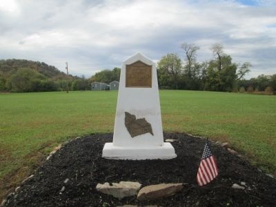
On Sycamore Street at Court Street, on the left when traveling south on Sycamore Street. Reported missing.
Cincinnati Riots of 1884
In March 1884, public confidence of Cincinnati law enforcement was extremely low. The public believed that murderers and other serious offenders were not brought to justice promptly or received little punishment. Civil . . . — — Map (db m168206) HM
On Heaton Street, on the right when traveling south.
Warren Gard (1873-1929), son of Samuel Z. Gard and Mary Duke, was born in Hamilton, Ohio. He established his practice in Hamilton after graduating from Cincinnati Law School and being admitted to the Ohio Bar in 1894. Gard served as Butler County . . . — — Map (db m122416) HM
On Scott Street at Corn Planters Street, on the left when traveling west on Scott Street.
This area was part of Codner's Ferry Road (1709), renamed Scott's Ferry (1765), which ended at a ferry dock along the Cooper River. Ferries were once the primary means of transportation on and off the island. For a fee, a man would use a long sweep . . . — — Map (db m264886) HM
On Summit Street, on the right when traveling north.
Civil War
Brown, Wilson, W. Co. F, 21st Ohio Infantry, Private, Army. Born; December 25, 1837 in Logan County, Ohio. Entered service in Wood County, Ohio. Died; December 25th, 1916, in Toledo, Ohio. Buried at New Belleville Ridge Cemetery, . . . — — Map (db m160385) WM
On North Railroad Street, on the left when traveling north.
Farmer, rancher, merchant, and ginner. Born in Ohio, in 1850 he moved to Pleasant Run, Dallas County, Texas. Married Miss Emily Beeman, the daughter of James J. Beeman, Dallas pioneer. Although a Unionist, as a loyal Texan he made shoes for . . . — — Map (db m226063) HM
Near South 9th Street at Washington Street, on the right when traveling north.
Ironton's Role on the Ohio Ironton was a prominent port at one time and many boats docked here to take on iron ore, coal and other products. There were also many great steamboats built in Ironton. Many of these photos were taken by Thornton . . . — — Map (db m310294) HM
On 2nd Street at Main Street, on the right when traveling west on 2nd Street.
Army Captain Samuel Colville Vance was a surveyor for the United States government living in Cincinnati, Ohio. In 1802 he purchased all the land comprising the original town of "Lawrenceburgh." At that time the land was part of Hamilton County, . . . — — Map (db m66906) HM
Columbia Presbyterian & Fulton Cemeteries The cemetery dates to 1794 and is comprised of two adjacent cemeteries: Columbia Presbyterian Cemetery and Fulton Cemetery. Another cemetery, the Fulton Mechanics Cemetery, had been in Fulton, a village . . . — — Map (db m134942) HM WM
On Belmont Avenue just west of Pasadena Avenue, on the left when traveling west.
The first in a succession of schools that eventually gave College Hill its name was CARY'S ACADEMY FOR BOYS. Freeman Cary opened this school in his home on Hamilton Avenue in 1832. Success necessitated larger quarters and in 1833 . . . — — Map (db m158447) HM
Near Cleves Warsaw Pike 0.2 miles west of Glenway Avenue (Ohio Route 264), on the left when traveling west.
Powhatan Beaty. Born in Richmond, Virginia. Powhatan Beaty moved to Cincinnati in 1849, where he spent the majority of his life. Beaty enlisted as a private in the Union Army in June 1863, and two days later was promoted to first sergeant, . . . — — Map (db m87543) HM
On Ohio Route 664 at River Street (County Road 13), on the left when traveling east on Ohio Route 664.
The previous bridge at this location was a 250 foot long, steel Pennsylvania truss. It was originally built in 1914 by the Pennsylvania Bridge Company and located in Hamilton County. In 1956 it was moved for reuse at this location to carry State . . . — — Map (db m96062) HM
Near Riverboat Row, on the right when traveling south.
Covington and Newport sit at the confluence of the Ohio and the Licking. Over the years the rivers have brought many benefits — natural beauty, trade, jobs. But they also have brought floods.
For generations citizens have accepted as . . . — — Map (db m174907) HM
Near Riverboat Row, on the right when traveling south.
Cincinnati 1800
Twelve years after its founding, Cincinnati was still a rough village of mostly two-story log and frame houses with a population of 750. No real skyline yet existed — unless you count the steeple of First Presbyterian Church . . . — — Map (db m174863) HM
On Glendale Milford Road (Ohio Route 126) at E; Galbraith Road, in the median on Glendale Milford Road.
The Land of Opportunity
When Ohio was opened for settlement by the Northwest Ordinance (1787) and made secure from Indian attacks by the Treaty of Greenville (1795), it became the new “Promised Land.” The new territory lured frustrated . . . — — Map (db m134234) HM
On North Bend Road at Frolicher Drive, on the left when traveling north on North Bend Road.
Enoch Terry Carson was born on this site of 100 acres in 1822, a grandson of Enoch Carson who was Cheviot’s first settler, in 1806, grandfather Enoch began a harvest days celebration which became the Green Township Harvest Home Fair currently . . . — — Map (db m158476) HM
On Clough Pike at Hunley Road, on the right when traveling east on Clough Pike.
The land along Clough Pile was predominately farmland until the 1950s. A photograph from the late 1890s of the Wolfe family farm shows the buildings and fields along a narrow dusty Clough Pike. Today the rebuilt farm house is an office building . . . — — Map (db m169927) HM
On Harrison Avenue at Montana Avenue, on the right when traveling south on Harrison Avenue.
Five Miles northwest of Cincinnati in 1868, in a sparsely populated area of southeast Green Township, farmers, local merchants, and landed gentry gathered together to form the Village of Westwood. They envisioned a new community to better control . . . — — Map (db m164159) HM
Near Springfield Pike (Ohio Route 4) near Glendale-Milford Road.
The large stones used here as fountain elements, benches, and garden accents were quarried from a deposit of granite in Milford, Massachusetts in 1887. These stones artifacts were originally cut for the construction of the Cincinnati Chamber of . . . — — Map (db m134160) HM
Near Gray Road west of Winton Road, on the left when traveling west.
5th Ohio Vol. Inf.
Boys Keep the Colors Up
5th O.V.I.
Badge.
In memory of the dead
of the
5th. Regt. Ohio Vol. Infantry
Total Enrollment: 1871 Men
Mustered for 3 Mos April 20 1861
Remustered for 3 Yrs June 19 1861 . . . — — Map (db m289987) WM
On Reading Road (U.S. 42) at West Columbia Avenue, on the left when traveling north on Reading Road.
Voorhees Town
In 1794 Abraham Voorhees, a Revolutionary War veteran, brought his family from New Jersey to the Northwest Territory to settle on 640 acres of land, part of the Miami Purchase, for which he paid John Cleves Symmes "533 dollars . . . — — Map (db m282763) HM
On Tramway Drive at Mustafa Drive, on the right when traveling north on Tramway Drive.
Dedication
Mr. & Mrs. R.L. and Ellen Trammel celebrated their 58th wedding anniversary on the dedication of this park, September 29, 2003. It has been restored as an educational resource to accommodate the wishes of the Trammel family.
This . . . — — Map (db m283647) HM
On West First Street west of South Main Street, on the right when traveling west.
Born in Virginia, George Boxley, first settler in Adams Township, Hamilton County, came to Indiana, as a fugitive from justice. Accused of helping slaves to escape and fomenting a slave rebellion in 1816 in Spotsylvania County, Virginia, Boxley . . . — — Map (db m216521) HM
On Indiana Route 66 just east of County Road 1290E, on the right when traveling east.
These markers were funded with a grant from Federal Highway Administration through the National Scenic Byways Program.
The Hoosier National Forest - Then and Now
This area has been inhabited continuously by humans for 12,000 years. . . . — — Map (db m178232) HM
First Jain Temple in Ohio
"Souls render service to one another"
The Jain Center of Cincinnati and Dayton was established on April 22, 1979 as a non-profit tax-exempt organization under the laws of the United States and the State of Ohio. . . . — — Map (db m24073) HM
On South Main (Ohio Route 48) near Railroad Street, on the right when traveling north.
Side A
Deerfield was laid out around 1795 and in 1802 Major Benjamin Stites, his son Benjamin, Jr., and John Gano officially recorded the village’s plat. A part of the great tide of Americans moving into the Northwest Territory (and Ohio after . . . — — Map (db m118357) HM
On Ohio Route 198 south of Deep Cut Road (Local Highway 230), on the right when traveling north.
76 Troops
Captain Daniel Hosbrook's Company
Ohio Militia
(Formed in Hamilton County, Ohio)
Commandant - Daniel Kain •
Hosbrook, Daniel Captain •
Davis, Joseph Lieutenant •
Schillinger, William Ensign •
VanWinkle, David R. 1st . . . — — Map (db m167043) WM
On Traders Alley south of East Main Street (County Route 151), on the left when traveling south.
Location #6B
Charley Harper • Shadow Dancers • 1969 • Serigraph
Artist Statement
"Have you rested above a shallow creek on a lazy, sunny day? Chances are, then, you've wondered at the movements of water striders, pond . . . — — Map (db m269337) HM
Near Riverboat Row, on the right when traveling south.
In 1865, with the Civil War ending, John Roebling was able to resume construction of his famous Suspension Bridge connecting Covington and Cincinnati. The top of the bridge pier on the Covington side immediately became a favorite place for . . . — — Map (db m174873) HM
Near Riverboat Row, on the right when traveling south.
Cincinnati 1910
Skyscrapers built along Fourth Street during the first decade of the 20th century transformed Cincinnati — and its skyline. Photo courtesy of the Cincinnati Historical Society
[Photograph] . . . — — Map (db m174879) HM
On Eswin Street close to Farragut Road, on the right when traveling north.
The Village of Greenhills is nationally significant as one of three U.S. Government-sponsored, planned communities designed and built as a reflection of American Garden-City principles during the Great Depression era of the 1930s.
A legacy of . . . — — Map (db m180790) HM
Near Walnut Street north of East Aquarium Way, on the right when traveling north.
As the conflict between the North and South became more intense, many residents of Chattanooga had mixed sympathies. The town was obviously in the South, but further economic growth could only come as a result of increased trade with the North. . . . — — Map (db m254495) HM
Thin black lines indicate changes in relevance. Between each pair of lines entries are ordered geographically but all have the same relevance.
* Inflectional forms of words are their plurals, singulars, and possessives as well as gramatical tenses and similar variations.