By Bernard Fisher, April 18, 2009
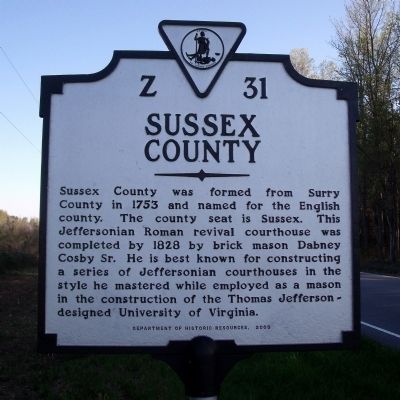
Sussex County Marker
RANKED BY RELEVANCE
| On Plank Road (Virginia Route 35) 0.5 miles north of Big Woods Road, on the right when traveling south. Reported missing. |
| Near Courthouse Road (Virginia Route 735) at Thornton Square. |
| On Sussex Drive (U.S. 301) 1.2 miles north of Moonlight Road, on the right when traveling north. |
| On South Crater Road (U.S. 301) 0.5 miles south of Johns Road, on the right when traveling south. |
| On Courtland Road (Virginia Route 35) 0.5 miles south of Log Road, on the right when traveling south. |
| On Comans Well Road (Virginia Route 642) at Tyus Lane, on the right when traveling west on Comans Well Road. |
| On General Mahone Highway (U.S. 460) at Skeet lane, on the right when traveling west on General Mahone Highway. |
| On South Main Street (U.S. 301) 0.1 miles south of Brunswick Avenue, on the right when traveling south. |
| On Courthouse Road (State Road 735) at Peters Bridge Road (State Road 631), on the right when traveling north on Courthouse Road. |
| On Princess Street east of North 19th Street, on the right when traveling east. |
| On General Mahone Highway (U.S. 460) 0.1 miles east of Cedar Lane, on the right when traveling east. |
| On Main Street at Southampton Parkway (U.S. 58), on the right when traveling south on Main Street. |
| On Rochelle Street (County Road T-611) at Main Street (Business U.S. 58), on the left when traveling north on Rochelle Street. |
| On John J Williams Highway (Delaware Route 24) 0.2 miles east of Rock Pile Way, on the right when traveling east. |
| On Pleasant Shade Drive (U.S. 58) west of Carter Road (Virginia Route 649), on the right when traveling west. |
| On Vaden Drive (Virginia Route 40) 0.1 miles west of Fitzgerald Street, on the right when traveling west. |
| On E. Railroad Avenue close to Main Street (Delaware Road 16), on the right when traveling south. |
| Near South Bedford Street (Business U.S. 9) north of Zoar Road, on the right when traveling south. Reported permanently removed. |
| On South Bedford Street (Bypass U.S. 9) at Zoar Road, on the right when traveling south on South Bedford Street. |
| On Sussex Drive (Virginia Route 40) 0.3 miles east of Flatfoot Road ( Route 626), on the left when traveling east. |
| Near South Main Street (U.S. 301) south of Spring Street, on the left when traveling south. |
| On Savannah Road 0.1 miles north of County Road 263, on the right when traveling south. |
| Near Elizabeth River Way at Poindexter Street. |
| On New Road at Lynn Road, on the right when traveling west on New Road. |
| On South State Street at East North Street, on the left when traveling south on South State Street. |
| On Dayett Mills Road south of Old Baltimore Pike, on the right when traveling south. |
| On West 3rd Street west of Shipcarpenter Street, on the right when traveling west. |
Thin black lines indicate changes in relevance. Between each pair of lines entries are ordered geographically but all have the same relevance.* Inflectional forms of words are their plurals, singulars, and possessives as well as gramatical tenses and similar variations.
Nov. 13, 2026
