By Dawn Bowen, July 3, 2008
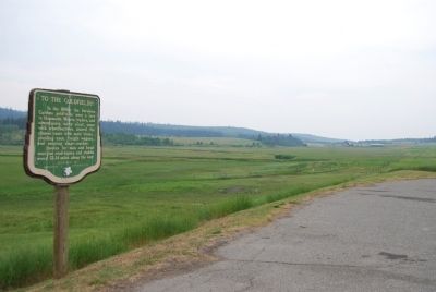
To the Goldfields! Marker
GEOGRAPHIC SORT Title Sort Marker Number Sort Marker Number Sort for Trails Publication Order Sort Publication Order Sort A Erected Year Sort Most Viewed Sort Most Recent-Interest Sort Most Recently Changed Sort SEE FAQ #33 FOR DESCRIPTIONS
On Provincial Highway 97 23.3 kilometers south of 150 Mile House, on the right when traveling south.
Near Barkerville Highway (Provincial Highway 26).
On Barkerville Highway (Provincial Highway 26) 1 kilometer south of Reduction Road, on the left when traveling south.
Near Barkerville Highway (Highway 26).
On Barkerville Highway (Provincial Highway 26).
On Kwah Road West 0.3 kilometers west of Stewart Lake Highway (British Columbia Highway 27), on the right when traveling west.
On Chilcotin-Bella Coola Highway (Provincial Highway 20) 8.2 kilometers east of Hanceville Cut Off Road, on the right when traveling east. Reported missing.
On Cariboo Highway (Provincial Highway 97) 1.1 kilometers south of Spur Road, on the right when traveling south.
On Front Street (Provincial Highway 97) at Carson Street, on the left when traveling north on Front Street.
Near Cariboo Highway (Provincial Highway 97) 2.2 kilometers south of Unity Road, on the left when traveling south. Reported missing.
On Southern Yellowhead Highway (Provincial Highway 5) 2.4 kilometers south of Bear Road, on the left when traveling south.
Near Yellowhead Highway (Provincial Highway 16) at British Columbia-Alberta boundary line, on the right when traveling west.
On Yellowhead Highway (Provincial Highway 16) 24.8 kilometers west of Icefields Parkway (Provincial Highway 93), on the right when traveling west.
On Yellowhead Highway (Provincial Highway 16) 24.8 kilometers west of Icefields Parkway (Provincial Highway 93), on the right when traveling west.
Paid Advertisement
On Yellowhead Highway (Provincial Highway 16) 24.8 kilometers west of Icefields Parkway (Provincial Highway 93), on the right when traveling west.
On Yellowhead Highway (Provincial Highway 16) 24.8 kilometers west of Icefields Parkway (Provincial Highway 93), on the right when traveling west.
On Yellowhead Highway (Provincial Highway 16) 24.8 kilometers west of Icefields Parkway (Provincial Highway 93), on the right when traveling west.
On Yellowhead Highway (Provincial Highway 16) 24.8 kilometers west of Icefields Parkway (Provincial Highway 93), on the right when traveling west.
On Yellowhead Highway (Provincial Highway 16) 24.8 kilometers west of Icefields Parkway (Provincial Highway 93), on the right when traveling west.
On Yellowhead Highway (Provincial Highway 16) 24.8 kilometers west of Icefields Parkway (Provincial Highway 93), on the right when traveling west.
Near Viewpoint Road 0.2 kilometers east of Kinney Lake Road, on the left when traveling east.
On Caine Drive, on the right when traveling north.
︽