43 entries match your criteria.
Entries Containing All of the Phrases «howard county» AND «missouri»
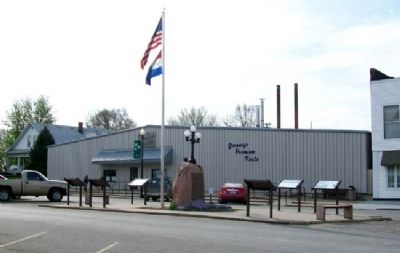
By William Fischer, Jr., April 11, 2011
City of Trails Marker
RANKED BY RELEVANCE
1 ► Missouri, Howard County, New Franklin — City of Trails —  |
| On Broadway, in the median. | |||
| 2 ► Missouri, Howard County, New Franklin — Franklin and New Franklin — |
| On Broadway, in the median. | |||
| 3 ► Missouri, Howard County, New Franklin — Franklin — Santa Fe National Historic Trail — |
| On Missouri Route 87 west of U.S. 40, on the right when traveling north. | |||
| 4 ► Missouri, Montgomery County, Danville — The Historic Boonslick Region — Missouri's Civil War — |
| On Missouri Route 161 at Boonslick Road, on the right when traveling east on Missouri Route 161. | |||
| 5 ► Missouri, Cooper County, Boonville — History of Boonville — |
| On West Spring Street. | |||
| 6 ► Missouri, Cooper County, Boonville — Cobblestone Street Park — Missouri's Civil War — |
| On East Water Street east of 4th Street, on the right when traveling west. | |||
| 7 ► Missouri, Cooper County, Boonville — Hannah Allison Cole — (1762 - 1843) — |
| On Morgan Street near Main Street (U.S. 40), on the left when traveling east. | |||
| 8 ► Missouri, Cooper County, Boonville — Affair at Rawlings Lane — Missouri's Civil War — |
| On South Street east of Nelson Street, on the left when traveling east. | |||
| 9 ► Missouri, Howard County, Glasgow, Chariton Township — Worlds First Large All-Steel Bridge — |
| On Water Street at Market Street, on the right when traveling south on Water Street. | |||
| 10 ► Missouri, Cooper County, Boonville — David Barton — 1783 - 1837 — |
| On Morgan Street near Main Street (U.S. 40), on the left when traveling east. | |||
| 11 ► Missouri, Cooper County, Boonville — Hannah Cole's Fort — |
| On Morgan Street, on the left when traveling east. | |||
| 12 ► Missouri, Clay County, Gladstone — 36 — Atkins-Johnson Farm — |
| Near Northeast Pleasant Valley Road east of Northeast Antioch Road, on the right when traveling east. | |||
| 13 ► Missouri, Howard County, Glasgow — Glasgow — |
| On Randolph Street (Highway 240) at Bridge Street, on the right when traveling east on Randolph Street. | |||
| 14 ► Missouri, Howard County, New Franklin — "Missouri Waltz" — by Lee Edgar "Jelly" Settle — |
| On Broadway, in the median. | |||
| 15 ► Missouri, Warren County, Warrenton — Daniel Boone — |
| On Market Street near Main Street, on the right when traveling south. | |||
| 16 ► Nebraska, Phelps County, Bertrand — Sarepta Gore Fly — |
| On B Road north of Local Road 748, on the left when traveling north. | |||
| 17 ► Missouri, Callaway County, Fulton — Fulton - 1824 — Boone's Lick Road — |
| On East 4th Street east of Court Street, on the left when traveling east. | |||
| 18 ► Missouri, Howard County, New Franklin — Franklin: Mother of the Santa Fe Trail — Artist: Harry Weber — Dedicated August 31, 2013 — |
| On Missouri Route 5 at Katy Trail, on the right when traveling south on Missouri Route 5. | |||
| 19 ► Missouri, Howard County, New Franklin — Josiah Gregg — July 19, 1806 to Feb. 25, 1850 — |
| Near Missouri Route 5 at Katy Trail, on the right when traveling south. | |||
| 20 ► Missouri, St. Charles County, Matson — Daniel Boone Judgment Tree Memorial — |
| On State Highway 94 north of Lucille Avenue, on the right when traveling north. | |||
| 21 ► Missouri, St. Louis, Downtown — St. Charles Rock Road — Boone's Lick Road — St. Louis — |
| On North Broadway south of Chestnut Street, on the right when traveling south. | |||
| 22 ► Missouri, Callaway County, Jefferson City — Bicentennial Monument — |
| On Katy Road (County Road 391) 0.6 miles north of Oilwell Road, on the right when traveling north. | |||
| 23 ► Missouri, Cape Girardeau County, Cape Girardeau, Cape Girardeau Township — St. James African Methodist Episcopal Church — Loving Out Loud — |
| On North Street at Rear North Middle Street, on the right when traveling west on North Street. | |||
| 24 ► Missouri, Howard County, Fayette — Fayette — |
| On North Church Street (State Highway 240) at East Davis Street, on the right when traveling north on North Church Street. | |||
| 25 ► Missouri, Howard County, New Franklin — Visit the Trail — Santa Fe National Historic Trail — |
| On Missouri Route 87 west of U.S. 40, on the right when traveling north. | |||
| 26 ► Missouri, Cooper County, Boonville — Old Trails National Highway Bridge — |
| On East Water Street 0.2 miles west of 8th Street, on the right when traveling west. | |||
| 27 ► Missouri, Cooper County, Boonville — The Civil War in Boonville — Missouri's Civil War — 1861-1865 — |
| On Main Street (U.S. 40) north of Vine Street, on the right when traveling north. | |||
| 28 ► Missouri, Howard County, New Franklin — The Boone's Lick Road — |
| On Missouri Route 87 west of U.S. 40, on the right when traveling north. | |||
| 29 ► Missouri, Moniteau County, California — Moniteau County Courthouse — |
| On Main Street (Missouri Route 87) east of High Street, on the left when traveling east. | |||
| 30 ► Missouri, Boone County, Centralia — The Civil War in Centralia — Missouri's Civil War — |
| On West Singleton Street at South Allen Street, on the right when traveling east on West Singleton Street. | |||
| 31 ► Missouri, Cooper County, Boonville — Skirmish at Vollrath Farm — Missouri's Civil War — 1861-1865 — |
| On Boonslick Drive south of Main Street ( Route B), on the right when traveling north. | |||
| 32 ► Missouri, Howard County, New Franklin — History of New Franklin — |
| Near South Howard Street. | |||
| 33 ► Missouri, Howard County, Petersburg — History in Boone's Lick Country — |
| Near Missouri Route 187. | |||
| 34 ► Missouri, Howard County, Petersburg — Settlement History of the Spring — |
| Near Missouri Route 187. | |||
| 35 ► Missouri, St. Charles County, O'Fallon — Early O'Fallon — the James H. Audrain Settlement — City of O'Fallon, Missouri: Founded in 1856 — |
| On Dames Park Drive at State Highway P, on the right when traveling north on Dames Park Drive. | |||
| 36 ► Missouri, Howard County, New Franklin — The Lewis and Clark Expedition Across Missouri — Lewis and Clark National Historic Trail — |
| On Missouri Route 87 west of U.S. 40, on the right when traveling north. | |||
| 37 ► Missouri, Montgomery County, High Hill — Lewiston - 1826 — Boone's Lick Road — |
| On Boone's Lick Road 0.5 miles east of Ellis Road, on the left when traveling east. | |||
| 38 ► Missouri, St. Charles County, St. Peters — Centennial Greenway - Heritage Crossing — |
| On Heritage Landing south of South St. Peters Parkway, on the right when traveling north. | |||
| 39 ► Texas, Howard County, Big Spring — Big Spring Hardware Company — |
| On South Main Street north of East 2nd Street, on the right when traveling north. | |||
| 40 ► Missouri, Howard County, New Franklin — Mildred (Millie) Cooper Brown — January 25, 1796 to October 10, 1869 — |
| Near Missouri Route 5 at Katy Trail, on the right when traveling south. | |||
| 41 ► Missouri, Boone County, Columbia — Boone County Bicentennial Monument — |
| On East Walnut Street east of North 7th Street, on the right when traveling west. | |||
| 42 ► Missouri, St. Charles County, Matson — The Boone Trace — Eastern Trailhead — ca. 1805 — |
| On Lucille Avenue west of Highway 94 ( Route 94), on the left when traveling west. | |||
| 43 ► Texas, Donley County, Clarendon — 5127 — Stockton P. Donley — County Named for Texas Confederate — 1821 — 1871 — |
| On Sully Street at East 3rd Street, on the right when traveling south on Sully Street. | |||
Thin black lines indicate changes in relevance. Between each pair of lines entries are ordered geographically but all have the same relevance.
* Inflectional forms of words are their plurals, singulars, and possessives as well as gramatical tenses and similar variations.
Nov. 13, 2026