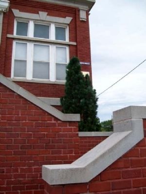
On Main Street at D Avenue (U.S. 54/400), on the right when traveling north on Main Street.
In honor of Kingman County residents
who died while serving their country
Kaufman, Burdette 1944 ·
Folkers, William 1918 ·
Brown, R. R. 1918 ·
Trent, Morgan 1949 ·
Surface, Charles R. 1944 ·
Harding, Ralph Warren 1943 · . . . — — Map (db m62634) WM
Before this became a great agricultural country its most important product was the buffalo. Millions of these animals grazed over the prairies, moving in great herds that stretched from horizon to horizon. They were life itself to the Plains . . . — — Map (db m62657) HM
On Main Street at D Avenue (U.S. 54/400), on the right when traveling north on Main Street.
With the faith and courage of
their forefathers who made
possible the freedom of these
United States
The Boy Scouts of America
dedicate this copy of the
Statue of Liberty as a pledge
of everlasting fidelity and
loyalty
The . . . — — Map (db m62635) HM
On Main Street south of 1st Avenue, on the left when traveling south.
This bell was purchased from the C and S Bell Co. by the City of Norwich in 1912 for use as a firebell. It was used until it was replaced by an electric siren in 1939. This monument was erected in 1985 by the Norwich Jaycees in honor of Norwichs . . . — — Map (db m62699) HM
On Old U.S. 81 0.3 miles south of Comanche Road, on the right when traveling south.
In 1825 President James Monroe approved a bill providing for the survey of the Santa Fe Trail from Missouri to New Mexico and the making of treaties to insure friendly relations with Indians along the route. A mile west of this sign, on Dry Turkey . . . — — Map (db m53059) HM
On 22nd Avenue 1.9 miles south of U.S. 56, on the left when traveling south.
When the Cherokee Trail group arrived at
the junction of their new wagon road from
Oklahoma and the Santa Fe Trail, the company
devised a post office, wrapped news of their
arrival and accomplishment in pasteboard and
oilcloth, then placed it . . . — — Map (db m250438) HM
On 22nd Avenue 1.9 miles south of U.S. 56, on the left when traveling south.
The Running Turkey Creek crossing and campsite were an oasis for early trail travelers and in use by the time of the earliest survey of the Santa Fe Trail in 1825. The campsite became the location of the Running Turkey Creek trading ranch, also . . . — — Map (db m250412) HM
On Main Street at Union Street, on the right when traveling south on Main Street.
Charles Wesley
Hark! The Herald Angels Sing
Glory To The New Born KingO For A Thousand Tongues To Sing
My Great Redeemer's Praise
John Wesley
"The World Is My Parish"
Swedish Methodist Church, 1881 - . . . — — Map (db m80604) HM
On Lincoln Street at the Välkommen Trail, on the right when traveling west on Lincoln Street.
THE FIRST SWEDISH AGRICULTURAL COMPANY was formed in Chicago in early 1868. The Company, with the assistance of Railroad Agents, purchased 13,160 acres of land here in the Smoky Valley, and sent Anders Olsson, A. Jacobson, L. N. Sandell, Magnus . . . — — Map (db m92299) HM
On Swensson Avenue at the Välkommen Trail, on the right when traveling west on Swensson Avenue.
Bethany College, located one block west, is a small, liberal-arts based college solidly rooted here in Lindsborg.
Established by Swedish Lutheran immigrants in 1881, Bethany is a college of the Evangelical Lutheran Church in America, owned and . . . — — Map (db m92293) HM
On Olsson Street at the Välkommen Trail, on the right when traveling west on Olsson Street.
To the plains and mountains of America's West came not only waves of pioneers but also immigrants directly from Europe. Swedish painter Birger Sandzén (1871-1954) arrived in Lindsborg at the age of 23 on September 4, 1894, to teach at Bethany . . . — — Map (db m92294) HM
On Lincoln Street at the Välkommen Trail, on the left when traveling west on Lincoln Street.
Emigrants from Östergötland, Sweden formed the Rose Hill Church northeast of Lindsborg in 1874 with J.A. Pihl as pastor. They were joined by fifty people who had left Bethany Lutheran Church. In 1876 the congregation built a church in town, only . . . — — Map (db m92298) HM
On Main Street (State Highway 4) at Lindsborg Street, on the left when traveling south on Main Street.
Anton Pearson was an immigrant from Lund, Skåne, in southern Sweden. He is best known for his woodcarvings of local Lindsborg and Smoky Valley characters depicted in everyday situations. Anton opened his studio in 1929. Today it continues to be a . . . — — Map (db m129427) HM
Handel's "Messiah" has been performed annually in Lindsborg since 1882. Dr. Carl Aaron Swensson, the founder of Bethany College and pastor at Bethany Lutheran Church, was introduced to it by Pastor Olof Olsson, a Lindsborg pioneer who had moved to . . . — — Map (db m95408) HM
On Olsson Street at the Välkommen Trail, on the left when traveling west on Olsson Street.
In 1908, Lindsborg presented a fertile time and place for the establishment of an English speaking Lutheran Church. Messiah Evangelical Lutheran Church, located two blocks west, was organized on January 15, 1909.
Following an organizational . . . — — Map (db m92295) HM
On Main Street at Lincoln Street, on the right when traveling north on Main Street.
Hello! Welcome to My World, a place where you can, like me, let your imagination run wild. Do you believe that good buildings die and go to heaven? If you do, welcome to my fantasy of Architectural Heaven. Please travel with me and our . . . — — Map (db m54089) HM
1872 Dam grant to Charles Johnson. First grist and saw mill
1887 Destroyed by fire
1889 Smoky Valley Roller Mill built by J. C. Bergsten
1890 Purchased by Theodore Teichgraber
1907-1927 Operated by Wm. Hagstrom
1934-1935 Reopened and . . . — — Map (db m54054) HM
On Mill Street west of 1st Street, on the right when traveling west.
1Lt. USAF who was shot down on April 2, 1970 while on a mission over South Vietnam
He will be remembered with pride by all who knew him. — — Map (db m80660) WM
On Lindsborg Street east of Main Street (Kansas Highway 4), on the right when traveling east.
The Swedish Pavilion, the largest building to the south, was originally the Swedish exposition building at the 1904 World's Fair in St. Louis, Missouri. Modeled after traditional Swedish manor houses, the Pavilion was prefabricated in Sweden, . . . — — Map (db m95406) HM
On Mill Street west of 1st Street, on the left when traveling west.
Built 1906
has been placed on the
National Register of
Historic Places
by the United States
Department of the Interior
Reg.[istered] 11-15-2005 — — Map (db m80658) HM
The Terrible Swedes
In 1902, Dr. Carl A. Swensson, president of Bethany College, hired Bennie Owen as coach of the Bethany Swedes football team. He developed an awesome team that demolished all opponents, including the University of Oklahoma . . . — — Map (db m95415) HM
Dedicated in perpetual memory to those who served and to the valiants who gave their lives for the United States of America in its wars.
World War I
Killed in Action
Emil Pinkall
Died in Service
Claude Pratt • Elmer Holmgren
World . . . — — Map (db m81795) WM
On Main Street near Lincoln Street, on the left when traveling south.
The story of Lucia, the symbol of light amid the darkness for Sweden, has many different versions. Although her feast day is celebrated on December 13th in Sweden, Lindsborg celebrates Lucia Day on the second Saturday in December. Lucia was born . . . — — Map (db m54082) HM
The
Womans Missionary Society
of
The Lutheran Augustana Synod was
organized at this site June 6-1892
which was then the home of
Dr. C.A. Swensson
Founder and President of Bethany College
with
Fifty Charter Members present . . . — — Map (db m57008) HM
On Washington Street at 1st Street, on the right when traveling south on Washington Street.
These mill stones were used in Marquette's first mill built in 1874 on the bank of the Smoky Hill River by H. S. Bacon, the town founder. The mill was the first industry and the beginning of Marquette - founded February 9th, 1874. This is a . . . — — Map (db m95299) HM
On Washington Street north of 3rd Street, on the right when traveling north.
Organized in 1880. A school was built 9 mil. NW of Marquette. In 1906 a new school was built and closed in 1948. Range was donated by John Hughes and then moved to Marquette. Plaque by Etta Hockstrasser Memorial in memory of Hughes' who attended . . . — — Map (db m95291) HM
On Washington Street south of 5th Street, on the right when traveling south.
The people of
Marquette
dedicate this memorial
to the men and women
of this community
who served our country
—————————
The Walkway of Honor
for those who have
served our . . . — — Map (db m163629) WM
On Marlin Street at Walnut Street, on the left when traveling west on Marlin Street.
In grateful tribute to the supreme sacrifice of our comrades
Co. D, 2nd Kans. Inf.
James C. Marymee • Donald E. McKellar • Virgil Berkebile • Rosser C. Fraser • Earl J. Lathwell • Sidney P. Fisher • Ralph Branton • Andrew Malm • Lester L. Reid • . . . — — Map (db m80708) WM
On Interstate 135 at milepost 68, on the left when traveling north.
Federal Interstate Highway I-35 has been declared
as a living memorial honoring the 35th Infantry
Division by the Legislature and Governor by the
provisions of K.S.A. 68-1013, enacted June 30, 1963.
The 35th Infantry Division was composed . . . — — Map (db m223507) HM WM
On Main Street (Business U.S. 81) at Sutherland Street, on the left when traveling south on Main Street.
has been placed on the
National Register
of Historic Places
by the United States
Department of the Interior
Reg.[istered] 3-17-1972 — — Map (db m80664) HM
On Main Street at Marlin Street, on the left when traveling north on Main Street.
On this site was located the McPherson Town Company Building built in 1873 at a cost of $1,250.00. It was the headquarters of all government and civic activity for the little village as a court house, city hall, school house, church meeting place, . . . — — Map (db m80710) HM
On Marlin Street at Walnut Street, on the left when traveling west on Marlin Street.
In honored remembrance of
all American Prisoners of War
and those still Missing in Action
Dedicated on Veteran's Day
November 11, 2004 — — Map (db m80704) WM
On 13 May 2003, Kansas Governor Kathleen Sebelius, proclaimed the Eisenhower Interstate Highway System in Kansas, as the "Purple Heart Trail." This trail memorializes those heroic service members who have had the Purple Heart medal bestowed on . . . — — Map (db m223497) HM WM
On Interstate 135 4 miles south of Exit 72 (Interstate 135), on the left when traveling south.
On 3 September 1846, the Mormon Battalion camped near here on its way to fight in the war with Mexico. This small army of more than 500 men and officers had been recruited at Council Bluffs, Iowa, from among the Mormon pioneers (members of The . . . — — Map (db m80663) HM
On Aztec Lane 0.2 miles east of 18th Avenue, on the left when traveling west.
Anabaptism originated in Switzerland in 1525 during the Reformation under the leadership of Conrad Grebel, Felix Manz, Georg Blaurock, and others. Most Anabaptists were later named "Mennonites" in recognition of the leadership of Menno . . . — — Map (db m57138) HM
On Aztec Lane 0.2 miles east of 18th Avenue, on the left when traveling west.
The Memorial symbolizes our heritage of the Christian faith and expresses gratitude to God for His faithful leading.
The Pillar directs us Godward and suggests a tower of strength.
The Globe symbolizes the world populated by . . . — — Map (db m57139) HM
On Aztec Lane 0.2 miles east of 19th Avenue, on the left when traveling west.
The parent of this tree is the centuries old oak on the island of Chortitza near Zaparozhye, Ukraine, on the site of a Mennonite settlement dating from 1789. Acorns were gathered on the 1997 Mennonite Heritage Tour led by Harley Stucky and Oswald . . . — — Map (db m57029) HM
On Aztec Lane 0.2 miles east of 18th Avenue, on the left when traveling west.
Elder Jacob Stucky and Rev. Jacob D. Goering laid the foundation for orderly church life that centered in the Immigrant House and later in the Hopefield Church, Moundridge, Kansas. After some time the group began to disperse. Today, . . . — — Map (db m57144) HM
On 18th Avenue 0.1 miles north of Arrowhead Road, on the right when traveling north.
of Kotosufka, Volhynia, Russia whose members left Russia in search of religious liberty, sixty-two families sailing on the "City of Richmond," landing in New York September 3, 1874, and in October arriving on this Quarter Sectin (S.W. Quarter . . . — — Map (db m57149) HM
On Aztec Lane 0.2 miles east of 18th Avenue, on the left when traveling west.
This Centennial Memorial, erected in gratitude to God, commemorates the coming to America of the Swiss-German Mennonites in the Fall of 1874 from Volhynia, a former Polish province, in the present Russian Ukraine. It symbolizes the Christian . . . — — Map (db m57109) HM
On Aztec Lane 0.2 miles east of 18th Avenue, on the left when traveling west.
The Mennonites came here because of their Anabaptist vision of the Christian faith and established Christian communities. Some wept as they said farewell to Russia and later, as they saw the endless miles of raw prairie, and encountered prairie . . . — — Map (db m57145) HM
On Aztec Lane 0.2 miles east of 18th Avenue, on the left when traveling west.
Seventy-three families, the Mennonite Congregation of Kotosufka, left Russia on Aug. 6, 1874, under the leadership of Elder Jacob Stucky and Rev. Jacob D. Goering, at Liverpool, England. They embarked on the "City of Richmond," arriving in . . . — — Map (db m57132) HM
On Aztec Lane 0.2 miles east of 18th Avenue, on the left when traveling west.
The Mennonites brought Turkey Hard Red Winter Wheat. The seeds were carefully selected, often kernel by kernel, frequently by grandparents and sometimes with the help of children. Many Mennonite families, here and in surrounding communities, . . . — — Map (db m57142) HM
On Smoky Valley Road at 27th Avenue, on the left when traveling west on Smoky Valley Road.
In honor of
Robert G. Manning
whose hardware store and civic reliability served this community from 1915 to 1958. It is with much respect, gratitude and affection that we acknowledge his intellect; his integrity; his independent spirit and . . . — — Map (db m80639) HM
On Broadway Avenue (Kansas Route 156) at Maple Street, on the right when traveling east on Broadway Avenue.
Burdett is the boyhood home of Dr. Clyde Tombaugh, discoverer of the planet Pluto. Born in Illinois in 1906, he grew up on a farm northwest of here and was graduated from Burdett High School in 1925.
During his youth, Tombaugh explored the . . . — — Map (db m160245) HM
On North Road 0.7 miles west of U.S. 156, on the right when traveling west.
Confrontation Ridge, April 14, 1867 - The Army
History happened here. During the winter of 1866-1867, false rumors spread fears of a major uprising of Plains Indians. Gen. Winfield S. Hancock, new department commander who had no . . . — — Map (db m218039) HM
For travelers arriving on the Santa Fe Trail, Fort Larned must have looked more like a small town than a fortified place. In the early years, about 150 soldiers lived here in the summers. During the Indian Wars, as many as 400 troops called Fort . . . — — Map (db m40157) HM
For travelers arriving on the Santa Fe Trail, Fort Larned must have looked more like a small town than a fortified place. In the early years, about 150 soldiers lived here in the summers. During the Indian Wars, as many as 400 troops called Fort . . . — — Map (db m95839) HM
After you cross this bridge over the Pawnee Fork River, you will be able to walk directly into an 1860s Army post. Today no wall of sharpened upright logs surrounds Fort Larned because the Army never put such a wall or other type of stockade here . . . — — Map (db m40158) HM
On State Highway 156 0.4 miles east of 180th Avenue, on the right when traveling east.
Established Oct. 22, 1859 and known as Camp on the Pawnee Fork. Name changed to Camp Alert Feb. 1, 1860, and to Fort Larned, June 1, 1860 in honor of Col. B. F. Larned, Paymaster General of the United States Army. Abandoned in 1878, and sold Mar. . . . — — Map (db m95812) HM
Dedicated to the Soldiers who died while serving their country at Fort Larned, Kansas (1859-1878). In 1888, remains were relocated from the post cemetery to Fort Leavenworth National Cemetery, Section B, where they were not identified. Among the . . . — — Map (db m40162) HM
The cavalry company are used entirely for escorting the mails between this post and Fort Dodge 55 miles west and Fort Zarah 33 miles east. The mails come and depart twice a week.
William Forwood, captain, Fort Larned post surgeon, . . . — — Map (db m95846) HM
It all started over trade that promised great profits. Once Mexico won independence from Spain in 1821 Americans were welcomed and encouraged to trade. Trade quickly flourished, creating opportunities and profits linking the economies of Missouri . . . — — Map (db m40127) HM
Original monument erected in 1867 by soldiers in the Third Infantry, to honor fellow soldiers who lost their lives at the fort. After Fort Larned was closed in 1878, this monument was moved to the Larned [city] Cemetery in 1887. In 2009 it was . . . — — Map (db m40180) HM
In 1868 post surgeon William H. Forwood reported on the condition of the drinking water:
The water is brought by wagon from the creek and placed in barrels in the yards... There are several wells here from 15 to 40 feet deep, but the water in . . . — — Map (db m40160) HM
On U.S. 56 at 3rd Street, on the left when traveling east on U.S. 56.
Camp Criley was established in 1872 as a supply station for workmen building the Santa Fe Railroad, name changed to Garfield in 1873 by pioneers settling here.
This park was planned in 1880 and the first trees planted in April 1882. The Band . . . — — Map (db m55283) HM
On State Highway 156, on the left when traveling west.
The Kanza Indians left their homelands east of the Mississippi River during the 1600s. They settled into what is today the northeast part of Kansas. Waterways provided sustenance for their people and were part of the tribe's culture. The success . . . — — Map (db m95883) HM
On U.S. 56 at milepost 181, on the left when traveling east.
This 280 acres was collateral for the nation's first Federal Land Bank loan made on April 10, 1917 to farmer-stockman A. L. Stockwell. In those days, farmers and ranchers found credit hard to come by. If available, it was often very expensive . . . . . . — — Map (db m55285) HM
On Fort Larned Avenue at College Street, on the left when traveling east on Fort Larned Avenue.
[Veteran Honor Rolls]
Indian Wars • Civil War • Spanish American War
World War I • World War II • Korean War and After
Vietnam War and Era • Modern Era
[Memorial Benches, Stones, and Pavers] — — Map (db m95783) WM
On State Highway 19, on the right when traveling south.
The desire for home ownership and self employment caused many people to move from east to west in the early history of our country. Pleasant Valley Townships No. 1 and No. 2, Pawnee County, Kansas, were no exception. People of numerous religious . . . — — Map (db m40251) HM
On Fort Larned Avenue at College Street, on the left when traveling east on Fort Larned Avenue.
This jagged and twisted metal is a piece of the World Trade Center in New York City which was attacked by terrorists on September 11, 2001. It was part of a perimeter column which came from the south tower and was located between the 34th and . . . — — Map (db m95792) WM
On State Highway 156, on the left when traveling west.
The Mormon Battalion camped here on 8 September 1846. The more than 500 volunteers in this little army were enlisted to fight in the war with Mexico. They had been recruited from among the Mormon pioneers (members of The Church of Jesus Christ of . . . — — Map (db m95885) HM
On 8th Street 1 mile west of Morris Avenue, on the right when traveling west.
In memory of
those from Pawnee County
that sacrificed their lives to
protect their country, this
land of the free—home of the brave
Spanish-American War
Elmer R. Payne 1898 • Joseph R. McBride 1898
World War I
Tony A. . . . — — Map (db m95797) WM
On U.S. 281 at NE 40th Street, on the left when traveling north on U.S. 281.
First Group to train at PAAB
Activated April 1, 1941
Deactivated October 22, 1946
Served with Distinction
From Bases In
——————————
Puerto Rico • Panama • Guatemala • Ecuador . . . — — Map (db m65077) WM
301 entries matched your criteria. Entries 101 through 200 are listed above. ⊲ Previous 100 — Next 100 ⊳