150 entries match your criteria. Entries 101 through 150 are listed.⊲ Previous 100
Virginia, The City of Alexandria Historical Markers
By Devry Becker Jones (CC0), March 17, 2018
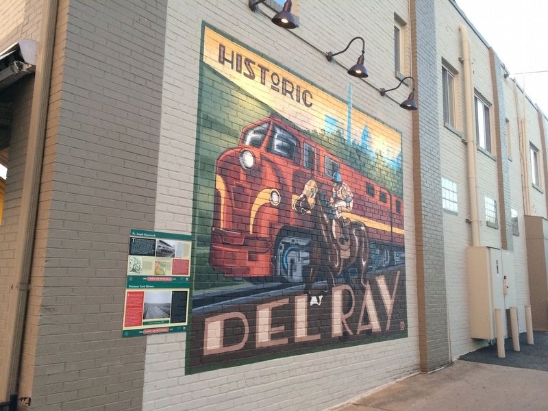
Potomac Yard History Marker
| 101 ► Virginia, Alexandria, Potomac West — Potomac Yard History — Town of Potomac — 1908 - 1929 — |
| On Mount Vernon Avenue south of East Uhler Avenue, on the right when traveling north. | |||
| 102 ► Virginia, Alexandria, Potomac West — Rosemont — City of Alexandia, Est. 1749 — Alexandria Heritage Trail — |
| On Commonwealth Avenue at West Rosemont Avenue, on the right when traveling south on Commonwealth Avenue. | |||
| 103 ► Virginia, Alexandria, Potomac West — Ruby Tucker — (1932 - 2009) — |
| On Richmond Highway (U.S. 1) just north of Lynhaven Drive, on the right when traveling south. | |||
| 104 ► Virginia, Alexandria, Potomac West — Schools in the Town of Potomac — Town of Potomac — 1908 - 1929 — |
| On Mount Vernon Avenue at Stewart Avenue, on the left when traveling north on Mount Vernon Avenue. | |||
| 105 ► Virginia, Alexandria, Potomac West — St. Asaph Racetrack — Town of Potomac — 1908 - 1929 — |
| On Mount Vernon Avenue south of East Uhler Avenue, on the right when traveling north. | |||
| 106 ► Virginia, Alexandria, Potomac West — St. Asaph Racetrack — Town of Potomac — 1908 - 1929 — |
| On East Oxford Avenue at Dewitt Avenue, on the right when traveling west on East Oxford Avenue. | |||
| 107 ► Virginia, Alexandria, Potomac West — The Alexandria Almshouse — 1908 Town of Potomac 1929 — |
| On East Monroe Avenue at Leslie Avenue, on the right when traveling west on East Monroe Avenue. | |||
| 108 ► Virginia, Alexandria, Potomac West — The Bluemont Line — |
| On East Raymond Avenue, 0.1 miles east of DeWitt Avenue, on the right when traveling west. | |||
| 109 ► Virginia, Alexandria, Potomac West — The Electric Railway — Town of Potomac — 1908 - 1929 — |
| On Clyde Avenue at Commonwealth Avenue, on the left when traveling north on Clyde Avenue. | |||
| 110 ► Virginia, Alexandria, Potomac West — The Town of Potomac / Mount Vernon Avenue — Town of Potomac — 1908 - 1929 — |
| On Mount Vernon Avenue at East Oxford Avenue, on the right when traveling north on Mount Vernon Avenue. | |||
| 111 ► Virginia, Alexandria, Potomac West — The Triangle Site — Town of Potomac — 1908 - 1929 — |
| On Mount Vernon Avenue north of Commonwealth Avenue, on the right when traveling north. | |||
| 112 ► Virginia, Alexandria, Potomac West — World War I Memorial — |
| On King Street (Virginia Route 7) at Callahan Drive, on the left when traveling west on King Street. | |||
| 113 ► Virginia, Alexandria, Potomac Yard — Building Potomac Yard — City of Alexandria Est. 1749 — Potomac Yard — |
| On Potomac Avenue at Swann Avenue, on the right when traveling north on Potomac Avenue. | |||
| 114 ► Virginia, Alexandria, Potomac Yard — Crossroads of Transportation — City of Alexandria Est. 1749 — Potomac Yard — |
| On Potomac Avenue east of Main Line Boulevard, on the right when traveling north. | |||
| 115 ► Virginia, Alexandria, Potomac Yard — Potomac Yard in Transition — City of Alexandria Est. 1749 — Potomac Yard — |
| On Potomac Avenue at Main Line Boulevard, on the right when traveling east on Potomac Avenue. | |||
| 116 ► Virginia, Alexandria, Potomac Yard — The Alexanders & Agriculture — City of Alexandria Est. 1749 — Potomac Yard — |
| On Potomac Avenue north of East Glebe Road, on the right when traveling north. | |||
| 117 ► Virginia, Alexandria, Potomac Yard — 4 — The People of Potomac Yard — City of Alexandria Est. 1749 — |
| On Potomac Avenue at East Custis Avenue, on the right on Potomac Avenue. | |||
| 118 ► Virginia, Alexandria, Potomac Yard — The Rail Yard Hump — City of Alexandria Est. 1749 — Potomac Yard — |
| On Main Line Boulevard at Potomac Avenue, on the right when traveling north on Main Line Boulevard. | |||
| 119 ► Virginia, Alexandria, Potomac Yard — Virginia's First Highways — City of Alexandria Est. 1749 — Potomac Yard — |
| On Potomac Avenue north of East Glebe Road, on the right when traveling north. | |||
| 120 ► Virginia, Alexandria, Rosemont — Fun in the Forest — Alexandria Heritage Trail — |
| Near Chinquapin Drive, 0.2 miles south of King Street (Virginia Route 7), on the right when traveling north. | |||
| 121 ► Virginia, Alexandria, Seminary Hill — "The Fort" and "Seminary" Community — Civil War to Civil Rights — City of Alexandria, est. 1749 — |
| On West Braddock Road, 0.2 miles west of Marlboro Drive, on the right when traveling west. | |||
| 122 ► Virginia, Alexandria, Seminary Hill — African Americans and the Civil War — Fleeing, Fighting and Working for Freedom — City of Alexandria, est. 1749 — |
| On West Braddock Road, 0.2 miles west of Marlboro Drive, on the right when traveling west. | |||
| 123 ► Virginia, Alexandria, Seminary Hill — Gerald R. Ford — Thirty-Eighth President of the United States — Alexandria Resident 1951-1974 — |
| Near Janneys Lane (Virginia Route 420) at North Quaker Lane, on the right when traveling east. | |||
| 124 ► Virginia, Alexandria, Seminary Hill — Jackson Cemetery — City of Alexandria Est. 1749 — |
| Near West Braddock Road, 0.2 miles west of Marlboro Drive, on the right when traveling west. | |||
| 125 ► Virginia, Alexandria, Seminary Hill — Oakland Baptist Church Cemetery — City of Alexandria Est. 1749 — |
| Near West Braddock Road east of North Howard Street, on the right when traveling west. | |||
| 126 ► Virginia, Alexandria, Seminary Hill — Outlying Gun Battery — City of Alexandria, Virginia — |
| Near West Braddock Road, 0.1 miles west of Marlboro Drive, on the right when traveling west. | |||
| 127 ► Virginia, Alexandria, Seminary Hill — Phoenix Mill — Alexandria Heritage Trail — City of Alexandria, est. 1749 — |
| On Wheeler Avenue west of Duke Street (Virginia Route 236), on the left when traveling west. | |||
| 128 ► Virginia, Alexandria, Seminary Hill — Powder Magazine and Filling Room — |
| Near West Braddock Road, on the right when traveling west. | |||
| 129 ► Virginia, Alexandria, Seminary Hill — Profile of Fort — |
| Near West Braddock Road, on the right when traveling west. | |||
| 130 ► Virginia, Alexandria, Seminary Hill — Rifle Trench — |
| Near West Braddock Road, on the right when traveling west. | |||
| 131 ► Virginia, Alexandria, Seminary Hill — Schuyler Hamilton Jones — |
| Near Wheeler Avenue south of Duke Street (Virginia Route 236), on the left when traveling south. | |||
| 132 ► Virginia, Alexandria, Seminary Hill — Southwest Bastion — City of Alexandria, Virginia |
| Near West Braddock Road, 0.2 miles west of Marlboro Drive, on the right when traveling west. Reported damaged. | |||
| 133 ► Virginia, Alexandria, Seminary Hill — The Oakland Baptist Church — City of Alexandria Est. 1749 — |
| Near West Braddock Road, 0.1 miles west of Marlboro Drive, on the right when traveling west. | |||
| 134 ► Virginia, Alexandria, Seminary Hill — Within Its Walls — A Foundation for Education and Opportunity — |
| Near West Braddock Road, 0.1 miles east of North Howard Street, on the left when traveling east. | |||
| 135 ► Virginia, Alexandria, Southwest Quadrant — 1323 Duke Street – From Slavery to Freedom and Service — Alexandria Heritage Trail — |
| On West Street at Duke Street (Virginia Route 236) on West Street. | |||
| 136 ► Virginia, Alexandria, Southwest Quadrant — Brick Making on Broomilaw Point — ca. 1882-1919 — City of Alexandria, est. 1749 — |
| On Thornton Way west of George Washington Parkway (Virginia Route 400), on the right when traveling west. | |||
| 137 ► Virginia, Alexandria, Southwest Quadrant — Contrabands and Freedmen Cemetery Memorial — |
| On South Washington Street south of Church Street, on the right when traveling south. | |||
| 138 ► Virginia, Alexandria, Southwest Quadrant — Contrabands and Freedmen Cemetery Memorial — |
| On Church Street at South Columbus Street when traveling north on Church Street. | |||
| 139 ► Virginia, Alexandria, Southwest Quadrant — Hooff's Run Bridge — Alexandria Heritage Trail — |
| On Jamieson Avenue at Daingerfield Road, on the right when traveling west on Jamieson Avenue. | |||
| 140 ► Virginia, Alexandria, Southwest Quadrant — In Memory of Ronald F. Kirby — Born: 1944 Adelaide, Australia Died: 2013 Alexandria, Virginia — City of Alexandria, Virginia — |
| On South Washington Street, 0.1 miles south of Church Street, on the right when traveling north. | |||
| 141 ► Virginia, Alexandria, Southwest Quadrant — The West End — Alexandria Heritage Trail — |
| Near Jamieson Avenue at Daingerfield Road, on the right when traveling west. | |||
| 142 ► Virginia, Alexandria, Taylor Run — A Chinquapin House — Alexandria Heritage Trail |
| On Chinquapin Drive, 0.2 miles south of King Street (Virginia Route 7), on the right when traveling north. Reported damaged. | |||
| 143 ► Virginia, Alexandria, Taylor Run — A Native American Village — Alexandria Heritage Trail — |
| Near Francis Hammond Parkway, 0.2 miles east of Key Drive, on the right when traveling east. | |||
| 144 ► Virginia, Alexandria, Taylor Run — Chinquapin Trek — Alexandria Heritage Trail — |
| On Chinquapin Drive, 0.1 miles south of King Street (Virginia Route 7), on the right when traveling north. | |||
| 145 ► Virginia, Alexandria, Taylor Run — Life of a Creek — Alexandria Heritage Trail — |
| Near Chinquapin Drive, 0.3 miles south of King Street (Virginia Route 7), on the right when traveling north. | |||
| 146 ► Virginia, Alexandria, Taylor Run — Life of a Forest — Alexandria Heritage Trail — |
| Near Francis Hammond Parkway just south of Maple Hill Place, on the right when traveling south. | |||
| 147 ► Virginia, Alexandria, Taylor Run — Listen for Chipmunks — Alexandria Heritage Trail — |
| Near Roan Lane, 0.1 miles east of Key Drive, on the right when traveling east. | |||
| 148 ► Virginia, Alexandria, Taylor Run — Mills and Molassas — Alexandria Heritage Trail — |
| Near Chinquapin Drive, 0.3 miles south of King Street (Virginia Route 7), on the right when traveling north. | |||
| 149 ► Virginia, Alexandria, Taylor Run — The Bloxham Cemetery: Portal to the Past — Alexandria Heritage Trail — City of Alexandria, est. 1749 — |
| On Business Center Drive east of Witter Drive, on the left when traveling north. | |||
| 150 ► Virginia, Alexandria, Taylor Run — The Bloxham Family Cemetery — Alexandria Heritage Trail — City of Alexandria, est. 1749 — |
| On Business Center Drive south of Witter Drive, on the left when traveling north. | |||
150 entries matched your criteria. Entries 101 through 150 are listed above. ⊲ Previous 100