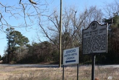
Bishop Francis Asbury stopped in this region in 1801 and 1803. About 1811, a congregation was organized and by 1815 Jericho Meeting House was standing on land given by Jacob Felkel. The present building there was apparently erected before 1850. A . . . — — Map (db m26875) HM
This is the original site of Mt. Lebanon Lutheran Church, organized January 13, 1844, as an extension of the St. Matthew's Church, Creston. Later, Mt. Lebanon Church moved to Cameron about 2 miles NW, dedicated its new building in 1917, and was . . . — — Map (db m27239) HM
Shady Grove Methodist Church was an outgrowth of Tabernacle Church, the parent Methodist body of this area. It was built in the early 1800s on land of Adam Holman, has a framework of hewn logs held together with wooden pegs, and has been . . . — — Map (db m26201) HM
This African Methodist Episcopal (AME) congregation organized in 1880 when five trustees acquired one acre of land at this site. The first church was a simple wood frame building. It was replaced by a more substantial wood structure, which had a . . . — — Map (db m292417) HM
In 1737-38, the elder Rev. John U. Giessendanner
from Orangeburg began Lutheran work in this
area; this was continued by his nephew until 1749.
By the 1760s, St. Matthew's Lutheran Church near
here was in use. A later building erected at . . . — — Map (db m26240) HM
St. Matthew's Parish was established by the S.C. Colonial Assembly between 1765 and 1768. The first of four church buildings was erected in Amelia Township c. 1765. The parish church was incorporated by the S.C. General Assembly in 1788 as the . . . — — Map (db m237357) HM
Sandy Run Church. This Lutheran church, one of the oldest in the state, is thought to have been organized ca.1765. By 1774, the Rev. Lewis Hochheimer was minister here. The church was incorporated in 1788 as "The German Lutheran Church of . . . — — Map (db m28827) HM
Lutheran and Reformed (Calvinistic) Congregations were worshiping in a church three miles north of this site prior to the year 1751. The church was incorporated in 1788 under the name German Lutheran Church of Salem on Sandy Run but later came to . . . — — Map (db m28386) HM
This stream was originally called Savannah Hunt, but German-speaking settlers about 1740 corrupted the first word and Savany Hunt became the permanent name. — — Map (db m264926) HM
The Good Hope Picnic, a celebration of the end of the planting season, is the oldest African-American event in the Lone Star community. Founded in August 1915 by farmers to market their produce and held on the second Friday in August, it has . . . — — Map (db m27879) HM
(side 1)
In 1841, St. Matthews Lutheran Church (5 mi. W) directed Rev. J.P. Margart to begin holding services in the nearby Pine Grove community. On September 27, 1847, congregants
formally organized as Pine Grove Lutheran Church. They . . . — — Map (db m220281) HM
Bethel A.M.E. Church was established in 1865 and held its early services under a brush arbor. Bethel was the first A.M.E. Church in Lewisville (now St. Matthews). Trustees Robin Amaker, Jack Dantzler, and Frank Keitt purchased land from Jacob G. . . . — — Map (db m292419) HM
First settled in 1704, this region by 1733 included Amelia and lower Saxe Gotha townships. In 1765 much of it was made part of the new St. Matthew's Parish and was so named until 1865. Efforts in 1890 and 1896 led to an act signed on Feb. 14, 1908 . . . — — Map (db m26057) HM
George Sterling was granted 570 acres of land here on March 14, 1704. During the lifetime of his daughter, Mary Sterling Heatly Russell, the plantation was a stopping place for Indians and travelers on the Cherokee Path. The Rev. John . . . — — Map (db m27218) HM
Ca. 1699 D. 1754
Mary Sterling Heatly
Russell Chapter
Honoring a pioneer woman
Mother of first white child
Born in
Calhoun - Orangeburgh Area — — Map (db m27215) HM
Governor of Georgia, 1777
A stern Revolutionary patriot
Born at Berchtesgaden, Austria in 1726
Brutally murdered by Tories
about 1782 near this spot — — Map (db m51711) HM
In 1954, this became the new site of John Ford High School, a segregated high school for African Americans. Previously known as St. Matthews Colored School and located on Herlong Ave., it was renamed for longtime principal John Andrew Ford . . . — — Map (db m292421) HM
The first church built by African Americans at Fort Motte grew out of services held by slaves at nearby Bellville, Goshen, Lang Syne, and Oakland plantations. It was formally organized in 1867 by Caleb Bartley, Israel Cheeseborough, Cudjo . . . — — Map (db m26789) HM
Organized in 1870 by freed slaves, this Baptist congregation is said to have first met in a brush arbor before temporarily worshipping in the balcony of nearby Buckhead Baptist Church, the nearby disbanded congregation of their former . . . — — Map (db m292422) HM
In Grateful Appreciation of the Services of the Patriots of Calhoun County 1775 - 1781
Gov. John Adams Treutlan •
Col. Wm. Thompson •
Maj. Lewis Colson •
Maj. Jacob Geiger •
Capt. Jacob Rumph •
Com. Alexander Gillam •
Capt. . . . — — Map (db m51702) WM
Burial place of Lt. Col. Olin M. Dantzler, C.S.A. Appointed Brigadier General 1 June 1864 Defender of Charleston, SC and Petersburg, VA His recorded notes to General P.G.T. Beauregard led to the location of the submarine H.L. Hunley in 1995 Killed . . . — — Map (db m134424) HM
In 1950, West End Calhoun County Library opened in a rented 4-room building off Calhoun Road to serve Black residents of Calhoun County. It was organized by local African Americans, who sought Calhoun County Co. Public Library (CCPL) support to . . . — — Map (db m292420) HM
SC Gen. Assembly incorp. this Lutheran church 17 Dec. 1794. Frederick Josephus Wallern served as 1st pastor. Today's church, dedicated 1936 is the 3rd building. — — Map (db m21507) HM
(Front text) Eastover, so named for being “east and over” from Columbia, was a small rural community of the mid-19th century that grew into a town after the Wilmington, Columbia, & Augusta RR completed its line through this area . . . — — Map (db m37364) HM
(Front text)
This plantation on the Wateree River features a remarkable Italianate Revival house built in 1852-54. Designed by Charleston architects Edward C. Jones and Francis D. Lee, it was built for Matthew Richard Singleton (1817-1854) . . . — — Map (db m33260) HM
This church, organized by 1835, met first in a brush arbor 1 ½ mi. N., then constructed a sanctuary on this site shortly thereafter. Its first pastor was Rev. Anderson Burns, and its original trustees were Joseph and Robert Collins, Barnes . . . — — Map (db m29316) HM
By August of 1780, British garrisons had been stationed at Camden, Orangeburg, and Ninety-Six. Lieutenant General Charles, Lord Cornwallis (image below) and the British forces under his command had defeated the patriot forces in Charleston and . . . — — Map (db m283073) HM
General Nathanael Greene
A Rhode Island merchant with virtually no military experience, Greene became one of General George Washington's most trusted leaders. Understanding how critical supplies and logistics were to the war effort, Greene . . . — — Map (db m283068) HM
John McCord began operating a ferry in 1755 near the location where you are now standing. An immigrant from Ireland, McCord started out trading with the Catawba Tribe. His business was successful and he was soon able to purchase land near the . . . — — Map (db m283071) HM
When travellers heading south had crossed over the Congaree River via McCord's Ferry, they would then follow this road (today's Bates Ferry Trail) past the nearby Mt. Joseph Plantation. In 1781, the plantation had become the home of Rebecca . . . — — Map (db m283063) HM
The wood of mature, old-growth bald cypress is naturally resistant to rot from moisture and insects, which made these trees highly desirable and profitable to lumber companies. From 1899 until 1914, loggers from Francis Beidler's Santee River . . . — — Map (db m299493) HM
The Harriet Barber House, the home of
Reverend Samuel Barber and his wife
Harriet McPherson Barber, is significant
for its association with the South Carolina
Land Commission during the late nineteenth
century. Samuel Barber purchased a . . . — — Map (db m38823) HM
In 1872 Samuel Barber (d. 1891) and his wife Harriet (d. 1899), both former slaves, bought 42½ acres here from the S.C. Land Commission, established in 1869 to give freedmen and freedwomen the opportunity to own land. Barber, a well-digger as a . . . — — Map (db m38083) HM
This rural community grew up around the plantation of John Hopkins (1739-1775). Hopkins, a native of Virginia, settled here in 1764. A surveyor and planter, he was later a delegate to the First Provincial Congress of 1775. Between 1836 and 1842, . . . — — Map (db m37547) HM
New Light Beulah Baptist Church was organized in 1867 when 565 African American members withdrew from Beulah Baptist Church. Before the Civil War enslaved people composed the majority of the Beulah congregation. After emancipation they left to form . . . — — Map (db m123496) HM
300 yards north is the site of the Richland County Court House built about 1794; abandoned when county courts were abolished 1798. Corn was ground in 1781 for Sumter's army at John Marshall's Mill, on Cedar Creek, ¾ mi. east. There has been a mill . . . — — Map (db m30163) HM
Minervaville, between Cabin Branch and Cedar Creek, was an early 19th-century community. Named after the Minerva Academy, founded in 1802 with William J. Bingham as its headmaster, Minervaville appears on Robert Mills’s Atlas of S.C. (1825). It was . . . — — Map (db m38416) HM
Named In Honor
of
Native of Edgefield
County
Longtime Resident of
Richland County
Born 1909 Died 1980
Who during 35 years
as a general contractor
built more than 1,000
miles of roads, streets
and highways
in . . . — — Map (db m44295) HM
Named in 1979 in honor
of
prominent public spirited
citizen of this section
(Born 1871 Died 1924)
for his many contributions
to highway transportation
During early 1900's he led
several highway location parties.
He personally . . . — — Map (db m30040) HM
This community, named by 1791 for the springs at the foot of the Stone Hill, included Eleazer's Tavern, a post office, schools, grist mills, and Spring Hill Baptist Church before the Civil War. In February 1865, as the war ended in S.C., Federal . . . — — Map (db m42379) HM
(side 1)
Joseph Joyner owned a private ferry on the Congaree River near this site by 1749. John McCord's private ferry succeeded Joyner's by 1757, becoming public in 1766 by statue. A route from Charleston to Camden crossed the river at . . . — — Map (db m100887) HM