Capitol of Monterey County’s Los Burros Mining District.
In the spring of 1887 the Last Chance Mine was discovered by W.D. Cruikshank and later worked by the Krinkle family. Down the hill (from the mine) around this spot, a thriving town of . . . — — Map (db m68653) HM
Located along the south bank of the San Antonio River it was at the junction of Pleyto Road and the road to Bradley. The town of Pleyto now lies under the waters of Lake San Antonio.
As early as 1796, the area was known as Pleito or El Pleito. . . . — — Map (db m64420) HM
On September 26, 1836, Teodoro Gonzalez received a grant to the 15,218.62 acre Rancho Rincon de la Puente de Monte (“nook of the point of the woods”). Teodoro’s sons, Alfredo and Mariano, laid out a town on the Rancho and assured its . . . — — Map (db m64256) HM
(There are two markers mounted on the monument.)
Upper Marker:
Built in 1873, it is the oldest structure in Gonzales. It became a saloon in 1890 and has never strayed from such an honorable enterprise since that time.
Lower . . . — — Map (db m64257) HM
Upper Marker:
Back in the 1970s, where the mountains reach the river, Metz field was just that, a field. In 1973, a fella by the name of Wayne Handley built a runway, a hanger, a chemical loading facility and hauled in a mobile home office . . . — — Map (db m166819) HM
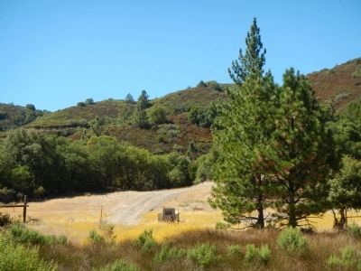
The town of Jolon (pronounced Hōe-Lōne) was established in the 1860s to meet the needs of miners traveling to the Los Burros Mining District on the coast. It later developed into the center of commercial and social activity in southern . . . — — Map (db m59783) HM
The American Legion was chartered by Congress in 1919 as a patriotic veterans organization. Focusing on service to veterans, servicemembers, and communities, the Legion evolved from a group of war-weary veterans of World War I into one of the most . . . — — Map (db m143558) HM
This simple bronze plaque honoring the work of John Steinbeck was sculptured in 1938 by William Gordon Huff. It was dedicated that same year by noted Western historian Dr. Charles L. Camp with all the unwavering oratorical profundity which . . . — — Map (db m54906) HM
Western terminal of the Monterey and Salinas Valley Railroad ending on 1,000 foot pier over Monterey Bay. First in operation October 1874 bringing grain from Salinas Valley to Monterey for ocean shipment to San Francisco.
Officers: Carr S. . . . — — Map (db m63309) HM
This intersection on the Old Stage Road between San Francisco and Los Angeles is the site of the second and last location of Natividad, a busy and important staging and business establishment before Salinas city was created. Originally in the . . . — — Map (db m63624) HM
On this site stood the first Salinas Library. Funds were raised through the efforts of the citizens of Salinas and a pledge from Andrew Carnegie.
Designed by Jacob Lenzen, the library opened Nov. 5. 1909, demolished in Aug. 1960. The above plaque . . . — — Map (db m63633) HM
This beautiful Victorian was built by merchant J. J. Conner in 1897, and sold at the turn of the century to John Ernst and Olive Hamilton Steinbeck. On February 27,1902 John Steinbeck was born in what is now the reception room. He remained a . . . — — Map (db m25107) HM
Claus Spreckels, a German immigrant, at the age of 70 constructed the worlds largest sugar beet factory. The building consisted of 3500 tons of steel framing, 4.5 million brick, a 74,500 sq. ft. slate roof, 6.5 inside stories. The brick walls were . . . — — Map (db m63626) HM
First saloon serving steam beer in this area. Has been here for over 100 years. Owned and operated for many years by Steve Kaelin. Presently owned by Lydia C. and Ray L. Dassel. — — Map (db m62682) HM
On November 19, 1868, the newly-formed San Justo Homestead Association initiated the formation of Hollister through the purchase of 21,000 acres of the former Rancho San Justo from
William Welles Hollister. The association assured the prosperity of . . . — — Map (db m203278) HM
The Tres Pinos Branch of the Southern Pacific Railroad began train service to Hollister on July 13, 1871. Train service was a main reason the population grew from 300 in 1870 to over 2000 in 1873. Besides passenger service, major commodities shipped . . . — — Map (db m26832) HM
Fueled with a zest largely unknown outside of WW II combat vets, Wino Willie Forkner and other early members of the Boozefighters Motorcycle Club partied with other clubs and the citizens of Hollister at its famous 1947 Gypsy Tour. Prominent at the . . . — — Map (db m78353) HM
Was discovered on February 22, 1907 by James Marshall Couch while prospecting for quicksilver on a fifty dollar grubstake for shares from R.W. Dallas and Tom Sanders. On July 30, 1907 mineralogy Professor George D. Louderback identified it as a new . . . — — Map (db m63910) HM
Built in 1894 by J.J. Burt to carry “Diamond Brand” lime from Harlan Mt. the S.P. railhead at Tres Pinos.
The track was a single wooden rail. The locomotive was wood fueled steam operated. On its maiden voyage the engine exploded while . . . — — Map (db m62683) HM
The Downfall of Tiburcio Vasquez began here in what was at that time the Monterey County hamlet of Tres Pinos at about 7 p.m. on August 26, 1873, when the notorious outlaw and six others arrived to rob Andrew Snyder's store.
But first, they . . . — — Map (db m229357) HM
The original town of Tres Pinos had been here for more than a decade when its post office opened on January 24, 1971. The town lost use of its name after August 12, 1873, when the Southern Pacific Railroad opened the Tres Pinos Station 4.7 miles . . . — — Map (db m229358) HM
The USPS opened a post office in town on July 28, 1851, calling it San Juan, and on September 6, 1869, the Monterey County Board of Supervisors approved officially incorporated the town with the title of, "The Inhabitants of the Town of San Juan." . . . — — Map (db m138933) HM
Jim Jack was known as China Jim, the Mustard King. In the 1880’s he gathered mustard seed from the grain fields in the San Juan Valley. Jim Jack, “the big-hearted Chinaman” had that rarest of gifts, the gift of giving. — — Map (db m62721) HM
John Charles Fremont was a naturalist, explorer, scientist and Captain with the U.S. Topographical Engineers on his third expedition to the West when he camped on this mountain. His assignment was to survey, map, chart trails and find the shortest . . . — — Map (db m57986) HM
The San Juan Pacific Railway was incorporated May 4, 1907, becoming the California Central Railroad in 1912. Some of the locals referred to it as The San Juan Terrific. Built to haul the expected large quantities of Portland cement from the Old . . . — — Map (db m100906) HM
Eviglia's Place operated by Frank & Henrietta Eviglia for 40 years. Operated as 19th Hole by John Eviglia & Jean Mouret for 17 years.
Operated by Buck (ECV) & Stoffer (ECV) for 13 years. Operated 1 year by Welch & Galleri. Currently operated by . . . — — Map (db m229348) HM
First saloon serving steam beer in this area. Has been here for over 100 years. Owned and operated for many years by Steve Kaelin. Presently owned by Lydia C. and Ray L. Dassel. — — Map (db m62925) HM
Costanoan Peoples passed through this area along a trade route from their villages between the Pinnacles and San Juan Bautista. Durning the Mexican Era of Alta California, this property was government land enjoining Rancho Santa Ana y Quien Sabe. . . . — — Map (db m132149) HM
The hotel served patrons
of the Southern Pacific
line that ended at the
Tres Pinos turntable.
Monterey Viejo Chapter
E Clampus Vitus
June 2, 1973 — — Map (db m26920) HM
A toll road was built over Pacheco Pass in 1857 by Andrew D. Firebaugh. Later in that same year he built a tavern near this site, which became a Butterfield transcontinental stage stop. In 1859 the Pacific and Atlantic Company built a telegraph line . . . — — Map (db m54036) HM
This establishment sits on a portion of the Mexican Grant Rancho de Aptos conveyed to Rafael Castro by Jose Figueroa in 1833. The hotel was built in 1870 by Jose Arano, a french basque who had married Castro's youngest daughter Maria de Las . . . — — Map (db m25571) HM
During the 1870's and 1880's, a small village constructed of scrap lumber and driftwood was erected at the base of these cliffs. Known as China Beach, or China Cove, it was established by Chinese fishermen who set their nets by boat and then hauled . . . — — Map (db m19881) HM
The Ocean Shore Railway was Incorporated in May of 1905 to build a “road" along the coast from San Francisco to Santa Cruz via Half Moon Bay under the leadership of A.D. Bowen, J.D. Harvey, J.A. Folger, P.D. Martin, and others.
A 26 mile . . . — — Map (db m62417) HM
The only remaining structure of the Villa de Branciforte established in 1797. The last and least prosperous of threee Spanish settlements in Alta California. Populated by paroled petty criminals from Guadalajaran juzgados and pensioned soldiers. The . . . — — Map (db m100905) HM
Near this site Charles Henry “Mountain Charlie” McKiernan, native if Ireland, erected his cabin in 1850. The cabin was built of whip-sawed lumber cut from nearby redwood groves. Whip-sawing was a crude form of lumbering preformed by two . . . — — Map (db m53477) HM
An accomplished attorney and Watsonville mayor, James A. Hall was an adventurer at heart. In the summer of 1900, he set out to find a lost mining claim near Teller, Alaska. Before too long, he was lost himself. Without provisions and clad in summer . . . — — Map (db m62799) HM
Named for Arthur R. Wilson, who founded Granite Rock Company on February 14, 1900, this quarry has been the heart of Granite Rock's business since the beginning. In more than a century of continuous operation, the quarry has seen destruction from . . . — — Map (db m149110) HM
Operated by Hiram Cory, this was one of the first ferries to cross the Salinas River. The Monterey County Board of Supervisors regulated the toll, which was, in 1877:
Buggy and horse, 25 cents:
Buggy and horses, 37½ cents:
Four horses and . . . — — Map (db m224487) HM
Education was important to settlers in San Benito County, who would start a school with as few as five pupils, a place to hold class and a teacher. Early schools were placed 'about 5 miles apart' because the students had to travel on foot or on . . . — — Map (db m26730) HM
Once a common sight in the rural Hollister area, apricot cutting sheds were where the harvested apricots were cut in half and then were placed on wood trays to be dried in the sun. The apricot season usually started at the same time that school got . . . — — Map (db m137801) HM
Built by Peter Brooks in 1883, serving the needs of tourists, local citizens, mourners, partyers, Clampers, and a host of others ever since. — — Map (db m18405) HM
Built in 1892-93 and believed to be the tallest covered bridge in the country, it stood as the only entry to Felton for 45 years. In 1937 it was retired from active service to become a pedestrian bridge and figured prominently in many films of that . . . — — Map (db m2348) HM
Upper Marker:
A tiny village where violence, hangings, drinking, and bull and bear fights were part of daily life. Located on the old Santa Cruz Road, which crossed a portion of the San Andreas and Corralitos ranchos. As the town became . . . — — Map (db m54862) HM
Misión La Exaltación de la Santa Cruz, the 12th Franciscan mission, was consecrated by Father Fermín Lasuen in August 1791. In 1793 the adobe church was built where the Holy Cross Catholic Church is now located. The mission was damaged by several . . . — — Map (db m203623) HM
Combined American forces under Captains Charles D. Burrass (or Burroughs) and Bluford K. Thompson clashed with Comandante Manuel de Jesús Castro's Californians in this vicinity on November 16, 1846. Casualties on each side consisted of several men . . . — — Map (db m26646) HM
During the Gold Rush Days of California the organization known as E Clampus Vitas flourished throughout the gold diggings. It was sort of a parody of the solemn and mysterious fraternal orders then so popular in the states. Every member held an . . . — — Map (db m115597) HM
* Inflectional forms of words are their plurals, singulars, and possessives as well as gramatical tenses and similar variations.