On Courthouse Road (Virginia Route 106), on the right when traveling west.
In June 1864, Gen. U.S. Grant began to confine Gen. Robert E. Lee’s Army of Northern Virginia within the Richmond and Petersburg defenses. The South Side R.R., connecting Petersburg and Lynchburg, and the Richmond and Danville R.R. supplied Lee’s . . . — — Map (db m14771) HM
On Acorn Drive, 0.1 miles south of Oak Grove Road (County Route 606), on the left when traveling south.
In June 1864, to deny Gen. Robert E. Lee the use of the South Side R.R. and the Richmond and Danville R.R., Gen. Ulysses S. Grant sent Gen. James H. Wilson and Gen. August V. Kautz south of Petersburg on a cavalry raid to destroy track and rolling . . . — — Map (db m13776) HM
On Sycamore Drive at Boydton Plank Road (U.S. 1), on the left when traveling south on Sycamore Drive.
In June 1864, to deny Gen. Robert E. Lee the use of the South Side R.R. and the Richmond and Danville R.R., Gen, Ulysses S. Grant sent Gen. James H. Wilson and Gen. August V. Kautz south of Petersburg on a cavalry raid to destroy track and rolling . . . — — Map (db m17556) HM
On Baltimore Road at Zion Road, on the right when traveling north on Baltimore Road.
In June 1864, to deny Gen. Robert E. Lee the use of the South Side R.R. and the Richmond and Danville R.R., Gen. Ulysses S. Grant sent Gen. James H. Wilson and Gen. August V Kautz south of Petersburg on a cavalry raid to destroy track and rolling . . . — — Map (db m18840) HM
On Tavern Street, on the right when traveling west.
In June 1864, to deny Gen. Robert E. Lee the use of the South Side R.R. and the Richmond and Danville R.R., Gen. Ulysses S. Grant sent Gen. James H. Wilson and Gen. August V. Kautz south of Petersburg on a cavalry raid to destroy track and . . . — — Map (db m14765) HM
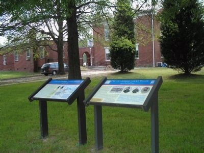
On South Main Street (Business U.S. 460) 0.1 miles south of West Irvin Street, on the right when traveling south.
Blackstone was first known as Blacks and Whites, after two rival late 18th-century taverns. One of these taverns, Schwartz (Blacks) Tavern, listed on the National Register of Historic Places, still stands. The town was renamed for the English jurist . . . — — Map (db m18879) HM
On Old Nottoway Road (U.S. 460) near The Grove Road, on the right when traveling west. Reported missing.
This was the first in a series of raids from Petersburg led by Union Generals James Wilson and August Kautz. The purpose of the raid was to destroy portions of the South Side and Richmond & Danville Railroads and curtail the use of these supply . . . — — Map (db m18521) HM
On Old Nottoway Road (U.S. 460) near The Grove Road, on the right when traveling west.
“…the mingled roar of the musketry, and heavy lumbering of the artillery, seemed to rend the whole heavens…” At this railroad cut on June 23, 1864, 3,500 Union cavalrymen commanded by Gen. James H. Wilson fought a Confederate . . . — — Map (db m6509) HM
On Colonial Trail (U.S. 460) near Old Nottoway Road (Business U.S. 460), on the right when traveling east.
Near here on 23 June 1864, Confederate Maj. Gen. W. H. F. "Rooney" Lee positioned his cavalrymen between those of Union generals August V. Kautz and James H. Wilson, who were riding toward Burkeville. The resulting engagement, according to Wilson, . . . — — Map (db m18877) HM
On W Virginia Avenue (U.S. 460) at Meade Street, on the left when traveling north on W Virginia Avenue.
Roger A. Pryor was reared at Old Place near present-day Crewe. A lawyer and newspaper editor, he won election to the House of Representatives in 1859 and resigned in 1861. He agitated for secession in Charleston, S.C., and before the attack on Fort . . . — — Map (db m14769) HM
Near 2nd Street NW (Business U.S. 460) at Maple Road.
In late June 1864, Confederate Gen. Robert E. Lee and the Army of Northern Virginia were engaged in a desperate defense of the city of Petersburg. Victory for Lee depended on a steady flow of supplies, brought in by rail. To force Lee from . . . — — Map (db m18836) HM
Near 2nd Street NW (Business U.S. 460) near Maple Road.
In June 1864, to deny Gen. Robert E. Lee the use of the South Side R.R. and the Richmond and Danville R.R., Gen. Ulysses S. Grant sent Gen. James H. Wilson and Gen. August V Kautz south of Petersburg on a cavalry raid to destroy track and rolling . . . — — Map (db m18835) HM
On Moores Ordinary Road (Virginia Route 728) at Stagecoach Road (County Route 630), on the left when traveling west on Moores Ordinary Road.
In June 1864, to deny Gen. Robert E. Lee the use of the South Side R.R. and the Richmond and Danville R.R., Gen. Ulysses S. Grant sent Gen. James H. Wilson and Gen. August V. Kautz south of Petersburg on a cavalry raid to destroy track and . . . — — Map (db m19257) HM
On David Bruce Avenue (Virginia Route 40) at Legrande Avenue (Virginia Route 47), on the right when traveling east on David Bruce Avenue.
In June 1864, to deny Gen. Robert E. Lee the use of the South Side R.R. and the Richmond and Danville R.R., Gen. Ulysses S. Grant sent Gen. James H. Wilson and Gen. August V. Kautz south of Petersburg on a cavalry raid to destroy track and . . . — — Map (db m31011) HM
On Depot Street at Drakes Main Street (Virginia Route 47), on the right when traveling south on Depot Street.
In June 1864, to deny Gen. Robert E. Lee the use of the South Side R.R. and the Richmond and Danville R.R., Gen. Ulysses S. Grant sent Gen. James H. Wilson and Gen. August V. Kautz south of Petersburg on a cavalry raid to destroy track and . . . — — Map (db m31006) HM
Near Hailey Road (County Route 759) at Sylvan Hill Road (County Route 612).
In June 1864, to deny Gen. Robert E. Lee the use of the South Side R.R. and the Richmond and Danville R.R., Gen. Ulysses S. Grant sent Gen. James H. Wilson and Gen. August V. Kautz south of Petersburg on a cavalry raid to destroy track and rolling . . . — — Map (db m31004) HM
Near Black Walnut Road (County Route 600) 0.5 miles north of Fort Hill Trail.
The Battle of Staunton River Bridge
was fought here June 25, 1864
Capt. Benj. L. Farinholt 53rd Va. Inf. with
296 men reinforced by 642 citizens
and soldiers from Halifax Charlotte
and Mecklenburg counties Virginia
Defeated
Col. . . . — — Map (db m20253) HM
On North Main Street (U.S. 501) at Houston Street (Virginia Route T-1110), on the right when traveling north on North Main Street. Reported damaged.
In June 1864, to deny Gen. Robert E. Lee the use of the South Side R.R. and the Richmond and Danville R.R., Gen. Ulysses S. Grant sent Gen. James H. Wilson and Gen. August V. Kautz south of Petersburg on a cavalry raid to destroy track and . . . — — Map (db m181120) HM
On Barnesville Highway (U.S. 15) 0.3 miles north of Jackson-Vaughan Road (County Route 607), on the right when traveling south. Reported permanently removed.
The railroad bridge over Staunton River, nine miles west, was held by a body of Confederate reserves and citizens from Halifax, Charlotte and Mecklenburg counties against Union cavalry raiding to destroy railroads, June 25, 1864. When the Unionists . . . — — Map (db m31862) HM
On North Marshall Street at East 4th Street, on the left when traveling south on North Marshall Street.
In June 1864, to deny Gen. Robert E. Lee the use of the South Side Rail Road and the Richmond and Danville Rail Road, Gen. U1ysses S. Grant sent Gen. James H. Wilson and Gen. August V. Kautz south of Petersburg on a cavalry raid to destroy track and . . . — — Map (db m20166) HM
On Old Cox Road, 0.1 miles east of Meadows Road, on the left when traveling east.
In June 1864, to deny Gen. Robert E. Lee the use of the South Side R.R. and the Richmond and Danville R.R., Gen. Ulysses S. Grant sent Gen. James H. Wilson and Gen. August V. Kautz south of Petersburg on a cavalry raid to destroy track and rolling . . . — — Map (db m20170) HM
On Madison Street (Business U.S. 58) at Washington Street (Virginia Route 92), on the right when traveling west on Madison Street. Reported damaged.
Alexander Boyd, Sr., a businessman and founder of Boydton, erected the core of this tavern about 1785. The hostelry thrived, and its presence was a major reason for the selection of Boydton as the Mecklenburg County seat. By the mid-19th century, . . . — — Map (db m30900) HM
On Shade Street at South Broad Street, on the left when traveling east on Shade Street. Reported damaged.
In June 1864, to deny Gen. Robert E. Lee the use of the South Side R.R. and the Richmond and Danville R.R., Gen. Ulysses S. Grant sent Gen. James H. Wilson and Gen. August V. Kautz south of Petersburg on a cavalry raid to destroy track and . . . — — Map (db m20172) HM
On Christanna Highway (Virginia Route 46) at New Hope Road, on the right when traveling north on Christanna Highway.
In June 1864, to deny Gen. Robert E. Lee the use of the South Side R.R. and the Richmond and Danville R.R., Gen. Ulysses S Grant sent Gen. James H. Wilson and Gen. August V. Kautz south of Petersburg on a cavalry raid to destroy track and rolling . . . — — Map (db m20168) HM
On Liberty Road at Old Stage Road, on the left when traveling east on Liberty Road.
In June 1864, to deny Gen. Robert E. Lee the use of the South Side R.R. and the Richmond and Danville R.R., Gen. Ulysses S. Grant sent Gen. James H. Wilson and Gen. August V. Kautz south of Petersburg on a cavalry raid to destroy track and rolling . . . — — Map (db m20171) HM
On Old Stage Road, 0.4 miles south of Smoky Ordinary Road.
The ordinary that stood on this site catered to travelers on the north-south stage road as early as 1750. During the American Revolution local warehouses were burned by British Colonel Tarleton, and legend says that it was from that occurrence that . . . — — Map (db m20164) HM
On Smoky Ordinary Road at Purdy Road, on the left when traveling east on Smoky Ordinary Road.
In June 1864, to deny Gen. Robert E. Lee the use of the South Side R.R. and the Richmond and Danville R.R., Gen. Ulysses S Grant sent Gen. James H. Wilson and Gen. August V. Kautz south of Petersburg on a cavalry raid to destroy track and rolling . . . — — Map (db m20169) HM
On Blue Star Highway (U.S. 301), on the left when traveling south.
Several important river crossings took place
over the Nottoway River during two wars.
Revolutionary War cavalry commander Lt.Col.
John Graves Simcoe led British forces across
the river in this area on 11 May 1781, as he
rode south to join Gen. . . . — — Map (db m7821) HM
On Blue Star Highway (U.S. 301) at Lee Avenue (State Highway 40), on the right when traveling south on Blue Star Highway.
In 1864, supplies for Lee's army were
carted from the Weldon Railroad here
to Petersburg. Here the Union Cavalryman,
Wilson, returning from his raid in Burkeville,
fought an action with Lee's cavalry, June 28-29,
1864. The place was raided . . . — — Map (db m7752) HM
On Sussex Drive (Virginia Route 40) at Concord Sappony Road, on the left when traveling west on Sussex Drive.
In June 1864, to deny Gen. Robert E. Lee the use of the South Side R.R. and the Richmond and Danville R.R., Gen. Ulysses S. Grant sent Gen. James H. Wilson and Gen. August V. Kautz south of Petersburg on a cavalry raid to destoy track and rolling . . . — — Map (db m18841) HM
On Concord Sappony Road, 0.1 miles south of Sussex Drive (Virginia Route 40), on the left when traveling south. Reported missing.
Sappony Baptist Church, originally called Sappony Meeting House, was erected here in 1773. It was a part of the Kehukee Association, which consisted of churches in North Carolina and Virginia. In 1791, these associations divided along state lines . . . — — Map (db m18852) HM
On South Crater Road (U.S. 301) at Woodys Road, on the right when traveling south on South Crater Road.
Three miles north. There the Union cavalryman Kautz, in Wilson's raid, destroyed the station, June 22, 1864. Returning from Burkeville, Kautz reached there again June 29, and was joined by Wilson. Attacked by Hampton, Wilson and Kautz hastily . . . — — Map (db m164222) HM
On Acorn Drive, 0.1 miles south of Oak Grove Road (County Route 606), on the left when traveling south. Reported missing.
Racing the pursuing Confederate cavalry for the safety of the Union lines at Petersburg after accomplishing most of its mission, Gen. James H. Wilson's command reached Ream's Station about 7 a.m. June 29. Two brigades of Gen. William Mahone's . . . — — Map (db m13774) HM
On Reams Drive (County Route 606) 0.1 miles west of Halifax Road (County Route 604), on the right when traveling west. Reported permanently removed.
The first field fortifications were built at Reams Station on July 1, 1864 by soldiers of the Union Sixth Corps while tearing up the railroad following the return of the ill-fated Wilson-Kautz cavalry raid. Hastily thrown up, the works were "L" . . . — — Map (db m164221) HM