By William Fischer, Jr., January 31, 2015
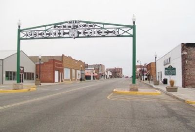
Gateway Sign and Marker
| On Main Street (Route 66) (U.S. 69) north of 3rd Avenue (State Highway 10), on the right when traveling north. |
| On State Highway 66, 0.1 miles south of Kansas State Line, on the left when traveling north. |
| On 100th Road (State Highway 10C) east of 679th Road, on the right when traveling east. |
| On East 6th Avenue (State Highway 51) at South Bethel Road (County Route N34330), on the right when traveling east on East 6th Avenue. |
| On U.S. 69 at Main Street, on the right when traveling south on U.S. 69. |
| On State Highway 1, 0.3 miles north of Blackrock Road (County Road E149.5), on the right when traveling north. |
| On North Harrison Avenue (State Highway 18), on the right when traveling north. |
| On East Main Street at South Pennsylvania Avenue, on the right when traveling west on East Main Street. |
| On Oklahoma 2, 1 mile north of U.S. 271, on the right when traveling north. |
| On North 4355 Road north of County Road 4358, on the left when traveling north. |
| On L. L. Males Boulevard (U.S. 283) near Clay Avenue, on the right when traveling north. |
| On U.S. 283, 0.2 miles north of Ranch to Market Road E 1070, on the right when traveling south. |
| On Oklahoma Route 33 at U.S. 283, on the left when traveling south on State Route 33. |
| On State Highway 88, 0 miles north of East Canyon Oaks Road, on the left when traveling north. |
| On State Highway 66 at 4th Street, on the right when traveling north on State Highway 66. |
| On U.S. 169 at County Road 300, on the left when traveling north on U.S. 169. |
| Near South Perkins Avenue north of East 5th Street (U.S. 412), on the right when traveling north. |
| On U.S. 54 at County Highway D, on the left when traveling east on U.S. 54. |
| On South 3rd Street, on the right when traveling south. |
| On N. Elm Avenue when traveling east. |
| On South Union Avenue (U.S. 75) north of West 119th Street, on the right when traveling north. |
| On South Union Avenue (U.S. 75) north of 146th Street, on the right when traveling north. |
| On 33rd West Avenue, 2 miles south of State Highway 67, on the right when traveling north. |
| On Tower Road near SR 51 and Tower Road, on the left when traveling south. |
| On West Detroit Street (Oklahoma Route 11) at East 98th Street, on the right when traveling north on West Detroit Street. |
| On North Greenwood Avenue north of East Cameron Street, on the right when traveling south. |
| On John Hope Franklin Boulevard east of Elgin Avenue, on the right when traveling east. |
| On Southwest Boulevard (State Highway 66) south of West 41st Street South, in the median. |
| On 21st Street, on the right when traveling west. |
| On State Highway 51 east of S 305th E Street, on the right when traveling east. |
| On U.S. 69, 0.4 miles north of 820th Road, on the right when traveling north. |
| On U.S. 69, 0.4 miles north of 820th Road, on the right when traveling north. |
| On U.S. 69, 0.4 miles north of 820th Road, on the right when traveling north. |
| On Cherokee Street (State Highway 51) at Casaver Avenue, on the left when traveling east on Cherokee Street. |
| On Old U.S. 66, 0.3 miles east of County Road N2080, in the median. |
| On Old U.S. 66, 0.3 miles east of County Road N2080, in the median. |
| On Old U.S. 66, 0.3 miles east of County Road N2080, in the median. |
| On East Main Street west of South Market Street, in the median. |
| On Highway 3 / Highway 412 east of Reservation Avenue, on the right when traveling west. |
139 entries matched your criteria. Entries 101 through 139 are listed above.
⊲ Previous 100