51 entries match your criteria.
Delaware Canal (AKA Delaware Division of the Pennsylvania Canal) Historical Markers
Markers highlighting the history of the Delaware Canal that was in operation along the west bank of the Delaware River between Easton and Bristol, Pennsylvania, from 1831-1932. The canal remnants are now part of the Delaware & Lehigh National Heritage Corridor.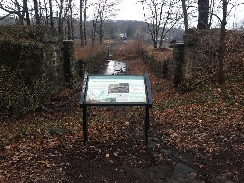
By Russell Galen, December 24, 2016
Lambertville Outlet Lock Marker
| 1 ► New Jersey, Hunterdon County, Lambertville — Lambertville Outlet Lock — |
| Near Delaware and Raritan State Park Trail. | |||
| 2 ► New Jersey, Hunterdon County, Mount Pleasant — Mount Pleasant General Store — |
| On Little York - Mt. Pleasant Road (County Route 519) at Rick Road, on the right when traveling north on Little York - Mt. Pleasant Road. | |||
| 3 ► New Jersey, Mercer County, Trenton, South Trenton — Canals and Railroads – Arteries to the Heart of Industrial Trenton — |
| Near New Jersey Route 29. | |||
| 4 ► Pennsylvania, Bucks County, Bristol — Canal Office — 1832 - 1931 |
| Reported permanently removed. | |||
| 5 ► Pennsylvania, Bucks County, Bristol — Fueling the Economy — |
| On Canals End Road just south of Basin Park, on the left when traveling south. | |||
| 6 ► Pennsylvania, Bucks County, Bristol — In the Basin — |
| On Basin Park. | |||
| 7 ► Pennsylvania, Bucks County, Bristol — Life Along the Canal — Delaware Canal State Park — |
| On Jefferson Avenue. | |||
| 8 ► Pennsylvania, Bucks County, Bristol — Lock 1 — The Canal's First and Last — |
| On Canals End Road just west of Nichols Memorial Drive, on the left when traveling west. | |||
| 9 ► Pennsylvania, Bucks County, Bristol — Lock 2 — In the Middle — |
| On Old U.S. 13 west of Market Street, on the right when traveling west. | |||
| 10 ► Pennsylvania, Bucks County, Bristol — Lock 3 — At the Heart of Commerce — |
| Near Old U.S. 13 near Mulberry Street, on the right when traveling west. | |||
| 11 ► Pennsylvania, Bucks County, Bristol — Lock No. 2 — Lehigh Coal and Navigation Company — 1832-1931 |
| On Pond Street at Bath Street on Pond Street. Reported permanently removed. | |||
| 12 ► Pennsylvania, Bucks County, Bristol — Marsh Ecology in an Urban Setting |
| On Canals End Road just south of Basin Park when traveling west. Reported unreadable. | |||
| 13 ► Pennsylvania, Bucks County, Bristol — The Basin — 1832 - 1931 |
| Reported permanently removed. | |||
| 14 ► Pennsylvania, Bucks County, Bristol — The Bend before the End — |
| On Canals End Road just west of Nichols Memorial Drive, on the right when traveling west. | |||
| 15 ► Pennsylvania, Bucks County, Bristol — The Locktender's House at Lock 1 — |
| On Canals End Road just east of Nichols Memorial Drive, on the right when traveling east. | |||
| 16 ► Pennsylvania, Bucks County, Bristol — The Ring — 1831 - 1932 |
| Reported permanently removed. | |||
| 17 ► Pennsylvania, Bucks County, Bristol — The Tidal Lock — 1832 - 1931 |
| Reported permanently removed. | |||
| 18 ► Pennsylvania, Bucks County, Bristol — Tidal Delaware Water Trail — |
| On Basin Park, 0.1 miles south of Mill Street, on the left when traveling south. | |||
| 19 ► Pennsylvania, Bucks County, Bristol — Where the Canal Met the River — |
| On Basin Park. | |||
| 20 ► Pennsylvania, Bucks County, Bristol — Working with the Tide — |
| On Canals End Road just south of Basin Park, on the left when traveling south. | |||
| 21 ► Pennsylvania, Bucks County, Bristol, Bristol Township — Delaware Canal — 1831 - 1932 — |
| On Green Lane south of Bristol Pike (U.S. 13), on the right when traveling south. | |||
| 22 ► Pennsylvania, Bucks County, Kintnersville, Durham Township — Canal Boats — Delaware Canal Lock 21 — |
| On Pennsylvania Route 611 at Durham Road on State Route 611. | |||
| 23 ► Pennsylvania, Bucks County, Kintnersville, Durham Township — Delaware Canal — |
| On Pennsylvania Route 611, on the right when traveling north. | |||
| 24 ► Pennsylvania, Bucks County, Lumberville, Solebury Township — Delaware Canal / Pennsylvania Canal — |
| On River Road (Pennsylvania Route 32), on the right when traveling north. | |||
| 25 ► Pennsylvania, Bucks County, New Hope — Delaware Canal — |
| On Main Street, on the right when traveling north. | |||
| 26 ► Pennsylvania, Bucks County, New Hope — Delaware Canal — |
| On River Rd./S Main St. (PA 32). | |||
| 27 ► Pennsylvania, Bucks County, New Hope, Solebury Township — Thompson-Neely Bridge — |
| Near Delaware Canal Towpath. | |||
| 28 ► Pennsylvania, Bucks County, Riegelsville — Riegelsville — |
| Near Delaware Road. | |||
| 29 ► Pennsylvania, Bucks County, Tinicum Township, Pipersville — Treasure Island Reservation — Delaware Canal Lock 17 — |
| On River Road (Pennsylvania Route 32), on the right when traveling north. | |||
| 30 ► Pennsylvania, Bucks County, Upper Black Eddy — Canal Boats — 1831-1932 — Delaware Canal Lock 19 State Park — |
| On Sanctuary Hill Circle, on the left when traveling south. | |||
| 31 ► Pennsylvania, Bucks County, Upper Black Eddy — Cemented in the Past — Delaware Canal Lock 20 State Park — |
| On River Road (Pennsylvania Route 32), on the left when traveling east. | |||
| 32 ► Pennsylvania, Bucks County, Upper Black Eddy — Delaware Canal — 1832 Sesquicentennial 1982 — Delaware Canal Lock 19 State Park — |
| On Sanctuary Hill Circle, on the right when traveling south. | |||
| 33 ► Pennsylvania, Bucks County, Upper Black Eddy — Delaware Canal — National Historic Landmark — Delaware Canal Lock 19 State Park — |
| On Sanctuary Hill Circle, on the left when traveling south. | |||
| 34 ► Pennsylvania, Bucks County, Upper Black Eddy — Delaware Canal — 1831-1932 — Delaware Canal Lock 20 State Park — |
| On River Road (Pennsylvania Route 32), on the left when traveling east. | |||
| 35 ► Pennsylvania, Bucks County, Upper Black Eddy — Life Along The Canal — 1831-1932 — Delaware Canal Lock 19 State Park — |
| On Sanctuary Hill Circle, on the right when traveling north. | |||
| 36 ► Pennsylvania, Bucks County, Upper Black Eddy — Mules and Men — 1821-1932 — Delaware Canal Lock 19 State Park — |
| On Sanctuary Hill Circle, on the left when traveling south. | |||
| 37 ► Pennsylvania, Bucks County, Upper Black Eddy, Tinicum Township — Delaware Canal — |
| On Uhlerstown Hill Road, on the right when traveling west. | |||
| 38 ► Pennsylvania, Bucks County, Washington Crossing, Upper Makefield Township — A Nation's Signature Event — |
| On Washington Crossing Memorial Blvd. at River Road on Washington Crossing Memorial Blvd.. | |||
| 39 ► Pennsylvania, Northampton County, Carpentersville, Williams Township — A Transportation Hub — |
| On Delaware Drive (Pennsylvania Route 611) at Canal Road, on the left when traveling south on Delaware Drive. | |||
| 40 ► Pennsylvania, Northampton County, Carpentersville, Williams Township — Taking Advantage of Water Power — |
| On Delaware Drive (Pennsylvania Route 611) at Canal Road, on the left when traveling south on Delaware Drive. | |||
| 41 ► Pennsylvania, Northampton County, Carpentersville, Williams Township — The Lost Town of Uhlersville — |
| On Delaware Drive (Pennsylvania Route 611) at Canal Road, on the right when traveling south on Delaware Drive. | |||
| 42 ► Pennsylvania, Northampton County, Easton — Canal Boats — 1831 - 1932 — |
| 43 ► Pennsylvania, Northampton County, Easton — Delaware Canal — National Historic Landmark — |
| On S Delaware Dr. (PA 611). | |||
| 44 ► Pennsylvania, Northampton County, Easton — Easton & Nearby Heritage Attractions — 1829 - 1932 — |
| 45 ► Pennsylvania, Northampton County, Easton — From Waterways to Highways — |
| 46 ► Pennsylvania, Northampton County, Easton — It's a Short Commute — 1829 - 1942 — |
| 47 ► Pennsylvania, Northampton County, Easton — Mid-Atlantic Highlands — Delaware Canal State Park — |
| On S Delaware Dr. (PA 611). | |||
| 48 ► Pennsylvania, Northampton County, Easton — The Lehigh Canal — |
| 49 ► Pennsylvania, Northampton County, Easton, Williams Township — Delaware Canal — |
| On South Delaware Drive. | |||
| 50 ► Pennsylvania, Northampton County, Easton, Williams Township — Life Along The Canal — 1831-1932 — Delaware Canal — |
| On Delaware Drive (Pennsylvania Route 611) at Canal Road, on the left when traveling south on Delaware Drive. | |||
| 51 ► Pennsylvania, Northampton County, Easton, Williams Township — Mules and Men — 1831-1932 — Delaware Canal — |
| On Delaware Drive (Pennsylvania Route 611), on the left when traveling south. | |||