By Mike Wintermantel, May 7, 2013
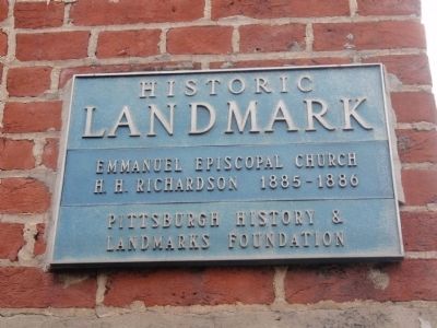
Emmanuel Episcopal Church Historical Landmark Marker
GEOGRAPHIC SORT Title Sort Marker Number Sort Marker Number Sort N Marker Number Sort T Publication Order Sort Publication Order Sort A Erected Year Sort Most Viewed Sort Most Recent-Interest Sort Most Recently Changed Sort SEE FAQ #33 FOR DESCRIPTIONS
On Allegheny Avenue at West North Avenue, on the right when traveling north on Allegheny Avenue.
Has Been Designated A
National Historic Landmark
This site possesses national significance in commemorating the history of the United States of America.
Henry Hobson Richardson, one of America's premier architects, designed this church (1884). . . . — — Map (db m176700) HM
Near California Avenue at North Home Avenue.
Greenstone United Methodist Church
1906 — — Map (db m97624) HM
Mount Assisi
1927
Edward J. Weber, architect — — Map (db m81964) HM
On Parker Avenue at Orchard Street, on the left when traveling west on Parker Avenue.
[Title is text] — — Map (db m224792) HM
Bridgeville Public Library, Built c. 1870
as Bridgeville Railroad Depot — — Map (db m231093) HM
On Washington Pike (Pennsylvania Route 50) south of Bower Hill Road, on the right when traveling north.
Murray House
Built c. 1830 — — Map (db m243125) HM
Near Noblestown Road, 0.1 miles east of Pinkerton Run Road.
Built c. 1795 — — Map (db m70113) HM
Hyeholde
William Kryskill, designer
1931-38; 1952 — — Map (db m94365) HM
Paid Advertisement
Borough of Dormont Pool
1920 — — Map (db m72864) HM
Near Church Lane at Oliver Road.
Shields Presbyterian Church
J.W. Kerr, Architect
1868-69 — — Map (db m78419) HM
On South 3rd Avenue south of Ekin Avenue, on the right when traveling south.
Historic
LANDMARK
Walker House
1844
Pittsburgh History &
Landmarks Foundation — — Map (db m205554) HM
Near Wilson Street, 0.1 miles east of Wendelin Street, on the right when traveling east.
All Saints Church
John Theodore Comes, architect
1914
— — Map (db m82015) HM
Near Brandt School Road, 0.2 miles north of Wexford Run Road, on the right when traveling south.
Trinity German Evangelical Lutheran Church
Built 1868 — — Map (db m65236) HM
Near 8th Avenue (Pennsylvania Route 837) 0.2 miles east of McClure Steet.
This building possesses national significance in commemorating the history of the United States of America.
This was the headquarters of the Amalgamated Association of Iron and Steelworkers at the time of the Homestead Strike. It is one of the . . . — — Map (db m44873) HM
On Lang Avenue at Kelly Street, on the left when traveling south on Lang Avenue.
[Title is text] — — Map (db m181923) HM
On Ella Street at Helen Street, on the left when traveling west on Ella Street.
St. Mary's Ukrainian Orthodox Church
1922
Carlton Strong, architect — — Map (db m82111) HM
St. Nicholas Croatian Church
1900, Frederick Sauer, Architect
Murals 1937, Maxo Vanka — — Map (db m82018) HM
Paid Advertisement
Near Washington Road (Bypass U.S. 19) 0.1 miles south of Cedar Avenue.
Mt. Lebanon Municipal Building
William H. King, Jr., Architect
1928-30 — — Map (db m72863) HM
Near Washington Road (Bypass U.S. 19) at Bower Hill Road.
Saint Bernard Church
1933-47
William Richard Perry, Architects — — Map (db m72865) HM
Near Washington Road (Bypass U.S. 19) at Castle Shannon Boulevard.
Southminster Presbyterian Church
Originally Mount Lebanon Presbyterian Church
Thomas Pringle, Architect
1927-1928 — — Map (db m72866) HM
Near 10th Avenue, 0.1 miles west of Andrew Street.
Carnegie Library
of Homestead
Alden and Harlow, Architects
1896-98 — — Map (db m44874) HM
On Dickson Street at East 10th Avenue, on the right when traveling north on Dickson Street.
Originally St. John the Baptist Greek Catholic Church
Titus de Bobula, architect
1903 — — Map (db m156106) HM
Near Burtner Road, 0.1 miles east of Allegheny Valley Expressway (Pennsylvania Route 28).
Built 1821 — — Map (db m74890) HM
Near Allegheny River Boulevard at Pennsylvania Avenue, on the right when traveling north.
Built 1901
Alden & Harlow, Architects
— — Map (db m72331) HM
Near Frew Street, 0.1 miles west of Tech Street, on the right when traveling west.
Baker Hall
1914, 1919
(formerly Central Building, Administration Hall)
Palmer & Hornbostel,
architects — — Map (db m237412) HM
Near Frew Street west of Tech Street, on the right when traveling west.
College of Fine Arts
1912, 1916
(formerly School of Applied Design)
Henry Hornbostel,
architect — — Map (db m238726) HM
Paid Advertisement
On Forbes Avenue east of South Neville Street, on the right when traveling east.
Hamburg Hall
1915
(formerly U.S. Bureau of
Mines)
Henry Hornbostel, architect — — Map (db m236234) HM
Near Hamerschlag Drive north of Frew Street, on the right when traveling north.
Hamerschlag Hall
1906, 1914
(formerly Machinery Hall)
Palmer & Hornbostel, architects — — Map (db m238750) HM
On Frew Street, 0.2 miles west of Tech Street, on the right when traveling west.
Porter Hall
1905, 1915
(formerly School of Applied Industries)
Palmer & Hornbostel, architects — — Map (db m236841) HM
Near West Commons, 0.1 miles north of Children's Way.
Allegheny High School
1904
Frederick John Osterling, Architect — — Map (db m58602) HM
Near Children's Way, 0.1 miles east of West Commons.
Children's Museum of Pittsburgh
Originally Allegheny Post Office
William M. Aiken, Architect 1894-97 — — Map (db m58600) HM
Near Children's Way, 0.2 miles east of West Commons.
Children's Museum of Pittsburgh
Originally Buhl Planetarium and Institute of Popular Science
Ingham and Boyd, architects, 1939 — — Map (db m58601) HM
Near Ridge Avenue at Arch Street.
Saint Peter R.C. Church 1872-74
Andrew Peebles, Architect — — Map (db m58599) HM
On Ridge Avenue, 0.1 miles east of Allegheny Avenue.
Byers-Lyon House
1898
Alden & Harlow, Architects — — Map (db m65207) HM
On Allegheny Avenue at Beech Avenue, on the right when traveling north on Allegheny Avenue.
Calvary United Methodist Church
Built 1892-95
Vrydaugh & Shepherd and T.B. Wolfe, Architects — — Map (db m65165) HM
Paid Advertisement
Near Ridge Avenue at Brighton Road, on the right when traveling west.
Jones Hall
1908-1910
Rutan and Russell, Architects — — Map (db m65171) HM
Near Ridge Avenue at Rope Way, on the right when traveling west.
West Hall
1911-1912
Thomas Hannah, Architect — — Map (db m65170) HM
Near Ridge Avenue at Galveston Avenue, on the right when traveling west.
William Penn Snyder House
George Orth, Architect 1911 — — Map (db m65169) HM
Near Saw Mill Run Boulevard (Pennsylvania Route 51) at Woodruff Street.
Seldom Seen Arch
1902
Boller & Hodge, engineers — — Map (db m133062) HM
First United Methodist Church
Weary and Kramer, H. Wagoner, Architects
1893-95, 1952 — — Map (db m65135) HM
St. Joseph's Roman Catholic Church
Bloomfield
Built 1886-87 — — Map (db m65144) HM
Western Pennsylvania Hospital
1848-1973 — — Map (db m65147) HM
Near Seventh Avenue, 0.1 miles west of Grant Street, on the right when traveling west.
Gulf Building 1930-1932
Trowbridge & Livingston, Archs. — — Map (db m83953) HM
On Smithfield Street at Fifth Avenue, on the right when traveling east on Smithfield Street.
Kaufmann's Dept. Store and Clock
Built 1898 Charles Bickel Architect
Addition 1913 Janssen & Abbot Architects — — Map (db m66448) HM
Paid Advertisement
Near Sixth Avenue, 0.1 miles south of Wood Street.
The Duquesne Club
Longfellow, Alden & Harlow;
Janssen & Cocken, Architects
Built 1889; 1902; 1930-1931 — — Map (db m74766) HM
Near Sixth Avenue, 0.1 miles south of Wood Street.
Granite Building
Originally German National Bank
Charles Bickel & J.P. Brennan, architects
1889-90 — — Map (db m74767) HM
Allegheny Cemetery Incorporated
1844 — — Map (db m66198) HM
[Title is text] — — Map (db m225200) HM
Brown Chapel A.M.E. Church
1903 — — Map (db m65226) HM
Near Wylie Avenue at Green Street.
First Muslim Mosque of Pittsburgh
Originally, Wylie Avenue Branch
Carnegie Library of Pittsburgh
Alden & Harlow, architects, 1899 — — Map (db m78473) HM
Near Seventh Avenue at Fort Duquesne Boulevard, on the right.
Aria Cultural District Lofts
Originally, Gerber Carriage Company
Rutan & Russell, Architects, 1904-05 — — Map (db m128179) HM
On Sixth Street at Penn Avenue, on the right when traveling north on Sixth Street.
Heinz Hall
(formerly Loew's Penn Theatre)
Rapp & Rapp, Architects
1926
Stotz, Hess, MacLachlan & Fosner
remodeling 1971 — — Map (db m67122) HM
Near Pressley Street at North Canal Street, on the right when traveling east.
Pittsburgh's Grand Hall at the Priory
(formerly St. Mary's German Catholic Church)
Father John Stibiel, designer; Sidney F. Heckert, architect for vestibule 1854; vestibule 1906 — — Map (db m65227) HM
Paid Advertisement
On Wood Street at Fourth Avenue, on the right when traveling west on Wood Street.
1902
Frederick John Osterling, architect — — Map (db m67181) HM
On Fourth Avenue, 0.1 miles east of Stanwix Street, on the left when traveling east.
Benedum-Trees Building
Thomas H. Scott, Arch., 1905 — — Map (db m67184) HM
On Fourth Avenue, 0.1 miles east of Stanwix Street, on the left when traveling east.
Burke's Landmark, 1836
John Chislett, architect — — Map (db m67183) HM
On Grant Street just north of 4th Avenue, on the right when traveling north.
Henry Hornbostel, designer
Edward B. Lee, architect with
Palmer, Hornbostel & Jones, 1915-17
[Additional plaque on the building:]
This building erected A.D. 1915▼ 1917 ▼ For the City of . . . — — Map (db m156235) HM
On Forbes Avenue at Ross Street, on the right when traveling east on Forbes Avenue.
County Office Building
Stanley L. Roush, architect
1929-31 — — Map (db m65609) HM
Near Washington Place at Centre Avenue.
Epiphany Roman Catholic Church
1904
Edward Stotz, Architect
John T. Comes, Interior Designer — — Map (db m65607) HM
On Ross Street, 0.1 miles north of Forbes Avenue, on the right when traveling north.
Family Court Facility, Court of Common Pleas
Originally Allegheny County Jail
Henry Hobson Richardson, architect
1884-86 — — Map (db m65613) HM
On 4th Avenue at Wood Street, on the right when traveling east on 4th Avenue.
Pittsburgh industry boomed 1890 and 1910, leading to the development of Pittsburgh's "Wall Street," the Fourth Avenue financial district. Growth of the district was first spurred by the flow of corporate income of the burgeoning iron and steel . . . — — Map (db m156258) HM
Near Fort Pitt Boulevard at Wood Street, on the right when traveling west.
Monongahela Wharf Commercial Buildings
Market Street to Wood Street
C. 1850 to C. 1890 — — Map (db m79633) HM
Paid Advertisement
On Ninth Street at Fort Duquesne Boulevard, on the right when traveling north on Ninth Street.
Ninth Street Bridge
Department of Public Works, Allegheny County, Engineers — — Map (db m47882) HM
On 6th Street at Fort Duquesne Boulevard, on the right when traveling north on 6th Street.
Roberto Clemente Bridge
Department of Public Works, Allegheny County, Engineers
1928 — — Map (db m40941) HM
On Seventh Street at Fort Duquesne Boulevard, on the right when traveling north on Seventh Street.
Seventh Street Bridge
Department of Public Works, Allegheny County, Engineers — — Map (db m47880) HM
Site of Bear Tavern 1827
Oyster House c.1871-1971 — — Map (db m67186) HM
On Fourth Avenue, 0.1 miles east of Wood Street, on the left when traveling east.
Union Trust Co.-Lawyers Title Building
D.H. Burnham & Co., Architects, 1898 — — Map (db m67189) HM
On Grandview Avenue, on the right when traveling north.
Historic Landmark The Duquesne Incline - 1877Built by Samuel Diescher, Engineer for Kirk Bigham & Associates Pittsburgh History & Landmarks Foundation — — Map (db m8859) HM
Congregation B'nai Israel
Built 1923
Henry Hornbostel, Architect — — Map (db m65133) HM
East Liberty Presbyterian Church
Built 1931-1935
Cram & Ferguson, Architects — — Map (db m122315) HM
St. Peter's Evangelical & Reformed Church
Built 1889 — — Map (db m65145) HM
Paid Advertisement
Near Corliss Street at West Carson Street (Route 51).
Corliss Street Tunnel
1914
Stanley L. Roush, architect; D.N. Sprague, chief engineer — — Map (db m101344) HM
Pittsburgh Brewing Company
Built 1886
Nic Kessler, Architect — — Map (db m65138) HM
Near Liberty Avenue at 36th Street, on the right when traveling west.
Louis & Michael Beezer Brothers, architects
John T. Comes, designer
1903 — — Map (db m64808) HM
On Schenley Drive, 0.1 miles west of Frew Street, on the right when traveling west.
Schenley Park Bridge over Boundary Street
Henry B. Rust, engineer
1897 — — Map (db m65141) HM
Riverview United Presbyterian Church
Originally Watson Memorial Presbyterian Church
Allison & Allison, Architects, 1907 — — Map (db m67175) HM
Near Reynolds Street just east of South Homewood Avenue, on the left when traveling east.
Henry Clay Frick Estate
c. 1870, remodeled 1891 - 92
Frederick John Osterling, architect for remodeling — — Map (db m156189) HM
On Mellon Park Road, 0.1 miles east of Shady Avenue, on the left when traveling east.
Former R.B. Mellon Estate
1912; Alden & Harlow, architects
— — Map (db m156198) HM
On South Dallas Avenue at Aylesworth Avenue, on the right when traveling north on South Dallas Avenue.
The Homewood Cemetery Incorporated 1878 — — Map (db m108031) HM
Near McPherson Boulevard at Linden Avenue, on the right when traveling west.
Linwood Apartments
Built c. 1907
Frederick G. Scheibler, Jr., Architect — — Map (db m65136) HM
Paid Advertisement
Near Perry Highway (U.S. 19) 0.1 miles north of Thompson Lane.
Hiland Presbyterian Church
Darby and Evans, R. Hensel Fink, Architects
1836, 1914, 1936 — — Map (db m60569) HM
On Colonial Place at Ellsworth Avenue, on the left when traveling north on Colonial Place.
Colonial Place Historic District
George S. Orth, architect
E.H. Bachman, landscape artist
1898 — — Map (db m76367) HM
On Ellsworth Avenue at Roslyn Place, on the right when traveling west on Ellsworth Avenue.
Roslyn Place Wood Block Paving
Installed 1914 — — Map (db m76368) HM
Sacred Heart Church 1924-53
C. Strong, Kaiser, Neal, Reid — — Map (db m65139) HM
Near Ellwood Street at South Highland Avenue.
The Highwood
1929-1930
R. Garey Dickson, Architect — — Map (db m65146) HM
On West Station Square Drive, 0.2 miles east of Station Square, on the right when traveling west.
Former P&LE R.R. Central Warehouse
Built 1917, an historic property of
Pittsburgh History &
Landmarks Foundation
— — Map (db m156287) HM
On East Station Square Drive at Three Rivers Heritage Trail, on the left when traveling west on East Station Square Drive.
Design in 1992 by Oehme, van Swoden & Associates, Inc., these gardens pioneer the concept of the modern naturalized garden.
This natural landscape concept is now maintained by the Pittsburgh History & Landmarks Foundation.
For . . . — — Map (db m156282) HM
On West Station Square Drive, on the right when traveling west.
Built 1898-1901
William George Burns, Architect
[Additional plaque on the left:]
This Building Listed
National Register
of Historic Places
— — Map (db m156285) HM
On West Carson Street (Pennsylvania Route 837) at Smithfield Street Bridge, on the right when traveling east on West Carson Street.
Brady St. Bridge was a through-cantilever bridge designed by Albert L. Schultz in 1896 for highway and streetcar traffic crossing the Monongahela River. It was the first city-erected bridge that was toll free. The railings were recovered by the . . . — — Map (db m156281) HM
On 12th Street north of Carson Street (Pennsylvania Route 837), on the left when traveling north.
[Title is text] — — Map (db m181882) HM
On East Carson Street (Pennsylvania Route 837) at South 7th Street, on the right when traveling east on East Carson Street.
St. John the Baptist
Ukrainian Catholic Church
1895 — — Map (db m99333) HM
Near East Street, 0.2 miles south of Suffolk Street, on the right when traveling north.
Saint Boniface R.C. Church
1925-1926
A.F. Link, Architect — — Map (db m62739) HM
On Schenley Drive at Frew Street, on the left when traveling east on Schenley Drive.
Schenley Park
Founded 1889 — — Map (db m83073) HM
On Panther Hollow Road, 0.1 miles north of Boulevard of the Allies, on the right when traveling north.
Schenley Park Bridge
Over Panther Hollow
Henry B. Rust, engineer
1897 — — Map (db m65142) HM
Near 21st Street at Smallman Street, on the right when traveling north.
Historic Landmark
Saint Stanislaus Kostka R.C. Church
Built 1891-1892 — — Map (db m62560) HM
On Allegheny Valley Expressway (Pennsylvania Route 28), on the right when traveling south. Reported missing.
Saint Nicholas R.C. Church
1900-1901
F.C. Sauer, Architect — — Map (db m60287) HM
On Sixteenth Street, 0.1 miles north of Smallman Street, on the right when traveling north.
Sixteenth Street Bridge
H.G. Balcom, Engineer;
Warren and Wetmore, Architects — — Map (db m44875) HM
Near Ley Street at Froman Street.
Troy Hill Fire Station #39
Joseph Stillburg, architect
1901 — — Map (db m70995) HM
On Lowrie Street at Froman Street, on the right when traveling east on Lowrie Street.
Troy Hill Incline
This is the upper station of the first incline in Allegheny, completed in 1887 and out of service by 1898. The engineer was Samuel Diescher, a specialist in incline construction. The total length was 370 feet on a 47-percent . . . — — Map (db m70994) HM
Near Frederick Avenue at Walnut Street.
Atwell-Christy House
Built 1862 — — Map (db m65668) HM
113 entries matched your criteria. The first 100 are listed above.
The final 13 ⊳