On W Gold Street at S Railroad Avenue, on the left when traveling west on W Gold Street.
Named by Holly Melton’s Class of 2000 at Kings Mountain High School to honor the soldiers who fought nearby during the Revolutionary War. — — Map (db m35245) HM
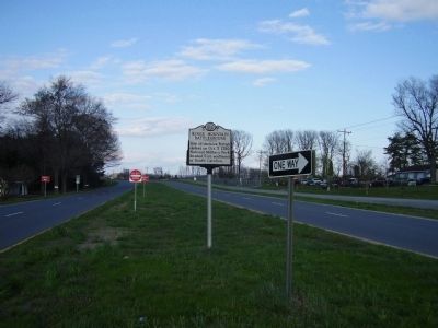
On Old Cherry Point Road (County Route 1113) at Green Springs Road (County Route 1129), on the right when traveling north on Old Cherry Point Road.
Site of Fort Caswell, built by N.C., 1775-76, to protect New Bern, renamed Fort Lane by Confederacy. Taken by U.S., Mar., 1862. ½ mi. E. — — Map (db m77005) HM
On Pollock Street at Middle Street, on the right when traveling west on Pollock Street.
This cannon was taken from the Ship-of-war Lady Blessington, captured after a sharp engagement during the revolution by an armed privateer belonging to John Wright Stanley of New Bern. Marked by Richard Dobbs Spaight chapter D.A.R. — — Map (db m181639) HM
On Gillespie Street at Franklin Street, on the right when traveling south on Gillespie Street.
On March 4-5, 1825, was guest of Fayetteville (named for him 1783), staying at home of Duncan McRae, on site of present courthouse. — — Map (db m24377) HM
On Person Street at Bow Street, on the right when traveling west on Person Street.
At or near this place
ever since known as
“Liberty Point”
was promulgated in
June 1775,
by patriots of the Cape Fear
A Declaration of Independence
of the British Crown. . . . — — Map (db m24431) HM
On State Highway 87 at Butler Nursery Road, on the right when traveling south on State Highway 87.
Prior to the Battle of Moores Creek Bridge, forces of Gen. James Moore, Whig commander camped, Feb. 15-21,1776, 1½ miles northeast. — — Map (db m4588) HM
On Old Bluff Church Road, 1.2 miles west of Sisk Culbreth Road when traveling west.
Near this spot at Old Bluff Church is buried Colonel Alexander McAllister; Patriot and Revolutionary Hero; Colonel of Cumberland County Militia; Representative First Assembly in Newbern, December 1773; Representative Second Assembly in Newbern, . . . — — Map (db m31594) HM
On Coinjock Canal Road, 0.2 miles north of Cromwell Drive.
Planted November, 2003
to commemorate the dedication of
Veterans Memorial Park
in the year 2003
The American Liberty Elm was named after “The Liberty Tree. Our Country’s First Symbol of Freedom.” On the morning of August 14, . . . — — Map (db m205433) HM WM
On Abbotts Creek Church Road (State Road 1743) at Browntown Lane, on the right when traveling east on Abbotts Creek Church Road.
The army of General Greene camped here in Feb. 1781 on his retreat before Lord Cornwallis, prior to the Battle of Guilford Court House. — — Map (db m239125) HM
Near North Main Street at West Center Street, on the right when traveling south.
Sacrificed his life for the cause of the Regulators. Was executed by officials of the Crown, June 19, 1771. Home was 8 miles south. — — Map (db m222577) HM
On Becks Church Road, 0.2 miles north of Homestead Drive, on the right when traveling north.
Came to America from
Palatinate, Germany, 1738
Located in North Carolina
1755 to 1760
Took up 1465 acres of
land on “Four Mile-Branch”
A patriotic officer
in the Revolutionary War.
Tories burned his buildings
and stole his . . . — — Map (db m238974) HM WM
On North Main Street near W Center Street, on the right when traveling south.
In 1750, Daniel Boone, age 16, came with his father from Pennsylvania and settled near Boone’s Ford on Yadkin River, then in Rowan, now Davidson County. Near this spot, in 1781, the American Army under Gen. Nathanael Greene passed on its way from . . . — — Map (db m222580) HM
Near Becks Church Road, 0.2 miles north of Homestead Drive, on the right when traveling north.
born January 6, 1761.
died November 15, 1843
Son of Devault & Catherina Beck
American Revolutionary War veteran
North Carolina Militia
1778 – 1781
In the summer of 1778 at the age
of 17, John volunteered to take up
arms and . . . — — Map (db m238976) WM
Near Pilgrim Church Road, 0.2 miles west of City Lake Road, on the right when traveling west.
Dedicated to the memory of
these Revolutionary War
soldiers buried in unmarked
graves in Pilgrim Cemetery
John George Clodfelter 1757-1833
Peter Everhart 1754-1836
George Fritts 1753-1845
Michael Leonard 1750-1827
Philip Leonard . . . — — Map (db m239081) WM
On Trading Ford Way (State Highway 1147) north of Sowers Road (State Highway 1139), on the right when traveling north.
General Nathanael Greene in his masterly retreat from the British army under Lord Cornwallis, crossed the Yadkin at Trading Ford, one-half mile southeast of this spot, February 2-3, 1781. A sudden rise in the river prevented the passage of . . . — — Map (db m222575) HM
On U.S. 601 at Pine Ridge Road, on the right when traveling north on U.S. 601.
First U. S. Judge for District of N. C., 1790, captain in Revolution, state legislator, member of convention of 1789. His plantation was nearby. — — Map (db m181935) HM
BORN 1751, MARYLAND
WIFE: Margaret Watkins
Migrated to Rowan County (Now Davie) in 1781
CHILDREN: Ellen (Nellie) b. 1769; Walter b. 1772; Nicholas b. 1773; Basil, Jr. b. 1774; Gassaway b. 1780; Nathan b. 1788; Betsey b. 1790
CAPTAIN: . . . — — Map (db m181937) HM
On North Carolina Route 48, 0.1 miles south of Beasley Road, on the right when traveling north.
British troops led by Col. Banastre Tarleton defeated N.C. militia nearby at Swift Creek and 7 mi. N. at Fishing Creek on May 7, 1781. — — Map (db m221797) HM
The Moravian Church is a Protestant denomination tracing its roots to the followers of Jan Hus. A Czech priest and reformer, Hus was martyred for his faith in 1415. The Moravians founded a church body dedicated to a simple and devout life. For . . . — — Map (db m140201) HM
On Bethania Road at Main Street, on the right when traveling east on Bethania Road.
Occupied Bethania during American Revolution, 9 February 1781, with 2,000 soldiers after crossing the Shallowford on the Yadkin while pursuing patriots whom Daniel Morgan led to victory over a portion of the British army under Banastre Tarleton at . . . — — Map (db m52626) HM
On Shallowford Road, on the right when traveling east.
Colonial route across Yadkin River. Scene of Tory defeat by Whigs, 1780. Crossing used in 1781 by army of Lord Cornwallis. 600 yds. S. — — Map (db m51877) HM
On Catawba Street (State Highway 7) at Glenway Street, on the right when traveling east on Catawba Street.
Major in Revolution, leader of Lincoln County forces at the battle of Kings Mountain, 1780, where he was killed. His home stood nearby. — — Map (db m83249) HM
On Tryon Courthouse Road (State Highway 274) 0.1 miles Tryon School Road, on the left when traveling north.
Site of Tryon Court House 1774 to 1783
Camp of Lord Cornwalis ad British Army January 23, 1781.
Erected by descendants of Christian Mauney and their friends.
1919. W. A. Mauney CHM. — — Map (db m156454) HM
On North Lincoln Street (State Highway 321) near Thompkins Street (State Highway 1812), on the right when traveling south.
Founder of High Shoals Iron Works about 1795. One of first producers of pig iron by charcoal process. Revolutionary patriot. Buried 20 yds. W. — — Map (db m18571) HM
On Charles Raper Jonas Highway (State Highway 27) at Westland Farm Road (County Highway 1924), on the right when traveling south on Charles Raper Jonas Highway.
Colonel in Revolution, later brigadier general, member of legislatures of N.C. and Tenn., and of U.S. Congress. His home stands ¼ mile W. — — Map (db m156459) HM
On Court Street at Main Street, on the right when traveling east on Court Street.
North Carolina signer Declaration of Independence. Born Caroline County, Virginia 1741. Died Granville County, North Carolina 1787. — — Map (db m181038) HM
On U.S. 13 (U.S. 258) at County Route 903, on the right when traveling north on U.S. 13.
This road was part of the original Hull Road cut by General Hull in the march of the British Army through Eastern North Carolina during the Revolutionary War Two miles east is the grave of Thomas Holliday General in the American Army in the . . . — — Map (db m222350) HM
Near North Park Drive east of North Elm Street, on the left when traveling west.
Approximate Center Of Guilford County as Determined for the Establishment of Greensborough as the County Seat of Guilford County, 1808.
In 1807 a petition from the people of southeast Guilford, many of whom were from the German settlements, . . . — — Map (db m219600) HM
Near Tour Road - East west of Old Battleground Road, on the left when traveling west.
This site was occupied
by the 1st Virginia Cavalry
under Lieutenant Colonel
William Washington Cont’l
Line and it was here Captain
Griffin Fauntleroy, 1st Va.
Lt. Dragoons, Cont’l Line
was mortally wounded on
March 15, 1781.
Born . . . — — Map (db m219613) HM
Near Tour Road - East east of Old Battleground Road, on the left when traveling east.
As the Americans withdrew from the field they lost all four of their cannons to the British. Two of the six-pounder guns fired the opening shots in the battle from the center of the first line. Greene ordered them pulled back to join his other . . . — — Map (db m219409) HM
On Tour Road - East east of Old Battleground Road, on the left when traveling east.
To Cornwallis, Guilford Courthouse was not a military or strategic objective. Greene’s army was his target. After receiving intelligence that the British were marching toward the American camp, Greene switched his battle plans from attack to . . . — — Map (db m219407) HM
On New Garden Road at George Fox Road, on the right when traveling north on New Garden Road.
Early on Mar. 15, 1781, the British and American forces skirmished near the New Garden Meeting House prior to the Battle of Guilford Courthouse. — — Map (db m216228) HM
On New Garden Road west of Old Battleground Road, on the left when traveling west.
Brig–Gen. Jethro Sumner
Born in the year 1733
Died March 18, 1785
———
Colonel of the Third North Carolina
Continental Troops
April 15, 1776
Charleston, June 28, 1776
Brandywine, Sept. 11, 1777
Germantown, Oct. 4, 1777
Monmouth, . . . — — Map (db m219404) HM
Near New Garden Road at Battleground Avenue (U.S. 220), on the left when traveling west.
British General Lord Cornwallis placed troops on both sides of New Garden Road below the fields of Joseph Hoskins’ farmstead. Ahead of them the North Carolina militia, drawn up behind a fence line, was supported by two cannons in the middle of . . . — — Map (db m219414) HM
On Guilford Courthouse Auto Tour Road, on the left when traveling west.
In Memoriam Capt. George Reynolds 1754 – 1813 Officer under General Green in Revolutionary Army [ Rear of Marker: ] Erected by Charter Members of George Reynolds Chapter D. A. R. Mrs. E. R. Taylor • Mrs. A. M. Ivey • Mrs. K. R. . . . — — Map (db m34780) HM
Near New Garden Road west of Old Battleground Road, on the left when traveling west.
To
Captain James Morehead
of the 10th Regiment,
N.C. Continental Line.
Battle of Stono
June 20th 1779.
• • • • • •
Elizabethton July 1781.
Born 1750 Died 1815. — — Map (db m219355) WM
On Tour Road - West, 0.2 miles south of New Garden Road, on the left when traveling south.
In Honor of Col. Arthur Forbis of the N.C. Troops who fell at his post in the discharge of duty on this memorable field of battle. March 15, 1781. — — Map (db m219416) WM
Near Tour Road - East east of Old Battleground Road, on the left when traveling east.
Another such victory would ruin the British army. Charles James Fox, addressing the House of Commons after news of the Battle of Guilford Courthouse reached London. Fighting along the third line swayed back and forth. From Continental . . . — — Map (db m219601) HM
On Green Acres Lane at Green Acres Lane, on the right when traveling south on Green Acres Lane.
In memory of the men who fought
and the units of the Crown Forces
in which they served at the
Battle of Guilford Courthouse
March 15, 1781
MMXVI
(Rear of Monument)
Lt. Gen. Charles, 2nd Earl Cornwallis
Commanding Officer . . . — — Map (db m218335) HM
Near Tour Road - East east of Old Battleground Road, on the left when traveling west.
The small monument in the field commemorates the death of Lt. Col. James Stewart (Stuart) of the Second Battalion of Guards. During hand-to-hand fighting, Captain John Smith of the 1st Maryland Regiment cut down Stewart with a heavy saber. . . . — — Map (db m219401) HM
On Tour Road east of Old Battleground Road, on the right when traveling east.
This monument honors Maj. Joseph Winston and the Surry County rifleman who fought stubbornly beside William Campbell and “Light-Horse Harry” Lee. During the fierce struggle with British regiments, Lee’s Legion veered southeast of the American second . . . — — Map (db m218715) HM
Among these trees you may find it difficult to stay oriented to the battlefield. The combatants faced the same problem. Stationed here on the left flank of the American First Line, Lt. Col. Henry Lee and his legion of cavalry and infantry had orders . . . — — Map (db m218350) HM
Near New Garden Road west of Old Battleground Road, on the left when traveling west.
“Dulce et Decorum est pro patria mori”
Erected by the Literary Societies and alumni of Oak Ridge Institute May 6th, 1898 to the memory of the gallant Gillies who fell under the swords of Tarleton’s dragoons near Oak Ridge, N.C. Feb. . . . — — Map (db m219357) HM WM
On New Garden Road, on the right when traveling east.
On March 15, 1781, the crackling of musket fire, the clamor of headlong cavalry charges, and the cries of the wounded disturbed the serenity of these woods and fields. Coming late in the war, the Battle of Guilford Courthouse was a climatic episode . . . — — Map (db m218338) HM
On Oman Road at Nathanael Green Drive, on the right when traveling west on Oman Road.
On March 15, 1781, the crackling of musket fire, the clamor of headlong cavalry charges, and the cries of the wounded disturbed the serenity of these woods and fields. Coming late in the war, the Battle of Guilford Courthouse was a climatic episode . . . — — Map (db m221871) HM
Near Old Battleground Road, on the right when traveling north.
John Penn Signer of the Declaration of Independence Placed by Descendants of the Signers of the Declaration of Independence, Inc. — — Map (db m221870) HM
On Guilford Courthouse Auto Tour Road, on the left when traveling west.
July 9th, 1840. January 1, 1911. Joseph M. Morehead Vice-President, acting President, and second President of the Guilford Battle Ground Company — — Map (db m35003) HM
On Tour Road - West, 0.2 miles south of Old Battleground Road, on the left when traveling south.
This monument honors Capt. Arthur Forbis of the Guilford County militia. At approximately this site along the American first line, Forbis picked off one of the British officers who was leading the redcoat advance. Forbis was wounded during the . . . — — Map (db m219418) HM
Near New Garden Road west of Old Battleground Road, on the left when traveling west.
The old postcard (below) depicts the Guilford Battle Ground Company’s treatment of the battlefield landscape. In 1887 the company began constructing the row of monuments and arched entrance gates. Installing a total of thirty-two monuments on . . . — — Map (db m218346) HM
On New Garden Road, 0.2 miles south of New Garden Road, on the right when traveling south.
Loyal Whig – Enthusiastic Patriot Revolutionary Heroine We are indebted to E. W. Caruthers for the eventfull story of her life. — — Map (db m221872) HM
On Guilford Courthouse NMP Tour Road, on the left when traveling west.
[Front of monument pedestal]:
Appointed Major General in command of the Southern Army October 14, 1780
Born in Rhode Island August 7, 1742
Died in Georgia June 19 1786
[Left Side of monument pedestal]:
Guilford Court House . . . — — Map (db m6975) HM
On Guilford Courthouse Auto Tour Road, on the left when traveling west.
Nearby monuments commemorate park founders David Schenck and Joseph M. Morehead. Appalled at the neglect of the battlefield in the 1880s, Schenck directed the purchase of historic land and incorporated the Guilford Battle Ground Company to preserve . . . — — Map (db m35002) HM
On Guilford Courthouse Auto Tour Road, on the left when traveling east.
This trail follows the second American line for a half-mile to Stop 8 on the Tour Road. All along the line, Virginia militia opened their ranks for the retreating North Carolinians and then waited tensely for the British attack. The first section . . . — — Map (db m219403) HM
Near Guilford Courthouse Auto Tour Road, on the left when traveling west.
This monument honors the three North Carolina delegates to the Continental Congress who signed the Declaration of Independence of July 4, 1776. Although Hooper and Penn were reburied here in 1894, they had no direct ties to the battle. The relation . . . — — Map (db m11891) HM
After swiftly rolling over the American first line, the British met unexpected resistance here. Greene had posted the second line in the woods astride New Garden Road, and the Patriots held a strong position along the high ground just ahead. Firing . . . — — Map (db m11577) HM
On New Garden Road at Battleground Avenue (U.S. 220), on the right when traveling east on New Garden Road.
In 1778 Joseph and Hannah Hoskins moved to Guilford County from Chester County, Pennsylvania, and purchased 150 acres of land here from James Ross. During the Battle of Guilford Courthouse on March 15, 1781, the British army formed its first battle . . . — — Map (db m34841) HM
On New Garden Road at Battleground Avenue (U.S. 220), on the right when traveling east on New Garden Road.
This park is dedicated by the Guilford Battleground Company to the brave men and women who fought and served here for our freedom in the Battle of Guilford Courthouse on March 15, 1781 and to all those who came together to preserve this site for . . . — — Map (db m34849) HM
On New Garden Road, 0.1 miles west of Old Battleground Road, on the left when traveling west.
You are standing 200 yards behind the first American line, which stood looking across what was then an open field. A quarter-mile away the British arrived and formed well-ordered ranks on either side of New Garden Road. To the untrained North . . . — — Map (db m219405) HM
On Guilford Courthouse Auto Tour Road, on the left when traveling west.
Nathanael Greene’s statue, the largest in the park, looks like the monument of a victor. But by the end of the day the British had forced him from the field.
The fighting did not go according to plan for either side. After an orderly retreat, . . . — — Map (db m6972) HM
Near New Garden Road at George Fox Road, on the left when traveling north.
This tree stood in the center of New Garden burying ground. Here the first skirmish of the Battle of Guilford Court House occurred, 3d. month 1781.
Nearby are the cornerstones of the original Friends meeting house, used as a hospital during the . . . — — Map (db m242313) HM
On Tour Road - East east of Old Battleground Road, on the left when traveling east.
This trail passes through the actual deployment of the American third line, contradicting the location of the Regulars’ Monument near Stop 7. Recent research and study may reveal more accurately where the battle action fit the terrain. Before . . . — — Map (db m219618) HM
On North O Henry Boulevard (U.S. 29) at Hicone Road, on the right when traveling north on North O Henry Boulevard.
Site of a skirmish between American forces under Col. O.H. Williams and British troops under Col. James Webster, Mar. 6, 1781, is 6 mi. E. — — Map (db m216365) HM
Near Old Battleground Road, on the right when traveling north.
William Hooper Signer of the Declaration of Independence Placed by Descendants of the Signers of the Declaration of Independence, Inc. — — Map (db m81686) HM
On Guilford Courthouse Tour Road, on the right when traveling east.
In memory of the North Carolina Troops under Major Joseph Winston who were fighting the Hessians and Tarleton’s Cavalry near this spot after the Continental Line had retreated from the field of battle March the 15th, 1781. [ Right Side of Monument: . . . — — Map (db m35265) HM
Near New Garden Road west of Old Battleground Road, on the left when traveling west.
Mrs. Keren Happuch Turner
mother of Elizabeth
the wife of Joseph
Morehead of N.C., and
grandmother of Captain
James and of John Morehead,
a young N.C. soldier under
Greene, rode horse-back from
her Maryland home and at
Guilford . . . — — Map (db m219356) HM
Near Guilford Courthouse Tour Road, on the left when traveling west.
In 1888, David Schenck, searching for battlefield artifacts, found the upturned bones of three unidentified soldiers on a farm north of the park. From buttons found in the grave, supposedly marked “USA,” Schenck concluded that the deceased were . . . — — Map (db m221874) HM
On Guilford Courthouse Tour Road, on the left when traveling west.
Of the Second Bat- alion of the Queens Guards, was killed at this spot by Captain John Smith of the First Maryland Regiment. [ Left Side of Monument: ] Col. Stuart’s sword was unburied here in 1866. [ Right Side of Monument: ] Erected by . . . — — Map (db m221876) HM
On Guilford Courthouse Tour Road, on the left when traveling north.
According to the Guilford Battle Ground Company, the British Guards emerged from the woods, crossed this open field, and clashed on the right with the American third line. In the 1880s this version of the battle seemed to agree with the historical . . . — — Map (db m11595) HM
Near Guilford Courthouse Tour Road, on the left when traveling west.
Maryland’s tribute to her heroic dead. ----------- Erected by members of the Maryland Historical Society in memory of the soldiers of the Maryland Line. 1781-1892 ---------- Non Omnis Moriar — — Map (db m34991) HM
On Guilford Courthouse Tour Road, on the left when traveling north.
To Peter FranciscoA giant in stature, might and courage – who slew in this engagement eleven of the enemy with his own broad sword rendering himself thereby perhaps the most famous private soldier of the Revolutionary War. [ Reverse Side: . . . — — Map (db m34889) HM
As a British soldier, you are far more disciplined and experienced in battle than the rag-tag militia. Here at Guilford Courthouse your troops are outnumbered by more than two to one, but hunger and exhaustion seem greater enemies. This is . . . — — Map (db m11582) HM
On S Greene Street at W McGee Street, in the median on S Greene Street.
[ Right of Monument: ] “ . . . in the very name Greene are remembered all the virtues and talents which can illustrate the patriot, the statesman, and the military leader.” Marquis de Lafayette [ Left of Monument: ] “I . . . — — Map (db m34179) HM
415 entries matched your criteria. Entries 101 through 200 are listed above. ⊲ Previous 100 — Next 100 ⊳